Wasdale, Eskdale and Duddon — is a National Trust property located in south western Cumbria, England. WasdaleIn Wasdale, the National Trust owns both the country s highest mountain, Scafell Pike, as well as its deepest lake, Wastwater. The majority of the surrounding… … Wikipedia
Wasdale — but generally more open on the opposite side.The head of the valley is dominated by the mountains of Great Gable and the highest peak in England, Scafell Pike, which along with Scafell, Kirk Fell and Yewbarrow, surround the small community of… … Wikipedia
Church of St Olaf, Wasdale — … Wikipedia
Red Pike (Wasdale) — Infobox Mountain Name = Red Pike (Wasdale) Elevation = 826 m, (2,709 ft) Location = Cumbria, ENG Range = Lake District, Western Fells Topographic OS Landranger 89, Explorer OL4, OL6 Prominence = c. 62 m Grid ref UK = NY165105 Listing = Wainwright … Wikipedia
Whin Rigg — Infobox Mountain Name = Whin Rigg Photo = Whin Rigg and Wast Water from Yewbarrow.jpg Caption = Whin Rigg and The Screes seen across Wast Water from Yewbarrow. Location = Cumbria, ENG Range = Lake District, Southern Fells Elevation = 535 m (1,755 … Wikipedia
List of places in Cumbria — This is a list of cities, towns and villages in the county of Cumbria, England. See the list of places in England for places in other counties.compactTOC NOTOC A*Abbey Town, Above Derwent, Ackenthwaite, Adgarley, Aglionby *Aiketgate, Aikhead,… … Wikipedia
Buckbarrow — Infobox Mountain Name = Buckbarrow Photo = The cliffs of Buckbarrow.jpg Caption = The cliffs of Buckbarrow are unassailable to walkers and prevent a direct ascent Elevation = 423 m (1,388 ft) Location = Cumbria, ENG Range = Lake District, Western … Wikipedia
River Irt — The River Irt is a river in the county of Cumbria in northern England. It flows from the south western end of Wast Water, the deepest lake in England, leaving the lake at the foot of Whin Rigg, the southern peak of the famous Wastwater Screes.On… … Wikipedia
Scoat Fell — Infobox Mountain Name = Scoat Fell Elevation = 841 m (2,759 ft) Grid ref UK=NY159113 Location = Cumbria, ENG Range = Lake District, Western Fells Prominence = c. 46 m Parent peak = Pillar Topographic OS Landranger 89, Explorer OL4 Listing =… … Wikipedia
Middle Fell — Middle Fell … Wikipedia
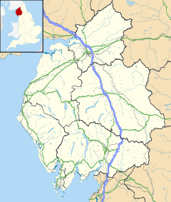
 Nether Wasdale shown within Cumbria
 Media related to Nether Wasdale at Wikimedia CommonsCategories:
