- River Aire
Geobox|River
name = River Aire
map_size =
map_caption =
country = England
region_type = Counties
region =North Yorkshire
region1 =West Yorkshire
region2 =East Riding of Yorkshire
city = Leeds
length = 114
watershed = 1004
discharge_location = River Ouse
discharge_average = 35.72
source_name =
source_location =Malham Tarn , North Yorkshire
source_elevation = 377
mouth_name =River Ouse
mouth_location =Airmyn , East Riding of Yorkshire
mouth_elevation = 5
tributary_left =
tributary_left1 =
tributary_right =River Worth
tributary_right1 =River Calder

image_size = 300
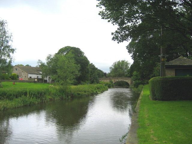
image_caption = The River Aire atGargrave , North YorkshireThe River Aire is a majorriver inYorkshire ,England of length 114km (71m). Part of the river is canalised and is known as theAire and Calder Navigation .The Aire is one ofEngland 's major rivers and flows through one of the largest populated areas in the UK, which isWest Yorkshire .It rises at
Malham Tarn flowing underground toMalham Cove (Aire Head), nearMalham , inNorth Yorkshire and flows throughGargrave andSkipton . AfterCononley , the river entersWest Yorkshire where it passes through the former industrial areas ofKeighley ,Bingley ,Saltaire , Shipley, it then passes throughLeeds , on to the villages ofSwillington andWoodlesford . At Castleford is the confluence of the Aire and Calder; just downstream of the confluence was the ford where the ancient British road, utylised and strengthened by the Romans, crossed on its journey north to York. The river re-enters North Yorkshire nearKnottingley and in its lower reaches forms part of the boundary between North Yorkshire and theEast Riding of Yorkshire .The River Aire empties into the River Ouse at
Airmyn , 'myn' being an old English word for 'river mouth'. The name possibly derived from British *Isara, meaning "strong river". The ancient British name for the Aire was Winwoed. [ [http://web.onetel.net.uk/~gedburnell/fairburn.htm A Brief History of the Fairburn Area] ]ettlements
"from source"
*
Malham
*Hanlith
*Airton
*Bell Busk
*Gargrave
*Skipton
*Low Bradley
*Kildwick
*Steeton
*Utley
*Riddlesden
*Crossflatts
*Bingley
*Saltaire
*Shipley
*Charlestown
*Apperley Bridge
*Horsforth
*Kirkstall
*Holbeck
*Leeds City Centre
*Knowsthorpe
*Allerton Bywater
*Castleford
*Brotherton
*Knottingley
*Beal
*West Haddlesey
*Chapel Haddlesey
*Temple Hirst
*Gowdall
*Snaith
*Rawcliffe
*Newland
*Airmyn (Joins River Ouse)
ee also
*
Rivers of the United Kingdom References
External links
Wikimedia Foundation. 2010.
