- Dinnington, Tyne and Wear
-
Coordinates: 55°03′14″N 1°40′31″W / 55.0540°N 1.6754°W
Dinnington 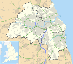
 Dinnington
Dinnington shown within Tyne and WearPopulation 1,710 Parish Dinnington Metropolitan borough Newcastle-upon-Tyne North Tyneside Metropolitan county Tyne and Wear Region North East Country England Sovereign state United Kingdom Post town NEWCASTLE UPON TYNE Postcode district NE13 Dialling code 01661 Police Northumbria Fire Tyne and Wear Ambulance North East EU Parliament North East England UK Parliament Newcastle North North Tyneside List of places: UK • England • Tyne and Wear Dinnington is a village and civil parish in the City of Newcastle upon Tyne in Tyne and Wear, England. It is about 9 miles (14 km) north of the city centre, near Newcastle International Airport. It has a population of 1,710.[1]
Formerly a coal-mining village with at least four pits within two miles (3 km), Dinnington has now turned into a more "property-developed area", with the local farmhouse and all its buildings demolished to create housing at rather high-prices at a quite sought-after location[citation needed].
Situated a 5 minutes drive from Newcastle International Airport, the village boasts both ease of access to City Centre and beautiful countryside walks or drives.
The local school, Dinnington First School has around 140 pupils and feeds into Gosforth East Middle School [2].
References
- ^ Office for National statistics : Census 2001 : Parish Headcounts : Newcastle upon Tyne Retrieved 2009-09-14
- ^ Newcastle council schools web page Retrieved 2010-05-14
External links
- GENUKI (accessed: 27 November 2008)
- Dinnington First School (accessed: 14 Mat 2010)
Categories:- Villages in Tyne and Wear
- Northumberland geography stubs

Wikimedia Foundation. 2010.