- NE postcode area
-
Newcastle upon Tyne postcode area 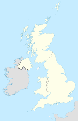
 NE
NEPostcode area NE Postcode area name Newcastle upon Tyne Post towns 34 Postcode districts 66 Postcode sectors 210 Postcodes (live) 32,980 Postcodes (total) 41,481 Statistics as at October 2006 [1] The NE postcode area, also known as the Newcastle upon Tyne postcode area,[2] is a group of postcode districts around Alnwick, Ashington, Bamburgh, Bedlington, Belford, Blaydon-on-Tyne, Blyth, Boldon Colliery, Chathill, Choppington, Corbridge, Cramlington, East Boldon, Gateshead, Haltwhistle, Hebburn, Hexham, Jarrow, Morpeth, Newbiggin-by-the-Sea, Newcastle upon Tyne, North Shields, Prudhoe, Riding Mill, Rowlands Gill, Ryton, Seahouses, South Shields, Stocksfield, Wallsend, Washington, Whitley Bay, Wooler and Wylam in England.
The original NE district created in 1858 was in North East London, but this was abolished in 1866; parts were transferred to the N and E districts, while others were removed from the London postal district altogether.
Contents
Coverage
The approximate coverage of the postcode districts:
Postcode district Post town Coverage Local authority area NE1 NEWCASTLE UPON TYNE City Centre Newcastle NE2 NEWCASTLE UPON TYNE Jesmond & Spital Tongues Newcastle NE3 NEWCASTLE UPON TYNE Gosforth, Fawdon & Kingston Park Newcastle NE4 NEWCASTLE UPON TYNE Fenham, West gate & Wingrove Newcastle NE5 NEWCASTLE UPON TYNE Westerhope & Newcastle West Newcastle NE6 NEWCASTLE UPON TYNE Walker, Byker & Heaton Newcastle NE7 NEWCASTLE UPON TYNE High Heaton & Benton Newcastle NE8 GATESHEAD Gateshead & Bensham Gateshead NE9 GATESHEAD Low Fell, Springwell Gateshead & Sunderland NE10 GATESHEAD Felling, Leam Lane & Pelaw Gateshead NE11 GATESHEAD Dunston, Metro Centre & Team Valley & Kibblesworth Gateshead NE12 NEWCASTLE UPON TYNE Killingworth North Tyneside NE13 NEWCASTLE UPON TYNE Airport, Wideopen & Dinnington Newcastle, North Tyneside NE15 NEWCASTLE UPON TYNE Lemington, Throckley & Newburn Newcastle NE16 NEWCASTLE UPON TYNE Whickham, Sunniside & Burnopfield Gateshead, County Durham NE17 NEWCASTLE UPON TYNE Chopwell & Western Chopwell Wood Gateshead NE18 NEWCASTLE UPON TYNE Stamfordham Northumberland NE19 NEWCASTLE UPON TYNE Otterburn Northumberland NE20 NEWCASTLE UPON TYNE Ponteland Northumberland NE21 BLAYDON-ON-TYNE Blaydon & Winlaton Gateshead NE22 BEDLINGTON Bedlington & Hartford Bridge Northumberland NE23 CRAMLINGTON Cramlington Northumberland NE24 BLYTH Blyth, Newsham, Cowpen & Cambois Northumberland NE25 WHITLEY BAY Monkseaton, New Hartley, Holywell & Seaton Delaval North Tyneside NE26 WHITLEY BAY Whitley Bay & Seaton Sluice North Tyneside NE27 NEWCASTLE UPON TYNE Shiremoor, West Allotment, Backworth, Holystone & Murton Village North Tyneside NE28 WALLSEND Battle Hill, Willington, Wallsend & North Tyne Tunnel North Tyneside NE29 NORTH SHIELDS North Shields, Royal Quays, Billy Mill & New York North Tyneside NE30 NORTH SHIELDS Marden, Tynemouth & Cullercoats North Tyneside NE31 HEBBURN Hebburn South Tyneside NE32 JARROW Jarrow, Fellgate & South Tyne Tunnel South Tyneside NE33 SOUTH SHIELDS Town Centre, Deans & High Shields South Tyneside NE34 SOUTH SHIELDS Harton, Horsley Hill, Marsden, Simonside & Brockley Whins South Tyneside NE35 BOLDON COLLIERY Boldon Colliery South Tyneside NE36 EAST BOLDON East & West Boldon South Tyneside NE37 WASHINGTON Usworth, Sulgrave & Albany Sunderland NE38 WASHINGTON Town Centre, Oxclose & Fatfield Sunderland NE39 ROWLANDS GILL Rowlands Gill, High Spen, Hamsterley Mill & Eastern Chopwell Wood Gateshead & County Durham NE40 RYTON Ryton, Crawcrook & Greenside Gateshead NE41 WYLAM Wylam Gateshead & Northumberland NE43 STOCKSFIELD Stocksfield NE44 RIDING MILL Riding Mill & Broomhaugh Northumberland NE45 CORBRIDGE Corbridge Northumberland NE46 HEXHAM Hexham Northumberland NE47 HEXHAM Acomb Northumberland NE48 HEXHAM Falstone, Kielder Northumberland NE49 HALTWHISTLE Haltwhistle Northumberland NE61 MORPETH Morpeth, Tranwell, Clifton Hepscott Northumberland NE62 CHOPPINGTON Scotland Gate, Guidepost, Stakeford, West Sleekburn and Bomarsund Northumberland NE63 ASHINGTON Ashington Northumberland NE64 NEWBIGGIN-BY-THE-SEA Newbiggin-by-the-Sea Northumberland NE65 AMBLE Amble Northumberland NE66 ALNWICK Alnwick, Shilbottle Northumberland NE67 CHATHILL Chathill, Beadnell Northumberland NE68 SEAHOUSES Seahouses Northumberland NE69 BAMBURGH Bamburgh Northumberland NE82 NEWCASTLE UPON TYNE non-geographic NE83 NEWCASTLE UPON TYNE non-geographic NE85 NEWCASTLE UPON TYNE non-geographic NE88 NEWCASTLE UPON TYNE non-geographic NE98 NEWCASTLE UPON TYNE non-geographic - used for bulk mail purposes NE99 NEWCASTLE UPON TYNE Used for "PO Box" addresses and other bulk mail purposes Adjacent areas
Adjacent postcode areas TD 
CA  NE
NE 

DL DH SR Clockwise from the east, the adjacent postcode areas are: , SR (Sunderland), DH (Durham), DL (Darlington), CA (City of Carlisle), TD (Galashiels).
See also
References
- ^ "National Statistics Postcode Directory" (PDF). Office for National Statistics Postcode Directory (November 2006). Office for National Statistics. November 2006. http://www.statistics.gov.uk/geography/downloads/NSPDVersionNotes.pdf. Retrieved 2009-05-29.
- ^ Royal Mail, Address Management Guide, (2004)
Postcode areas in the United Kingdom, Channel Islands and Isle of Man AB AL B BA BB BD BH BL BN BR BS BT BX CA CB CF CH CM CO CR CT CV CW DA DD DE DG DH DL DN DT DY E EC EH EN EX FK FY G GIR GL GU GY HA HD HG HP HR HS HU HX IG IM IP IV JE KA KT KW KY L LA LD LE LL LN LS LU M ME MK ML N NE NG NN NP NR NW OL OX PA PE PH PL PO PR RG RH RM S SA SE SG SK SL SM SN SO SP SR SS ST SW SY TA TD TF TN TQ TR TS TW UB W WA WC WD WF WN WR WS WV YO ZE
Categories:- Newcastle upon Tyne
- Northumberland
- Postcode areas covering North East England

Wikimedia Foundation. 2010.