- DD postcode area
-
Coordinates: 56°27′40″N 2°58′05″W / 56.461°N 2.968°W
Dundee postcode area 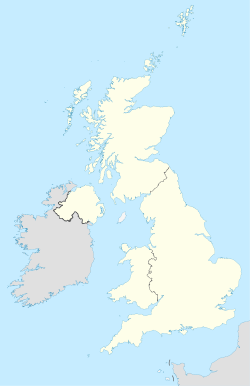
 DD
DDPostcode area DD Postcode area name Dundee Post towns 9 Postcode districts 11 Postcode sectors 45 Postcodes (live) 8,878 Postcodes (total) 10,668 Statistics as at October 2006 [1] The DD postcode area, also known as the Dundee postcode area,[2] is a group of postcode districts around Arbroath, Brechin, Carnoustie, Dundee, Forfar, Kirriemuir, Montrose, Newport-on-Tay and Tayport in Scotland.
Contents
Coverage
The approximate coverage of the postcode districts:
Postcode district Post town Coverage Local authority area DD1 DUNDEE Most of the city centre, the University and the Riverside. Dundee DD2 DUNDEE The West of the city including Lochee, Blackness, Ninewells, Menziehill, Charleston, Balgay, Ardler and Logie. Dundee DD3 DUNDEE The northwest of the city including St Marys, Downfield and Kirkton, and the inner city areas of Strathmartine, Coldside and the Hilltown. Dundee DD4 DUNDEE The inner city area of Stobswell and Craigie, and the northeast of the city including Pitkerro, Douglas, Fintry and Whitfield. Dundee, Angus DD5 DUNDEE The east of the city including Broughty Ferry, Barnhill and Monifieth Dundee, Angus DD6 NEWPORT-ON-TAY The towns on the south bank of the River Tay, Newport-on-Tay, Wormit, Balmerino, Gauldry and Tayport Fife TAYPORT Fife DD7 CARNOUSTIE The town of Carnoustie. Angus DD8 FORFAR The towns of Forfar, Glamis and Kirriemuir. Angus KIRRIEMUIR Angus DD9 BRECHIN The town of Brechin. The village of Edzell Angus DD10 MONTROSE The town of Montrose. The villages of St Cyrus, Inverbervie and Gourdon Angus, Aberdeenshire DD11 ARBROATH The towns of Arbroath and Friockheim Angus Adjacent areas
Adjacent postcode areas AB 
PH  DD
DD 

KY Clockwise from the east, the adjacent postcode areas are: , KY (Kirkcaldy), PH (Perth), AB (Aberdeen).
See also
References
- ^ "National Statistics Postcode Directory" (PDF). Office for National Statistics Postcode Directory (November 2006). Office for National Statistics. November 2006. http://www.statistics.gov.uk/geography/downloads/NSPDVersionNotes.pdf. Retrieved 2009-05-29.
- ^ Royal Mail, Address Management Guide, (2004)
Postcode areas in the United Kingdom, Channel Islands and Isle of Man AB AL B BA BB BD BH BL BN BR BS BT BX CA CB CF CH CM CO CR CT CV CW DA DD DE DG DH DL DN DT DY E EC EH EN EX FK FY G GIR GL GU GY HA HD HG HP HR HS HU HX IG IM IP IV JE KA KT KW KY L LA LD LE LL LN LS LU M ME MK ML N NE NG NN NP NR NW OL OX PA PE PH PL PO PR RG RH RM S SA SE SG SK SL SM SN SO SP SR SS ST SW SY TA TD TF TN TQ TR TS TW UB W WA WC WD WF WN WR WS WV YO ZE
Categories:- Dundee
- Postcode areas covering Scotland
- Post and philately stubs

Wikimedia Foundation. 2010.