- Monifieth
-
Coordinates: 56°28′51″N 2°49′11″W / 56.480865°N 2.819644°W
Monifieth Scottish Gaelic: Monadh Feith 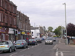
Monifieth High Street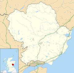
 Monifieth
Monifieth shown within AngusPopulation est.8,220[1] (2008) OS grid reference NO496323 - Edinburgh 42 mi (68 km) SSW - London 367 mi (591 km) SSE Council area Angus Lieutenancy area Angus Country Scotland Sovereign state United Kingdom Post town DUNDEE Postcode district DD5 Dialling code 01382 Police Tayside Fire Tayside Ambulance Scottish EU Parliament Scotland UK Parliament Dundee East Scottish Parliament Angus
North East ScotlandList of places: UK • Scotland • Monifieth (pronounced /ˈmɒnifiːθ/) is a town and former police burgh in the council area of Angus, Scotland. It is situated on the North bank of the Firth of Tay on the East Coast. In 2008, the population of Monifieth was estimated at 8,220,[1] making it the fifth largest town in Angus.
The presence of a number of class II and III Pictish stones points to Monifieth having had some importance as an ecclesiastical centre in the early medieval period. The lands were a possession of the Céli Dé monastic order until they were granted to the Tironensian monks of Arbroath Abbey in the early 13th century. Until the early 19th century, Monifieth remained a small village but grew rapidly due to the expansion of the local textile industry.
Monifieth can be considered a dormitory town for its closest city, Dundee, which is 6 miles (10 km) to the west. Politically, Monifieth can be seen to be a stronghold of the Scottish National Party, being represented at local, national and European levels by SNP politicians. The town falls within the boundaries of Angus Council but was part of Dundee City Council from 1975 to 1996. The local constituency boundary and whether Monifieth should fall within Angus or Dundee council areas continues to be a source of debate.
Public transport consists mainly of bus services operated by Stagecoach Buses. While the town is notionally served by Monifieth railway station, the station presently operates only a token service. Its nearest major road is the A92 and the town is connected to Dundee by the A930.
Contents
History
Toponomy
The name Monifieth is generally taken to derive from the Gaelic Monadh Feith, 'Hill of the deer'.[2] An alternative etymology Monaich Fother, 'Monks' Land' has been suggested, which holds some appeal due to Monifieth's early status as a possession of the Céli Dé monastic order.[3]
'Monifieth' has been given various spellings over the years, including 'Monifođ'/'Monifod', 'Monifoth', 'Munifođ',[4] 'Monyfuthe',[5] 'Monyfuthie',[6] 'Monyfaith',[7] 'Monyfuth',[8] 'Monifuth',[9] 'Monifeith',[10] 'Monyfeith',[11][12] and 'Monyfieth',[13][14] before becoming standardised as 'Monifieth' on publication of the first edition of the Ordnance Survey maps.[15]
Early History
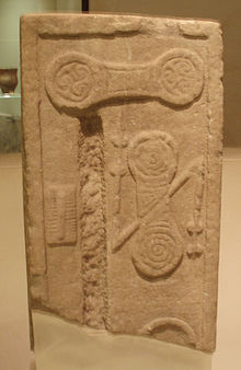 Pictish stone formerly incorporated within the structure of St Rule's Church, now on display at the Museum of Scotland.
The earliest evidence for occupation of the area surrounding Monifieth dates to the Mesolithic period. Midden pits of that age have been found nearby at Stannergate,[16] and worked flints apparently of that age have been found at Balmossie.[17] More tangible evidence for settlement can be found from the Neolithic period, for example with the Cursus monument, identified from cropmarks near Woodhill, between Monifieth and Carnoustie.[18] This cursus is of a similar scale to the well characterised, mid 4th century BC enclosure found nearby at Douglasmuir near Friockheim.[19] Numerous stones incised with cup and ring marks have also been found in the surrounding area.[20][21][22]
Approximately 1 mile (1.6 km) to the north of Monifieth lies Laws hill, on which lies the Iron age ruins of a Broch and vitrified fort.[23] These ruins are much reduced as the stone from their walls has been used on the estate for construction of dykes and drains, well into the 19th century,[24] and while very little remains of the structure today,[25] tradition recorded in 1842 attests to the walls being 5 foot (1.5 m) tall at the beginning of the 19th century.[26] Artefacts found at and around the site include a quantity of gold coins, iron spear heads and a stone lamp.[27]
One artifact found near Laws Hill (but now lost and only known from an illustration) is that of a Pictish crescent plate, found in a cist grave which incorporated a later Norse Younger Futhark runic inscription (MKITIL:THA[...]).[28] This find is particularly intriguing in light of the paucity of Viking archaeology in this part of Scotland.[29]
Domestic remains from the late Prehistoric period can also be found in abundance in the area. Perhaps most well known are the souterrains at Carlungie and Ardestie,[30] but cropmarks point to other settlements of that age, for instance at Woodhill.[31]
Medieval History
Prior to the thirteenth century, the church and lands of Monifieth were possessions of the Céli Dé monastic order.[32] The church was endowed to the recently founded Tironensian abbey of Arbroath by Gille Críst, Mormaer of Angus, around 1201-1207,[4] and the lands to the south of the Church (now much reduced in size due to erosion) in 1242-1243 by Matilda, Countess of Angus.[32] A hoard of 700 coins dating to the reigns of Edward I and Edward II were found in this area in 1854.[33]
The present building of St Rule's Church (built 1812) originally incorporated three Class II and Class III Pictish/Early Medieval sculpted stones, recycled as building stones, including one that had previously been used in the pre-reformation building it replaced.[34] These stones were removed in the mid 19th century and, along with a fourth stone found in an adjoining garden, were donated to the National Museums of Scotland in 1871.[34] They represent some of the latest Pictish era monuments and can be confidently dated to the late 9th/early 10th centuries.[35]
Modern History
Monifieth remained a small village, comprising a number of turf huts until the early 19th century.[32] In the eighteenth century, the economy of the parish was mainly dependent on agriculture. Other industries included quarrying, weaving within the home and the start of manufacturing of linseed oil at a water-powered mill by the Dighty burn,[36] supporting a small community, 'Milltown',[12] later named as 'Milton of Monifieth'.[37] Although Monifieth had no harbour, cargo was off-loaded from vessels on Monifieth Sands (in the relatively sheltered Firth of Tay) at low tide and horse-drawn vehicles would move the cargo to nearby destinations.[3]
During the 19th century, the village gradually expanded following the introduction of larger scale industries to the area, including manufacture of machinery for flax mills in 1811.[32] James Low and Robert Fairweather had set up their foundry in the village at the start of the nineteenth century and in 1815 developed the first carding machine for flax tow in the area. With the growth of the textile industry in Dundee and Angus the business grew rapidly, and, by the late nineteenth century, James F Low & Co Ltd was producing a wide range of machines used for the processing and spinning of jute, flax and similar fibres. As well as building machinery for local use, the firm attracted orders from across the world and by the 1880s the Monifieth Foundry employed about 300 workers.[38] The expansion of Monifieth's industrial economy was aided by the opening of the Dundee and Arbroath Railway on 6 October, 1838. This railway, which was originally intended only as a local line, was constructed with an unusual gauge of 5 ft 6 in (1,676 mm) (shared only with the Arbroath and Forfar Railway),[39][40] later being converted to standard gauge when it was incorporated into the national Rail system.[41] Between 1861 and 1901, Monifieth's population more than tripled; from 558 to 2,134 and in 1895, Monifieth was registered at Forfar Sheriff Court as a burgh.[3]
A tramway service was introduced in 1905, with cars journeying into Dundee City centre at regular intervals. This service was welcomed by the many who travelled daily either from the Burgh into the City on business, or the many hundreds who commuted daily to work in the factories and mills.[3]
In 1905 Monifieth gained a Cottage Hospital via a provision made in the will of the Reverend James Gerard Young DD. The Reverend Young had been Minister of Monifieth Parish Church from 1855 until his death in 1899. The funds he left were used to establish the Gerard Trust which managed the Gerard Cottage Hospital from its opening until it passed into the control of the new National Health Service in 1948. The hospital closed in 1969 and subsequently became Mary's Residential Home for the elderly.[42]
During the Second World War the Monifieth Foundry was used for the production of war supplies including bombs and and aircraft parts.[38]
Governance
Monifieth is represented within Angus Council by the Monifieth & Sidlaw Ward, from which four councillors are elected. The members elected from this ward are, as of 2009: Councillor Jean Lee (Scottish National Party), Councillor Rob Murray (Scottish National Party), Councillor John R Whyte (Conservative Party) and Councillor Margaret Thomson (Labour Party).[43]
The town is part of the Dundee East constituency of the Parliament of the United Kingdom which returns a Member of Parliament (MP) to the House of Commons, at Westminster. The constituency's MP is currently Stewart Hosie of the Scottish National Party.[44]
Monifieth is also part of the Angus South constituency of the Scottish Parliament, which has significantly different boundaries to the Westminster constituency. The constituency returns a Member of the Scottish Parliament (MSP) to Holyrood directly, and is part of the North East Scotland electoral region with regards to additional Members of the Scottish Parliament. The constituency's MSP is currently Graeme Dey of the Scottish National Party.[45]
Monifieth's status in Angus Council has long been the subject of debate, with Dundee City councillors arguing that it should be part of Dundee Council in order to rebalance Dundee City Council Tax revenues.[46] Initial moves were made by the council of Dundee to annex the burgh into Dundee's boundaries nearly a hundred years ago. In 1913 a petition signed by the residents of Monifieth was presented before Parliament in London and successfully retained Monifieth's independence. The Local Government (Scotland) Act 1973 redrew the council boundaries and Monifieth became part of Dundee City Council in 1975.[3] In 1996, after Local government reorganisation, Monifieth became part of the Angus council area, after being part of Dundee District in the Tayside region for 21 years.[3]
Geography
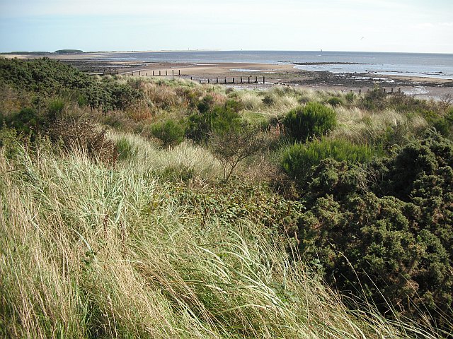
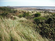 Monifieth Links, looking towards Barry Buddon.
Monifieth Climate chart (explanation) J F M A M J J A S O N D 588330824393341353815754181143201285191229171063148391043372Average max. and min. temperatures in °C Precipitation totals in mm Source: Monifieth Weather Station Imperial conversion J F M A M J J A S O N D 2.346371.246361.748371.355411.559452.164521.768543.366541.163502.557461.550391.34536Average max. and min. temperatures in °F Precipitation totals in inches Monifieth occupies a position on the North Bank of the Firth of Tay on the East Coast of Scotland, on land immediately to the West of the Buddon Ness, 6 miles (10 km) E of Dundee,[47] 10.3 miles (17 km) WSW of Arbroath,[47] and 11.3 miles (18 km) S of Forfar.[47] The town lies 38.4 miles (62 km) NNE of Edinburgh,[48] and 360.3 miles (580 km) NNW of London.[49] The built-up area occupies a roughly rectangular shape 1.2 miles (2 km) long by 0.7 miles (1 km) wide, aligned in a ENE direction. The land is relatively flat, rising gradually to around 50m elevation to the North of the town at South Grange.[47]
The town occupies the southern part of the Parish of Monifieth, at the South Western most corner of the county of Angus, and incorporates a number of former villages and Hamlets, including Ashludie, Milton and South Grange. Contiguous to the town, on the West side of the county boundary, is Barnhill and Panmurefield Village and the Dundee conurbation. To the East is a 2.7 miles (4 km) expanse of rural land between the town and the village of Barry and town of Carnoustie. This rural area includes a number of farmsteads and hamlets, including Lucknow, West Cotside, Ardestie, Balhungie and Woodhill, as well as the Monifieth golf courses and Panmure golf course.
To the south of this, on the southern side of the railway, is the peninsula of the Buddon Ness, on which lies the Ministry of Defence owned Barry Buddon training camp. This land is classified as a Site of Special Scientific Interest and a Special Area of Conservation.[50][51]
The Buddon Ness is a triangle of land around 11 km2.[52] Its position at the estury of the River Tay makes it prone to erosion, and the position of both the West and East facing shores have changed considerably over the years. Comparison of Ordnance Survey maps from the mid-19th century with present day maps show the shoreline retreating on the West shore and advancing on the East shore.[53]
To the North of the town runs the A92, between Dundee and Arbroath. Beyond this lies the farms of North Grange, Balmossie and Ardownie and Ethiebeaton retail and leisure park, as well as Roman Hill, Gallow Hill and Laws Hill. The Edinburgh to Aberdeen railway line runs along the South of the town, separating the built up area from the Blue Seaway leisure area and the two caravan sites. The A930 runs through the town East to West from Barry to Barnhill.
The Western political boundary of the town is marked by West Grange Road, leading south from the West Grange roundabout on the A92, the cycle track that goes from West Grange Road over the Seven Arches viaduct over the Dighty Burn (once part of the Dundee to Forfar Railway), around Monifieth High School grounds, between Inchkeith Avenue and Balmossie Place, and down North and South Balmossie Street to the river bank.
Demography
Accurate demographic information for Monifieth is complicated by the town's inclusion in the Dundee locality in the 2001 census. Estimates from 2008 put the population at 8,220.[1]
Almost 2,400 Monifieth residents (approximately 29% of the population) travel to work or study in Dundee.[54] Assuming that the figure of 73% in Angus being between the ages of 16 and 65,[55] holds for Monifieth then this represents a figure of 40% of people of working age.
Economy
Monifieth's proximity to Dundee is a key feature of its economy. Approximately 40% of working age residents commute to Dundee for work or to study.
Monifieth has a small retail and leisure complex to the north of the town at Ethiebeaton, which comprises a garden centre, a gym and a department store which sells local produce. There is also a shopping area centred around the high street, which has a variety of businesses.
Tourism plays a small but significant role in Monifieth's economy and has benefited from the area's associations with golf. Monifieth Golf Links is used as a qualifying course for the Open Championship,[56] which returned to nearby Carnoustie in 2007. The golf links is included in the Carnoustie Country golf marketing campaign, which is funded by Angus Council to promote golf in the area.[57] Monifieth is served by a number of small hotels within the town, as well as larger hotels at Monifieth Farm at the Ethiebeaton retail park and at Forbes of Kingennie to the north of the town.
Landmarks
To the west side of the town there is the Dighty Water, which is known as a 'burn' in Scotland. It begins up in the Sidlaw Hills and runs 15 miles east-southeast where it meets the Firth of Tay. At least two mills are known to have existed beside the burn: the Milton Mill and the Balmossie Mill. The Milton Mill, which opened in 1788 as a flax spinning mill, was part of the Milton industrial area. It is the oldest water-powered flax mill in Angus.[58] The mill, which is a category B listed building, suffered significant fire damage in June 2006. Initially, the mill was not permitted to be demolished but, in April 2010, it was agreed by the Angus Development Standards Committee that the building was "beyond saving" and demolition was permitted.[59] Demolition of surrounding buildings was already under way, clearing the way for a housing development.
The Balmossie Mill, the smaller of the two mills, was a water mill. Remains of a water wheel and machinery is evident. The exact date of the building is unknown but in 1692 two local men were recorded by local newspapers for poaching. The Balmossie Mill is a category B listed building.[60]
Continuing eastwards from the Milton Mill, along Ferry Road and Maule Street towards the town centre, Monifieth's war memorial is situated. The memorial was dedicated in 1921 and was built by Charles Soutar. The design includes a sculpture of an angel warrior figure with a sword and laurel wreath.[61] Invertay House, located further along Maule Street on the south side of the road, was built in 1878 and opened as Monifieth Public School. Today, the building houses offices. Opposite Invertay House, on the north side of the road, is the Gerard Hall. The hall was built in 1882 for Sunday School pupils of the adjacent St Rule's Parish Church.
Transport
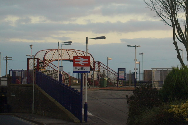
 Monifieth railway station
The A92 runs between Arbroath and Dundee immediately to the North of Monifieth. There are several ways to reach the A92, including: the B962, which links to the A92 at the Ardestie junction; Victoria Street, which links to the A92 at the Ethiebeaton Park roundabout; and via the West Grange Road roundabout. The other main road route from Monifieth is the A930, which leads Westwards to Dundee via Barnhill and Broughty Ferry and eastwards to Carnoustie, and is named Ferry Road, Maule Street, High Street and Panmure Street.
Trains are operated by First ScotRail on the Edinburgh to Aberdeen line. There is at present only a token service, stopping only once a day each way at Monifieth Station (0623 West-bound and 1906 East-bound).
Buses are operated by Stagecoach on their Arbroath-Dundee route, including the number 73 and 73A buses, and the number 39A (early weekday mornings, evenings and on Sundays). They operate on a regular basis, with most stopping at bus stops along the main A930 road. Additional services operate via Ashludie Hospital and Ethiebeaton Park, including the 75 service (which stops at Ethiebeaton Park) and the 78 and 79 services (which go on towards Wellbank, Newbigging and Monikie). Stagecoach buses provide timetables online.[62]
Education
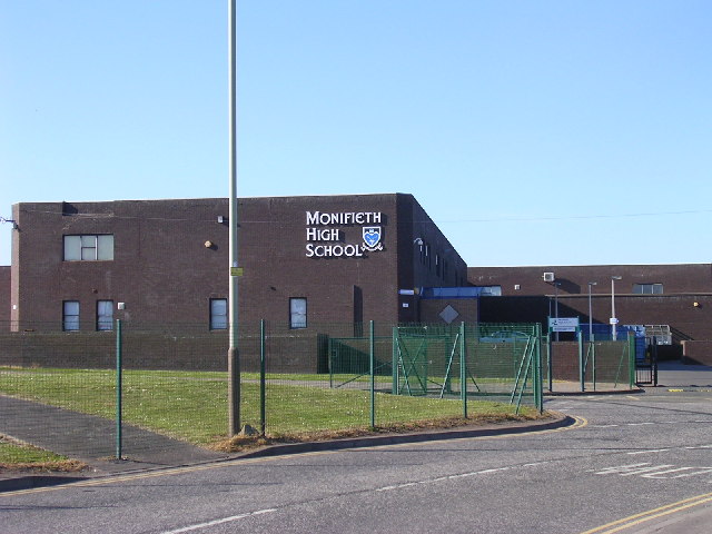
 Monifieth High School
There are currently two primary schools located in Monifieth and one secondary school. The schools are Grange Primary School, Seaview Primary School and Monifieth High School. Between them, they have approximately 1700 pupils. Seaview Primary School is the oldest of all three schools, although it was formerly a secondary school. It had 342 pupils and 19 teachers (as of September 2007). Seaview Primary School was knocked down recently and a new primary school of the same name was built in its place.
Monifieth High School was founded in 1976 and has a catchment area of Monifieth, Birkhill and other rural areas of Angus including Newbigging. During the school's thirty-three years, there have only been three headteachers. Many of the school's facilities have just recently been renovated, including new windows and several extensions. A new "community wing" has been planned for the school to allow the local community to become more involved in school life.
Sport and Leisure
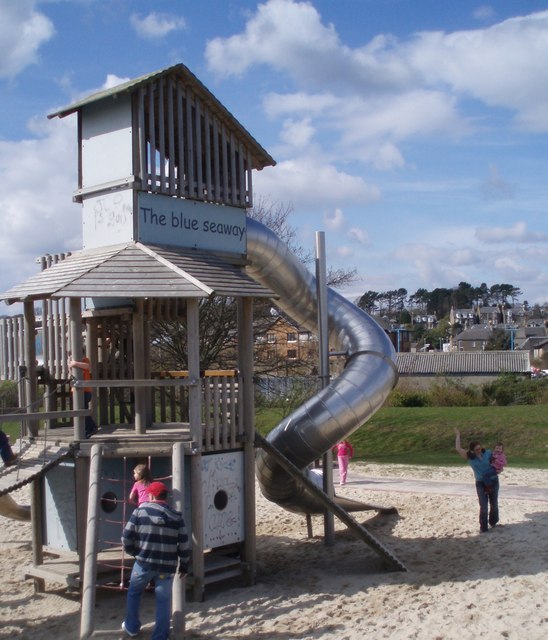
 The Blue Seaway
Monifieth has two golf courses, The Medal and The Ashludie. The Medal course was used as a qualifying course for the Open Championship in 2007. There are 4 golf clubs in the area - Broughty Golf Club, Grange, the Ladies Panmure and Monifieth.
Monifieth Athletic is a football club that plays in the Dundee and District Youth Football Association with players up to the age of 16. They play at Riverside Park in Monifieth.
The Blue Seaway is a development on the seafront that was opened in 2003 at a cost of £800,000. It incorporates an adventure play ground, skate park, putting green and tennis courts.[63]
Public Services
Monifieth and the surrounding area is supplied with water by Scottish Water. Water was supplied from Crombie reservoir until 1981.[64] Since then, along with Dundee and parts of Perthshire, Angus has been supplied from Lintrathen and Backwater reservoirs in Glen Isla. Electricity distribution is by Scottish Hydro Electric plc, part of the Scottish and Southern Energy group.
Waste management is handled by Angus Council. There is a kerbside recycling scheme that has been in operation since May 2006. Cans, glass, paper and plastic bottles are collected on a weekly basis. Compostable material and non-recyclable material are collected on alternate weeks.[65] Roughly two thirds of non-recyclable material is sent to landfill at Angus Council's site at Lochhead, Forfar and the remainder sent for incineration (with energy recovery) outside the council area.[66]
A recycling centre is located at Riverview Drive. Items accepted include, steel and aluminium cans, cardboard, paper, electrical equipment, engine oil, fridges and freezers, garden waste, gas bottles, glass, liquid food and drinks cartons, plastic bottles, plastic carrier bags, rubble, scrap metal, shoes and handbags, spectacles, textiles, tin foil, wood and yellow pages. Angus Council publishes details of where and how each product is processed.[67] There is also a glass bank at the Tesco car park.[68] The Angus Council area had a recycling rate of 34.7% in 2007/08.[65]
Healthcare is supplied in the area by NHS Tayside. The nearest hospitals with accident and emergency departments are Arbroath Infirmary,[69] and Ninewells Hospital, Dundee.[70] Primary Health Care in Monifieth is supplied by Monifieth Medical Practice which is based at the Health Centre on Victoria Street;[71] Monifieth along with the rest of Scotland is served by the Scottish Ambulance Service.[72]
Law enforcement is provided by Tayside Police,[73] and Monifieth is served by Tayside Fire and Rescue Service.[74]
Twin Town
References
- ^ a b c "Mid-2008 Population Estimates". General Register Office for Scotland (GROS). http://www.gro-scotland.gov.uk/files2/stats/population-estimates/08mye-localities-table1.pdf. Retrieved December 6, 2010.
- ^ Knox, A (1904). Glossary of geographical and topographical terms and of words of frequent occurrence in the composition of such terms and of place names. London: Stanford. p. 261. http://www.archive.org/download/glossaryofgeogra00knoxrich/glossaryofgeogra00knoxrich.pdf. Retrieved December 6, 2010.
- ^ a b c d e f Monifieth History Society. "Burgh of Monifieth". www.monifiethhistorysociety.co.uk. http://www.monifiethhistorysociety.co.uk/burghofmonifieth.html. Retrieved December 6, 2010.
- ^ a b Innes, C. and Chalmers, P., ed (1843). Liber S. Thome de Aberbrothoc; Registrorum Abbacie de Aberbrothoc. 1178-1329. Edinburgh: The Bannatyne Club.
- ^ "That the money and victuallis assignit in tyme bypast for keping of the castellis of Edinburgh, Dumbritane, Striveling and Blaknes sall remane and abyid with the capitanis and keiparis thairoff". Records of the Parliaments of Scotland. 1584. http://www.rps.ac.uk/search.php?a=fcf&fn=jamesvi_ms&id=id5592&t=ms. Retrieved December 6, 2010.
- ^ "Ratificatioun of the capitanrie of the castell of Edinburgh to the Laird of Coldinknowis". Records of the Parliaments of Scotland. 1585. http://www.rps.ac.uk/search.php?action=print&id=id5696&filename=jamesvi_ms&type=ms. Retrieved December 6, 2010.
- ^ Pont, T (c1583-96). "Lower Angus and Perthshire east of the Tay". National Library of Scotland. http://www.nls.uk/maps/counties/detail.cfm?id=289. Retrieved December 6, 2010.
- ^ "Ratificatioun in favouris of the Lord Balmirrenoch and his sone, James Elphingstoun, of thair infeftmentis of Ballumbie and Barntoun". Records of the Parliaments of Scotland. 1605. http://www.rps.ac.uk/search.php?action=fc&fn=jamesvi_ms&id=id7100&query=&type=ms&variants=&google=. Retrieved December 6, 2010.
- ^ Gordon, R (c1636-52). "Anguss". National Library of Scotland. http://www.nls.uk/maps/counties/detail.cfm?id=29. Retrieved December 6, 2010.
- ^ Edward, R (1678). "Angusia Provincia Scotiae Sive, The Shire of Angus". National Library of Scotland. http://www.nls.uk/maps/counties/detail.cfm?id=200. Retrieved December 6, 2010.
- ^ Moll, H (1745). "The Shire of Angus or Forfar". National Library of Scotland. http://www.nls.uk/maps/counties/detail.cfm?id=232. Retrieved December 6, 2010.
- ^ a b Ainslie, John (1794). "Map of the County of Forfar or Shire of Angus". National Library of Scotland. http://www.nls.uk/maps/joins/577.html. Retrieved December 6, 2010.
- ^ Roy, W (1747-55). "Roy Military Survey of Scotland". National Library of Scotland. http://www.nls.uk/maps/roy/index.html. Retrieved December 6, 2010.
- ^ Knox, J (1850). "Map of the Basin of the Tay, including the greater part of Perth Shire, Strathmore and the Braes of Angus or Forfar". National Library of Scotland. http://www.nls.uk/maps/coasts/chart.cfm?id=842. Retrieved December 6, 2010.
- ^ "Ordnance Survey one-inch to the mile maps of Scotland, 1st edition, Sheet 49". National Library of Scotland. 1888. http://www.nls.uk/maps/os/oneinch_1st_list.html. Retrieved December 6, 2010.
- ^ "Site record for Dundee, Stannergate". Royal Commission on the Ancient and Historical Monuments of Scotland. Canmore database. http://canmore.rcahms.gov.uk/en/site/33477/details/dundee+stannergate/. Retrieved December 7, 2010
- ^ Crerar, R (1963). "Dighty Valley". Discovery and Excavation Scotland: 1. http://ads.ahds.ac.uk/catalogue/adsdata/arch-753-1/dissemination/pdf/1960/1963.pdf. Retrieved December 6, 2010
- ^ "Re: the monument known as Woodhill, cursus 100 m NW of in the Parish of Barry and County of Angus". Historic Scotland. 1996. http://hsewsf.sedsh.gov.uk/eschedule/show?id=6564&OK=Y. Retrieved December 6, 2010.
- ^ Kendrick, J. (1995). "Excavation of a Neolithic enclosure and an Iron Age settlement at Douglasmuir, Angus". Proceedings of the Society of Antiquaries of Scotland 125: 29–67. http://ads.ahds.ac.uk/catalogue/adsdata/PSAS_2002/pdf/vol_125/125_029_067.pdf. Retrieved December 6, 2010.
- ^ Romilly Allen, J. (1882). "Notes on some undescribed stones with cup-markings in Scotland". Proceedings of the Society of Antiquaries of Scotland 16: 79–156. http://ads.ahds.ac.uk/catalogue/adsdata/PSAS_2002/pdf/vol_016/16_079_156.pdf. Retrieved December 6, 2010.
- ^ Sherriff, J.R. (1999). "Five Neolithic carved stones from Angus". Tayside and Fife Archeological Journal 5: 7–11.
- ^ Sherriff, J.R. (1995). "Prehistoric rock-carving in Angus". Tayside and Fife Archaeological Journal 1: 11–22. http://www.tafac.freeuk.com/vol1.pdf. Retrieved December 6, 2010.
- ^ "Certificate of service of notice by the minister of public building and works under the Ancient Monuments Acts 1913 and 1931, affecting Laws Hill Broch & Fort, Monifieth, Angus". Historic Scotland. 1964. http://hsewsf.sedsh.gov.uk/eschedule/show?id=2394&OK=Y. Retrieved December 6, 2010.
- ^ Neish, J. (1860). "Reference notes to plan and views of ancient remains on the summit of the Laws, Forfarshire". Proceedings of the Society of Antiquaries of Scotland 3: 440–454. http://ads.ahds.ac.uk/catalogue/adsdata/PSAS_2002/pdf/vol_003/3_440_454.pdf. Retrieved December 6, 2010.
- ^ "Site record for Laws of Monifieth". Royal Commission on the Ancient and Historical Monuments of Scotland. Canmore Database. http://canmore.rcahms.gov.uk/en/site/33450/details/laws+of+monifieth/. Retrieved December 6, 2010
- ^ Miller, S. (1842). "Parish of Monifieth". The new statistical account of Scotland. pp. 539–558. http://books.google.com/?id=He81AAAAMAAJ&pg=PA539. Retrieved December 6, 2010
- ^ Jervise, A. (1844-1847). "Notes regarding historical and antiquarian peculiarities of the districts in Forfarshire, where the various relics now presented to the Museum of the Society were found". Proceedings of the Society of Antiquaries of Scotland 2: 64–70. http://ads.ahds.ac.uk/catalogue/adsdata/PSAS_2002/pdf/vol_002/2_064_070.pdf. Retrieved December 6, 2010.
- ^ Roger, J.C. (1880). "Notice of a drawing of a bronze crescent=shaped plate which was dug up at Laws, Parish of Monifieth, in 1796". Proceedings of the Society of Antiquaries of Scotland 14: 268–278. http://ads.ahds.ac.uk/catalogue/adsdata/PSAS_2002/pdf/vol_014/14_268_278.pdf. Retrieved December 6, 2010.
- ^ Graham-Campbell, C. (1998). Vikings in Scotland. An Archaeological Survey. Edinburgh: Edinburgh University Press. ISBN 0585122571.
- ^ Armit, I. (1999). "The abandonment of souterrains: evolution, catastrophe or dislocation?". Proceedings of the Society of Antiquaries of Scotland 129: 577–596. http://ads.ahds.ac.uk/catalogue/adsdata/PSAS_2002/pdf/vol_129/129_577_596.pdf. Retrieved December 6, 2010.
- ^ "Site record for Woodhill House, Cropmark, Cultivation Remains". Royal Commission on the Ancient and Historical Monuments of Scotland. Canmore Database. http://www.rcahms.gov.uk/pls/portal/newcanmore.newcandig_details_gis?inumlink=34596. Retrieved December 6, 2010.
- ^ a b c d Warden, A.J. (1884). Angus of Forfarshire, the land and people, descriptive and historical.. 4. Dundee: Charles Alexander & Co..
- ^ Jervise, A (1854-57). "Notes regarding historical and antiquarian peculiarities of the districts in Forfarshire, where the various relics now presented to the museum of the society were found". Proceedings of the Society of Antiquaries of Scotland 2: 64–70. http://ads.ahds.ac.uk/catalogue/adsdata/PSAS_2002/pdf/vol_002/2_064_070.pdf. Retrieved December 7, 2010.
- ^ a b Neish, J. (1871). "Note of a donation of four sculptured stones from Monifieth, Forfarshire". Proceedings of the Society of Antiquities of Scotland 9: 71–81. http://ads.ahds.ac.uk/catalogue/adsdata/PSAS_2002/pdf/vol_009/9_071_081.pdf. Retrieved December 7, 2010.
- ^ Laing, Lloyd R. (2000). "How late were Pictish symbols employed". Proceedings of the Society of Antiquaries of Scotland 130: 637–650. http://ads.ahds.ac.uk/catalogue/adsdata/PSAS_2002/pdf/vol_130/130_637_650.pdf. Retrieved December 6, 2010
- ^ Roger, J (1794). "Parish of Monifieth". The Statistical account of Scotland (Edinburgh: William Creech) 13: 481. http://books.google.com/?id=BSYtAAAAYAAJ&pg=PA481&dq=statistical+account+monifieth. Retrieved December 7, 2010
- ^ "Milton of Monifieth". Monifieth History Society. http://www.monifiethhistorysociety.co.uk/MiltonofMonifieth.doc. Retrieved December 7, 2010.
- ^ a b "Archive Services Online Catalogue James F Low & Co Ltd". University of Dundee. http://134.36.1.31/dserve.exe?&dsqIni=Dserve.ini&dsqApp=Archive&dsqCmd=show.tcl&dsqDb=Catalog&dsqPos=109&dsqSearch=(Level='Fonds'). Retrieved 14 October 2011.
- ^ The Topographical, Statistical, and Historical Gazetteer of Scotland: A-H. Edinburgh; London; and Dublin: A. Fullarton and co. 1845. p. 384. http://books.google.co.uk/books?id=8KTVAAAAMAAJ&pg=PA384. Retrieved December 7, 2010.
- ^ Wishaw, Francis (1842). The Railways of Great Britain and Ireland. London: John Weale. pp. pages 79–82. http://books.google.co.uk/books?id=lPkgAAAAMAAJ&pg=PA79. Retrieved December7, 2010
- ^ Casson, Mark (2009-07). The World's First Railway System. Oxford: Oxford University Press. p. 200. ISBN 9780199213979. http://books.google.co.uk/books?id=fgSO0ea-0CEC&pg=PA200.
- ^ "Archive Services Online Catalogue Gerard Trust". University of Dundee. http://134.36.1.31/dserve.exe?&dsqIni=Dserve.ini&dsqApp=Archive&dsqCmd=show.tcl&dsqDb=Catalog&dsqPos=11&dsqSearch=((text)='gerard'). Retrieved 1 October 2011.
- ^ "Councillor Information - Monifieth & Sidlaw". Angus Council. http://www.angus.gov.uk/councillorinfo/viewWard.cfm?w=4. Retrieved December 7, 2010.
- ^ "List of MPs". UK Parliament. http://www.parliament.uk/mps-lords-and-offices/mps/. Retrieved December 7, 2010.
- ^ "SNP's Angus wins no surprise — but margin of victory exceeds all expectations". The Courier. 6 May 2011. http://www.thecourier.co.uk/News/Angus/article/13694/snp-s-angus-wins-no-surprise-but-margin-of-victory-exceeds-all-expectations.html. Retrieved 6 May 2011
- ^ "Councils plot revolt over re-draw plan". The Scotsman. February 19, 2005. http://news.scotsman.com/politicalboundaryreview/Councils-plot-revolt-over-redraw.2603731.jp. Retrieved December 7, 2010.
- ^ a b c d OS Explorer 1:25000 382 (6th edition) Arbroath, Montrose & Carnoustie. Ordnance Survey. 2006
- ^ "UK Postcode to PostCode Distance Calculator: DD5 to EH1". PostCode.org.uk. http://www.postcode.org.uk/country/uk/_postcode-distance-calculator.asp?SPC=DD5&FPC=EH1&Submit=Calculate+Distance. Retrieved December 7, 2010.
- ^ "UK Postcode to PostCode Distance Calculator: DD5 to W1". PostCode.org.uk. http://www.postcode.org.uk/country/uk/_postcode-distance-calculator.asp?SPC=DD7&FPC=W1&Submit=Calculate+Distance. Retrieved December 7, 2010.
- ^ "Scottish Natural Heritage Sitelink site Details, Barry Links, Site of Special Scientific Interest". Scottish Natural Heritage. http://gateway.snh.gov.uk/portal/page?_pageid=53,910305,53_910314&_dad=portal&_schema=PORTAL&PA_CODE=154&NEW_WINDOW=false. Retrieved December 7, 2010.
- ^ "Scottish Natural Heritage Sitelink site Details, Barry Links, Special Area of Conservation". Scottish Natural Heritage. http://gateway.snh.gov.uk/portal/page?_pageid=53,910305,53_910314&_dad=portal&_schema=PORTAL&PA_CODE=8196&NEW_WINDOW=false. Retrieved December 7, 2010.
- ^ Hansom, J.D. (2007). "Coastal Geomorphology of Great Britain. Chapter 7: Sandy beaches and Dunes. Barry Links". Geological Conservation Review 28. http://www.jncc.gov.uk/pdf/gcrdb/GCRsiteaccount1440.pdf. Retrieved December 7, 2010.
- ^ "Ordnance Survey six inch maps of Scotland, Forfarshire, sheet LI". National Library of Scotland. 1858. http://www.nls.uk/maps/os/6inch/forfarshire.html. Retrieved December 7, 2010.
- ^ "Scotland's Census 2001 Statistics on Travel to Work or Study". General Register Office for Scotland. http://www.gro-scotland.gov.uk/statistics/theme/occpapers/scotlands-census-2001-statistics-on-travel-to-work-or-study/index.html. Retrieved December 6, 2010.
- ^ "Scotland's Census 2001. 2001 Key statistics for Council areas and Health Boards.". General Register Office for Scotland. http://www.gro-scotland.gov.uk/files1/stats/key_stats_chareas.pdf. Retrieved December 6, 2010.
- ^ "Monifieth:Visit Monifieth". Angus Ahead. http://www.angusahead.com/VisitAngus/ExploringAngus/VisitMonifieth.asp. Retrieved December 6, 2010.
- ^ "Carnoustie Country". http://www.carnoustiecountry.com/home/home.asp. Retrieved December 6, 2010.
- ^ "Listed Building Report- Milton Mill". Historic Scotland. http://hsewsf.sedsh.gov.uk/hslive/hsstart?P_HBNUM=37959. Retrieved December 6, 2010.
- ^ "Milton Mill decision spells end for industrial landmark". The Courier. DC Thomsons. http://www.thecourier.co.uk/Community/Heritage-and-History/article/448/milton-mill-decision-spells-end-for-industrial-landmark.html. Retrieved December 6, 2010.
- ^ Historic Scotland. "Listed Building Report- Balmossie Mill". http://hsewsf.sedsh.gov.uk/hslive/hsstart?P_HBNUM=25737. Retrieved December 6, 2010.
- ^ Historic Scotland. "Listed Building Report- Maule Street War Memorial". http://hsewsf.sedsh.gov.uk/hslive/hsstart?P_HBNUM=37973. Retrieved December 6, 2010.
- ^ "Timetable, routes 39 and 39A". Stagecoach Bus. http://www.stagecoachbus.com/GetUpload.ashx?Id=4890. Retrieved December 6, 2010.
"Timetable, routes 73 and 73A". Stagecoach Bus. http://www.stagecoachbus.com/GetUpload.ashx?Id=4891. Retrieved December 6, 2010.
"Timetable, route 75". Stagecoach Bus. http://www.stagecoachbus.com/GetUpload.ashx?Id=1174. Retrieved December 6, 2010.
"Timetable, routes 78A, 78C, 79A and 79C". Stagecoach Bus. http://www.stagecoachbus.com/GetUpload.ashx?Id=5018. Retrieved December 6, 2010. - ^ "Fun for all at new Blue Seaway". angus.gov.uk. http://www.angus.gov.uk/new/releases-archive/2003/2003-03-19a.html. Retrieved December 6, 2010.
- ^ "Monikie Country Park". monikie.org.uk. http://www.monikie.org.uk/cntryprk.htm. Retrieved December 6, 2010.
- ^ a b "Angus Council kerbside Recycling Scheme". Angus Council. http://www.angus.gov.uk/services/view_service_detail.cfm?serviceid=1304. Retrieved December 6, 2010.
- ^ "Angus Council local plan section 37". Angus Council. http://www.angus.gov.uk/localplan/localplansection37.pdf. Retrieved December 6, 2010.
- ^ "Angus Council Recycling centres". Angus Council. http://www.angus.gov.uk/services/view_service_detail.cfm?serviceid=1299. Retrieved December 6, 2010.
- ^ "Neighbourhood Recycling Points & Glass Banks in Angus". Angus Council. http://www.angus.gov.uk/atoz/recyclingcentres.cfm. Retrieved December 6, 2010.
- ^ "Arbroath Infirmary". NHS Tayside. http://www.nhstayside.scot.nhs.uk/patients/hospital/ARBROATH_INF.shtml. Retrieved December 6, 2010.
- ^ "Ninewells Hospital". NHS Tayside. http://www.nhstayside.scot.nhs.uk/patients/hospital/ninewells.shtml. Retrieved December 6, 2010.
- ^ "Monifieth Medical Practice". http://www.monifieth-medical-practice.co.uk/index.htm. Retrieved December 6, 2010.
- ^ "Scottish Ambulance Service". http://www.scottishambulance.com/AboutUs/Default.aspx. Retrieved December 6, 2010.
- ^ "Tayside Police". http://www.tayside.police.uk/. Retrieved December 6, 2010.
- ^ "Tayside Fire and Rescue Service". http://www.taysidefire.gov.uk/. Retrieved December 6, 2010.
- ^ "Twin Towns". France Magazine. http://www.francemag.com/france-travel-travel-guide-and-information-twin-towns--211. Retrieved December 6, 2010.
External links
- Images of the Pictish stones from the RCAHMS' Scran database
Angus Principal towns Other towns
and villagesAberlemno · Airlie · Arbirlot · Ardovie · Ascreavie · Auchnacree · Auchmithie · Auchinleish · Auchterhouse · Balgray · Balintore · Balkeerie · Balmirmer · Balnaboth · Barry · Birkhill · Boddin · Boysack · Brewlands Bridge · Bridgend of Lintrathen · Bridgefoot · Bridge of Craigisla · Bucklerheads · Burnside of Duntrune · Caldhame · Camuston † · Careston · Carlungie · Carlogie · Carmyllie · Castleton · Charleston · Clayholes · Clova · Colliston · Cortachy · Cottown of Guthrie · Craichie · Craigo · Craigton · Douglastown · Dronley · Drumsturdy · Dubton · Dun · Dunnichen · Dykehead · Eassie · East Haven · Edzell · Elliot · Farnell · Folda · Friockheim · Gardynebourg † · Gateside · Glamis · Greystone · Guthrie · Hillside · Hunter's Town † · Inveraldie · Inverarity · Inverkeilor · Inverpeffer † · Kellas · Kingennie · Kingsmuir · Kirkbuddo · Kirkinch · Kirkton of Glenisla · Kirkton of Kingoldrum · Letham · Liff · Little Brechin · Little Forter · Lucknow · Lunan · Lundie · Marywell · Memus · Menmuir · Milden · Milton of Finavon · Milton of Ogilvie · Monikie · Muirdrum · Murroes · Newbigging · Newtyle · Northmuir · Oathlaw · Old Balkello · Panbride · Redford · Ruthven · Salmond's Muir · St Vigeans · Stracathro · Strathmartine · Tannadice · Tarfside · Tealing · Trinity · Unthank · Upper Victoria · Wellbank · Wester Denoon · Whigstreet · WoodhillCategories:- Towns in Angus
- Burghs


Wikimedia Foundation. 2010.