- Craigton, Angus
-
This article is about the village in Angus. For other uses, see Craigton.
Coordinates: 56°31′56″N 2°47′48″W / 56.532361°N 2.796612°W
Craigton 
 Craigton
Craigton shown within AngusOS grid reference NO511381 Council area Angus Lieutenancy area Angus Country Scotland Sovereign state United Kingdom Post town DUNDEE Postcode district DD5 Dialling code 01382 Police Tayside Fire Tayside Ambulance Scottish EU Parliament Scotland UK Parliament Dundee East Scottish Parliament Angus
North East ScotlandList of places: UK • Scotland • Craigton is a village in Angus, Scotland. It lies to the north of the Downie Hills, approximately three miles north of Carnoustie.[1] Immediately to the west of the village lie the reservoirs of Monikie Country Park, and to the south is the Panmure Testimonial.
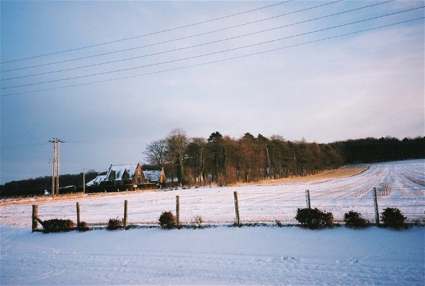
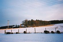 Craigton School during Winter 2009
References
- ^ "Dundee and Montrose, Forfar and Arbroath", Ordnance Survey Landranger Map, 2007, ISBN 0319229807
Angus Principal towns Other towns
and villagesAberlemno · Airlie · Arbirlot · Ardovie · Ascreavie · Auchnacree · Auchmithie · Auchinleish · Auchterhouse · Balgray · Balintore · Balkeerie · Balmirmer · Balnaboth · Barry · Birkhill · Boddin · Boysack · Brewlands Bridge · Bridgend of Lintrathen · Bridgefoot · Bridge of Craigisla · Bucklerheads · Burnside of Duntrune · Caldhame · Camuston † · Careston · Carlungie · Carlogie · Carmyllie · Castleton · Charleston · Clayholes · Clova · Colliston · Cortachy · Cottown of Guthrie · Craichie · Craigo · Craigton · Douglastown · Dronley · Drumsturdy · Dubton · Dun · Dunnichen · Dykehead · Eassie · East Haven · Edzell · Elliot · Farnell · Folda · Friockheim · Gardynebourg † · Gateside · Glamis · Greystone · Guthrie · Hillside · Hunter's Town † · Inveraldie · Inverarity · Inverkeilor · Inverpeffer † · Kellas · Kingennie · Kingsmuir · Kirkbuddo · Kirkinch · Kirkton of Glenisla · Kirkton of Kingoldrum · Letham · Liff · Little Brechin · Little Forter · Lucknow · Lunan · Lundie · Marywell · Memus · Menmuir · Milden · Milton of Finavon · Milton of Ogilvie · Monikie · Muirdrum · Murroes · Newbigging · Newtyle · Northmuir · Oathlaw · Old Balkello · Panbride · Redford · Ruthven · Salmond's Muir · St Vigeans · Stracathro · Strathmartine · Tannadice · Tarfside · Tealing · Trinity · Unthank · Upper Victoria · Wellbank · Wester Denoon · Whigstreet · WoodhillCategories:- Villages in Angus
- Angus geography stubs

Wikimedia Foundation. 2010.