- Birkhill, Angus
-
This article is about a village in Angus. For a station in Falkirk, see Birkhill railway station.
Coordinates: 56°29′34″N 3°03′20″W / 56.492695°N 3.055644°W
Birkhill 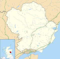
 Birkhill
Birkhill shown within AngusPopulation est. 2,160[1] (2006) OS grid reference NO351339 Council area Angus Lieutenancy area Angus Country Scotland Sovereign state United Kingdom Post town DUNDEE Postcode district DD2 Dialling code 01382 Police Tayside Fire Tayside Ambulance Scottish EU Parliament Scotland UK Parliament Dundee East Scottish Parliament Angus
North East ScotlandList of places: UK • Scotland • Birkhill and neighbouring Muirhead are two small villages in Angus, just to the west of Dundee, Scotland.[2]
Contents
The main attractions
The main attractions of Birkhill include:
- a branch of the Co-op, formerly called Alldays
- a small hill known to locals as The Roundie
- Birkhill Primary School, built in 1993 and later extended (the extension officially opened by Andrew Welsh MSP in 2002). Most students go to Monifieth High School for secondary education, with the school providing buses for the long journey to Monifieth.
The school has about 300 pupils and around 17-18 teachers. Famous Scottish footballer Craig Brewster attended the older Birkhill Primary School in Muirhead which has now been converted into several houses.
- sports facilities, including a football pitch and a tennis court an also a very busy and enthusiastic Bowling Club
- the Birkhill Inn, a small restaurant and pub often called the Birkie Inn
- the Millennium Hall, which hosts clubs and events.
Birkhill is located right next to Templeton Woods, home to one of the largest populations of Red Squirrels in the UK.
Muirhead
In Muirhead there is:
- a convenience store called Adil's
- a chemist
- a doctor's surgery
- a post office
- a Scout Hall, home to the 46th Angus Scouts which is available for rent and is currently well utilised
- a small police station.
- a stables and riding school
- two nursery schools, called Birkhill Nursery School and Tiddlywinks Nursery School.
- a large area of woodland known as Backmuir Wood or 5 Mile Wood
- a Motor Mechanics
- a Church
- The Muirhead and Birkhill Millennium Hall which has over 25 different groups using it. Their website can be found at www.muirheadbirkhillmilleniumhall.org.uk
Sports
Birkhill has many sports teams including the school's very successful football team. They are also developing a basketball team, and a karate club.
There is also the newly formed Birkhill FC, An Amateur Sunday League Football team that play in the Dundee Sunday Morning Amateur Football Association. They play their home games at Birkie Park and more information can be found on their official website, www.birkhillfc.co.uk
Birkhill Primary School
Each year, round about May or early June the school has its official sports day and house football. The pupils from all classes are split up into houses, named Bruce, Duncan, Gray and Wallace.The 2008 Sports Day winners were wallace. Gray won in 2009, and Wallace won in 2010 and 2011. In 2010 Duncan won the house football and this year (2011) Gray won.
When they graduate from Birkhill P.S most go to Monifieth High. However, some choose Forfar Academy or Menzieshill High.
The school currently has a pupil roll of roughly 250.
Scouts Group
One of the main attractions of Birkhill and Muirhead is the "46th Angus Scouts" group who meet every Wednesday night at The Scout Hall. The troup have had considerable success in competition camps over the years and also have Scouts who have achieved the highly acclaimed Queens Scout Award. During the summer of 2010 the Scouts attended a very successful week long camp in the Lake District meeting Scouts from across the world and later this year fund raising permitted they will spend a week in Paris. The Scouts also run each year a highly successful Burns Night with tickets being in huge demand.
The Scout Hall is available for rent and current utilisation of the hall is very good with a huge selection of groups regularly renting the hall for many different functions with the income being ploughed back into the maintenance and upgrading of the hall and its facilities
Street Names
Many street names in Birkhill have been inspired by the local environment, for instance, Post Box Road has a post box on it and Wood Road leads to a wooded area. There are also streets named after the late John Huband who was a very famous accordion player from the village and also wrote a huge amount of music in his day. The streets are John Huband Drive and Accordion Way and are located just off Dronley Road
References
- ^ http://www.gro-scotland.gov.uk/statistics/publications-and-data
- ^ "Dundee and Montrose, Forfar and Arbroath", Ordnance Survey Landranger Map, 2007, ISBN 0319229807
Angus Principal towns Other towns
and villagesAberlemno · Airlie · Arbirlot · Ardovie · Ascreavie · Auchnacree · Auchmithie · Auchinleish · Auchterhouse · Balgray · Balintore · Balkeerie · Balmirmer · Balnaboth · Barry · Birkhill · Boddin · Boysack · Brewlands Bridge · Bridgend of Lintrathen · Bridgefoot · Bridge of Craigisla · Bucklerheads · Burnside of Duntrune · Caldhame · Camuston † · Careston · Carlungie · Carlogie · Carmyllie · Castleton · Charleston · Clayholes · Clova · Colliston · Cortachy · Cottown of Guthrie · Craichie · Craigo · Craigton · Douglastown · Dronley · Drumsturdy · Dubton · Dun · Dunnichen · Dykehead · Eassie · East Haven · Edzell · Elliot · Farnell · Folda · Friockheim · Gardynebourg † · Gateside · Glamis · Greystone · Guthrie · Hillside · Hunter's Town † · Inveraldie · Inverarity · Inverkeilor · Inverpeffer † · Kellas · Kingennie · Kingsmuir · Kirkbuddo · Kirkinch · Kirkton of Glenisla · Kirkton of Kingoldrum · Letham · Liff · Little Brechin · Little Forter · Lucknow · Lunan · Lundie · Marywell · Memus · Menmuir · Milden · Milton of Finavon · Milton of Ogilvie · Monikie · Muirdrum · Murroes · Newbigging · Newtyle · Northmuir · Oathlaw · Old Balkello · Panbride · Redford · Ruthven · Salmond's Muir · St Vigeans · Stracathro · Strathmartine · Tannadice · Tarfside · Tealing · Trinity · Unthank · Upper Victoria · Wellbank · Wester Denoon · Whigstreet · WoodhillCategories:- Villages in Angus

Wikimedia Foundation. 2010.