- Muirdrum
-
Coordinates: 56°31′29″N 2°42′43″W / 56.524790°N 2.711928°W
Muirdrum Scots: Muirdrum 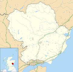
 Muirdrum
Muirdrum shown within AngusOS grid reference NO563372 - Edinburgh 43 mi (69 km) SSW - London 368 mi (592 km) SSE Council area Angus Lieutenancy area Angus Country Scotland Sovereign state United Kingdom Post town CARNOUSTIE Postcode district DD7 Dialling code 01241 Police Tayside Fire Tayside Ambulance Scottish EU Parliament Scotland UK Parliament Dundee East Scottish Parliament Angus North East Scotland List of places: UK • Scotland • Muirdrum (
 /mjʊərˈdrʌm/) is a small village in the council area of Angus, Scotland. It is situated at the junction of the old A92 road from Dundee to Arbroath, the A930 to Carnoustie and B9128 to Forfar. Its closest town is Carnoustie, which lies approximately 2 km (1 mi) to the south.[1]
The village is mentioned in the list of lands purchased by George Maule, 2nd Earl of Panmure in 1667.[2] These lands were forfeited by his heir, James Maule, 4th Earl of Panmure following the Jacobite Rebellion in 1715.[3] The opening of the Dundee to Arbroath turnpike road (later designated the A92 road) at the beginning of the 19th century lead to some expansion along this road.
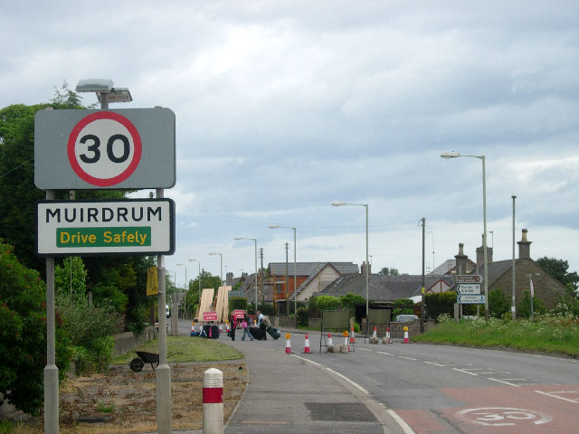
 Muirdrum (during A92 upgrade)
See also
References
- ^ "Dundee and Montrose, Forfar and Arbroath", Ordnance Survey Landranger Map, 2007, ISBN 0319229807
- ^ Ratification in favours of the earle of Panmuire, 1672, http://www.rps.ac.uk/search.php?action=fc&fn=charlesii_ms&id=id18588&query=&type=ms&variants=#m1672_6_142_d7_ms, retrieved 11 September 2008
- ^ Campbell, J.A. (1867), Balmerino and its abbey, a parochial history, Edinburgh: William Patterson, http://books.google.com/?id=aZELAAAAYAAJ&dq=history+of+balmerino+abbey&printsec=frontcover, retrieved 8 September 2008
External links
Angus Principal towns Other towns
and villagesAberlemno · Airlie · Arbirlot · Ardovie · Ascreavie · Auchnacree · Auchmithie · Auchinleish · Auchterhouse · Balgray · Balintore · Balkeerie · Balmirmer · Balnaboth · Barry · Birkhill · Boddin · Boysack · Brewlands Bridge · Bridgend of Lintrathen · Bridgefoot · Bridge of Craigisla · Bucklerheads · Burnside of Duntrune · Caldhame · Camuston † · Careston · Carlungie · Carlogie · Carmyllie · Castleton · Charleston · Clayholes · Clova · Colliston · Cortachy · Cottown of Guthrie · Craichie · Craigo · Craigton · Douglastown · Dronley · Drumsturdy · Dubton · Dun · Dunnichen · Dykehead · Eassie · East Haven · Edzell · Elliot · Farnell · Folda · Friockheim · Gardynebourg † · Gateside · Glamis · Greystone · Guthrie · Hillside · Hunter's Town † · Inveraldie · Inverarity · Inverkeilor · Inverpeffer † · Kellas · Kingennie · Kingsmuir · Kirkbuddo · Kirkinch · Kirkton of Glenisla · Kirkton of Kingoldrum · Letham · Liff · Little Brechin · Little Forter · Lucknow · Lunan · Lundie · Marywell · Memus · Menmuir · Milden · Milton of Finavon · Milton of Ogilvie · Monikie · Muirdrum · Murroes · Newbigging · Newtyle · Northmuir · Oathlaw · Old Balkello · Panbride · Redford · Ruthven · Salmond's Muir · St Vigeans · Stracathro · Strathmartine · Tannadice · Tarfside · Tealing · Trinity · Unthank · Upper Victoria · Wellbank · Wester Denoon · Whigstreet · WoodhillCategories:- Villages in Angus

Wikimedia Foundation. 2010.