- DN postcode area
-
Coordinates: 53°31′23″N 1°08′02″W / 53.523°N 1.134°W
Doncaster postcode area 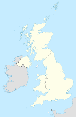
 DN
DNPostcode area DN Postcode area name Doncaster Post towns 13 Postcode districts 33 Postcode sectors 112 Postcodes (live) 21,425 Postcodes (total) 25,816 
Statistics as at October 2006 [1] The DN postcode area, also known as the Doncaster postcode area,[2] is a group of postcode districts around Barnetby, Barrow upon Humber, Barton-upon-Humber, Brigg, Cleethorpes, Doncaster, Gainsborough, Goole, Grimsby, Immingham, Retford, Scunthorpe and Ulceby in England.
The S64 postcode district was originally earmarked as the DN13 postcode district. On a map, a gap is formed in the geographic postcode pattern, which is why DN13 does not exist.
Contents
Coverage
The approximate coverage of the postcode districts:
Postcode district Post town Coverage Local authority area DN1 DONCASTER Doncaster town centre Doncaster DN2 DONCASTER Intake, Wheatley, Wheatley Hills Doncaster DN3 DONCASTER Armthorpe, Barnby Dun, Branton, Edenthorpe, Kirk Sandall Doncaster DN4 DONCASTER Balby, Belle Vue, Bessacarr, Cantley, Hexthorpe, Hyde Park, Warmsworth Doncaster DN5 DONCASTER Arksey, Barnburgh, Bentley, Cusworth, Harlington, Scawsby, Scawthorpe, Sprotborough, Toll Bar Barnsley, Doncaster DN6 DONCASTER Adwick-le-Street, Askern, Campsall, Moss, Norton, Sutton, Walden Stubbs, Woodlands Doncaster, Selby DN7 DONCASTER Dunsville, Hatfield, Lindholme, Stainforth Doncaster DN8 DONCASTER Thorne Doncaster DN9 DONCASTER Epworth, Finningley, Haxey, Owston Ferry Doncaster, North Lincolnshire, Belton DN10 DONCASTER Bawtry, Misson, Misterton, Scrooby Bassetlaw, Doncaster DN11 DONCASTER Harworth, New Rossington, Rossington, Tickhill, Wadworth Bassetlaw, Doncaster DN12 DONCASTER Conisbrough, Denaby Main, New Edlington, Old Denaby, Old Edlington Doncaster, Rotherham DN14 GOOLE Goole, Howden, Rawcliffe, Carlton East Riding of Yorkshire, Selby DN15 SCUNTHORPE Alkborough, Appleby, Burton upon Stather, Coleby, Dragonby, Flixborough, Flixborough Ind Estate, Foxhills Ind Estate, Gunness, High Risby, High Santon, Low Risby, Low Santon, Normanby, Roxby, Scunthorpe, Thealby, West Halton, Whitton, Wintringham, Winterton North Lincolnshire DN16 SCUNTHORPE Bottesford, Holme, Queensway Ind Estate, Raventhorpe, Scunthorpe, Twigmoor North Lincolnshire DN17 SCUNTHORPE Althorpe, Amcotts, Bottesford Moor, Bottesford, Crowle, Derrythorpe, Ealand, East Butterwick, Eastoft, Garthorpe, Gunness, Keadby, Luddington, Messingham, North Ewster, Scunthorpe, Susworth, West Butterwick, Yaddlethorpe North Lincolnshire DN18 BARTON-UPON-HUMBER North Lincolnshire DN19 BARROW-UPON-HUMBER North Lincolnshire DN20 BRIGG Brigg, Broughton, Hibaldstow, Scawby, Wrawby North Lincolnshire DN21 GAINSBOROUGH Gainsborough, Kirton Lindsey, Marton, Lea, Blyton, Scotter West Lindsey DN22 RETFORD Ranskill, Retford Bassetlaw DN31 GRIMSBY North East Lincolnshire DN32 GRIMSBY North East Lincolnshire DN33 GRIMSBY North East Lincolnshire DN34 GRIMSBY North East Lincolnshire DN35 CLEETHORPES Cleethorpes North East Lincolnshire DN36 GRIMSBY Holton le Clay, Humberston, Ludborough, Marshchapel, New Waltham, North Cotes, North Thoresby, Tetney East Lindsey, North East Lincolnshire DN37 GRIMSBY Ashby cum Fenby, Barnoldby-le-Beck, Beelsby, Bradley, Brocklesby, Great Coates, Great Limber, Irby-upon-Humber, Laceby, Waltham North East Lincolnshire, West Lindsey DN38 BARNETBY Barnetby, Grasby, Searby, Somerby North Lincolnshire, West Lindsey DN39 ULCEBY Croxton, Kirmington, Ulceby, Wootton North Lincolnshire DN40 IMMINGHAM North Killingholme, South Killingholme, Habrough, Immingham, East Halton North Lincolnshire, North East Lincolnshire DN41 GRIMSBY Healing, Keelby, Stallingborough North East Lincolnshire, West Lindsey Adjacent areas
Adjacent postcode areas WF YO HU 
S  DN
DN 

NG LN Clockwise from the east, the adjacent postcode areas are: , LN (Lincoln), NG (Nottingham), S (Sheffield), WF (Wakefield), YO (York), HU (Hull).
See also
References
- ^ "National Statistics Postcode Directory" (PDF). Office for National Statistics Postcode Directory (November 2006). Office for National Statistics. November 2006. http://www.statistics.gov.uk/geography/downloads/NSPDVersionNotes.pdf. Retrieved 2009-05-29.
- ^ Royal Mail, Address Management Guide, (2004)
Postcode areas in the United Kingdom, Channel Islands and Isle of Man AB AL B BA BB BD BH BL BN BR BS BT BX CA CB CF CH CM CO CR CT CV CW DA DD DE DG DH DL DN DT DY E EC EH EN EX FK FY G GIR GL GU GY HA HD HG HP HR HS HU HX IG IM IP IV JE KA KT KW KY L LA LD LE LL LN LS LU M ME MK ML N NE NG NN NP NR NW OL OX PA PE PH PL PO PR RG RH RM S SA SE SG SK SL SM SN SO SP SR SS ST SW SY TA TD TF TN TQ TR TS TW UB W WA WC WD WF WN WR WS WV YO ZE
Categories:- Doncaster
- Postcode areas covering Yorkshire and the Humber
- Postcode areas covering the East Midlands


Wikimedia Foundation. 2010.