- CM postcode area
-
Chelmsford postcode area 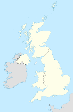
 CM
CMPostcode area CM Postcode area name Chelmsford Post towns 16 Postcode districts 26 Postcode sectors 95 Postcodes (live) 17,689 Postcodes (total) 24,228 Statistics as at October 2006 [1] The CM postcode area, also known as the Chelmsford postcode area,[2] is a group of postcode districts in central Essex, England around the towns of Billericay, Braintree, Brentwood, Burnham-on-Crouch, Chelmsford, Dunmow, Epping, Harlow, Ingatestone, Maldon, Ongar, Southminster, Stansted and Witham. However, CM13 and CM14 also covers part of the North east of Greater London, small and mostly unpopulated protrusions of Cranham and Harold Wood respectively, in the London Borough of Havering.
Contents
Coverage
The Stansted post town (CM24) is entirely surrounded by the Bishop's Stortford post town (CM22 and CM23).[2]
The approximate coverage of the postcode districts:
Postcode district Post town Coverage Local authority area CM0 SOUTHMINSTER Southminster, Bradwell, Tillingham, Asheldham, Dengie Maldon CM0 BURNHAM-ON-CROUCH Burnham-on-Crouch, Tillingham Maldon CM1 CHELMSFORD Chelmsford, Writtle Chelmsford CM2 Chelmsford Chelmsford CM3 Hatfield Peverel, South Woodham Ferrers, Boreham, Maylandsea Chelmsford CM4 INGATESTONE Blackmore, Fryerning, Ingatestone, Stock Brentwood CM5 ONGAR Chipping Ongar, High Ongar, Bobbingworth, Moreton, The Lavers, The Rodings Epping Forest CM6 DUNMOW Great Dunmow, Felsted Uttlesford CM7 BRAINTREE Braintree Braintree CM8 WITHAM Witham Braintree CM9 MALDON Maldon, Tollesbury, Tolleshunt D'Arcy, Tolleshunt Knights Maldon CM11 BILLERICAY Billericay (East), Great Burstead Basildon CM12 Billericay (West) Basildon CM13 BRENTWOOD Brentwood, East Horndon, Great Warley, Herongate, Hutton, Ingrave, Little Warley, West Horndon, Cranham Brentwood, Havering CM14 Brentwood, Harold Wood Brentwood, Havering CM15 Brentwood, Doddinghurst, Kelvedon Hatch, Mountnessing, Shenfield, Stondon Massey Brentwood CM16 EPPING Epping, Theydon Bois Epping Forest CM17 HARLOW Harlow, Old Harlow, Matching, Matching Tye, Matching Green Harlow and Epping Forest CM18 Harlow Harlow CM19 Harlow, Roydon Harlow and Epping Forest CM20 Harlow Harlow CM21 SAWBRIDGEWORTH Sawbridgeworth East Hertfordshire CM22 BISHOP'S STORTFORD Bishop's Stortford, Sheering East Hertfordshire,Uttlesford CM23 Bishop's Stortford East Hertfordshire, Uttlesford CM24 STANSTED Stansted Mountfitchet Uttlesford CM77 BRAINTREE Braintree, Great Notley, Rayne Braintree Adjacent areas
Adjacent postcode areas SG CB CO EN 
IG  CM
CM 

RM SS Clockwise from the east, the adjacent postcode areas are: , SS (Southend on Sea), RM (Romford), IG (Ilford), EN (Enfield), SG (Stevenage), CB (Cambridge), CO (Colchester).
See also
References
- ^ "National Statistics Postcode Directory" (PDF). Office for National Statistics Postcode Directory (November 2006). Office for National Statistics. November 2006. http://www.statistics.gov.uk/geography/downloads/NSPDVersionNotes.pdf. Retrieved 2009-05-29.
- ^ a b Royal Mail, Address Management Guide, (2004)
External links
Postcode areas in the United Kingdom, Channel Islands and Isle of Man AB AL B BA BB BD BH BL BN BR BS BT BX CA CB CF CH CM CO CR CT CV CW DA DD DE DG DH DL DN DT DY E EC EH EN EX FK FY G GIR GL GU GY HA HD HG HP HR HS HU HX IG IM IP IV JE KA KT KW KY L LA LD LE LL LN LS LU M ME MK ML N NE NG NN NP NR NW OL OX PA PE PH PL PO PR RG RH RM S SA SE SG SK SL SM SN SO SP SR SS ST SW SY TA TD TF TN TQ TR TS TW UB W WA WC WD WF WN WR WS WV YO ZE
Categories:- Postcode areas covering the East of England
- Basildon
- Brentwood
- Braintree
- Chelmsford
- Epping Forest
- Harlow
- Maldon (district)
- Uttlesford

Wikimedia Foundation. 2010.