- Chelmsford (borough)
-
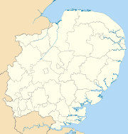
Borough of Chelmsford — Non-metropolitan district, Borough — Chelmsford shown within Essex
Sovereign state United Kingdom Constituent country England Region East of England Non-metropolitan county Essex Status Non-metropolitan district, Borough Admin HQ Chelmsford Incorporated 1 April 1974 Government - Type Non-metropolitan district council - Body Chelmsford Borough Council - Leadership Leader & Cabinet (Conservative) - MPs Simon Burns
Alan Haselhurst
John WhittingdaleArea - Total 132.1 sq mi (342.24 km2) Area rank 126th (of 326) Population (2010 est.) - Total 169,500 - Rank 101st (of 326) - Density 1,282.7/sq mi (495.3/km2) - Ethnicity 94.6% White
2.0% S.Asian
1.3% Black
1.2% Mixed RaceTime zone GMT (UTC0) - Summer (DST) BST (UTC+1) ONS code 22UF OS grid reference TL713070 Website chelmsford.gov.uk Chelmsford is a local government district and borough in Essex, England. It is named after its main settlement, Chelmsford, which is also the county town of Essex.
Contents
History
The current district was formed on 1 April 1974 from the borough of Chelmsford, and most of the Chelmsford Rural District.
Chelmsford Borough Council (CBC)
The mayor of the borough is Councillor Bob Shepherd M.B.E and is the first citizen of the borough and an ambassador for Chelmsford.[1] A cabinet of ten councillors, from the 57 that constitute the council, are led by Cllr Roy Whitehead.[2] Local elections are held every four years in the borough.
Parish and town councils
The borough contains 26 parishes--one town council and 25 parish councils.[3] They are:
Town council
Parish councils
- Boreham
- Broomfield
- Chignall
- Danbury
- East Hanningfield
- Galleywood
- Good Easter
- Great Baddow
- Great and Little Leighs
- Great Waltham
- Highwood, Essex
- Little Baddow
- Little Waltham
- Margaretting
- Pleshey
- Rettendon
- Roxwell
- Runwell
- Sandon
- South Hanningfield
- Springfield
- Stock
- West Hanningfield
- Woodham Ferrers and Bicknacre
- Writtle
Parish without a council
Boundaries
To the north-west it borders the district of Uttlesford and to the north-east the boundary is with the district of Braintree. It shares its eastern border with Maldon. To the south-east its borders the district of Rochford, to the south the district of Basildon and to the south-west it the borough of Brentwood. To the west the borough has a boundary with the district of Epping Forest.
Population
The total population of the area covered by the Borough council is 157,748 (ONS 2004 estimate). Approximately 60,000 live in the town and over 42,400 in the surrounding suburban and semi-rural parishes. Around 16,600 live in South Woodham Ferrers. The remainder of the population live in the surrounding rural areas, including the villages of Galleywood, Bicknacre, East, West and South Hanningfield, Boreham, Ford End, Pleshey, Highwood, Good Easter, High Easter, Chignal St James, Chignal Smealy, Howe Green, Roxwell, Great Leighs, Little Leighs, Broomfield, Great Waltham, Little Waltham, Great Baddow, Little Baddow, Danbury, Sandon, Rettendon, Runwell, Margaretting, Stock and Writtle. (Source: population derived from 2001 census). However this number is expected to rise dramatically, with 40,000 homes to be built in the metropolitan area of the borough which could bring the size of Chelmsford up to over 170,000 to be concentrated around Boreham Airfield, Broomfield, North Springfield and Beaulieu Park. These communities would be primarily built as an urban village design; a place to work, live and play.
Geography
The borough has two towns, the principal settlement Chelmsford in the centre and South Woodham Ferrers to the south east. The north west of the borough is predominantly rural. Villages are found throughout the borough.
The River Chelmer flows into the borough near North End and flows to Chelmsford where the River Can converges with it at the town centre, the River Chelmer then flows out of the borough between Boreham and Little Baddow. The River Can's source is in the north west of the borough. The River Wid flows from the South of the borough through Widford towards the centre past Writtle to join the River Can between Writtle and Chelmsford. The River Crouch flows along the part of the south-eastern border below South Woodham Ferrers. Hanningfield Reservoir, a Site of Special Scientific Interest, is located in the south of the borough.
Transport
The rail links, both national and international, which run through the borough, are all operated by National Express East Anglia. Two national rail services operate. The Great Eastern Main Line runs through the centre, stopping at Chelmsford railway station. Services via Chelmsford operate between London Liverpool Street and Ipswich, Clacton, Harwich, Braintree or Norwich. The Crouch Valley Line also runs through the far south-east tip of the borough, stopping at South Woodham Ferrers were services run from Wickford to Southminster from South Woodham Ferrers railway station.
The Amsterdam Express, a rail/sea/rail international service also stops in the borough at Chelmsford, connecting the town to the Netherlands.
There are several primary routes within the borough. One of these, the A12, is also a trunk road and runs from London and the M25, centrally in a north-easterly direction through the borough bypassing the town of Chelmsford onwards to Suffolk and Norfolk. Two other significant primary routes are the A130 which runs north-south across Essex and the A414, which begins as a primary route in Chelmsford but its terminus us Maldon in Essex. The A414 then runs west through Essex, meets the M11 and then its path continues into Hertfordshire via Harlow. Various other A- and B-Roads connect the borough, especially its main town, Chelmsford, to the rest of the county and beyond.
Education
Educational establishments in the borough include:
- Anglia Ruskin University
- King Edward VI Grammar School, known locally as 'KEGS'
- St John Payne Catholic Comprehensive School
- Chelmsford County High School
- Writtle College, an agricultural college
- Great Baddow High School
- Moulsham High School and humanities college
- Hylands School Specialist Science and Sixth Form College
- The Boswells School
- Columbus School and College, a special needs school.
- Chelmer Valley High School
- New Hall School, opened 1799.
- Chelmsford County High School for Girls, consistently one of the top five schools in the UK for both GCSE and A-level results.
- St Peters College, the former Rainsford High School, which is due for closure in August 2011.[4]
- The Sandon School
- Chelmsford College a college of further education
Tourism
Henry VIII's former Palace of Beaulieu is situated in Boreham, now occupied by the New Hall School. Other places to visit in the borough include the RHS Garden, Hyde Hall at Rettendon, and numerous open spaces in Chelmsford, including Admirals and Central Parks. Writtle, where Robert the Bruce is said to have married his second wife Elizabeth de Burgh in 1302, has English Royal connections, with King John building a hunting lodge there in 1211. Much of the site now lies within the grounds of Writtle College, the internationally famous centre for horticulture and agriculture. A few miles away is the attractive village of Pleshey, where stand the ruins of a once important castle mentioned in William Shakespeare's play Richard II. The entire circuit of the castle walls can still be traced in the village streets. American tourists often visit the village of Springfield, Essex, the origin of "Springfield" as a popular place name, first giving its name to the important City of Springfield, Massachusetts, and subsequently Springfield, Illinois, the state capital of Illinois, and Springfield, Missouri, among numerous others.
Twin towns
Chelmsford's official twin towns are:
 — Backnang (Germany)
 — Annonay (France)
 — Chelmsford, Massachusetts (USA)
References
- ^ "The Mayor of Chelmsford". www.chelmsford.gov.uk. October 2006. http://www.chelmsford.gov.uk/index.cfm?articleid=8949. Retrieved 2006-10-28.
- ^ "About The Council". www.chelmsford.gov.uk. October 2006. http://www.chelmsford.gov.uk/index.cfm?articleid=8401. Retrieved 2006-10-28.
- ^ "Parish Councils". www.chelmsford.gov.uk. October 2006. http://www.chelmsford.gov.uk/index.cfm?articleid=7090. Retrieved 2006-10-28.
- ^ http://www.thisistotalessex.co.uk/chelmsford/EXCLUSIVE-St-Peter-s-School-Chelmsford-shut/article-730133-detail/article.html
External links
 Districts of the East of England
Essex Basildon • Braintree • Brentwood • Castle Point • Chelmsford • Colchester • Epping Forest • Harlow • Maldon • Rochford • Southend-on-Sea • Tendring • Thurrock • Uttlesford
Hertfordshire Bedfordshire Cambridgeshire Norfolk Suffolk Contiguous with Chelmsford: Broomfield • Chelmer Village • Great Baddow • Moulsham • North Melbourne • Springfield • Widford Towns: 
Villages & Hamlets: Bicknacre • Boreham • Chalk End • Chatham Green • Chignal St James • Chignall Smealy • Cooksmill Green • Danbury • Downham • East Hanningfield • Fanner's Green • Ford End • Galleywood • Galleyend • Good Easter • Great Leighs • Great Oxney Green • Great Waltham • Highwood • Howe Green • Howe Street • Little Baddow • Little Leighs • Littley Green • Little Waltham • Margaretting • Margaretting Tye • Mashbury • Newney Green • North End • Pepper's Green • Pleshey • Ramsden Heath • Rettendon • Rettendon Place • Roxwell • Runwell • Sandon • South Hanningfield • Stock • Tye Green • West Hanningfield • Woodham Ferrers • WrittleChelmsford is the county town of Essex
List of places in EssexCategories:- Chelmsford
- Local government in Essex
- Non-metropolitan districts of Essex
- Local government districts of the East of England


Wikimedia Foundation. 2010.