- Luton
-
For other uses, see Luton (disambiguation).
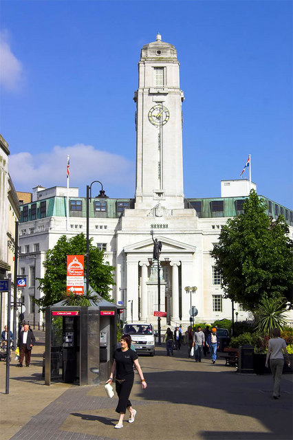
Borough of Luton — Town, Borough & Unitary authority — Luton Town Hall

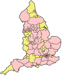
Luton Town Coat of ArmsLuton shown within Bedfordshire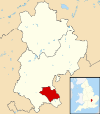
Coordinates: 51°54′0″N 0°26′0″W / 51.9°N 0.433333°W Country United Kingdom Constituent area England Region East of England Ceremonial county Bedfordshire Borough Luton Government[1] - Type Borough - Governing body Luton Borough Council - Executive: Labour - Mayor Don Worlding - MPs Kelvin Hopkins (L)
Gavin Shuker (L)Area - Total 16.7 sq mi (43.35 km2) Population [2] - Total 205,900 - ethnicity 68.0% White
18.9% S.Asian
7.3% Black
3.1% Mixed Race
2.5% E.Asian and OtherTime zone GMT - Summer (DST) British Summer Time (UTC) Postcode Area LU Area code(s) (01582) ONS code 00KA Demonym Lutonians Website www.luton.gov.uk Luton (
 i/ˈluːtən/ or local /ˈluːʔən/) is a large town and unitary authority of Bedfordshire, England, 30 miles (51 kilometres) north of London. Luton and its near neighbours, Dunstable and Houghton Regis, form the Luton/Dunstable Urban Area with a population of about 250,000.[3][4]
Luton is home to Blue Square Premier team Luton Town Football Club, whose history includes several spells in the top flight of the English league as well as a Football League Cup triumph in 1988. They play at Kenilworth Road stadium, which has been their home since 1905.
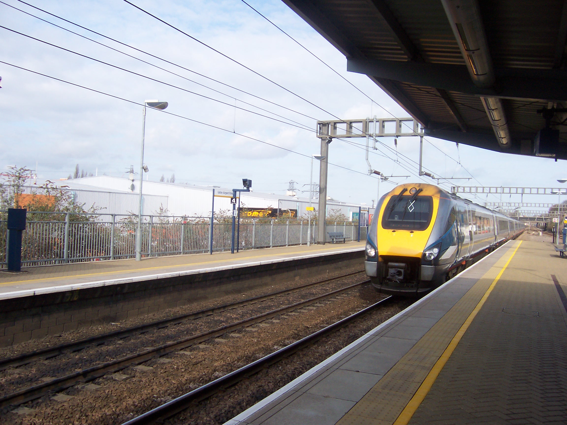
London Luton Airport, opened in 1938, is one of England's major airports. During the Second World War it doubled as an RAF base.
The University of Bedfordshire is based in the town.
The Luton Carnival, held on the late May bank holiday, is the largest one-day carnival in Europe.[citation needed]
The town was for many years famous for hat-making and was also home to a large Vauxhall Motors factory; the head office of Vauxhall Motors is still situated in the town. Car production at the plant began in 1905 and continued until 2002, but commercial vehicle production remains.
Contents
History
Main article: History of LutonEarly history
The earliest settlements in the Luton area were at Round Green and Mixes Hill, where Paleolithic encampments (about 250,000 years old) have been found.[5] Settlements re-appeared after the ice had retreated in the Mesolithic period around 8000 BC. Traces of these settlements have been found in the Leagrave area of the modern town. Remains from the Neolithic period (4500-2500 BC in this area) are much more common. A particular concentration of Neolithic burials has been found at Galley Hill.[6] The most prominent Neolithic structure is Waulud's Bank - a henge dating from around 3000 BC. From the Neolithic onwards, the area seems to have been populated, but without any single large settlement.
The first urban settlement nearby was the small Roman town of Durocobrivis at Dunstable, but Roman remains in Luton itself consist only of scattered farmsteads.[7]
The foundation of Luton is usually dated to the 6th century when a Saxon outpost was founded on the River Lea, Lea tun.[8] Luton is recorded in the Domesday Book as Loitone and also as Lintone.[9] Agriculture dominated the local economy at that time, and the town's population was around 700-800.
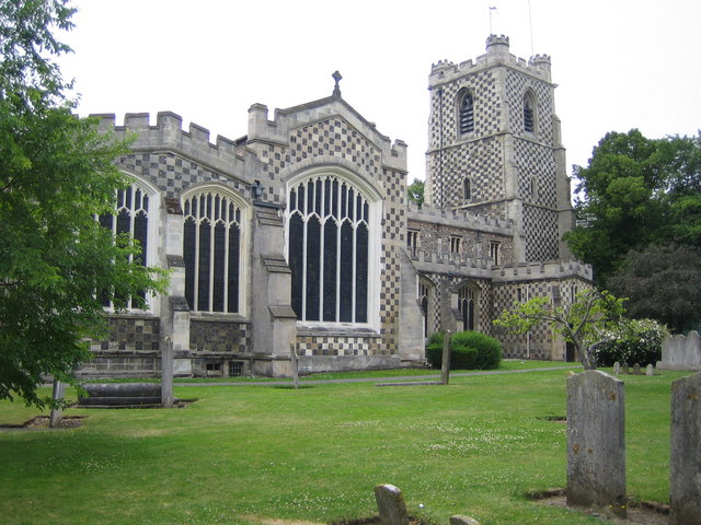
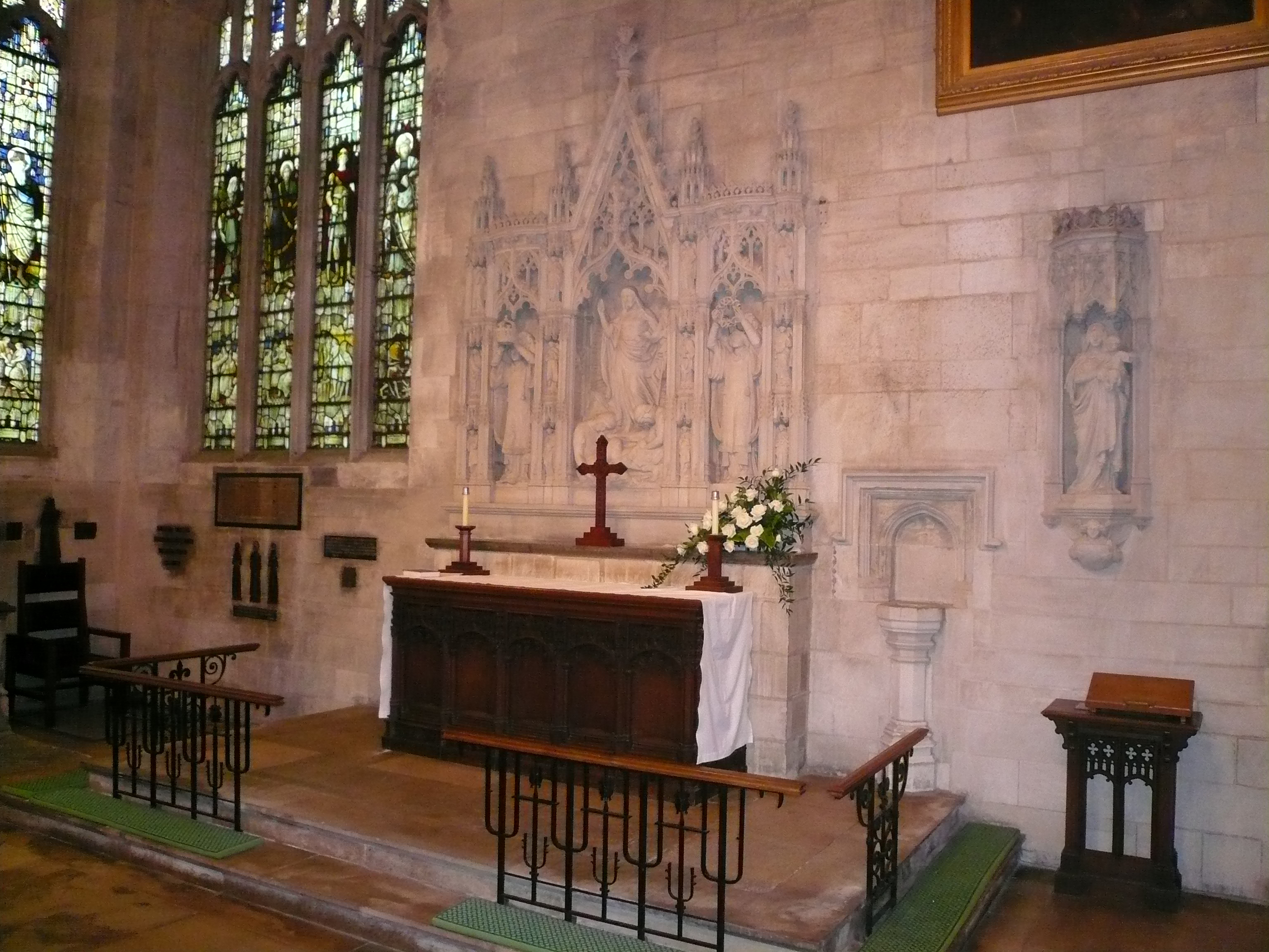
 St Marys Church, Luton town centre
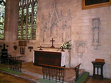 The Wenlock chapel within St Marys
In 1121 Robert, 1st Earl of Gloucester started work on St Mary's Church in the centre of the town. The work was completed by 1137.[10] A motte and bailey type castle which gives its name to the modern Castle Street was built in 1139. The castle was demolished in 1154[11] and the site is now home to a Matalan store. During the Middle Ages Luton is recorded as being home to six watermills. Mill Street, in the town centre, takes its name from one of them.
King John (1166–1216) had hired a mercenary soldier, Falkes de Breauté, to act on his behalf. (Breauté is a small town near Le Havre in France.) When he married, Falkes de Breauté acquired his wife's house which came to be known as "Fawkes Hall", subsequently corrupted over the years to "Foxhall", then "Vauxhall". In return for his services, King John granted Falkes the manor of Luton, where he built a castle alongside St Mary's Church. He was also granted the right to bear his own coat of arms and chose the mythical griffin as his heraldic emblem. The griffin thus became associated with both Vauxhall and Luton in the early 13th century.[12]
By 1240 the town is recorded as Leueton. The town had a market for surrounding villages in August each year, and with the growth of the town a second fair was granted each October from 1338.
In 1336, much of Luton was destroyed by a great fire, however the town was soon rebuilt.
The agriculture base of the town changed in the 16th century with a brick making industry developing around Luton, many of the older wooden houses were rebuilt in brick.
17th century
During the English Civil War of the 17th century, in 1645, royalists entered the town and demanded money and goods. Parliamentary forces arrived and during the fighting four royalist soldiers were killed and a further twenty-two were captured. A second skirmish occurred three years later in 1648 when a royalist army passed through Luton. A number of royalists were attacked by parliamentary soldiers at an inn on the corner of the current Bridge Street. Most of the royalists escaped but nine were killed.
18th century
The hat making industry began in the 17th century and became synonymous with the town.[13] By the 18th century the industry dominated the town. Hats are still produced in the town but on a much smaller scale.
The first Luton Workhouse was constructed in the town in 1722.
Luton Hoo, a nearby large country house was built in 1767 and substantially rebuilt after a fire in 1843. It is now a luxury hotel.[14]
19th century
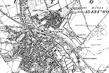 A map of Luton from 1888
The town grew strongly in the 19th century. In 1801 the population was 3,095.[15] By 1850 it was over 10,000 and by 1901 it was almost 39,000. Such rapid growth demanded a railway connection but the town had to wait a long time for one. The London and Birmingham Railway (L&BR) had been built through Tring in 1838, and the Great Northern Railway was built through Hitchin in 1852, both bypassing Luton, the largest town in the area. A branch line connecting with the L&BR at Leighton Buzzard was proposed, but because of objections to release of land, construction terminated at Dunstable in 1848. It was another ten years before the branch was extended to Bute Street Station, and the first train to Dunstable ran on 3 May 1858.[16] The line was later extended to Welwyn and from 1860 direct trains to King's Cross ran. The Midland Railway was extended from Bedford to St Pancras through Leagrave and Midland Road station and opened on 9 September 1867.[17]
Luton received a gas supply in 1834. Gas street lights were erected and the first town hall was opened in 1847.
Newspaper printing arrived in the town in 1854. The first public cemetery was opened in the same year. Following a cholera epidemic in 1848 Luton formed a water company and had a complete water and sewerage system by the late 1860s. The first covered market was built (the Plait Halls - now demolished) in 1869. Luton was made a borough in 1876.[18] A professional football club - the first in the South of England - was founded in 1885 following a resolution at the town hall that a 'Luton Town Club be formed'.[19]
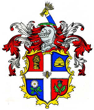
The crest also includes a hand holding a bunch of wheat, either taken as a symbol of the straw-plaiting industry, or from the arms of John Whethamsteade, Abbott of St Albans, who rebuilt the chancel of St Mary's Church in the 15th century.
20th century
In the 20th century, the hat trade severely declined and was replaced by other industries. In 1905, Vauxhall Motors opened the largest car plant in the United Kingdom in Luton. Electrolux built a household appliances plant around the same time and this was followed by other light engineering businesses.
In 1904 councillors Asher Hucklesby and Edwin Oakley purchased the estate at Wardown Park and donated it to the people of Luton. Hucklesby went on to become Mayor of Luton. The main house in the park became Wardown Park Museum.
The town had a tram system from 1908 until 1932 and the first cinema was opened in 1909. By 1914 the population had reached 50,000.
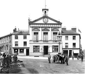
The original town hall was destroyed in 1919 during Peace Day celebrations at the end of World War I. Local people including many ex-servicemen were unhappy with unemployment and had been refused the use of a local park to hold celebratory events. They stormed the town hall setting it alight (see Luton Town Hall). A replacement building was completed in 1936. Luton Airport opened in 1938, owned and operated by the council.
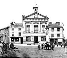 The first town hall was destroyed in 1919
In World War II, the Vauxhall Factory built Churchill tanks[20] as part of the war effort. Despite heavy camouflage, the factory made Luton a target for the Luftwaffe and the town suffered a number of air raids. 107 died[21] and there was extensive damage to the town (over 1,500 homes were damaged or destroyed). Other industry in the town, such as SKF which produced ball bearings, made a vital contribution to the war effort. Although a bomb landed at the SKF Factory[22] no major damage was caused.
The pre-war years, even at the turn of the 1930s when a Great Depression saw unemployment reach record levels nationally, were something of an economic boom for Luton, as new industries grew and prospered. New private and council housing was built in the 1920s and 1930s, with Luton growing as a town to incorporate nearby villages Leagrave, Limbury and Stopsley between 1928 and 1933.[23]
Post-war, the slum clearance continued and a number of substantial estates of council housing were built, notably at Farley Hill, Stopsley, Limbury, Marsh Farm and Leagrave (Hockwell Ring). The M1 motorway passed just to the west of the town, opening in 1959 and giving it a direct motorway link with London and - eventually - the Midlands and the North. In 1962 a new library (to replace the cramped Carnegie Library) was opened by the Queen in the corner of St George's Square.
In the late 1960s a large part of the town centre was cleared to build a large covered shopping centre, the Arndale Centre, which was opened in 1972.[24] It was refurbished and given a glass roof in the 1990s.
 The town centre still has some of the old hat factories
In 2000, Vauxhall announced the end of car production in Luton; the plant closed in March 2002.[25] At its peak it had employed in excess of 30,000 people. Vauxhall's headquarters remain in the town, as does its van and light commercial vehicle factory.
21st century
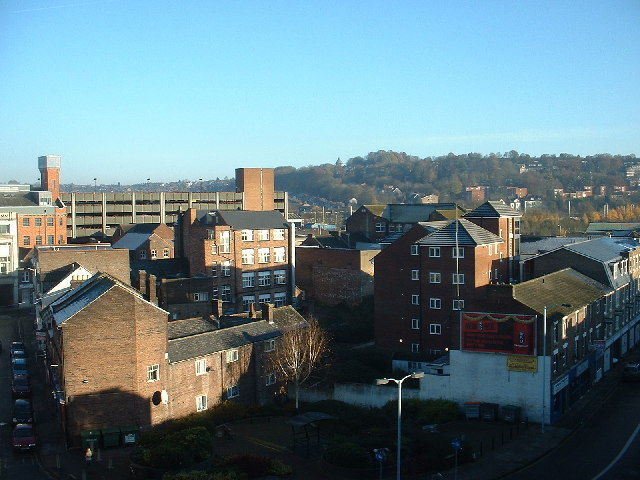
A major regeneration programme for the town centre is underway, which will include upgrades to the town's bus and railway stations as well as improvements to the town's urban environment. St George's Square has been rebuilt[26] and reopened in 2007. The new design won a Gold Standard Award for the Town Centre Environment from the annual British Council of Shopping Centres awards.[27]
Work was completed on an extension to the Mall Shopping Centre facing St George's Square, the largest of the new units to was taken by TK Maxx. Planning applications for a much larger extension to the Mall Arndale Shopping Centre (In the Northern Gateway area - Bute Street, Silver Street and Guildford Street) and also for a new centre in Power Court[28] (close to St Mary's Church) have been submitted. On the edge of Luton at Putteridge Bury a high-technology office park, Butterfield Green, is under construction. The former Vauxhall site is also to be re-developed as a mixed use site called Napier Park.[29] It will feature housing, retail and entertainment use, including a new casino.
An application for Luton to receive city status was made in 2011 and a decision is due in 2012.[30]
Governance
 Logo of Luton Unitary Authority
The town is situated within the historic county of Bedfordshire, but since 1997 Luton has been an administratively independent unitary authority. The town remains part of Bedfordshire for ceremonial purposes.
Luton Borough Council made a decision on 21 June 2010 to seek city status at the upcoming awards at the Diamond Jubilee of Elizabeth II. Their Love Luton city status bid is well underway. The town previously applied at the Millennium in 2000 and again in 2002 (Golden Jubilee of Elizabeth II) but failed. (see City status in the United Kingdom)
Parliamentary representation
Main article: Politics in LutonLuton is represented by two Members of Parliament. The constituency of Luton North has been held by Kelvin Hopkins (Labour) since 1997. Luton South has been held by Gavin Shuker (Labour) since 2010. Luton is within the East of England (European Parliament constituency).
Local council
Lutonians are governed by Luton Borough Council. The town is split into 19 wards, represented by 48 councillors. Elections are held for all seats every four years, with the most recent local elections held in May 2011 and the next due in May 2015. The Council is controlled by the Labour group, who have 36 Local Councillors (a majority of 24). The next largest party is the Liberal Democrats with 8 seats, followed by the Conservative Party with 4 seats.[31]
Position Current Representatives Members of Parliament Kelvin Hopkins, Labour, elected 1997 · Gavin Shuker, Labour, elected 2010 Town coat of arms
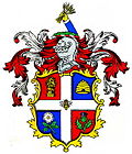 The town coat of arms: granted 25th July, 1876.
In 1876 the town was granted its own coat of arms. The wheatsheaf was used on the crest to represent agriculture and the supply of straw used in the local hatting industry (the straw-plaiting industry was brought to Luton by a group of Scots under the protection of Sir John Napier of Luton Hoo). The bee is traditionally the emblem of industry and the hive represents the straw-plaiting industry for which Luton was famous. The rose is from the arms of the Napier family, whereas the thistle is a symbol for Scotland. An alternative suggestion is that the rose was a national emblem, and the thistle represents the Marquess of Bute, who formerly owned the Manor of Luton Hoo.[32][33]
Geography
Luton is located in a break in the Eastern part of the Chiltern Hills. The Chilterns are a mixture of chalk from the Cretaceous period[34] (about 65-146 million years ago) and deposits laid at the southernmost points of the ice sheet during the last ice age (the Warden Hills area can be seen from much of the town).
Bedfordshire had a reputation for brick making but the industry is now significantly reduced. The brickworks[35] at Stopsley took advantage of the clay deposits in the east of the town.
The source of the River Lea, part of the Thames Valley drainage basin, is in the Leagrave area of the town. The Great Bramingham Wood surrounds this area. It is classified as ancient woodland; records mention the wood at least 400 years ago.
There are few routes through the hilly area for some miles, this has led to several major roads (including the M1 and the A6) and a major rail-link being constructed through the town.
Climate
Luton has a temperate marine climate, like much of the British Isles, with generally light precipitation throughout the year. The weather is very changeable from day to day and the warming influence of the Gulf Stream makes the region mild for its latitude. The average total annual rainfall is 698 mm (27.5 in) with rain falling on 117 days of the year.
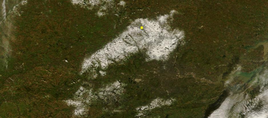
 Snow accumulation over the Chiltern hills during October 2008 snowfall, Luton is denoted by the yellow dot.
The local climate around Luton is differentiated somewhat from much of South East England due to its position in the Chiltern Hills, meaning it tends to be 1-2 degrees Celsius cooler than the surrounding towns - often flights at Luton airport, lying 160 m above sea level, will be suspended when marginal snow events occur, while airports at lower elevations, such as Heathrow, at 25 m above sea level, continue to function. An example of this is shown in the photograph to the right, the snowline being about 100 m above sea level. Absolute temperature extremes recorded at Rothamsted Research Station, 5 miles (8 km) south south east of Luton town centre and at a similar elevation range from −17 °C (1.4 °F)[36] in December 1981 and −16.7 °C (1.9 °F) in January 1963[37] to 36.0 °C (96.8 °F) in August 2003[38] and 33.8 °C (92.8 °F) in August 1990[39] and July 2006.[40] Records for Rothamsted date back to 1901.
Climate data for Rothamsted 1971-2000 (Weather station 5 miles (8 km) to the south of Luton) Month Jan Feb Mar Apr May Jun Jul Aug Sep Oct Nov Dec Year Average high °C (°F) 6.3
(43.3)6.7
(44.1)9.5
(49.1)11.9
(53.4)15.7
(60.3)18.6
(65.5)21.4
(70.5)21.4
(70.5)18.0
(64.4)13.8
(56.8)9.4
(48.9)7.2
(45.0)13.4 Average low °C (°F) 0.9
(33.6)0.7
(33.3)2.3
(36.1)3.6
(38.5)6.3
(43.3)9.2
(48.6)11.4
(52.5)11.4
(52.5)9.5
(49.1)6.7
(44.1)3.3
(37.9)1.9
(35.4)5.6 Precipitation mm (inches) 69.5
(2.736)47.3
(1.862)54.0
(2.126)53.1
(2.091)49.8
(1.961)60.4
(2.378)41.2
(1.622)53.6
(2.11)60.9
(2.398)74.4
(2.929)66.0
(2.598)67.6
(2.661)697.8
(27.472)Sunshine hours 55.2 70.6 107.3 146.7 194.7 190.2 203.4 196.5 142.2 112.2 70.2 48.1 1,537.2 Source: Met Office[41] Areas
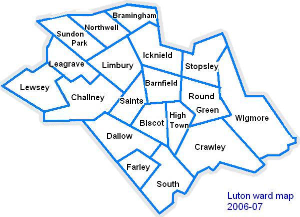
The Victorian expansion of Luton focused on areas close to the existing town centre and railways. In the 1920s and 1930s growth typically was though absorbing neighbouring villages and hamlets and infill construction between them and Luton. After the Second World War there were several estates and developments constructed both by the local authority such as Farley Hill or Marsh Farm, or privately such as Bushmead.
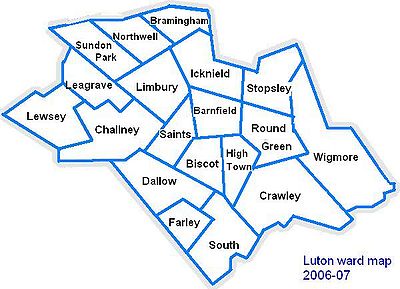
- Lewsey
- Limbury-cum-Biscot
- Northwell
- Round Green
- Saints
- South ward
- Stopsley
- Sundon Park
- Wigmore
More about Places within Luton
Demography
The United Kingdom Census 2001 showed that Luton had a population of 184,371, a 5.8% increase from the last census meaning that Luton was the 27th[42] largest settlement in the UK. Of this, 43,324 were under 15, 131,660 were between 16 and 74 and 9387 were over 74.[43] The Office for National Statistics mid-year estimate of the 2010 population is 198,800.[44] However, the Luton Borough Council Research and Geospatial Information team criticise this figure as understating the recent immigration from Eastern Europe, and they estimate the true figure to be approximately 205,900.[3]
Population since 1801 - Source: A Vision of Britain through Time[45] Year 1801 1851 1901 1911 1921 1931 1941 1951 1961 1971 1981 1991 2001 Population Luton 2,985 11,067 31,981 49,315 57,378 66,762 84,516 106,999 132,017 162,928 163,208 174,567 184,390 Local inhabitants are known as Lutonians.
Ethnicity
Luton has seen several waves of immigration. In the early part of the 20th century Irish and Scottish people arrived in the town - these were followed by Afro-Caribbean and Asian immigrants. More recently immigrants from Eastern Europe have made Luton their home. As a result of this Luton has a diverse ethnic mix, with a significant population of Asian descent, mainly Pakistani (8.6%), Indian (4.2%) and Bangladeshi (4.1%). The 2009 estimates from the Office of National Statistics figures show that the town has a white population of 68.0% (of which white British amount to 59.4%).
Luton: Ethnicity: 2009 Office of National Statistics estimates[46] Luton % East of England % England % White 68.0 90.0 87.5 Mixed 3.1 1.7 1.9 Asian or Asian British 18.9 4.4 6.0 Black or Black British 7.3 2.2 2.9 Chinese or Other Ethnic Group 2.5 1.8 1.6 Total 100.0 100.0 100.0 Religion
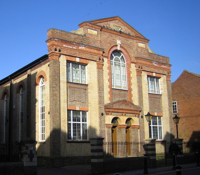
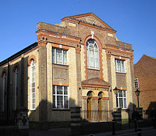 The Methodist Chapel in High Town (built 1897)
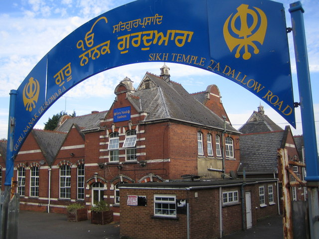
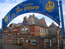 The Guru Nanak Gurdwara Sikh Temple, Luton
According to the United Kingdom Census 2001, 60% of the inhabitants in Luton are Christian and 15% are Muslim.[47]
The full statistics are as follows:[48]
Religion Luton % National % Christian 59.6% 71.7% Muslim 14.6% 3.0% Hindu 2.7% 1.1% Sikh 0.8% 0.6% Jewish 0.3% 0.5% Buddhist 0.2% 0.3% Other 0.3% 0.3% No religion 14.1% 14.8% Religion not stated 7.2% 7.7% Economic activity
Of the town's working population (classified 16–74 years of age by the Office for National Statistics), 63% are employed. This figure includes students, the self-employed and those who are in part-time employment. 11% are retired, 8% look after the family or take care of the home and 5% are unemployed.[49]
Economy
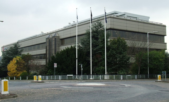
Main article: Economy of Luton Griffin House, headquarters of Vauxhall Motors
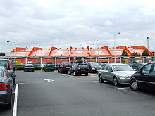 Hangar 89, EasyJet headquarters
Luton's economy has, traditionally been focused on several different areas of industry including Car Manufacture, engineering and millinery. However, today, Luton is moving towards a service based economy mainly in the retail and the airport sectors, although there is still a focus on light industry in the town.
Notable firms with headquarters in Luton include:
- EasyJet - head office (originally EasyLand, later moved into Hangar 89[50]) and main base at London Luton Airport
- Monarch Airlines - headquarters, at Luton Airport (Prospect House)[51]
- Thomson UK (Thomson Holidays and Thomson Airways) - travel[52]
- Vauxhall Motors - headquarters (Griffin House)[53]
Notable firms with offices in Luton include:
- Anritsu - electronics[citation needed]
- AstraZeneca - pharmaceuticals[citation needed]
- Selex Galileo - aerospace[citation needed]
- Ernst & Young - accountants [54]
- Experian - data and analytics[citation needed]
- Mazars - accountants [55]
- Siemens AG - electronics[citation needed]
- Whitbread - hospitality[citation needed]
Shopping
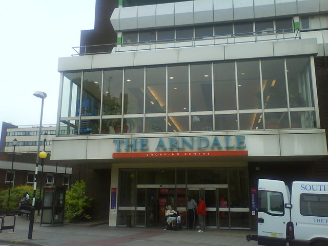
 The Mall Luton, the main shopping destination in Luton.
The main shopping area in Luton is centred around The Mall Luton. Built in the 1960s/1970s and opened as an Arndale Centre, construction of the shopping centre led to the demolition of a number of the older buildings in the town centre including the Plait Halls (a Victorian covered market building with an iron and glass roof). Shops and businesses in the remaining streets, particularly in the roads around Cheapside and in High Town, have been in decline ever since. George Street, on the south side of the Arndale, was pedestrianised in the 1990s.
Contained within the main shopping centre is the Market, which contains butchers, fishmongers, fruit and veg, hairdressers, tattoo parlours, ice cream, flower stall and T-shirt printing as well as eating places.
Another major shopping area is Bury Park where there are shops catering to Luton's ethnic minorities.
Food and drink
Luton has a diverse selection of restaurants - English, Italian, Chinese, Indian, Caribbean, Thai and Malaysian to name a few. No area of the town is specifically restaurant-orientated, but in some areas (such as Bury Park) there is a concentration of Asian restaurants.
There are pubs and clubs in the town centre. A number of these cater for the town's student population; however, there are still a number of traditional pubs in the town.
Transport
Main article: Transport in Luton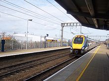
Luton has excellent transport links and is situated less than 30 miles north of the centre of London, giving it good links with the City and other parts of the country via the motorway network and the National Rail system. Luton is also home to London Luton Airport, one of the major feeder airports for London and the southeast. Luton is also served by a bus service run by Arriva and a large taxi network. As a Unitary Authority, Luton Borough Council is responsible for the local highways and public transport in the Borough and licensing of Taxis.
Education
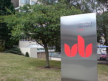 University of Bedfordshire - LutonMain article: Education in Luton
Luton is one of the main locations of the University of Bedfordshire. A large campus of the university is in Luton town centre, with a smaller campus based on the edge of town in Putteridge Bury, an old Victorian manor house. The other main campus of the university is located in Bedford.
The town is home to Luton Sixth Form College and Barnfield College. Both have been awarded Learning & Skills Beacon Status by the Department for Children, Schools and Families.[56][57]
Luton's schools and colleges have also been earmarked for major investment in the government scheme Building Schools for the Future programme, which intends to renew and refit buildings in institutes across the country. Luton is in the 3rd wave of this long term programme with work intending to start in 2009.[58]
There are 98 educational institutes in Luton - seven nurseries, 70 primary schools (9 voluntary-aided, 2 Special Requirements), 13 secondary schools (1 voluntary-aided, 1 Special Requirements), four further educational institutes and four other educational institutes.[59]
Culture and leisure
Sport
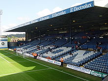 Kenilworth Road, home to Luton Town Football ClubMain article: Sport In Bedfordshire
Luton is the home town of Luton Town Football Club who have recently been relegated from the football league,[60] one below the 4th flight of the English league structure. Their nickname, "The Hatters", dates back to when Luton had a substantial millinery industry. Luton are currently in the Blue Square Bet Premier after failing to win automatic promotion to Football League Two during the 2009-10 season and 2010-1011 season. Luton were beaten 2-0 on aggregate by York City in the semi finals of the playoffs, and therefore failed to progress to the final at Wembley. York went on to lose in the final. Speedway racing was staged in Luton in the mid 1930s.
The town has three rugby union clubs - Luton Rugby Club who play in National 3 Midlands, Vauxhall Motors RFC who play in Midlands 4 SE and Stockwood Park who also play in Midlands 2 SE.
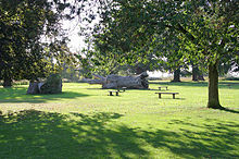
Wardown Park
 The Daisy-Chain Wall in Wardown Park.Main article: Wardown Park
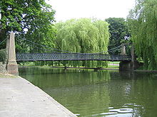
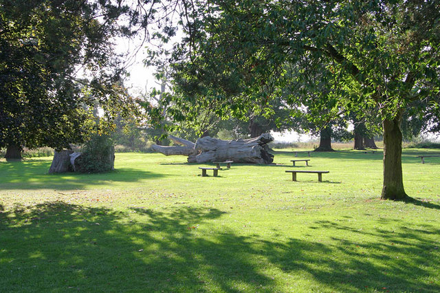
Wardown Park is situated on the River Lea in Luton. The park has sporting facilities, is home to the Wardown Park Museum and contains formal gardens. The park is located between Old Bedford Road and the A6, New Bedford Road and is within walking distance of the town centre.[61]
Stockwood Park
 Stockwood Park, LutonMain article: Stockwood Park
Stockwood Park is a large municipal park near Junction 10 of the M1. Located in the park is Stockwood Discovery Centre a free museum that houses the Mossman Collection and Luton local social history, archaeology and geology. There is an athletics track, an 18-hole golf course, several rugby pitches and areas of open space.
The park was originally the estate and grounds to Stockwood house, which was demolished in 1964.
Carnival
Main article: Luton CarnivalLuton Carnival is the largest one-day carnival in Europe. It usually takes place on the late May Bank Holiday. Crowds can reach 150,000[62] on each occasion.
The procession starts at Wardown Park and makes its way down New Bedford Road, around the Town Centre via St George's Square, back down New Bedford Road and finishes back at Wardown Park. There are music stages and stalls around the town centre and at Wardown Park.
St. Patrick's Day
The festival celebrating the patron saint of Ireland, St Patrick, is held on the weekend nearest to March 17.[63] In its 12th year in 2011,[64] the festival includes a parade, market stalls and music stands as well as Irish themed events.[65]
Theatre
Luton is home to the Library Theatre, a 238 seat theatre located on the 3rd floor of the town's Central Library. The Theatre's programme consists of local amateur dramatic societies, pantomime, children's theatre (on Saturday mornings) and one night shows of touring theatre companies.[66]
Luton is also home to The Hat Factory, originally as its name suggests, this Arts Centre was in fact a real Hat Factory. The Hat Factory is a combined arts venue in the centre of Luton. It opened in 2003 and since then has been the area’s main provider of contemporary theatre, dance and music. The venue provides live music, club nights, theatre, dance, films, children's activities, workshops, classes and gallery exhibitions. www.thehatfactory.org.
Museums
Luton Museum
Wardown Park Museum previously known as Luton Museum and Art Gallery, is housed in a large Victorian mansion in Wardown Park on the outskirts of the town centre. The museum collection focusses on the traditional crafts and industry of Luton and Bedfordshire, notably lace-making and hat-making. There are samples of local lace from as early as the 17th century.
Stockwood Craft Museum
Main article: Stockwood Craft MuseumBased in Stockwood Park, Luton, the collection of rural crafts and trades held at Stockwood Park Museum was amassed by Thomas Wyatt Bagshawe, who was a notable local historian and a leading authority on folk life. Bagshawe was born in Dunstable in 1901 and became a director of the family engineering firm.
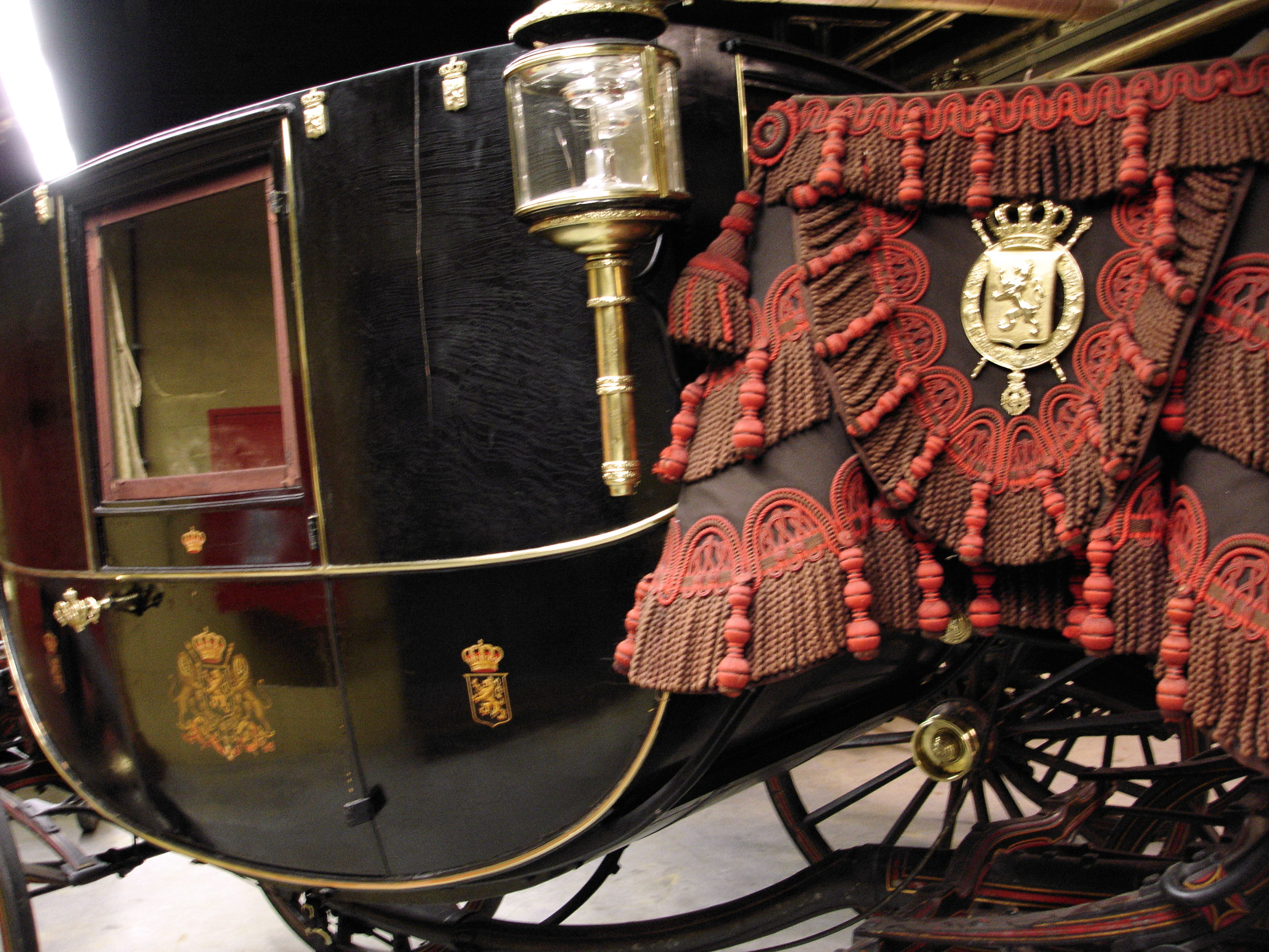
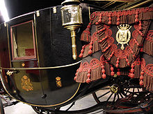 The Berline of King Leopold II, part of the Mossman Collection.
The collection only contains examples from Bedfordshire and the borders of neighbouring counties, giving the collection a very strong regional identity.
Mossman Collection
Main article: Mossman CollectionThe Mossman Carriage collection is held at Stockwood Park, Luton and is the largest and most significant vehicle collection of its kind in the country, including originals from the 18th, 19th and 20th centuries.
The Mossman collection of horse drawn vehicles was given to Luton Museum Service in 1991. It illustrates the development of horse-drawn road transportation in Britain from Roman times up until the 1930s.
Local attractions
Key 
Abbey/Priory/Cathedral 
Accessible open space 
Amusement/Theme Park 
Castle 
Country Park 
English Heritage 
Forestry Commission 
Heritage railway 
Historic House 

Museum (free/not free) 
National Trust 
Zoo  Dunstable Downs
 Chiltern Hills
- Leagrave Park
- Leighton Buzzard Light Railway
 Galley and Warden Hills Nature Reserve
- The hat Factory
 Luton Hoo
- Someries Castle
 Stockwood Discovery Centre
- Stockwood Park
- Wardown Park
- Wardown Park Museum
- Waulud's Bank
- Whipsnade Tree Cathedral
- Whipsnade Zoo
- Woburn Safari Park
- Woodside Farm and Wildfowl Park
- Wrest Park
Twin towns
Luton participates in international town twinning; its partners[67] are:
Country Place County / District / Region / State Date 
Germany 
Bergisch Gladbach 
North Rhine-Westphalia 1956 
France Bourgoin-Jallieu Rhône-Alpes 1956 
Sweden Eskilstuna 
Södermanland 1949 Germany 
Berlin-Spandau 
Berlin 1959 Germany 
Wolfsburg 
Lower Saxony 1950 
Israel 
Haifa Haifa District 1966 Media
Newspapers
Three weekly newspapers are delivered free to all the houses in Luton. They are:
- Luton & Dunstable Express, delivered free to Luton and Dunstable households on Wednesdays.[68]
- Luton on Sunday, delivered free to Luton and Dunstable households on Sunday.
- Herald and Post, delivered free to all Luton households on Thursdays.[69]
There are also two other newspapers in circulation around Luton:
- Luton News, the Herald & Post sister paper which is published every Wednesday.[70]
- Lutonline, a monthly newspaper produced by the local council. Usually delivered with the Luton & Dunstable Express.[71]
Radio
- BBC Three Counties Radio, the local BBC station, broadcasts from its office in Hastings Street, Luton to Bedfordshire, Hertfordshire and Buckinghamshire.[72]
- Heart 97.6 is the local independent station and broadcasts from Milton Keynes.
- Diverse FM[73] began broadcasts in April 2007 having been awarded a community radio license from Ofcom.
- Luton FM, the university's radio station, runs for 28 days during May. In addition, Ramadan FM broadcasts during the month of Ramadan.
Television
- Local-News TV is a local news channel for Bedfordshire and Luton. The channel is broadcast solely over the internet with content available on-demand.
- Television Luton falls at the cross over point between the two regions of Carlton/LWT (ITV London) and Anglia Television (ITV Anglia) which transmits from Norwich. Coverage for most Luton Town FC games and highlights is usually shown on BBC London news and on BBC 1 London's Football League show
- Days Like These, the British re-make of the popular American sitcom That '70s Show, was set in Luton.
Media references
In the TV series One Foot in the Grave there are often references to places within Luton. The script-writer David Renwick was brought up in the town.
The town was mentioned several times in the seminal sketch show Monty Python's Flying Circus. In one sketch a rather half-hearted hijacker demands that a plane headed for Cuba be diverted to Luton. Luton is one of the constituencies returning a "Silly Party" victory in the famous sketch Election Night Special. In the Piranha Brothers sketch Spiny Norman lived in a hangar at Luton Airport. A 1976 episode of the sci-fi series "Space: 1999" was called The Rules of Luton, inspired by the town name.
Notable Lutonians
People who were born in Luton or are associated with the town.
By birth
- Mick Abrahams, guitarist for Jethro Tull
- David Arnold, composer
- John Badham, film director
- Clive Barker, sculptor and artist
- Jonathan Barnbrook, graphic designer, typographer
- Leon Barnett, footballer
- Kevin Blackwell, goalkeeper, football manager
- Dean Brill, footballer
- Clive Bunker, drummer for Jethro Tull
- Danny Cannon, screenwriter, director and producer
- Ian Cashmore, actor
- Steve Dillon, comic artist
- Kerry Dixon, footballer
- Stacey Dooley, journalist and television presenter
- Kevin Foley, footballer
- Sean Gallagher, actor
- Liam George, footballer
- John Gosling, musician
- John Hagan, 8th master chief petty officer, U.S. Navy
- Arthur Hailey, novelist
- Neil Halstead, musician
- Neil Jackson, Actor
- Chris James, Racing Driver
- Ronnie Lee, Founder of the Animal Liberation Front
- Monty Panesar cricketer
- John Payne, musician
- Phil Read, motorcycle racer
- David Renwick, scriptwriter
- Stu Riddle, footballer
- Vaughan Savidge, announcer
- Billy Schwer, boxer
- Andy Selway, drummer
- Will Smith, cricketer
- Gavin Shuker, Labour party politician
- David Stoten, artist
- Stephen Yaxley-Lennon, political activist
- Mark Titchner, artist
- UK Decay, band
- Paul Young, singer
By association
- Taimour Abdulwahab al-Abdaly, Swedish Muslim suicide bomber
- Stefan Bailey, footballer
- Charles Bronson, prisoner
- Combat 786, Luton based crime family
- Diana Dors, actress
- Ian Dury, singer
- Danny Dyer, actor
- John Hegley, poet
- Hilda Hewlett, UK's first female pilot
- Sir Alec Jeffreys, geneticist
- Sarfraz Manzoor, columnist, The Guardian
- Eric Morecambe, entertainer
- Lee Ross, actor
- Colin Salmon, actor
- Edward Tudor-Pole, singer and actor
- Christopher Walken, actor
- Kenneth Williams, actor
- Richard Wiseman, psychologist
See also
References
- ^ Leadership=Mayor & Cabinet
Executive=Labour - ^ Luton Borough Council estimate for total population in 2010. ONS estimates for ethnicity in 2009. See the Demography section above for further information.
- ^ a b Luton Borough Council, LBC Population Estimate 2010.
- ^ Central Bedfordshire Council, Central Bedfordshire’s population. Dunstable 35,280. Houghton Regis 16,620.
- ^ Dyer J, Stygall F, Dony J, The Story of Luton, Luton, 1964, p 20
- ^ Dyer ibid, p 23
- ^ Dyer ibid, p 31
- ^ "Early history of Luton". http://www.localhistories.org/luton.html. Retrieved 2008-06-16.
- ^ "Domesday book record". http://www.domesdaybook.co.uk/bedfordshire2.html. Retrieved 2008-06-16.
- ^ "History of St Mary's Church". http://stmarysluton.org/page2.html. Retrieved 2008-06-16.
- ^ "Luton Castle only lasted 15 years". http://www.shoutluton.com/page8.html. Retrieved 2008-06-16.
- ^ "Vauxhall history". http://www.vauxhallandkennington.org.uk/history.shtml. Retrieved 2008-06-16.
- ^ "A history hat making in Luton". Plaiting and Straw Hat Making. Luton Libraries. http://www.galaxy.bedfordshire.gov.uk/webingres/luton/0.local/hat_plaiting.htm. Retrieved 2008-06-18.
- ^ "Website of Luton Hoo Hotel Golf and Spa". http://www.lutonhoo.co.uk/. Retrieved 2008-06-18.
- ^ "Population figures for 1801, 1901 and 1901". http://www.localhistories.org/luton.html. Retrieved 2008-06-16.
- ^ Dyer, ibid, p 141
- ^ Dyer, ibid, p 142
- ^ "Luton was made a borough". http://www.localhistories.org/luton.html. Retrieved 2008-06-16.
- ^ "Formation of Luton Town". http://lutonfc.hostinguk.com/history.asp. Retrieved 2008-06-16.
- ^ Churchill Tanks at Vauxhall
- ^ Deaths during WWII
- ^ See book Luton at War volume II,compiled by The Luton News, 2001, ISBN 1-871199-49-2
- ^ [1]
- ^ tant-car-hire.co.uk/england/luton.html Arndale opened in 1972
- ^ Vauxhall closure
- ^ St Georges Square on Luton Council Site
- ^ Award won by St Georges Square
- ^ Website for the development of Power Court
- ^ "Napier Park website". http://www.napierpark.com/. Retrieved 2008-06-18.
- ^ [2]
- ^ http://www.luton.gov.uk/internet/references/news/06_04_11%20-%202011%20local%20election%20results
- ^ "Luton Town Coat of Arms". http://www.civicheraldry.co.uk/thames_valley_chilterns.html#luton%20bc. Retrieved 2011-01-30.
- ^ "Arms of Luton (England)". http://www.ngw.nl/int/gbr/l/luton.htm. Retrieved 2008-06-18.
- ^ Map of soil distribution in Beds
- ^ ISBN 1-871199-94-8
- ^ "Anomaly details for station Rothamsted, UK and index TXx: Maximum value of daily maximum temperature". Royal Netherlands Meteorological Institute. http://eca.knmi.nl/utils/monitordetail.php?seasonid=18&year=1981&indexid=TNn&stationid=1844.
- ^ "Anomaly details for station Rothamsted, UK and index TXx: Maximum value of daily maximum temperature". Royal Netherlands Meteorological Institute. http://eca.knmi.nl/utils/monitordetail.php?seasonid=7&year=1963&indexid=TNn&stationid=1844.
- ^ "Anomaly details for station Rothamsted, UK and index TXx: Maximum value of daily maximum temperature". Royal Netherlands Meteorological Institute. http://eca.knmi.nl/utils/monitordetail.php?seasonid=14&year=2003&indexid=TXx&stationid=1844.
- ^ "Anomaly details for station Rothamsted, UK and index TXx: Maximum value of daily maximum temperature". Royal Netherlands Meteorological Institute. http://eca.knmi.nl/utils/monitordetail.php?seasonid=14&year=1990&indexid=TXx&stationid=1844.
- ^ "Met Office: July 2006 - record temperatures and sunshine". Met Office. http://www.metoffice.gov.uk/climate/uk/interesting/july2006.
- ^ "Rothamsted 1971-2000 averages". Met Office. http://www.metoffice.gov.uk/climate/uk/averages/19712000/sites/rothamsted.html. Retrieved 30 January 2011.
- ^ KS01 Usual resident population: Census 2001, Key Statistics for urban areas
- ^ 2001 Census
- ^ Office for National Statistics, Resident Population Estimates.
- ^ "Luton: Total Population". A Vision of Britain Through Time. Great Britain Historical GIS Project. http://www.visionofbritain.org.uk/data_cube_table_page.jsp?data_theme=T_POP&data_cube=N_TPop&u_id=10188970&c_id=10001043&add=N. Retrieved 2008-06-16.
- ^ "Resident Population Estimates by Ethnic Group". Office of National Statistics. http://neighbourhood.statistics.gov.uk/dissemination/LeadTableView.do?a=3&b=276843&c=Luton&d=13&e=13&g=404978&i=1001x1003x1004&m=0&r=1&s=1201380894093&enc=1&dsFamilyId=1812. Retrieved 2011-11-04.
- ^ "Religion breakdown". National Statistics Office. http://neighbourhood.statistics.gov.uk/dissemination/LeadTableView.do?a=3&b=276843&c=luton&d=13&e=16&g=404978&i=1001x1003x1004&m=0&enc=1&dsFamilyId=95. Retrieved 2008-06-16.
- ^ "National Statistics". http://www.statistics.gov.uk/census2001/profiles/00KA-A.asp. Retrieved 2008-06-16.
- ^ "Employment statistics". National Office of Statistics. http://www.statistics.gov.uk/census2001/profiles/00ka.asp. Retrieved 2008-06-16.
- ^ "New headquarters for easyJet at London Luton Airport." Easyjet. Retrieved on 27 September 2009.
- ^ "customer services & other faqs." Monarch Airlines. Retrieved on 27 September 2009.
- ^ "Luton." Thomson UK. Retrieved on 27 September 2009.
- ^ "Corporate contact information." Vauxhall Motors. Retrieved on 2 September 2009.
- ^ http://www.ey.com/OurLocations Ernst and Young Locations
- ^ http://www.mazars.co.uk/Home/News/Our-publications/Office-directions/Luton-directions Mazars Luton Office
- ^ Barnfield Newsletter
- ^ "Luton Sixth Form College". http://www.lutonsfc.ac.uk/lutonhome/About/Performance/Index.html. Retrieved 2008-06-16.
- ^ "L2G Building for the Future Programme details". http://www.learning.luton.gov.uk/index.cfm?s=1&m=649&p=238,index. Retrieved 2008-06-19.
- ^ "LEA School List". Luton Borough Council. http://www.luton.gov.uk/internet/education_and_learning/schools_and_colleges/School%20-%20general%20information%201. Retrieved 2008-06-16.
- ^ "Luton Town homepage". http://www.lutontown.premiumtv.co.uk/page/Welcome. Retrieved 2008-06-16.
- ^ "Luton Council website". http://www.luton.gov.uk/internet/Leisure_and_culture/Museums_and_galleries/Wardown%20Park. Retrieved 2008-06-16.
- ^ "Luton Carnival Coverage on the BBC". http://www.bbc.co.uk/threecounties/do_that/2004/05/carnival/carnival_day.shtml. Retrieved 2008-06-16.
- ^ BBC - Beds Herts and Bucks - Why Don't You - Luton's turning green!
- ^ Luton Irish Forum - St patrick's festival
- ^ St Patrick's Day party is coming to Luton - Luton Today
- ^ "Shout Luton Theatre Guide". http://www.shoutluton.com/entertainment/page2.html. Retrieved 2008-06-16.
- ^ "Town twinning". Luton Borough Council. Archived from the original on 2008-05-16. http://web.archive.org/web/20080516101802/http://www.luton.gov.uk/internet/Community_and_living/Twinning/Town+Twinning. Retrieved 2008-06-16.
- ^ "The Luton & Dunstable Express". http://www.ldexpress.co.uk. Retrieved 2008-06-16.
- ^ "Herald and Post". http://www.lutontoday.co.uk. Retrieved 2008-06-16.
- ^ "Luton News". http://www.lutonnews.co.uk. Retrieved 2008-06-16.
- ^ "Lutonline homepage". Archived from the original on 2008-05-16. http://web.archive.org/web/20080516101816/http://www.luton.gov.uk/internet/references/A_Z/C/Council_publications/lutonlineemail.html. Retrieved 2008-06-16.
- ^ "Three Counties Radio". http://www.bbc.co.uk/threecounties/. Retrieved 2008-06-16.
- ^ "Diverse FM". http://www.diversefm.com. Retrieved 2008-06-16.
External links
- Luton Borough Council YouTube channel
- Luton Live
- Luton has come to embody the failures of multiculturalism
The Town of Luton in Bedfordshire, England Places within Luton Barnfield · Biscot · Bramingham · Bury Park · Bushmead · Butterfield Green · Capability Green · Challney · Crawley Green · Farley Hill · Dallow · High Town · Hockwell Ring · Icknield · Leagrave · Lewsey · Limbury-cum-Biscot · Marsh Farm · New Town · Northwell · Putteridge · Round Green · Saints · South ward · Stopsley · Sundon Park · Warden Hills · Wigmore
Amenities Kenilworth Road · Luton Museum · The Mall (Luton) · Stockwood Park · Wardown Park · Waulud's Bank
Education Ashcroft High School · Barnfield College · Barnfield South Academy · Barnfield West Academy · University of Bedfordshire · Cardinal Newman · Challney High School For Boys · Challney High School For Girls · Denbigh High School · Icknield High School · Lea Manor High School · Lealands High School · Luton Sixth Form College · Putteridge High School · Rabia School · Stopsley High School · Woodlands Secondary School
Media England Portal Unitary authorities Major settlements Ampthill · Arlesey · Bedford · Biggleswade · Dunstable · Flitwick · Houghton Regis · Kempston · Leighton Buzzard · Linslade · Luton · Potton · Sandy · Shefford · Stotfold · Wixams ·
See also: List of civil parishes in BedfordshireTopics Unitary authorities of England Districts Bath and North East Somerset · Bedford · Blackburn with Darwen · Blackpool · Bournemouth · Bracknell Forest · Brighton and Hove · Bristol · Central Bedfordshire · Cheshire East · Cheshire West and Chester · Cornwall · County Durham · Darlington · Derby · East Riding of Yorkshire · Halton · Hartlepool · Herefordshire · Isle of Wight · Kingston upon Hull · Leicester · Luton · Medway · Middlesbrough · Milton Keynes · North East Lincolnshire · North Lincolnshire · North Somerset · Northumberland · Nottingham · Peterborough · Plymouth · Poole · Portsmouth · Reading · Redcar and Cleveland · Rutland · Shropshire · Slough · Southampton · Southend-on-Sea · South Gloucestershire · Stockton-on-Tees · Stoke-on-Trent · Swindon · Telford and Wrekin · Thurrock · Torbay · Warrington · West Berkshire · Wiltshire · Windsor and Maidenhead · Wokingham · York
Councils Bournemouth · Cornwall · Herefordshire · Isle of Wight · Kingston upon Hull · Leicester · Middlesbrough · Northumberland · Nottingham · Poole · Rutland · Shropshire · Slough · Thurrock · Wiltshire
 Districts of the East of England
Essex Basildon • Braintree • Brentwood • Castle Point • Chelmsford • Colchester • Epping Forest • Harlow • Maldon • Rochford • Southend-on-Sea • Tendring • Thurrock • Uttlesford
Hertfordshire Bedfordshire Bedford • Central Bedfordshire • Luton
Cambridgeshire Norfolk Suffolk Counties: Bedfordshire · Essex · Hertfordshire · Greater London · Mouth: River Thames
Settlements: Luton · Harpenden · Wheathampstead · Welwyn Garden City · Hertford · Ware · Stanstead Abbotts · Hoddesdon · Broxbourne · Cheshunt
Waltham Abbey · Ponders End · Edmonton · Tottenham · Upper Clapton · Hackney Wick · Stratford · Bromley-by-Bow · Canning Town · Leamouth
Major tributaries: River Ash · River Beane · River Ching · River Mimram · River Moselle · River Rib · River Stort
Minor tributaries: Bayford Brook · Broxbourne Mill Stream · Cobbins Brook · Coppermill Stream · Cornmill Stream • Cuffley Brook · Dagenham Brook ·
Hackney Brook · Millhead Stream • Pymmes Brook · Rags Brook • River Lynch · Salmons Brook
Small River Lea & Turnford Brook · Spital Brook · Theobalds Brook · Turkey Brook · Woollens Brook · Wormleybury BrookCounties Bedfordshire • Berkshire • Buckinghamshire • City of London • Essex (Thurrock) • Greater London • Hertfordshire • Kent (Medway) • Surrey
Major Cities Cities and towns
100k-250kChelmsford • Colchester • High Wycombe • Luton • Milton Keynes • Northampton • Reading • Slough • Southend-on-SeaCities and towns
25k-99kAshford, Kent • Ashford, Surrey • Aylesbury • Basildon • Bedford • Billericay • Bishop's Stortford • Borehamwood • Bracknell • Braintree • Brentwood • Camberley • Canterbury • Canvey • Cheshunt • Clacton-on-Sea • Dartford • Deal • Dover • Epsom • Ewell • Dunstable • Earley • Farnham • Folkestone • Guildford • Gravesend • Harlow • Harpenden • Hatfield • Hemel Hempstead • Herne Bay • Hitchin • Leighton Buzzard • Letchworth • Loughton • Maidenhead • Maidstone • Margate • Newbury • Ramsgate • Rayleigh, Essex • Redhill • Royal Tunbridge Wells • Sittingbourne • St Albans • Stevenage • Sunbury-on-Thames • Tonbridge • Ware • Watford • Welwyn Garden City • Whitstable • Wickford • Windsor • Woking • Wokingham • WoodleyCities and towns
10k-25kAddlestone • Amersham • Ashtead • Beaconsfield • Berkhamsted • Biggleswade • Broadstairs • Broxbourne • Buckhurst Hill • Buckingham • Bushey • Chertsey • Chesham • Chigwell • Cranleigh • Croxley Green • Dorking • Englefield Green • Epping • Faversham • Flitwick • Godalming • Hadleigh • Halstead • Harwich • Haslemere • Hertford • Hoddesdon • Horley • Houghton Regis • Hythe • Kempston • Knaphill • Leagrave • Maldon • Marlow • Potters Bar • Reigate • Rickmansworth • Royston • Saffron Walden • Sandhurst • Sandy • Sevenoaks • Snodland • Sheerness • Shepperton • Southborough, Kent • Staines • Stanwell • Swanley • Thatcham • Thundersley • Tring • Waltham Abbey • Waltham Cross • Walton-on-the-Naze • WithamCategories:- Luton
- Towns in Bedfordshire
- Places in Bedfordshire listed in the Domesday Book
- Local government in Bedfordshire
- Unitary authorities of England
- Hat making
- Local government districts of the East of England


Wikimedia Foundation. 2010.