- New Town, Luton
-
Coordinates: 51°52′15″N 0°24′49″W / 51.8708°N 0.4135°W
New Town 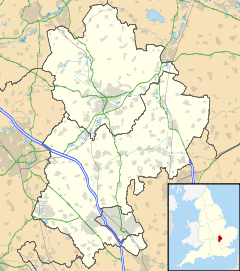
 New Town
New Town shown within BedfordshirePopulation Within South ward OS grid reference TL093202 Unitary authority Luton Ceremonial county Bedfordshire Region East Country England Sovereign state United Kingdom Post town LUTON Postcode district LU1 Dialling code 01582 Police Bedfordshire Fire Bedfordshire and Luton Ambulance East of England EU Parliament East of England UK Parliament Luton South List of places: UK • England • Bedfordshire New Town is a district of Luton just south east of the town centre between Castle Street, the main route to London and the M1 motorway on one side and Park Street, leading to Luton Hoo and the village of Hyde on the other side.
Contents
Local Area
Castle Street was the site of a medieval castle and Park Street and its surrounding streets are home to many students of the nearby University of Bedfordshire. The district has characteristic pubs and has traditionally been a working class area of the town. To alleviate the housing shortage of the 1960s several multi-story flats were built and an industrial park was added in the 1980s to attract new industries. The ring road, which passes nearby, was created at the same time to ease traffic congestion from the M1 motorway to the ever expanding Luton Airport.
Politics
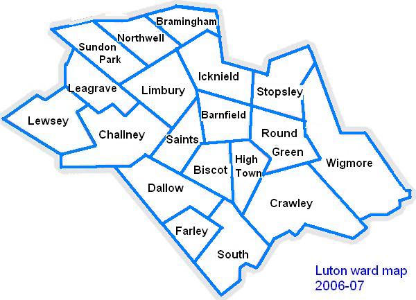
New Town is part of the South ward. The ward forms part of the parliamentary constituency of Luton South, and the MP is Gavin Shuker (Labour). South is situated within the East of England (European Parliament constituency).
 Map of Luton showing South Ward which contains New Town
Local Newspapers
Two weekly newspapers are delivered free to all the houses in New Town. However they are not specific to New Town. They are:
- Herald and Post - Delivered every Thursday
- Luton on Sunday- Delivered every Sunday
Local Attractions
Key 
Abbey/Priory/Cathedral 
Accessible open space 
Amusement/Theme Park 
Castle 
Country Park 
English Heritage 
Forestry Commission 
Heritage railway 
Historic House 

Museum (free/not free) 
National Trust 
Zoo  Bramingham Woods
 Dunstable Downs
- Chiltern Hills
- Leagrave Park
- Leighton Buzzard Light Railway
 Luton Museum & Art Gallery
- the hat Factory
 Luton Hoo
- Mossman Collection
- Someries castle
- Stockwood Craft Museum
- Stockwood Park
- Wardown Park
- Waulud's Bank
- Whipsnade Tree Cathedral
 Whipsnade Wildlife Park
- Woodside Farm and Wildfowl Park
- Wrest Park Gardens
The Town of Luton in Bedfordshire, England Places within Luton Barnfield · Biscot · Bramingham · Bury Park · Bushmead · Butterfield Green · Capability Green · Challney · Crawley Green · Farley Hill · Dallow · High Town · Hockwell Ring · Icknield · Leagrave · Lewsey · Limbury-cum-Biscot · Marsh Farm · New Town · Northwell · Putteridge · Round Green · Saints · South ward · Stopsley · Sundon Park · Warden Hills · Wigmore
Amenities Kenilworth Road · Luton Museum · The Mall (Luton) · Stockwood Park · Wardown Park · Waulud's Bank
Education Ashcroft High School · Barnfield College · Barnfield South Academy · Barnfield West Academy · University of Bedfordshire · Cardinal Newman · Challney High School For Boys · Challney High School For Girls · Denbigh High School · Icknield High School · Lea Manor High School · Lealands High School · Luton Sixth Form College · Putteridge High School · Rabia School · Stopsley High School · Woodlands Secondary School
Media Categories:- Luton
- Bedfordshire geography stubs

Wikimedia Foundation. 2010.