- Clapham, Bedfordshire
-
Coordinates: 52°09′54″N 0°30′07″W / 52.164892°N 0.501964°W
Clapham 
 Clapham
Clapham shown within BedfordshirePopulation 3,643 (2001) OS grid reference TL024529 Unitary authority Bedford Ceremonial county Bedfordshire Region East Country England Sovereign state United Kingdom Post town BEDFORD Postcode district MK41 Dialling code 01234 Police Bedfordshire Fire Bedfordshire and Luton Ambulance East of England EU Parliament East of England UK Parliament North East Bedfordshire List of places: UK • England • Bedfordshire Clapham is a village and civil parish in the Borough of Bedford in Bedfordshire, England. It has a population of 3,643.[1]
Contents
Facilities
Clapham has numerous public houses and several small shops; including a post office, Chinese and Indian takeaways, fish and chips, a florist, a hairdresser and a small bank; also it has two churches. It has its own lower school for children aged 4–9, Ursula Taylor Lower School. In the nearby village of Oakley is Lincroft Middle School for children aged 9–13. It has three pubs, the Horse and Groom, the Fox and Hounds and the Star, as well as these there is also an Italian restaurant, Bellini's.
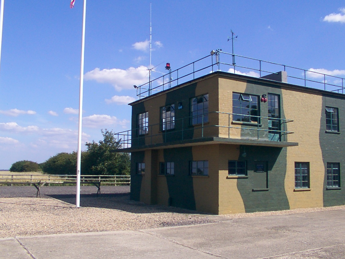
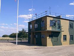 RAF Twinwood Control Tower, restored in 2002
RAF Twinwood Farm, a disused airfield on the western outskirts of the village, is where the famous bandleader Glenn Miller took off on his last fateful flight, having performed for the American soldiers based at the airfield (51 Operational Training Unit ROYAL AIR FORCE was the main unit based at Twinwood Farm) and at Bedford Corn Exchange. The Glenn Miller Museum is now open on site with many events taking place during the summer months.
Clapham Park, a large new country house, was built by James Howard, member of parliament for Bedford, in 1872.
There is also a derelict Italian POW camp, which is now owned by a farmer and has been the victim of graffiti artists.
Sport and recreation
Clapham has a King George V Field in memorial to King George V
References
External links
- Clapham community website
- Places I've visited – Clapham by Ian Meadows
- Information on Twin Woods - Events and museum
- Clapham Bedford Bed & Breakfast accommodation and information
- Clapham Historical Society
Categories:- Villages in Bedfordshire
- Civil parishes in Bedfordshire
- Bedfordshire geography stubs


Wikimedia Foundation. 2010.