River Beane

River Beane

Geobox River
name = Beane


map_size =
map_caption =
other_name =
other_name1 =
country = United Kingdom
country1 =
region =
region1 =
city =
city1 =
length = 17.8
length_imperial =
watershed =
watershed_imperial =
discharge_location =
discharge_average =
discharge_average_imperial =
discharge_max_month =
discharge_max =
discharge_max_imperial =
discharge_min_month =
discharge_min =
discharge_min_imperial =
discharge1_location =
discharge1_average =
discharge1_average_imperial =
discharge2_location =
discharge2_average =
discharge2_average_imperial =
discharge3_location =
discharge3_average =
discharge3_average_imperial =
discharge4_location =
discharge4_average =
discharge4_average_imperial =

source_name =
source_location = Nr. Stevenage, Hertfordshire
source_region =
source_country =
source_country1 =
source_elevation = 90
source_elevation_imperial =
source_lat_d =
source_lat_m =
source_lat_s =
source_lat_NS =
source_long_d =
source_long_m =
source_long_s =
source_long_EW =
mouth_name =
mouth_location = Hertford, Hertfordshire into River Lea
mouth_country =
mouth_region =
mouth_country1 =
mouth_elevation =
mouth_elevation_imperial =
mouth_lat_d =
mouth_lat_m =
mouth_lat_s =
mouth_lat_NS =
mouth_long_d =
mouth_long_m =
mouth_long_s =
mouth_long_EW =
tributary_left =
tributary_left1 =
tributary_right =
tributary_right1 =


image_size =
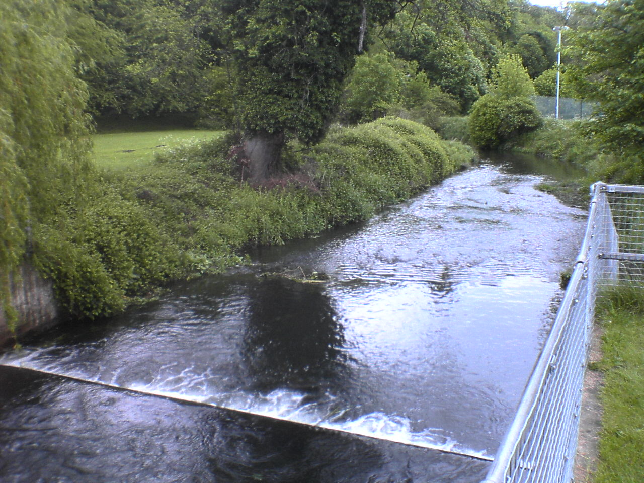
image_caption = Weir on the River Beane, Hartham Common
The River Beane originates from the hills around Stevenage in Hertfordshire and flows through Watton-at-Stone, Stapleford, Waterford until it reaches the River Lee in Hartham Common in Hertford.

Wikimedia Foundation. 2010.

Игры ⚽ Нужен реферат?

Look at other dictionaries:

  • River Moselle (London) — The River Moselle visible above ground on its way through Tottenham Cemetery. This now modest stream once posed a significant flooding threat to the area. (November 2005) The River Moselle, also referred to as Moselle Brook, is in North London… …   Wikipedia

  • River Mimram — Coordinates: 51°47′35.4″N 0°5′16.5″W / 51.793167°N 0.087917°W / 51.793167; 0.087917 …   Wikipedia

  • River Chess — Coordinates: 51°42′22″N 0°36′36″W / 51.706°N 0.610°W / 51.706; 0.610 …   Wikipedia

  • Old River Lea — River Country United Kingdom …   Wikipedia

  • Bengeo — infobox UK place country = England latitude = 51.804 longitude = 0.079 official name = Bengeo population = shire district = East Hertfordshire shire county = Hertfordshire region = East of England constituency westminster = Hertford and Stortford …   Wikipedia

  • Watton-at-Stone — infobox UK place static static image caption=Village cast iron water pump, dating from the early 19th century country = England official name= Watton at Stone population= 2,272 (2001) shire district= East Hertfordshire shire county =… …   Wikipedia

  • Walkern — infobox UK place country = England official name= Walkern latitude= 51.92 longitude= 0.13 population= shire district= East Hertfordshire shire county = Hertfordshire region= East of Englandconstituency westminster= North East Hertfordshire post… …   Wikipedia

  • List of rivers of England — This is a list of rivers of England, organised geographically and taken anti clockwise, from Land s End. It includes the whole length of those rivers whose estuary lies wholly or partly in England and thus includes a number of tributaries which… …   Wikipedia

  • List of waterway societies in the United Kingdom — This List of waterway societies in the United Kingdom is a list of links to waterway societies, charities, trusts, associations, clubs and other non governmental waterway organisations, concerned with the restoration, regeneration and use of the… …   Wikipedia

  • Luton — For other uses, see Luton (disambiguation). Borough of Luton   Town, Borough Unitary authority   Luton Town Hall …   Wikipedia

Share the article and excerpts

Direct link
Do a right-click on the link above
and select “Copy Link”