- River Mimram
-
Mimram River 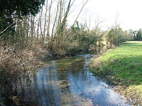
Country United Kingdom Source - location Nr. Stevenage, Hertfordshire - elevation 90 m (295 ft) Mouth - location Hertford, Hertfordshire
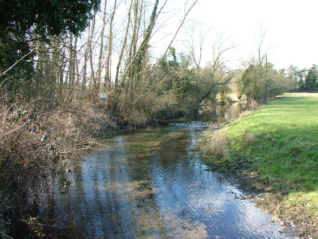
into River Lea- coordinates 51°47′35.4″N 0°5′16.5″W / 51.793167°N 0.087917°W Length 20 km (12 mi) The Mimram Valley is named after the River Mimram, which rises from a spring to the north of Whitwell, in North Hertfordshire, England, and makes its confluence with the River Lea near Horn's Mill in Hertford. At Whitwell there are cress beds which have existed since Roman times and these are fed by the same springs. The valley extends northwards where it becomes known as Lilley Bottom. Other sections of the valley are known as Kimpton Bottom and Codicote Bottom.
Although a dry valley to the north, it has been known in particularly wet years for the River Mimram to be extended for several miles by springs in the upper valley. In 2001, in a neighbouring valley to the west a village was flooded[1]. The Vvlley is the furthest east of all the Chiltern Hills valleys.
The river is the subject (and speaker) of a Stevie Smith poem, The River God.
External links
References
Counties: Bedfordshire · Essex · Hertfordshire · Greater London · Mouth: River Thames
Settlements: Luton · Harpenden · Wheathampstead · Welwyn Garden City · Hertford · Ware · Stanstead Abbotts · Hoddesdon · Broxbourne · Cheshunt
Waltham Abbey · Ponders End · Edmonton · Tottenham · Upper Clapton · Hackney Wick · Stratford · Bromley-by-Bow · Canning Town · Leamouth
Major tributaries: River Ash · River Beane · River Ching · River Mimram · River Moselle · River Rib · River Stort
Minor tributaries: Bayford Brook · Broxbourne Mill Stream · Cobbins Brook · Coppermill Stream · Cornmill Stream • Cuffley Brook · Dagenham Brook ·
Hackney Brook · Millhead Stream • Pymmes Brook · Rags Brook • River Lynch · Salmons Brook
Small River Lea & Turnford Brook · Spital Brook · Theobalds Brook · Turkey Brook · Woollens Brook · Wormleybury BrookCategories:- Rivers of Hertfordshire
- Hertfordshire geography stubs
Wikimedia Foundation. 2010.