- Cambridgeshire
-
For other uses, see Cambridgeshire (disambiguation).
Cambridgeshire 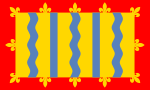
Flag of Cambridgeshire County Council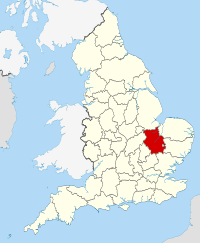
Geography Status Ceremonial & (smaller) Non-metropolitan county Region East of England[1] Area
- Total
- Admin. council
- Admin. areaRanked 15th
3,389 km2 (1,309 sq mi)
Ranked 15th
3,046 km2 (1,176 sq mi)Admin HQ Cambridge ISO 3166-2 GB-CAM ONS code 12 NUTS 3 UKH12 Demography Population
- Total ()
- Density
- Admin. council
- Admin. pop.Ranked 28th
789,600
233 /km2 (600 /sq mi)
Ranked 18th
616,200Ethnicity 94.6% White
2.6% S.AsianPolitics 
Cambridgeshire County Council
http://www.cambridgeshire.gov.uk/Executive Conservative Members of Parliament - Jonathan Djanogly (C)
- Julian Huppert (LD)
- Stewart Jackson (C)
- Andrew Lansley (C)
- Stephen Barclay (C)
- James Paice (C)
- Shailesh Vara (C)
Districts 
- Cambridge
- South Cambridgeshire
- Huntingdonshire
- Fenland
- East Cambridgeshire
- Peterborough (Unitary)
Cambridgeshire (
 /ˈkeɪmbrɪdʒʃər/ or /ˈkeɪmbrɪdʒʃɪər/; also known, archaically, as the County of Cambridge; abbreviated Cambs.) is a county in England, bordering Lincolnshire to the north, Norfolk to the northeast, Suffolk to the east, Essex and Hertfordshire to the south, and Bedfordshire and Northamptonshire to the west. Modern Cambridgeshire was formed from the historic counties of Cambridgeshire and Huntingdonshire, together with the Isle of Ely and the Soke of Peterborough; it contains most of the region known as Silicon Fen. The county town is Cambridge.
Cambridgeshire is twinned with Kreis Viersen in Germany.
Contents
History
Main article: History of CambridgeshireCambridgeshire is noted as the site of some of the earliest known Neolithic permanent settlements in the United Kingdom, along with sites at Fengate and Balbridie.
Cambridgeshire was recorded in the Domesday Book as "Grantbridgeshire" (or rather Grentebrigescire) (cf the river Granta). Covering a large part of East Anglia, Cambridgeshire today is the result of several local government unifications. In 1888 when county councils were introduced, separate councils were set up, following the traditional division of Cambridgeshire, for
- the area in the south around Cambridge, and
- the liberty of the Isle of Ely.
In 1965, these two administrative counties were merged to form Cambridgeshire and the Isle of Ely.[2] Under the Local Government Act 1972 this merged with the county to the west, Huntingdon and Peterborough (which had itself been created in 1965 by the merger of Huntingdonshire with the Soke of Peterborough – previously a part of Northamptonshire which had its own county council). The resulting county was called simply Cambridgeshire.[3]
Since 1998, the City of Peterborough has been a separately administered area, as a unitary authority, but is associated with Cambridgeshire for ceremonial purposes such as Lieutenancy, and functions such as policing and the fire service.[4]
In 2002, the conservation charity Plantlife unofficially designated Cambridgeshire's county flower as the Pasqueflower.
A great quantity of archaeological finds from the Stone Age, the Bronze Age and the Iron Age were made in East Cambridgeshire. Most items were found in Isleham.
The Cambridgeshire Regiment (or Fen Tigers) county based army unit fought in South Africa, WWI and WWII.
Due to its flat terrain and proximity to the continent, many bases were built for RAF Bomber Command, RAF Fighter Command, and the USAAF in WW2. In recognition of this, the only American WW2 burial ground in England is located in Madingley Cambridge American Cemetery and Memorial.
Most English counties have nicknames for their people, such as a Tyke from Yorkshire and a Yellowbelly from Lincolnshire; the traditional nicknames for people from Cambridgeshire are 'Cambridgeshire Camel' or 'Cambridgeshire Crane', referring to the wildfowl which were once abundant in the fens. The term 'Fenners' has been applied to those who come from the flat country to the north of Cambridge; however in recent times this term is considered to be abusive and its use is now less widespread.
Original historical documents relating to Cambridgeshire are held by Cambridgeshire Archives and Local Studies.
Geography
Large areas of the county are extremely low-lying and Holme Fen is notable for being the UK's lowest physical point at 2.75 m (9 ft) below sea level. The highest point is in the village of Great Chishill at 146 m (480 ft) above sea level. Other prominent hills are Little Trees Hill and Wandlebury Hill in the Gog Magog Downs, Rivey Hill above Linton, Rowley's Hill and the Madingley Hills.
Politics
Cambridgeshire contains seven Parliamentary constituencies: Cambridge, Huntingdon, North East Cambridgeshire, North West Cambridgeshire, Peterborough, South Cambridgeshire, and South East Cambridgeshire.
Economy
This is a chart of trend of regional gross value added of Cambridgeshire at current basic prices published (pp. 240–253) by Office for National Statistics with figures in millions of English Pounds Sterling.
Year Regional Gross Value Added[5] Agriculture[6] Industry[7] Services[8] 1995 5,896 228 1,646 4,022 2000 7,996 166 2,029 5,801 2003 10,154 207 2,195 7,752 AWG plc is based in Huntingdon. The RAF has several bases in the Huntingdon and St Ives area. Waterbeach, 6 miles north of Cambridge, is a former RAF base, now used as an army barracks. RAF Alconbury, 3 miles north of Huntingdon, is being reorganized after a period of obsolescence following the departure of the USAF, to be the focus of RAF/USAFE intelligence operations, with activities at Upwood and Molesworth being transferred there. Most of Cambridgeshire is agricultural. Close to Cambridge is the so-called Silicon Fen area of high-technology (electronics, computing and biotechnology) companies. ARM Limited is based in Cherry Hinton.
Education
Primary and secondary
Cambridgeshire has a completely comprehensive education system with 12 independent schools and over 240 state schools, not including sixth form colleges.
Some of the secondary schools act as Village Colleges, institutions unique to Cambridgeshire. For example Bottisham Village College.
Tertiary
Cambridgeshire is home to a number of institutes of higher education:
- The University of Cambridge - second-oldest university in the English-speaking world, and regarded as one of the most prestigious academic institutions in the world
- Anglia Ruskin University - has a campus located in Cambridge and a base at Fulbourn
- The Open University - has a regional centre located in Cambridge
- The University Centre Peterborough - operated by Anglia Ruskin University and Peterborough Regional College, located in Peterborough
- The College of West Anglia has a campus at Milton, on the northern outskirts of Cambridge
In addition, Cambridge Regional College and Huntingdonshire Regional College both offer a limited range of higher education courses in conjunction with partner universities.
Settlements
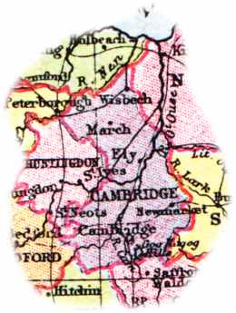
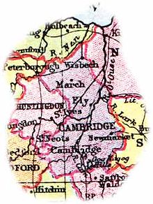 Map of the Cambridgeshire area (1904)
These are the settlements in Cambridgeshire with a town charter, city status or a population over 5,000; for a complete list of settlements see list of places in Cambridgeshire.
- Burwell
- Cambridge
- Chatteris
- Ely
- Godmanchester
- Huntingdon
- Littleport
- March
- Peterborough (no longer part of the administrative county)
- Sawston
- Sawtry
- Soham
- St Ives
- St Neots
- Wisbech
- Whittlesey
- Yaxley
The town of Newmarket is surrounded on three sides by Cambridgeshire, being connected by a narrow strip of land to the rest of Suffolk.
Climate
Cambridgeshire has a Maritime Temperate climate, similar to the rest of the United Kingdom. It has substantially less rainfall than the average as it is often sheltered by the core of Westerly and South Westerly winds. Temperatures are often cooler than the English average in winter, due to its position in the East of England and its sheltered area from the prevailing winds. Snowfall is slightly less rare than in Western areas, due to Easterly winds bringing occasional snow from the North Sea. In Summer, temperatures are average or slightly above, due to its dryness. It reaches 25C on around 10 days each year, and is comparable to parts of Kent and East Anglia.
Climate data for Cambridge 1971–2000 average Month Jan Feb Mar Apr May Jun Jul Aug Sep Oct Nov Dec Year Average high °C (°F) 7.0
(44.6)7.4
(45.3)10.2
(50.4)12.6
(54.7)16.5
(61.7)19.4
(66.9)22.2
(72.0)22.3
(72.1)18.9
(66.0)14.6
(58.3)9.9
(49.8)7.8
(46.0)14.1 Average low °C (°F) 1.3
(34.3)1.1
(34.0)2.9
(37.2)4.0
(39.2)6.7
(44.1)9.8
(49.6)12.0
(53.6)11.9
(53.4)10.1
(50.2)7.1
(44.8)3.7
(38.7)2.3
(36.1)6.1 Rainfall mm (inches) 45.0
(1.772)32.7
(1.287)41.5
(1.634)43.1
(1.697)44.5
(1.752)53.8
(2.118)38.2
(1.504)48.8
(1.921)51.0
(2.008)53.8
(2.118)51.1
(2.012)50.0
(1.969)553.5
(21.791)Source: Met Office Sports
Cambridgeshire is the birthplace of bandy,[citation needed] now an IOC accepted sport.[9] According to documents from 1813 Bury Fen Bandy Club was undefeated for 100 years. A member of the club, Charles Tebbutt, wrote down the first official rules in 1882.[citation needed] Tebbutt was instrumental in spreading the sport to many countries.[10] Bandy Federation of England is based in Cambridgeshire.[1]
Places of interest
Key 
Abbey/Priory/Cathedral 
Accessible open space 
Amusement/Theme Park 
Castle 
Country Park 
English Heritage 
Forestry Commission 
Heritage railway 
Historic House 

Museum (free/not free) 
National Trust 
Zoo Famous people from Cambridgeshire
As well as those born in the county there are many notable people from, or associated with, Cambridgeshire who moved there, particularly due to the presence of Cambridge University.
Cambridgeshire lays claim to Lord Protector Oliver Cromwell, Prime Minister John Major, businessmen Henry Royce and Peter Boizot, social reformers Octavia Hill and Thomas Clarkson, and economist John Maynard Keynes. Scientists include Brian J. Ford and Stephen Hawking, and Nobel laureate Harold Kroto. Literary figures who hail from Cambridgeshire include John Clare, Samuel Pepys, Lucy M. Boston, Jeffrey Archer, and Douglas Adams, Olaudah Equiano.
In entertainment, cartoonist Ronald Searle, comedian Rory McGrath, television presenter Sarah Cawood, and radio sports presenter Adrian Durham are all from Cambridgeshire. Paul Nicholas, Richard Attenborough and Warwick Davis are all associated with film, while musicians include Andrew Eldritch, lead singer of The Sisters of Mercy; Andy Bell, lead singer for Erasure; David Gilmour, Roger Waters and Roger Keith "Syd" Barrett of Pink Floyd; Don Airey, keyboardist in the rock band Deep Purple; trombonist Don Lusher; Keith Palmer, of dance music band The Prodigy; Nigel Sixsmith, founding member of The Art Of Sound and well known Keytar player; singer Aston Merrygold of JLS; the members of Britain's Got Talent Popera band The Arrangement; Matt Bellamy and Operatic Bass-Baritone, Darren Jeffery. Athletes Joe Bugner, Sir Jack Hobbs, Louis Smith and Marty Scurll are also from the county. Richard Garriott, televangelist Peter Foxhall, and Hereward the Wake are from Cambridgeshire.
See also
- Cambridgeshire Archives and Local Studies
- Cambridgeshire local elections
- High Sheriff of Cambridgeshire
- Lord Lieutenant of Cambridgeshire
References
- ^ Hierarchical list of the Nomenclature of Territorial Units for Statistics and the statistical regions of Europe The European Commission, Statistical Office of the European Communities . Retrieved 6 January 2008.
- ^ The Cambridgeshire and Isle of Ely Order 1964 (SI 1964/366), see Local Government Commission for England (1958 - 1967), Report and Proposals for the East Midlands General Review Area (Report No.3), 31 July 1961 and Report and Proposals for the Lincolnshire and East Anglia General Review Area (Report No.9), 7 May 1965
- ^ The English Non-metropolitan Districts (Definition) Order 1972 (SI 1972/2039) Part 5: County of Cambridgeshire
- ^ The Cambridgeshire (City of Peterborough) (Structural, Boundary and Electoral Changes) Order 1996 (SI 1996/1878), see Local Government Commission for England (1992), Final Recommendations for the Future Local Government of Cambridgeshire, October 1994 and Final Recommendations on the Future Local Government of Basildon & Thurrock, Blackburn & Blackpool, Broxtowe, Gedling & Rushcliffe, Dartford & Gravesham, Gillingham & Rochester upon Medway, Exeter, Gloucester, Halton & Warrington, Huntingdonshire & Peterborough, Northampton, Norwich, Spelthorne and the Wrekin, December 1995
- ^ Components may not sum to totals due to rounding
- ^ includes hunting and forestry
- ^ includes energy and construction
- ^ includes financial intermediation services indirectly measured
- ^ "Federation of International Bandy-Olympic". Internationalbandy.com. 2004-08-12. http://www.internationalbandy.com/viewNavMenu.do?menuID=4. Retrieved 2010-09-25.
- ^ "Cambridgeshire - History - A handy Bandy guide". BBC. 2006-02-21. http://www.bbc.co.uk/cambridgeshire/content/articles/2006/02/15/bandy_sport_feature.shtml. Retrieved 2010-09-25.
External links
- Cambridgeshire County Council
- Local News for Cambridgeshire
- Cambridgeshire.net community directory
- The Fens of North Cambridgeshire
- Cambridge Market Place Webcam
- Cambridgeshire Family History Society
- The Cambridge Time Traveller Group History Website.
- Cambridgeshire Community Archive Network.
- Cambridgeshire Churches website.
- Cambridgeshire at the Open Directory Project
Neighbouring counties 
Rutland Lincolnshire Norfolk Northamptonshire 
Suffolk  Cambridgeshire

Bedfordshire Hertfordshire Essex Ceremonial county of Cambridgeshire Unitary authorities Boroughs or districts Major settlements Rivers Topics Categories:- Cambridgeshire
- Non-metropolitan counties


Wikimedia Foundation. 2010.