- Ouse Valley Way
-
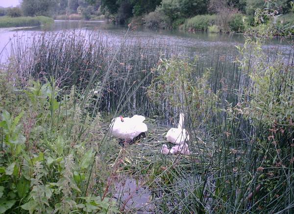
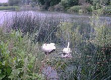 Swans nesting beside the Great Ouse near St Neots
The Ouse Valley Way is a 150-mile footpath in England, following the River Great Ouse from its source near Brackley in Northamptonshire to its mouth in The Wash near King's Lynn. The path begins outside the King's Head pub in Syresham (52°04′06″N 1°04′51″W / 52.0683°N 1.0807°W) and ends on the Green Quay in King's Lynn (52°45′04″N 0°23′37″E / 52.7512°N 0.3935°E).
There is a long-term plan to complete remaining gaps in the path, meanwhile it is possible to walk the entire route, although in places the footpath and river temporarily part company.
The route passes many interesting places and there is much to see, including attractive countryside, pretty villages, ancient English market towns, churches and a cathedral, and abundant wildlife.
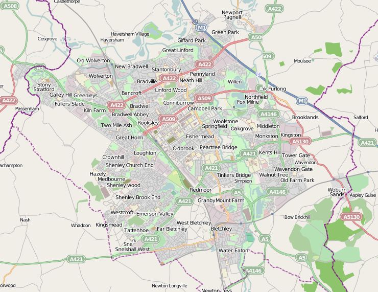
Towns from source to mouth include Buckingham, Milton Keynes, Olney, Bedford, St Neots, Huntingdon, St Ives, Ely, Downham Market, and King's Lynn.
The route is way-marked and maintained by The Countryside Agency who also provide maps and written guides online.
A small section of the Ouse Valley Way is used on the Pathfinder March.
External links
- Ouse Valley Way website - a guide for the entire route
- Huntingdonshire website - notes on the section from St Neots to Earith
- Borough of Milton Keynes - notes on the route from Stony Stratford across northern Milton Keynes to Newport Pagnell.
Coordinates: 52°18′55″N 0°02′52″W / 52.3152°N 0.0477°W
River Great Ouse, England Counties Flows into Towns
(upstream to downstream)Brackley · Buckingham · Old Stratford · Milton Keynes (Stony Stratford • Wolverton • New Bradwell) · Newport Pagnell · Olney · Kempston · Bedford · St Neots · Godmanchester · Huntingdon · St Ives · Ely · Littleport · Downham Market · King's Lynn
Major tributaries
(upstream to downstream by confluence)River Tove · River Ouzel (or Lovat) · River Ivel · River Kym · Old Bedford River · New Bedford River · River Cam · River Lark · River Little Ouse · River Wissey
Major bridges
(upstream to downstream)Harrold bridge · A428 Turvey bridge · A428 Bromham bypass · A6 Bedford Town Bridge · A421 Bedford bypass · Great Barford Bridge · A428 Bridge St Neots · St Neots Town Bridge · Godmanchester Chinese Bridge · A14 bridge, River Great Ouse · Huntingdon Old Bridge · St Ives Bridge
Transport in Bedfordshire Road MotorwaysA-RoadsRoman roadsNotable JunctionsMotorway service stationsToddingtonOtherTransport in Luton/Dunstable Urban AreaRail Main linesOther linesClosed linesOtherList of railway stationsAir Waterways RiversCanalsFootpaths Ouse Valley WayCycle Paths Categories:- Footpaths in Norfolk
- River Great Ouse
- Geography of Northamptonshire
- Visitor attractions in Northamptonshire
- Geography of Cambridgeshire
- Visitor attractions in Cambridgeshire
- Geography of Norfolk
- Visitor attractions in Norfolk
- Long-distance footpaths in England
Wikimedia Foundation. 2010.