- Wolverton
-
This article is about Wolverton in Milton Keynes, Buckinghamshire. For other uses, see Wolverton (disambiguation).
Coordinates: 52°03′46″N 0°48′37″W / 52.06265°N 0.8102°W
Wolverton 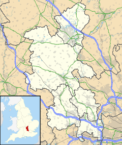
 Wolverton
Wolverton shown within BuckinghamshirePopulation 13,546 - 2001 Census (Wolverton and Greenleys) OS grid reference SP816410 Parish Wolverton and Greenleys Unitary authority Milton Keynes Ceremonial county Buckinghamshire Region South East Country England Sovereign state United Kingdom Post town MILTON KEYNES Postcode district MK12 Dialling code 01908 Police Thames Valley Fire Buckinghamshire Ambulance South Central EU Parliament South East England UK Parliament Milton Keynes South List of places: UK • England • Buckinghamshire Wolverton is a constituent town of Milton Keynes (which is in north Buckinghamshire, England). It is at its northern edge, between Stony Stratford and Newport Pagnell. It is the administrative seat of Wolverton and Greenleys civil parish.
It is one of the places in historic Buckinghamshire that went into the foundation of Milton Keynes in 1967.
Recorded in Domesday, Wolverton suffered badly in the Enclosures, before reinventing itself as a railway town in the industrial revolution. Today, Wolverton is a thriving focus for the northern edge of Milton Keynes.
Contents
History
Old Wolverton
The town name is an Old English language word, and means 'Wulfhere's estate'. It was recorded in the Domesday Book of 1086 as Wluerintone. The original Wolverton was a medieval settlement just north and west of today's town. This site is now known as Old Wolverton, although the medieval village is all but gone. The Ridge and Furrow pattern of agriculture can still be seen in the nearby fields and the Saxon church of the Holy Trinity (rebuilt in 1819) still sits next to the Norman Motte and Bailey site. Only the earth mound remains of the Norman castle, though the Saxon tower still stands as central to the rebuilt church, clad in the early 19th century 'Anglo-Norman' style. Next door to the church is a house built in 1729 which later became the vicarage; the front door has stonework from the nearby, demolished manor house of the 16th century including the de Longueville family coat of arms, and pieces from the earlier church building. A talbot, another symbol of the family, once graced the side-entrance which now marks the boundary between the ground floor of the house and its downstairs toilet.
Of the historic village itself, only field patterns marking a deserted village remain. The desertion of Old Wolverton was due to enclosure of the large strip cultivation fields into small "closes" by the local landlords, the Longville family, who turned arable land over to pasture. By 1654, the family had completely enclosed the parish. With the end of the feudal system, the peasants had lost their land and tillage/grazing rights and were forced to find other work or starve. Thus Old Wolverton was reduced from about thirty peasant families in the mid 16th century to almost none, within the space of a century.[1]
The newer area, built about 1 km to the east for the railways in the 19th century, assumed the Wolverton name.
Today, the site of the medieval village is bisected by the Grand Union Canal: the name "Old Wolverton" has been given to the area east of the canal and that to the west (which includes the watermill site) is called Wolverton Mill.
Canal village
The Grand Union Canal passes around the northern and eastern edge of the modern town. The canal originally crossed the River Great Ouse by descending 10 metres to the river by nine locks, crossing the river on the level and ascended by eight locks on the other side. This was time consuming for navigators and subject to disruption in time of flood. It seems inevitable, therefore, that there were some facilities to serve the barges at least until the Iron Trunk Aqueduct was built across the river to Cosgrove, but little remains except a wharf and a pub.
Railway town
In 1836 Wolverton was chosen as the site of the locomotive repair shop at the mid-point of the London and Birmingham Railway then under construction.
In 1846 the L & B became part of the London and North Western Railway, who subsequently decided that locomotives would be built and repaired at Crewe. The last locomotives at Wolverton were built in 1863 and repaired until 1877 after which it concentrated on carriages including railway owned road vehicles. It has also been and still is the home of the Royal Train fleet.[2] During the Second World War, the Works were used to build parts for Lee-Enfield rifles, bomber plane timber frames, Hawker Typhoon wings, Horsa Gliders, and ambulances. Like many older industrial sites, camouflage paint from the period can still be seen on the factory buildings. A pillbox remains opposite the Works Wall.
The railway built some 200 houses for its workers by 1844 along with schools, a church and a market.
Modern Wolverton
During the 1980s, the decline of the railway works and the strength of the Central Milton Keynes economy led to the dilution of Wolverton’s tight-knit railway community; and at the same time to its enrichment via immigration from other parts of the UK and from many parts of the world. People from South Asia became particularly prominent and transformed the town’s shopping facilities, rejuvenating the corner shops (as was common in small English towns) and providing access to sub-continental produce which would have previously required a trip to Bletchley’s Duncombe Street. Today the Anglican church of Saint George faces a mosque located in a former post office sorting office and what was the 'Empire' cinema. Wolverton remained a relatively cheap place to live in Milton Keynes through to the second half of the first decade of the 21st century, when it began to attract immigrants from Poland following that country’s accession to the European Union. It has a variety of foodstores (Polish mini-market, asian produce general stores) as well as a variety of restaurants (Asian, African, Caribbean, Lebanese, Chinese, traditional English). The town has a loyal group of residents who document the heritage of the town through the Living Archive Project and through influencing planning policy to preserve it cultural and historic features. There are many opportunities to be involved in the community through such iniatives as the community orchard (repurposed allotments), the urb farm, the annual scarecrow festival and the lantern parade at Christmas(running since 1990). There is a brass band and light orchestra and a programme of varied community arts events at Music and Drama Community Arts Programme (Madcap). There are two working men's clubs still functioning, reminders of earlier days of widespread manufacturing employment in the Works.
Wolverton railway station
A "toy town" wooden ticket office that stood on the railway bridge, facing out onto Newport Road, with steps leading down to the platform was actually the third location for a station in Wolverton. The original temporary stop was on the embankment above Wolverton Park, a larger station and refreshment rooms were soon built at a location behind what is now Glyn Square. In the 1880s the main line was re-routed to the east to allow for expansion and the current station site has been in use since. The wooden station stood here for over 100 years, however Milton Keynes Borough Council did not make it a listed building and British Rail demolished it in 1991.
The present station is a 'temporary' portacabin in the car park (at track level). Passengers must use stairways connecting an overhead open walkway to access the different platforms of the station, making it inaccessible to passengers with mobility impairments. The Council's 'Regeneration Strategy for Wolverton'[3] aims to build a new station in the original position. Work commences on the new station in the present car park in Spring 2012.
Historic football ground
The football ground beside the railway works and the station was home to the works team and subsequently to Wolverton Town football club. The stand, built in 1899, is believed to be the oldest covered football stand in the world. It was set to be demolished by September 2006 because its owners wish to redevelop the site for housing and a community park.[4] The development went ahead and a replica stand now sits on the original site to mark the significance of the original construction, painted green as it used to be.
Secret Garden
In 1999 a group of Wolverton residents clubbed together to persuade National Rail to sell them a piece of derelict land for £1. This piece of land which sits alongside the Grand Union Canal has been turned into a small parkland known locally as the 'Secret Garden', something the residents felt was missing from the largely industrial area. It is maintained by volunteers and hosts outdoor music events in the summer months.
Civil parish
Wolverton formed a civil parish within the Stratford and Wolverton Rural District from 1894 to 1919, which also contained the parishes of Calverton, Stony Stratford East and Stony Stratford West. The parishes had previously been part of the Potterspury Rural Sanitary District until it was disbanded in 1894. In 1919 these parishes, combined with New Bradwell, became part of the Stratford and Wolverton Urban District (renamed the Wolverton Urban District in 1920). This urban district would remain in existence until 1974 when it became part of the Borough of Milton Keynes. Today, Wolverton is the larger element of the modern parish of Wolverton and Greenleys.
Sport in Wolverton
The town's sports clubs include
- Wolverton Town Cricket Club: the club plays in Divisions 2 and 6 of The Oxford Times Cherwell League and play their home matches at the Cricket Ground on Osborne Street.
- Wolverton Town F.C., an amateur club.
- Wolverton Tennis Club
- Wolverton Town Bowls Club
- Wolverton Bowls Club
There is a 3 pool open air lido open during the summer months.
Twin City
- Comines-Warneton, Belgium
ONS Urban Sub-area
For census purposes, the Office of National Statistics has used the boundaries of the former Wolverton Urban District Council to designate an Urban Sub-area that it calls Wolverton/Stony Stratford. The area covered includes Stony Stratford CP, Wolverton and Greenleys CP, New Bradwell CP, Stantonbury CP and part of Great Linford CP.[5] At the 2001 Census, the population of the Sub-area was 60,359.[6]
See also
References
- ^ Buckinghamshire Historical Service plaque on site, of which this section is a summary.
- ^ For the Royal Train see this article at the site of the MK Museum
- ^ [1]
- ^ BBC news item about the spectator stand at Wolverton football ground
- ^ Map of Wolverton/Stony Stratford Urban Sub-area
- ^ KS01 Usual resident population: Census 2001, Key Statistics for urban areas, line 1815
External links
- ‘Parishes : Wolverton’, A History of the County of Buckingham, Victoria History of the Counties of England, Vol. 4 (1927), pp. 505–509.
- "Rides on Railways by Samuel Sidney" at Project Gutenberg. See pages 36 to 43 for a contemporary account (and critique) of the early years of the new railway town and the Works.
- Wolverton Words at the Living Archive project : Accents in Wolverton/New Bradwell and how they have changed between the generations, playground games, and memories of older Wolvertonians, as collected by Year 7 children at Bushfield Middle School
- A Vision of Britain - Wolverton Urban District
Ceremonial county of Buckinghamshire Unitary authorities Boroughs or districts - Aylesbury Vale
- Chiltern
- South Bucks
- Wycombe
Major settlements Rivers Topics - Boundary changes
- Grade I listed buildings
- High Sheriff
- History
- Lord Lieutenant
- Monastic houses
- Museums
- Parliamentary constituencies
- Places
- Places of interest
- Railways
- Schools (Bucks)
- Schools (Milton Keynes)
- Sites of Special Scientific Interest
- Transport
River Great Ouse, England Counties Flows into Towns
(upstream to downstream)Brackley · Buckingham · Old Stratford · Milton Keynes (Stony Stratford • Wolverton • New Bradwell) · Newport Pagnell · Olney · Kempston · Bedford · St Neots · Godmanchester · Huntingdon · St Ives · Ely · Littleport · Downham Market · King's Lynn
Major tributaries
(upstream to downstream by confluence)River Tove · River Ouzel (or Lovat) · River Ivel · River Kym · Old Bedford River · New Bedford River · River Cam · River Lark · River Little Ouse · River Wissey
Major bridges
(upstream to downstream)Harrold bridge · A428 Turvey bridge · A428 Bromham bypass · A6 Bedford Town Bridge · A421 Bedford bypass · Great Barford Bridge · A428 Bridge St Neots · St Neots Town Bridge · Godmanchester Chinese Bridge · A14 bridge, River Great Ouse · Huntingdon Old Bridge · St Ives Bridge
Categories:- Populated places on the River Great Ouse
- Wolverton
- Towns in Buckinghamshire
- Milton Keynes
- Railway towns in England

Wikimedia Foundation. 2010.