- Milton Keynes urban area
-
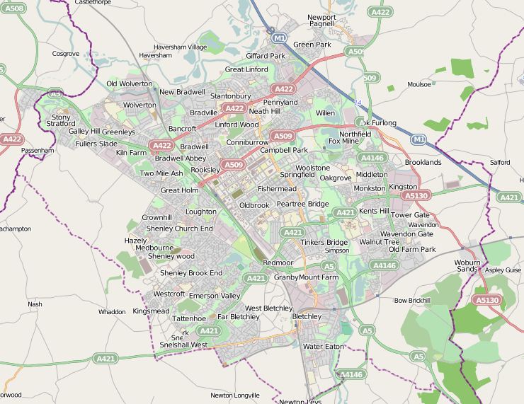
 Open Street Map mapping of Milton Keynes urban area and environs.
Milton Keynes is a large town in (ceremonial) Buckinghamshire. The Milton Keynes urban area is a designation established by the United Kingdom's Office of National Statistics.[1] As with other urban areas, it includes settlements that regard themselves as being outside Milton Keynes. However, unlike other long established towns and cities that have historic boundaries which the ONS can use, Milton Keynes does not have any such readily usable boundaries and consequently it is assigned a number of new urban sub-areas. Accordingly, it has defined a Milton Keynes urban area to be composed of the contiguous built environment, with 'urban sub-areas' that map to the original urban and rural districts (and sometimes to the chronological phases of urbanisation within them).
Contents
Urban sub-areas
Some of the "Urban Sub-areas" largely match the boundaries of the legacy local government areas that existed before its 1967 designation as a "new town". These were:
- Bletchley Urban District
- Wolverton Urban District
- Newport Pagnell Urban District
- Newport Pagnell Rural District
- Winslow Rural District
The corresponding modern Urban Sub-areas (with links to the relevant articles) are
- Bletchley USa
- Wolverton/Stony Stratford USa
- Newport Pagnell USa (but note that the M1 Motorway does not follow the historic boundary).
Newport Pagnell Rural was subdivided as development proceeded
The fragment of Winslow Rural in the designated area, Shenley Church End, was added to "Central Milton Keynes USa").
Note that the areas covered by these Urban Sub-area designations are larger (sometimes far larger) than the modern districts that share their names. This is particularly true of Central Milton Keynes USa.
The Milton Keynes urban boundary
Although Milton Keynes does not have statutory boundary, the 1967 "Designated Area" boundary (plus subsequent expansions west of the M1) is treated as the de-facto boundary. This contains the ONS Urban Sub-areas of Bletchley, Wolverton/Stony Stratford, Central Milton Keynes, North Milton Keynes, Walnut Tree and Browns Wood. It excludes Newport Pagnell or other expansions east of the M1.
Calculation of population
The Office of National Statistics gives the population of Milton Keynes as the entire urban area – thus including Newport Pagnell – as 184,506.[2]
The Borough of Milton Keynes calculates the population as being the sum of those urban sub-areas within the 1967 designation, resulting in a figure of 169,486.[citation needed]
External links
References
- ^ KS01 Usual resident population: Census 2001, Key Statistics for urban areas (lines 1808 to 1815)
For the OS definition of an Urban Area, see the notes tab on the Excel version. - ^ Office for National Statistics, Census 2001. "Usual resident population"
52°04′29″N 0°44′04″W / 52.07476°N 0.73450°WCoordinates: 52°04′29″N 0°44′04″W / 52.07476°N 0.73450°W
Categories:- Milton Keynes
- Urban areas of England
Wikimedia Foundation. 2010.