- Milton Keynes grid road system
-
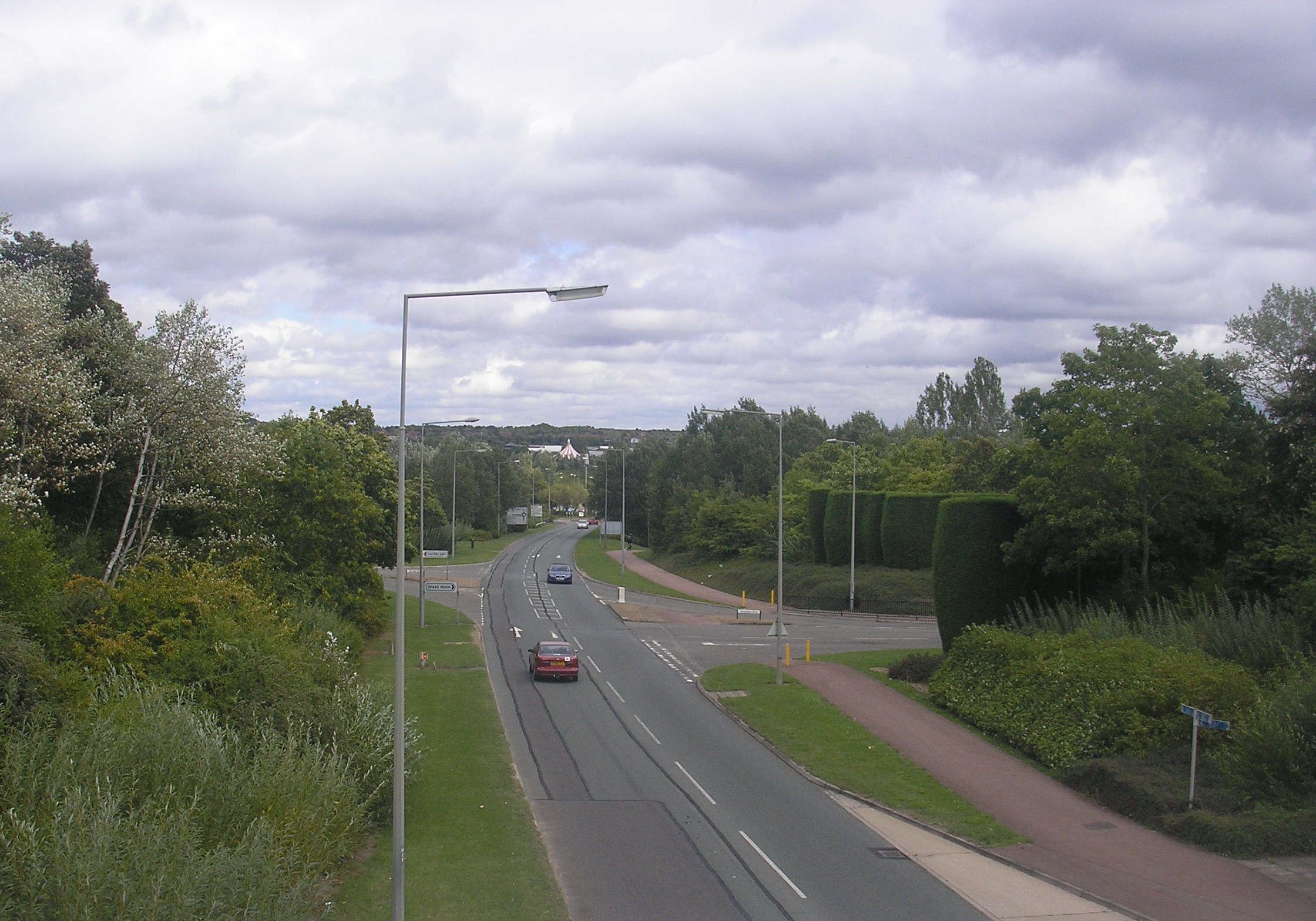
 A typical single carriageway grid road, H4 Dansteed Way, looking east from Two Mile Ash. Note the tree lining, the redway cyclepath and the staggered junction for local roads.
The Milton Keynes grid road system is a network of national speed limit, fully landscaped routes that form the top layer of the street hierarchy for both for private and public transport in Milton Keynes, (ceremonial) Buckinghamshire. The system is unique in the United Kingdom for its innovative use of street hierarchy principles: the grid roads run in between districts rather than through them. These facilitates the higher speed limits due to the absence of buildings close to the roads. High-speed motor traffic is segregated from pedestrian and leisure[1] cycling traffic, which uses the alternative Milton Keynes redway system. All grid junctions are roundabouts, which are efficient at moving cars but disadvantageous to buses and HGVs.
Contents
The grid roads
The geography of Milton Keynes – the railway line, Watling Street, Grand Union Canal, M1 motorway – sets up a very strong north-south axis. If you've got to build a city between (them) it is very natural to take a pen and draw the rungs of a ladder. Ten miles by six is the size of this city – 22,000 acres. Do you lay it out like an American city, rigid orthogonal from side to side? Being more sensitive in 1966-7, the designers decided that the grid concept should apply but should be a lazy grid following the flow of land, its valleys, its ebbs and flows. That would be nicer to look at, more economical and efficient to build, and would sit more beautifully as a landscape intervention.
The grid system is made up of 11 roads aligned roughly north-south and 10 aligned roughly east-west. In early planning documents, these were simply designated as "V roads" and "H roads" respectively (for "vertical" and "horizontal"); these designations have remained popular alongside the subsequent formal (conventional) names. V-roads are named as "Streets", and H-roads as "Ways". The roads are not precisely straight and aligned, and there are several places where two H roads, or two V roads, meet at a junction. The districts enclosed by the grid roads are known as grid squares.
In addition, the A5 road is a grade separated dual carriageway that is independent of the system (built to bypass the old Watling Street route), running between the grid roads but with four interchanges with the system.
Below is a list of the grid roads:
 Open Street Map mapping of Milton Keynes, showing most of the grid roads
H Roads V Roads H1 Ridgeway V1 Snelshall Street H2 Millers Way V2 Tattenhoe Street H3 Monks Way V3 Fulmer Street H4 Dansteed Way V4 Watling Street H5 Portway V5 Great Monks Street H6 Childs Way V6 Grafton Street H7 Chaffron Way V7 Saxon Street H8 Standing Way V8 Marlborough Street H9 Groveway V9 Overstreet H10 Bletcham Way V10 Brickhill Street V11 Tongwell Street Characteristics
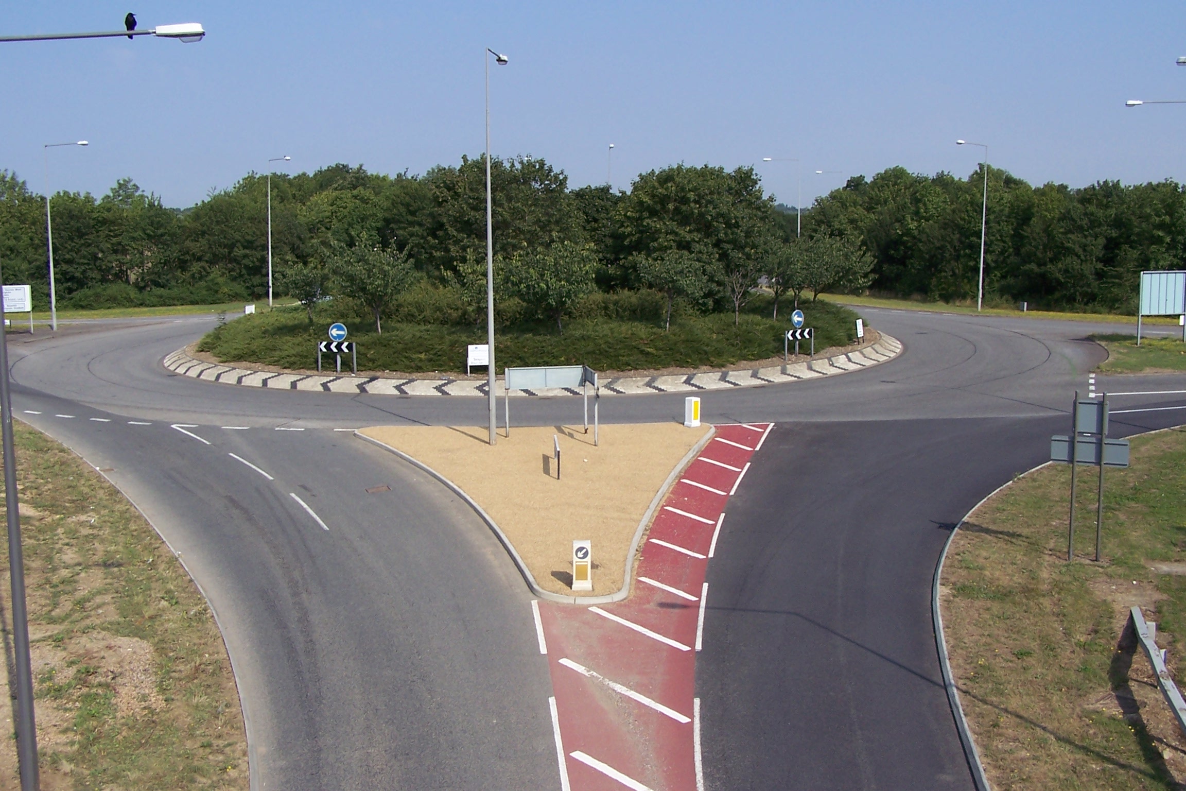
 The V8 at its intersection with the H9 Groveway looking north.
Grid roads are characterised by high speed limits, generous landscaping and greenery along their routes, all pedestrian crossings being by means of under- or overpasses, roundabouts at every intersection and an almost total lack of road-fronting buildings. Many of these points can be seen in this[1] aerial image showing the V8/H3 junction.
Horizontal grid roads
This section covers all of the major grid roads except the most significant ones which have their own articles. See V6 Grafton Street, H6 Childs Way, V8 Marlborough Street and H10 Bletcham Way.
The H1 Ridgeway runs from the northern edge of Stony Stratford, across V4 Watling Street to a point on the V5 east of Wolverton. It is the shortest of all grid roads, having only two grid roundabouts and with a large gap where a bridge over the A5 should be. An aerial view is here[2]. It serves Stony Stratford, Fullers Slade, Wolverton Mill and Greenleys.
The H2 Millers Way is another short route. It begins at V4 Watling Street, crosses over the A5 and the West Coast Main Line, then joins the V6 Grafton Street at Bradville. Among others, its route serves the Milton Keynes Museum.
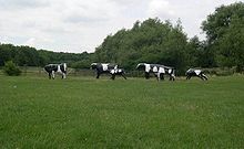 Liz Leyh's "Concrete Cows"
The H3 Monks Way is the most northerly of the major H roads. Whilst being a dual carriageway for most of its length, it starts its route in the west of the town at a double roundabout with V4 Watling Street[3] before running as a single carriageway up until a junction with the A5 and the V5 Great Monks Street at Abbey Hill. From this point, it becomes a dual carriageway and is co-designated as the A422. It continues east across the town, crosses over the M1, until it ends in a roundabout with the A509 road south of Newport Pagnell. The Concrete Cows are the best known landmark on this road.
The H4 Dansteed Way is a longer route. It starts in the western district of Grange Farm, crosses the town through Linford Wood and ends formally at V11 Tongwell Street. However the route continues as Willen Road into Newport Pagnell.
The H5 Portway begins its life in Oakhill as a single carriageway and remains as such up until its junction with the A5 (aerial view [3]. From there it becomes a dual carriageway and becomes the A509. It runs along the top edge of Central Milton Keynes, over Willen Lake and terminates at Northfield Roundabout with H6 Childs Way near M1 Junction 14. The route continues on as the A5130 road.
The H6 Childs Way runs from Whitney in the west of Milton Keynes to a point short of Junction 14 of the M1 in the east. For a more in depth description see the road's own article.
The H7 Chaffron Way is one of the longest grid roads but is a single carriageway for the entirety of its route. It starts in the district of Tattenhoe Park where it had a 300 metre extension built in 2007, runs past Westcroft District Centre, Furzton Lake, The National Bowl, bridges the A5 and the West Coast Main Line in one go, passes Woughton before terminating at a roundabout next to Broughton. In March 2010, Countess Way was opened which links to Newport Road (A5130), a dual carriageway with a permanent bus lane on each side with traffic lights at either end.
H8 Standing Way is a dual carriageway that crosses the entire town from west to east, co-designated as the A421. The route begins at M1 Junction 13 and enters Milton Keynes near Wavendon. Its route takes by the Open University, Milton Keynes General Hospital, over the A5 and the West Coast Main Line, a finally leaves the town at Tattenhoe.
The H10 Bletcham Way has its own article.
Vertical grid roads
V1 Snellshall Street begins at Whitney and ends at Tattenhoe in the south west of Milton Keynes.
V2 Tattenhoe Street begins at Hazeley in the west of Milton Keynes and travels south to end at Windmill Hill in Far Bletchley in the south west of Milton Keynes. Its route takes it past Woodhill (HM Prison).
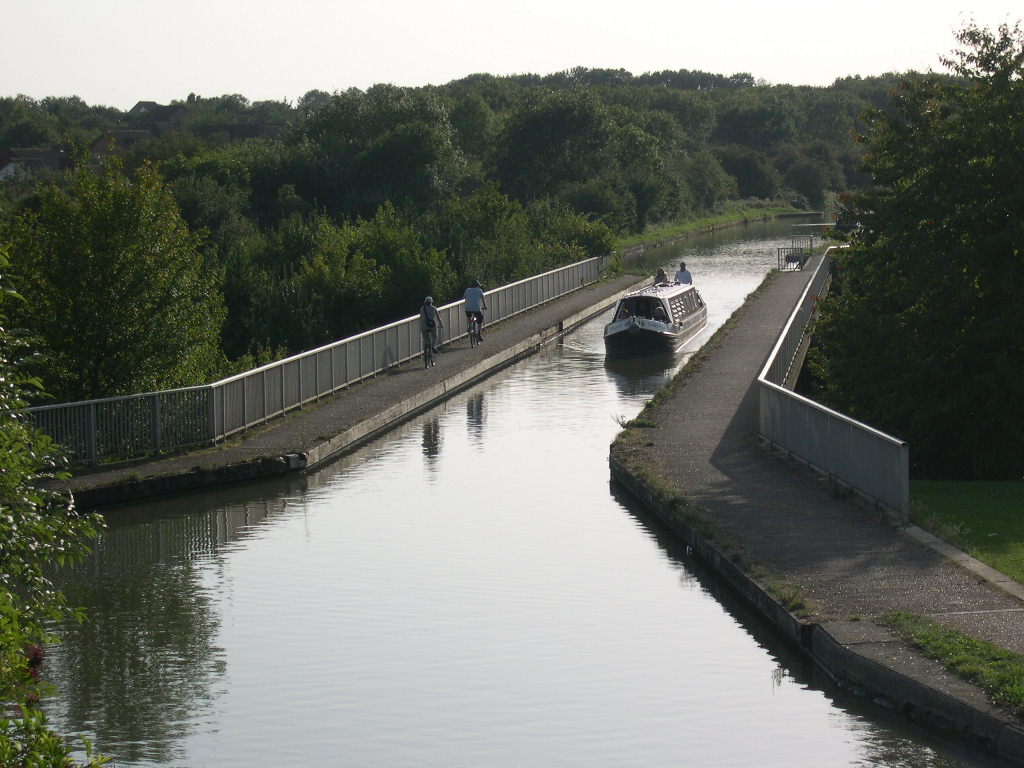
 the Grand Union Canal passes over V6 Grafton Street between Bradville and New Bradwell on the modern Bradwell Aqueduct, build specifically to accommodate it.
The V3 Fulmer Street Starts at is northern end between the districts of Crownhill and Grange Farm at a three (soon to be four) arm roundabout with the H4. It runs south crossing the H5, H6 and H7 before terminating at the H8, continuing on in the form of Shenley Road into West Bletchley.
The V4 Watling Street is part of the longer Watling Street.
The V6 Grafton Street is a major local road in Milton Keynes. Its formal name is simply "Grafton Street": the "V6" designation is an urban planning name that indicates that it is the sixth north-south grid road in the layout and urban form of the 'new city'. It starts beside Wolverton railway station in the north of Milton Keynes, between Wolverton and New Bradwell and extends as far as Denbigh (where it provides access to the Stadium:mk), where it terminates in a three-direction roundabout with the H10 Bletcham Way and V4 Watling Street. For a more detailed description see the road's own article V6 Grafton Street.
The V7 Saxon Street starts off near New Bradwell in the north of the town as a single carriageway and remains as such past Stantonbury to its junction with the H4 where it becomes a dual carriageway.[4] In this form it runs straight through the heart of Central Milton Keynes between the Centre:MK and the Ecumenical Church of Christ the Cornerstone and then returns to being a single carriageway after its junction with the H7. It then has a 40 mph (64 km/h) speed restriction on it for two grid squares until the H9. After passing the new Stadium:mk and crossing the H10 it becomes a dual carriageway once more and terminates in central Bletchley.
The V8 Marlborough Street runs from Stantonbury to Mount Farm. For a more detailed description see its own article.
The V10 Brickhill Street is mainly a single carriageway, but it is important in being one of the few that runs continuously between the northern and the southern borders of the town. It is only a dual carriageway for 200 metres south of the H4 roundabout at Willen.[5]
Finally the V11 Tongwell Street is a single carriageway to its junction with the H6 where it picks up the A4146 road. It is then a dual carriageway as far as the H10, then finally a single carriageway again for a very short distance into the districts of Old Farm Park and Browns Wood.
Other important routes that are not part of the grid system
There are other roads in Milton Keynes that could superficially be considered part of the grid system. Wolverton Road, formerly the A422, runs right from Stony Stratford to Newport Pagnell and functions as a grid road for much of its route (although with traffic calming measures). Indeed, the 1970 masterplan for Milton Keynes proposes that the stretch from New Bradwell to the M1 Motorway bridge (near Newport Pagnell services) would be part of the H2.
The A5130 road skirts the eastern edge of Milton Keynes forming an important route to Junction 14 of the M1 and is a de facto V12.[6] Part of this route is currently proposed for downgrading into a densely built, slow-speed, mixed mode "City Street". This proposal has met local opposition and the alternative option of upgrading it into a full grid road has been put forward by some town councillors. Interestingly, in a discussion document[7] considered at a meeting of the Milton Keynes Partnership, features this suggestion being put forward and immediately being dismissed without explanation. Recently according to the MK News newspaper a number of local parish councils voted 22 in favour and one abstaining to oppose the A5130 downgrading plans as they go against the nature of the grid system.
Grid system expansion
Despite the new expansion of Milton Keynes not following the grid principle, several new extensions are planned to the grid network. They are listed below in numerical order, listing H-roads first.
- H1 Ridgeway link-up: The land for this has been reserved since the 1970 Plan for Milton Keynes. This would join the two halves of the H1, crossing the A5. There is an alternative proposal to build on the H1 reservation (between Galley Hill and Fullers Slade) which would prevent the road link up. The latter seems more likely since the cost of a bridge would be difficult to justify.
- H6 Childs Way extension to Kingsmead: This was completed in 2004 and terminates here. It links Kingsmead and Whitney to the rest of the town.
- H7 Chaffron Way western: A downgraded H7 is planned to extend further between Kingsmead and Tattenhoe Park, according to the Kingsmead South master plan.
- H7 Chaffron Way eastern: the H7, as a 'city street' is planned to extend through Broughton Gate (Eastern Expansion Area) to the A5130 (this has been completed and opened in March 2010 with 'Countess Way' linking between Kingston and A5130 Newport Road).
- V2 Tattenhoe Steeet north: The V2 will extend north to the top of Grange Farm before becoming a 'city street' and running north into Fairfield (Western Expansion Area). It will not extend to the east of Stony Stratford.
- V6 Grafton Street south-east (to connect Granby with Sherwood Drive for Bletchley Park developments) via a new bridge over the West Coast Main Line: In 2004, urban design officers for Milton Keynes Borough Council proposed[8] (in its "Central Bletchley Renewal Strategy"[9]) this extension. Doing so would have relieved pressure on the heavily congested Saxon Street/Watling Street and the Buckingham Road/Saxon Street junctions. However, the Council declined to approve it and a subsequent amendment[10] records that it has been deleted.
- V7 Saxon Street north: In the form of a 'city street', the V7 will penetrate the new district of Statonbury Park Farm and loop round back on to the old Newport Pagnell - Wolverton Road, according to the master plan for the development.
- V8 Marlborough Street south: The V8 is planned to run alongside the A5 to join H10 Bletcham Way at Fenny Lock.
- V10 Brickhill Street north: The V10 is being extended north to meet Little Linford Lane, providing an alternative route from Newport Pagnell at the Poets Estate. However this stretch is not designated 'V10' and will have a 30 mph (48 km/h) speed limit.
The western and eastern expansion areas being developed by Milton Keynes Partnership move away from the grid system towards a more traditional road layout centred around 'city streets'. The Milton Keynes Forum and the Urban Eden pressure group are both fighting this, in favour of extending the grid system. The 'city streets' are designed to function as high streets, providing focal centres for the new developments and providing public transport corridors.
References
- ^ As detailed below and in the redway system article, experienced and commuting cyclists may choose the grid roads over the redways.
- ^ Kitchen, Roger; Hill, Marion (2007). 'The story of the original CMK' … told by the people who shaped the original Central Milton Keynes (interviews). Milton Keynes: Living Archive. p. 17. ISBN 978 090484734 - 5. http://www.livingarchive.org.uk/. Retrieved 26 January 2009. (Professor Lock is visiting professor of town planning at Reading University. He was the chief town planner for CMK.) (Ten miles is about 16km and 18,000 acres is about 7,300 hectares),
- ^ Interactive Map of Milton Keynes & North Bucks - MKWeb
- ^ Interactive Map of Milton Keynes & North Bucks - MKWeb
- ^ Interactive Map of Milton Keynes & North Bucks - MKWeb
- ^ [www.mk-news.co.uk/mknews-news/DisplayArticle.asp?ID=77795 More talks on A5130 'city street' plans] - MK News
- ^ Milton Keynes Partnership
- ^ page 21 "Bletchley Park Avenue"
- ^ MK Council - Urban Design - MKWeb
- ^ http://www.mkweb.co.uk/urban-design/documents/amendments_page.pdf
Categories:- Milton Keynes road network
- Transport in Milton Keynes

Wikimedia Foundation. 2010.