- Woughton
-
Coordinates: 52°01′26″N 0°43′23″W / 52.024°N 0.723°W
Woughton 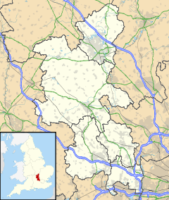
 Woughton
Woughton shown within BuckinghamshireOS grid reference SP876369 Parish Woughton on the Green Unitary authority Milton Keynes Ceremonial county Buckinghamshire Region South East Country England Sovereign state United Kingdom Post town MILTON KEYNES Postcode district MK6 Dialling code 01908 Police Thames Valley Fire Buckinghamshire Ambulance South Central EU Parliament South East England UK Parliament Milton Keynes South Website woughton-pc.gov.uk List of places: UK • England • Buckinghamshire Woughton is a civil parish[1] in south central Milton Keynes, ceremonial county of Buckinghamshire, England. It takes its name from the original ecclesiastic parish of Woughton and its original village, Woughton on the Green.
The pronunciation of Woughton is /ˈwʌftən/ wuf-tən.
Contents
Civil Parish
The civil parish of Woughton is enclosed by the A5 to the west, the River Ouzel to the east, Chafron Way (H7) to the north and Groveway (H9) to the south. The Parish Council offices are in Farthing Grove, Netherfield.[2] It consists of these districts:
Beanhill
The building of the Beanhill area of Milton Keynes started in 1973/1974 during a strike by brick makers. Hence phase one was constructed by timber frame with corrugated cladding. The later phase two bungalows are brick-built. From the original build, with the exception of the roads of Capron and Simnel (which are two story houses), the rest of the residential buildings were all bungalows. After construction every new home came with a tree voucher, compliments of The Milton Keynes Development Corporation, known then as the MKDC. More recently there have been additional roads / buildings slotted in. For example where Bracken House now stands there was originally allotments. In 1989 phase three introduced 35 shared ownership homes in the Wheatcroft Close area.
In keeping with the 1970s Milton Keynes culture there were various arts projects within the Beanhill community. Notably the underpass painted in the Wizard of Oz theme, which was between Beanhill and Coffee Hall, at the back of Lammas. Also the Toadstools, created by Sue McFarland, on the field behind Simnel, they are still there. In Beanhill's very early days there was also a street theatre based there called The Beanhill Flat Earth Society. They performed around MK.
Currently Beanhill benefits from local shops, a meeting place, a medical centre, and a first school and a nursery, both called Moorlands, although on different sites.
Bleak Hall
This district, next to the West Coast Main Line, is dedicated to light industry, construction industry supply and 'big shed' retail. The name Bleak Hall derives from a nearby farm. The streets of Bleak Hall are named after characters and places in the book Bleak House by Charles Dickens.
Coffee Hall
Coffee Hall consists of council and privately owned housing and a local shopping centre, including a church, local shop, fish and chip shop and the much loved locally Chinese restaurant & takeaway - Beijing Peter. Coffee Hall also houses a first school and the Coffee Hall Out Of School Project (CHOOSP) which offers child minding services for professional parents during office hours. Coffee Hall is located between Leadenhall, Eaglestone, Netherfield & Beanhill. The roads on Coffee Hall are all named after old London coffee houses hence the name Coffee Hall.[3]
Eaglestone
Eaglestone is home to Milton Keynes General Hospital, a large combined school (Falconhurst) and a retirement village. The layout of Eaglestone's residential area is unique in that it is mostly off road, with houses surrounding picturesque parks with child's playing equipment, outdoor furniture (often used for street parties) and vast quantities of greenery. Eaglestone has a ring road which leads into various parking garage areas with the housing streets themselves away from roads. Eaglestone has a local shopping centre, featuring a hairdressing salon, basketball & squash courts, activity centre, a public house (The Eagle), a veterinarians clinic, an off licence shop and also a much famed and locally popular fish and chip restaurant (The Brothers Fish Bar).
Leadenhall
Leadenhall contains the Woughton Campus of Milton Keynes College, Milton Keynes Academy, St Pauls School, Milton Keynes and Woughton Leisure Centre — including The Pitz performance space. (This general area of the district is usually called Woughton Campus).
Netherfield
Netherfield is a housing estate located opposite Milton Keynes General Hospital, it also has a large shopping district featuring a co-op, public house, African food specialists, kebab house, Chinese takeaway, fish & chip shop and a doctors surgery (The Grove). The Parish Council offices are in Farthing Grove, Netherfield.
The estate was largely designed by Dixon, Jones, Gold and Cross[4] around 1971, and is essentially modernist; it comprises several long parallel terraces, designed around the landform so that the roofline remains level: homes towards the top of the slopes are single storey; those at the bottom are three storey. The choice of prefabricated construction materials was partly a consequence of a shortage of bricks in the UK at the time. Milton Keynes Council has gradually been renovating the estate, adding a pitched roof when funds permit.
Peartree Bridge
Peartree Bridge is situated to the West of the Grand Union canal. There are two eateries in the area, Sam's Chinese and the Toby Inn restaurant, pub & hotel. Peartree Bridge has a small farm (InterAction) that provides workshops for local children including circus camp, pottery and community friendly underpass painting.
Redmoor
Redmoor is an industrial district. Notable organisations based there include Post Office Parcels.
Tinkers Bridge
Tinkers Bridge is an estate of mainly social housing. It is part of a grid square that also includes Passmore and Woughton Park private housing.
Woughton on the Green
Woughton on the Green is a traditional Buckinghamshire village that is now part of Milton Keynes in England. It gives its name to the Civil parish of Woughton, of which it is now a part.
 St Mary's parish church
The village was originally just called "Woughton", but by 1750 it was already being referred to as "Wofton on the Green". It has been suggested that the suffix was added to distinguish the village from other nearby places with the same name. On the Green refers to the large grassy area that lay in the centre of the village: the traditional village green.
In the Domesday Book of 1086 Woughton on the Green was recorded as Ulchetone. This is an Anglo-Saxon name, which means Eoca's Farm. The village had gained its more modern name by the mid twelfth century when the manor was recorded as belonging to the Verley family.
By the time of the coronation of Queen Victoria, Woughton on the Green was a large village, due largely to the nearby Grand Union Canal and later to the (West Coast Main Line) railway that passed through to the nearby parish of Wolverton.
Today the village is a suburb of Central Milton Keynes, though the residents like to maintain their autonomy. The Parochial Church Council still meets at the ecumenical parish church of St. Mary.[5]
Woughton Park
Woughton Park lies between the Grand Union Canal and the River Ouzel, in the same grid square as Walton Hall (home to the Open University), Tinkers Bridge and Passmore, although it is not connected by road to any of them: all development is accessed via Newport Road, the former B488. The housing is predominantly private, mainly built in the 1970s. The only employment in the area is a working farm. In terms of population, it is the smallest wholly residential area recognised by the council in Milton Keynes.
Campaign for a new, smaller, Parish
In 2010, the residents of Woughton On The Green, Woughton Park and Passmore (in the Tinkers Bridge grid square), came together to argue for the parish to be split into two smaller ones – one consisting primarily of private housing and the other of public housing.[6] In autumn 2010, the campaign was launched after a group of residents surveyed the three estates to find over 90% of those who responded supported the proposal.[7] In response, the chairman of the community council accused those in favour of elitism, saying 'to divide those communities in an artificial way that divides rich from poor is surely against the very spirit of what we are all seeking to do in Milton Keynes'.[8] In October 2010, Milton Keynes Borough Councillors, in a recorded vote, voted against the proposal to split the parish into two smaller parishes, however a further review was instigated.[9]
References
- ^ Parishes in Milton Keynes - Milton Keynes Council.
- ^ Woughton Parish Council web site
- ^ "Street Names". The Living Archive NVQ Using IT Course, 2003. http://www.livingarchive.org.uk/docs/externalsites/nvq/greg/streetnames.html. Retrieved 21 June 2010.
- ^ The architects and architecture of London, p428 Kenneth Allinson
- ^ Woughton Ecumenical Parish, St. Mary's
- ^ Outcry in battle of the boundaries – Milton Keynes Citizen, 3 November 2010
- ^ "SIB Proposal Document, part 8.1". http://www.sibc.org.uk/documents/sibcproposalseptember2010.pdf.
- ^ ‘City’s ‘rich’ and ‘poor’ should not be separated into new parishes’ – Milton Keynes Citizen, 11 November 2010
- ^ "Milton Keynes Council meeting minutes". Milton Keynes Council. 19 October 2010. http://cmis.milton-keynes.gov.uk/CmisWebPublic/Binary.ashx?Document=31550. Retrieved 16 March 2011.
Civil parishes in Milton Keynes Astwood • Bletchley and Fenny Stratford • Bow Brickhill • Bradwell • Bradwell Abbey • Broughton • Calverton • Campbell Park • Castlethorpe • Central Milton Keynes • Chicheley • Clifton Reynes • Cold Brayfield • Emberton • Gayhurst • Great Linford • Hanslope • Hardmead • Haversham-cum-Little Linford • Kents Hill, Monkston and Brinklow • Lathbury • Lavendon • Little Brickhill • Loughton • Milton Keynes • Moulsoe • New Bradwell • Newport Pagnell • Newton Blossomville • North Crawley • Olney • Ravenstone • Shenley Brook End • Shenley Church End • Sherington • Simpson • Stantonbury • Stoke Goldington • Stony Stratford • Tyringham and Filgrave • Walton • Warrington • Wavendon • West Bletchley • Weston Underwood • Woburn Sands • Wolverton and Greenleys • Woughton
Categories:- Civil parishes in Milton Keynes Borough
- Villages in Buckinghamshire
- Milton Keynes


Wikimedia Foundation. 2010.