- Cold Brayfield
-
Coordinates: 52°09′40″N 0°38′31″W / 52.161°N 0.642°W
Cold Brayfield 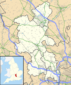
 Cold Brayfield
Cold Brayfield shown within BuckinghamshireOS grid reference SP929523 Parish Cold Brayfield Unitary authority Milton Keynes Ceremonial county Buckinghamshire Region South East Country England Sovereign state United Kingdom Post town OLNEY Postcode district MK46 Dialling code 01234 Police Thames Valley Fire Buckinghamshire Ambulance South Central EU Parliament South East England UK Parliament North East Milton Keynes List of places: UK • England • Buckinghamshire Cold Brayfield is a village and civil parish in the Borough of Milton Keynes, Buckinghamshire, England.[1] It is about three miles east of Olney, on the Bedfordshire border. Nearby places are Lavendon and Turvey (over the bridge on the Bedfordshire side of the River Great Ouse).
Cold Brayfield is probably the place named as 'Bragenfelda' in a charter of 967.[2] The elements of the name, 'brain' and 'field' are interpreted to mean 'open country on the crown of a hill'.[3] The village name is later recorded in twelfth- and thirteenth-century charters as 'Brauefeld', 'Brawefeld' or 'Brauufeld',[4] and becomes 'Cold Brayfield' towards the end of the sixteenth century.[5] The prefix 'Cold' is believed to refer to the village's bleak location on the banks of the River Great Ouse, however there is no known record for this.
References
- ^ Parishes in Milton Keynes - Milton Keynes Council.
- ^ Charters of Abingdon Abbey, ed. S.E. Kelly, 2 parts, Anglo-Saxon Charters VIII (British Academy: Oxford, 2001), part 2, no. 106, pp. 419-21
- ^ E. Ekwall, The Oxford Dictionary of English Place-Names, 4th edition (Oxford University Press: Oxford, 1960), p. 59; V. Watts, ed., The Cambridge Dictionary of English Place-Names (Cambridge University Press: Cambridge, 2004), p. 82
- ^ Records of Harrold Priory, ed. G. H. Fowler (Bedfordshire Historical Record Society: Aspley Guise, 1935), pp. 46-53
- ^ Victoria History of the County of Buckingham, IV (Victoria History of the Counties of England: London, 1927), pp. 323-327. URL: http://www.british-history.ac.uk/report.aspx?compid=62593 Date accessed: 03 July 2009
External links
Civil parishes in Milton Keynes Astwood • Bletchley and Fenny Stratford • Bow Brickhill • Bradwell • Bradwell Abbey • Broughton • Calverton • Campbell Park • Castlethorpe • Central Milton Keynes • Chicheley • Clifton Reynes • Cold Brayfield • Emberton • Gayhurst • Great Linford • Hanslope • Hardmead • Haversham-cum-Little Linford • Kents Hill, Monkston and Brinklow • Lathbury • Lavendon • Little Brickhill • Loughton • Milton Keynes • Moulsoe • New Bradwell • Newport Pagnell • Newton Blossomville • North Crawley • Olney • Ravenstone • Shenley Brook End • Shenley Church End • Sherington • Simpson • Stantonbury • Stoke Goldington • Stony Stratford • Tyringham and Filgrave • Walton • Warrington • Wavendon • West Bletchley • Weston Underwood • Woburn Sands • Wolverton and Greenleys • Woughton
River Great Ouse, England Counties Flows into Towns
(upstream to downstream)Brackley · Buckingham · Old Stratford · Milton Keynes (Stony Stratford • Wolverton • New Bradwell) · Newport Pagnell · Olney · Kempston · Bedford · St Neots · Godmanchester · Huntingdon · St Ives · Ely · Littleport · Downham Market · King's Lynn
Major tributaries
(upstream to downstream by confluence)River Tove · River Ouzel (or Lovat) · River Ivel · River Kym · Old Bedford River · New Bedford River · River Cam · River Lark · River Little Ouse · River Wissey
Major bridges
(upstream to downstream)Harrold bridge · A428 Turvey bridge · A428 Bromham bypass · A6 Bedford Town Bridge · A421 Bedford bypass · Great Barford Bridge · A428 Bridge St Neots · St Neots Town Bridge · Godmanchester Chinese Bridge · A14 bridge, River Great Ouse · Huntingdon Old Bridge · St Ives Bridge
Categories:- Civil parishes in Milton Keynes Borough
- Villages in Buckinghamshire
- Milton Keynes
- Populated places on the River Great Ouse
- Buckinghamshire geography stubs

Wikimedia Foundation. 2010.