- Central Milton Keynes
-
Coordinates: 52°02′32″N 0°45′35″W / 52.0423°N 0.7598°W
Central Milton Keynes 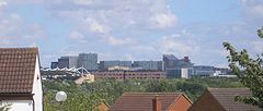
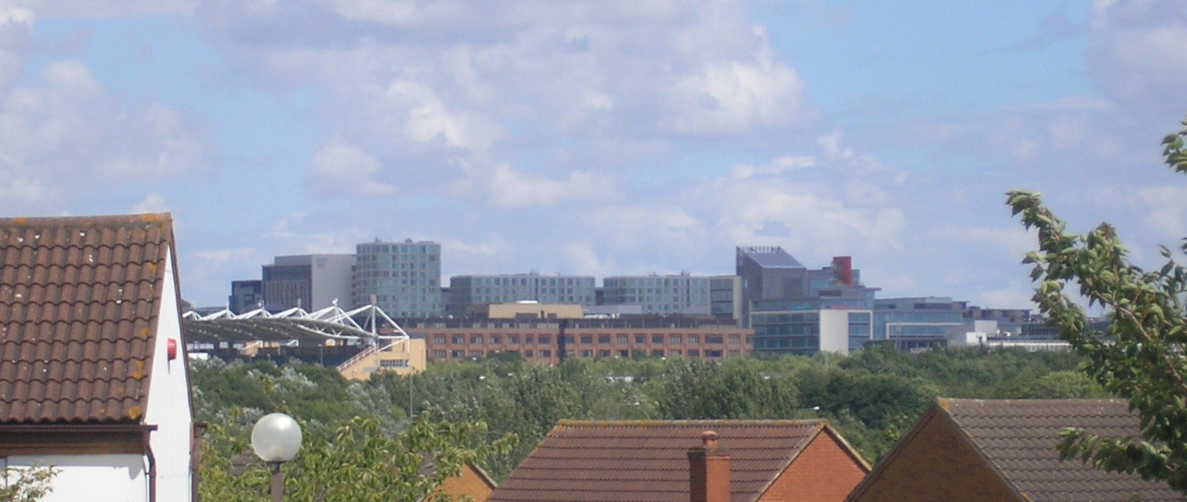
View from Great Holm, approximately one mile to the west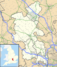
 Central Milton Keynes
Central Milton Keynes shown within BuckinghamshireArea 0.9 sq mi (2.3 km2) Population 1,272 (2001) - Density 1,413 /sq mi (546 /km2) OS grid reference SP851389 Parish Central Milton Keynes Unitary authority Milton Keynes Ceremonial county Buckinghamshire Region South East Country England Sovereign state United Kingdom Post town MILTON KEYNES Postcode district MK9 Dialling code 01908 Police Thames Valley Fire Buckinghamshire Ambulance South Central EU Parliament South East England UK Parliament Milton Keynes North Website centralmk-tc.gov.uk List of places: UK • England • Buckinghamshire Central Milton Keynes is the central business district of Milton Keynes, Buckinghamshire, England and a civil parish in its own right.
The district is approximately 2.5 km long by 1 km wide and occupies some of the highest land in Milton Keynes. It contains (behind the Central Library) the site of Secklow Hundred moot hill, the meeting site of the Anglo-Saxon settlers in the area. It contains the central retail, business, law enforcement and governmental districts and Milton Keynes Central railway station.
(Campbell Park, stretching from Marlborough Street down to the Grand Union Canal, is sometimes included in mental maps of the centre, though in fact it is part of a separate civil parish).
Contents
Topology
Occupying 238 hectares (590 acres),[1] the area lies between Portway (H5, A509) to the north, the West Coast Main Line and A5 to the west, Childs Way (H6) to the south and Marlborough Street (V8, B4034) to the east. It is crossed from north to south by (in west to east order, major roads only) Grafton Gate (V6), Witan Gate, Saxon Gate (V7) and Secklow Gate. It is crossed from west to east (in north to south order, major roads only) by Silbury Boulevard, Avebury Boulevard and Midsummer Boulevard. Avebury is the primary spine.
East of Saxon Gate: the main retail/service/entertainment district
This area is almost the highest[2] point of Milton Keynes and has the site of the Anglo-Saxon Secklow Hundred[1] moot mound (meeting place) just behind the library.
The area is defined by Marlborough Street (V8, B4034) to the north-east, the Saxon Gate (Saxon Street, V7) to the south-west, Portway (H5, A509) to the north-west and Childs Way (H6) to the south-east. The core retail district is further delimited by Silbury and Avebury Boulevards, with civic and office developments outside the Boulevards.
The retail district includes thecentre:mk and Midsummer Place (the covered high streets that are the Central Milton Keynes Shopping Centre). The Library, Milton Keynes Borough Council offices and commercial offices are on the north side of the shops; the theatre, art gallery, cinemas, Xscape snowdome, pubs, sports shops and other leisure facilities are on the south side.
Xscape
Main article: XscapeXscape is the main leisure complex in Central Milton Keynes, consisting of a real snow indoor ski slope, climbing wall and a multiscreen cinema, and a number of shops and restaurants.
Milton Keynes Theatre and Gallery
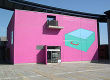 Milton Keynes Gallery, temporary surface by Michael Craig-Martin
The 1,400 seat Milton Keynes theatre/concert hall has an unusual feature: the ceiling can be lowered closing off the third tier (gallery) to create a more intimate space for smaller scale productions.
Milton Keynes Gallery (the municipal art gallery, beside the main theatre) does not have a permanent collection. This allows it to host edgy shows to critical acclaim.[3]
West of Saxon Gate, east of Grafton Gate: the main business district
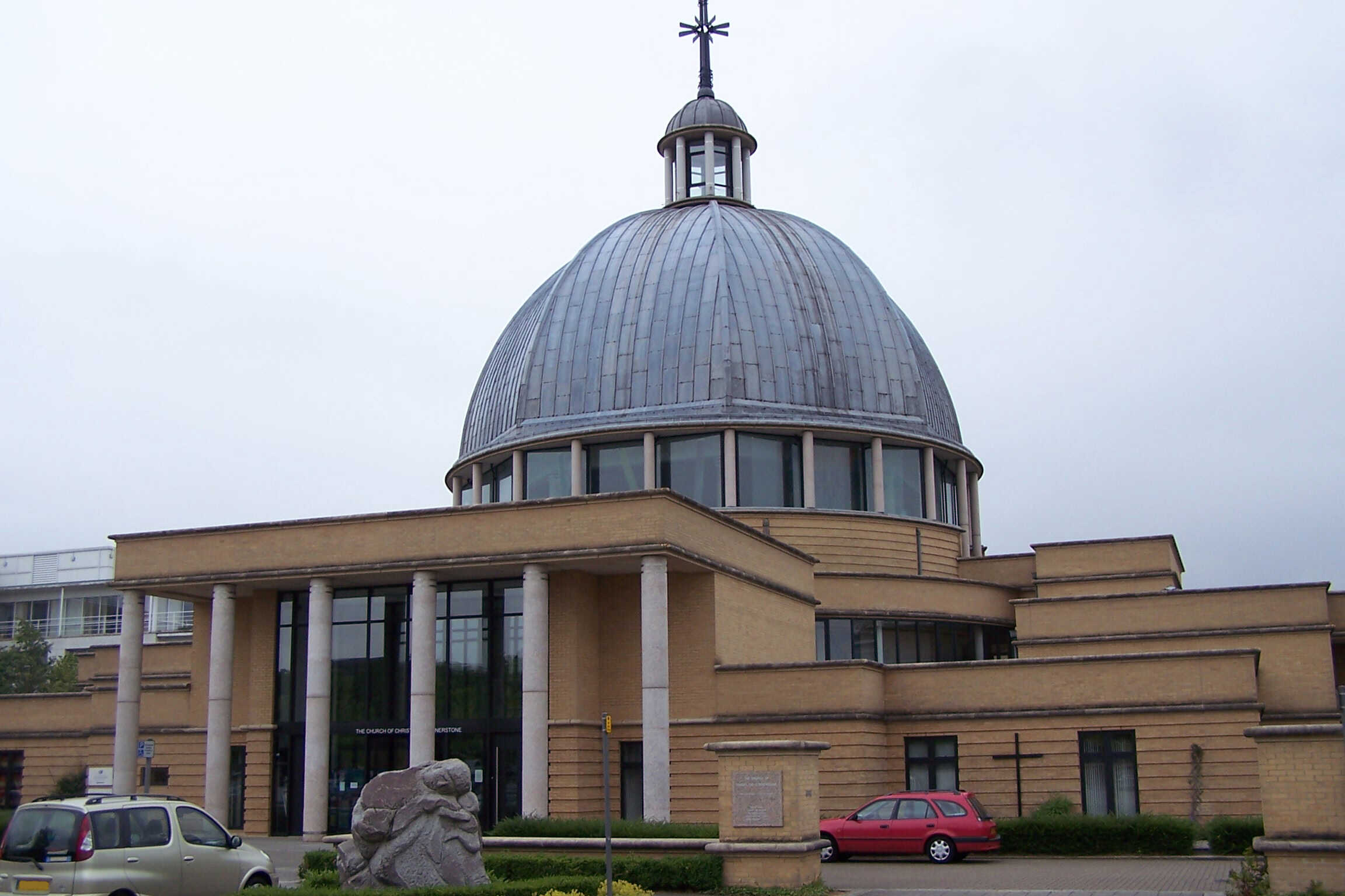
This area is also delimited by Portway and Childs Way. Saxon Gate separates it from the north-east area and Grafton Gate (Grafton Street, V7) marks its south-western edge. The domed Church of Christ the Cornerstone, law courts and police station are in the business district, which has a number of notable buildings including CBX, The Hub:MK and the remarkable purpose-built Indian restaurant beside the small linear park that provides its core. The restaurant claims to be the largest purpose-built Indian restaurant in Europe.
Ecumenical Church of Christ the Cornerstone
 Ecumenical Church of Christ the Cornerstone
This ecumenical church, the first such in the United Kingdom, is shared by the major Christian denominations to serve the office workers and the small resident population. (There are many denominational places of worship throughout the town at large).
The Hub:MK
The Hub:MK is a 13 storey development between the station and the church. The complex includes two high-rise hotels and a number of residential and office towers. The site controversially involves the closure of one of the original pedestrian underpasses and is built right up to the edge of the adjacent boulevard, the first of several proposals that will change the unique character of Milton Keynes Development Corporation's original design for Central Milton Keynes. The work is part of the 'densification' plan that central government, through its agency English Partnerships, has ordained for Milton Keynes. Its height, also a major departure from the original low-rise design, makes it the third tallest building in Milton Keynes, beaten only by the 14 storey Xscape and the 18 storey Mellish Court in Bletchley.
West of Grafton Gate: the station district
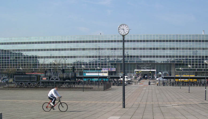
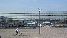 Milton Keynes Central and Station Square
This district is defined by Saxon Gate (Saxon Street, V7) to the north-east, the West Coast Main Line (and the adjacent A5) to the south-west, Portway (H5, A509) to the north-west and Childs Way (H6) to the south-east. The core retail district is further delimited by Silbury and Avebury Boulevards, with civic and office developments outside the Boulevards.
The main feature of the district is the Milton Keynes Central railway station (an inter-city stop on the West Coast Main Line), one of the five[4] stations serving Milton Keynes. Coach services operate from here as well as from the Milton Keynes coachway next to junction 14 of the M1 motorway. Services include the Stagecoach X5 service that replaces the Varsity Line, which links Milton Keynes with Oxford in the west (for connections to the west and Wales) and Cambridge in the east; and the VT99 service to Luton Airport, operated by Stagecoach on behalf of Virgin Rail. The station building houses commercial office lets and food outlets, and the Station Square development includes further office lets and retail outlets.
The central bus station is located opposite the station. This is used primarily by local services run by Arriva (as Arriva MK Star), but only as a driver rest and change-over point – the interchange point is the railway station forecourt. The upstairs level of the bus station accommodates a nightclub. There is a covered "urban" skate-boarding space, SK8MK, beside the bus station.
The National Hockey Stadium was formerly located to the north of the station, surrounded by a number of important retail units. This site is now being developed as the national headquarters of Network Rail. To its south there is another leisure and retail area, notably the Planet Ice Arena (home of Milton Keynes Lightning) and another ten-pin bowling alley.
Civil parish
Central Milton Keynes is a civil parish, bordering (clockwise from north) Great Linford, Campbell Park, Loughton, and Bradwell.[5] The parish was created in 2001, and had a population of 1,272 according to the 2001 census.[6]
ONS Urban sub-area
Main article: Milton Keynes urban areaThe Office of National Statistics designated urban sub-area (map) called "Central Milton Keynes" is far bigger than either the district or the parish. It consists of that part of Milton Keynes that is west of the River Ouzel, but north of the Bletchley urban sub-area (which approximates to the former Bletchley Urban District), south-east of the Wolverton/Stony Stratford urban sub-area (which approximates to the former Wolverton Urban District) and south of the North Milton Keynes urban sub-area. (The provenance of "North Milton Keynes", and of its boundary with the Central Milton Keynes urban sub-area, are unclear. The Central Milton Keynes and North Milton Keynes urban sub-areas together approximate to that part of the former Newport Pagnell Rural District that is west of the River Ouzel).
Media
Locations around Central Milton Keynes were used for the movie Superman IV, where it played the part of the United Nations building. Recognisable locations include Milton Keynes Central, CBX and the Argos building.[7]
See also
- Milton Keynes for a more general description of the amenities of the wider area.
- Central Milton Keynes Shopping Centre
- Milton Keynes Central railway station
- Milton Keynes Village
References
- ^ Borough of Milton Keynes: parish profiles
- ^ Oakhill, at the western border with Aylesbury Vale, is slightly higher.
- ^ Guardian Unlimited | Search |"Milton keynes gallery"
- ^ Bletchley, Bow Brickhill, Fenny Stratford, Milton Keynes Central, and Wolverton
- ^ Parishes in Milton Keynes - Milton Keynes Council.
- ^ http://www.mkweb.co.uk/statistics/documents/Profiles%5FA%2DL%281%29%2Epdf 1.6MB PDF Parishes A-L
- ^ Filming Locations for Superman IV
External links
Civil parishes in Milton Keynes Astwood • Bletchley and Fenny Stratford • Bow Brickhill • Bradwell • Bradwell Abbey • Broughton • Calverton • Campbell Park • Castlethorpe • Central Milton Keynes • Chicheley • Clifton Reynes • Cold Brayfield • Emberton • Gayhurst • Great Linford • Hanslope • Hardmead • Haversham-cum-Little Linford • Kents Hill, Monkston and Brinklow • Lathbury • Lavendon • Little Brickhill • Loughton • Milton Keynes • Moulsoe • New Bradwell • Newport Pagnell • Newton Blossomville • North Crawley • Olney • Ravenstone • Shenley Brook End • Shenley Church End • Sherington • Simpson • Stantonbury • Stoke Goldington • Stony Stratford • Tyringham and Filgrave • Walton • Warrington • Wavendon • West Bletchley • Weston Underwood • Woburn Sands • Wolverton and Greenleys • Woughton
Categories:- Civil parishes in Milton Keynes Borough
- Milton Keynes


Wikimedia Foundation. 2010.