- Middleton, Milton Keynes
-
Coordinates: 52°02′32″N 0°42′17″W / 52.0422°N 0.7047°W
Middleton 
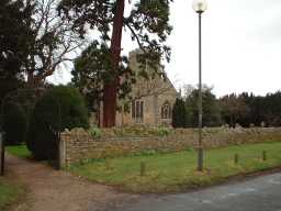
All Saints Church
 Middleton
Middleton shown within BuckinghamshireOS grid reference SP888390 Parish Milton Keynes Unitary authority Milton Keynes Ceremonial county Buckinghamshire Region South East Country England Sovereign state United Kingdom Post town MILTON KEYNES Postcode district MK10 Dialling code 01908 Police Thames Valley Fire Buckinghamshire Ambulance South Central EU Parliament South East England UK Parliament Milton Keynes North List of places: UK • England • Buckinghamshire Middleton is a district in Milton Keynes, Buckinghamshire, England. The district is centred on Milton Keynes Village, the village that gave its name to the 'New City' of Milton Keynes, which began to be developed during the late 1960s. The Village also gives its name to the local civil parish, of which Middleton is the more populated district.
The Village was originally known as Middeltone (11th cent.); then later as Middelton Kaynes or Caynes (13th cent.); Milton Keynes (15th cent.); and Milton alias Middelton Gaynes (17th cent.).[1] After the Norman invasion, the de Cahaines family held the manor from 1166 to the late 13th century as well as others in the country (Ashton Keynes, Somerford Keynes, and Horsted Keynes). During this time the village became known as Middleton de Keynes eventually shortening to Milton Keynes.[2]
The original core village of the district, along Willen Rd and Broughton Rd, has retained its "Milton Keynes" road signs and has an attractive collection of rural village houses and a thatched pub. It is now known as "Milton Keynes Village".
Contents
Education
The district has two schools, Middleton Primary School and Oakgrove School, a secondary comprehensive. Both were built in the early 2000s, in the south-west of the district.
Civil parish
After the development of Milton Keynes (the 'city'), the district in which the original village lies, and after which it was named, was given the name Middleton again. However, the civil parish is still formally called Milton Keynes, and has a joint parish council with Broughton, Broughton and Milton Keynes Parish Council.[3] (The civil parish for the 'new city' centre is called "Central Milton Keynes"). Milton Keynes civil parish consists of Middleton district and the neighboring grid-square, Oakgrove. It also consists of three wards: Milton Keynes Village Ward, Middleton Ward [the modern part of the district] and Oakgrove Ward.
According to the 2001 census the parish had a population of 1,720.[4]
External links
References
- ^ 'Parishes : Milton Keynes', Victoria History of the Counties of England: A History of the County of Buckingham: Volume 4 (1927), pp. 401-405.
- ^ Woodfield, Paul. A Guide to the Historic Buildings of Milton Keynes, Milton Keynes Development Corporation, 1996.
- ^ Parishes in Milton Keynes - Milton Keynes Council.
- ^ Borough of Milton Keynes population statistics, 2001 Census data, page 20
Civil parishes in Milton Keynes Astwood • Bletchley and Fenny Stratford • Bow Brickhill • Bradwell • Bradwell Abbey • Broughton • Calverton • Campbell Park • Castlethorpe • Central Milton Keynes • Chicheley • Clifton Reynes • Cold Brayfield • Emberton • Gayhurst • Great Linford • Hanslope • Hardmead • Haversham-cum-Little Linford • Kents Hill, Monkston and Brinklow • Lathbury • Lavendon • Little Brickhill • Loughton • Milton Keynes • Moulsoe • New Bradwell • Newport Pagnell • Newton Blossomville • North Crawley • Olney • Ravenstone • Shenley Brook End • Shenley Church End • Sherington • Simpson • Stantonbury • Stoke Goldington • Stony Stratford • Tyringham and Filgrave • Walton • Warrington • Wavendon • West Bletchley • Weston Underwood • Woburn Sands • Wolverton and Greenleys • Woughton
Categories:- Civil parishes in Milton Keynes Borough
- Milton Keynes
- Buckinghamshire geography stubs

Wikimedia Foundation. 2010.