- Clifton Reynes
-
Coordinates: 52°09′07″N 0°40′55″W / 52.152°N 0.682°W
Clifton Reynes 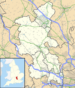
 Clifton Reynes
Clifton Reynes shown within BuckinghamshirePopulation 138 (2001) OS grid reference SP903513 Parish Clifton Reynes District Milton Keynes Shire county Buckinghamshire Region South East Country England Sovereign state United Kingdom Post town OLNEY Postcode district MK46 Dialling code 01234 Police Thames Valley Fire Buckinghamshire Ambulance South Central EU Parliament South East England UK Parliament Milton Keynes North East List of places: UK • England • Buckinghamshire Clifton Reynes is a village in the Borough of Milton Keynes, in the ceremonial county of Buckinghamshire, England.[1] It is about a mile east of Olney. It is a civil parish sharing a joint parish council with Newton Blossomville.
Contents
Extent
It is bounded, on the North, by the River Great Ouse, by which this parish is separated from Lavendon and Cold Brayfield; on the East, by Newton-Blossomville; on the South, by Petsoe and Emberton; and on the West, by the latter and by Olney.
Origin of name
The village name comes in two parts: the former name 'Clifton' is Anglo Saxon in origin and means 'Cliff farm', referring to the village's position on a cliff on a bank of the River Ouse. The latter name 'Reynes' refers to the ancient lords of the manor of the village, whose family name this was. In the Domesday Book on 1086 Clifton Reynes was recorded as Cliftone.
Buildings of note
The parish church dedicated to St Mary is (unusually for a Buckinghamshire church) completely castellated: even the gables are embattled. The tower is thought to be Norman, however the top is later probably 14th century. The majority of the building is of the 13th, 14th and 15th centuries and the nave is unusually tall. Features of interest include the 14th century font and the medieval monuments of the Reynes family. These include two pairs of wooden effigies; one pair is of Ralph and Amabel de Reynes (ca. 1320-30) and the other is unidentified and slightly earlier.[2]
References
- ^ Parishes in Milton Keynes - Milton Keynes Council.
- ^ Betjeman, J. (ed.) (1968) Collins Pocket Guide to English Parish Churches: the South. London: Collins; p. 126
External links
 Media related to Clifton Reynes at Wikimedia Commons
Civil parishes in Milton Keynes Astwood • Bletchley and Fenny Stratford • Bow Brickhill • Bradwell • Bradwell Abbey • Broughton • Calverton • Campbell Park • Castlethorpe • Central Milton Keynes • Chicheley • Clifton Reynes • Cold Brayfield • Emberton • Gayhurst • Great Linford • Hanslope • Hardmead • Haversham-cum-Little Linford • Kents Hill, Monkston and Brinklow • Lathbury • Lavendon • Little Brickhill • Loughton • Milton Keynes • Moulsoe • New Bradwell • Newport Pagnell • Newton Blossomville • North Crawley • Olney • Ravenstone • Shenley Brook End • Shenley Church End • Sherington • Simpson • Stantonbury • Stoke Goldington • Stony Stratford • Tyringham and Filgrave • Walton • Warrington • Wavendon • West Bletchley • Weston Underwood • Woburn Sands • Wolverton and Greenleys • Woughton
Categories:- Civil parishes in Milton Keynes Borough
- Villages in Buckinghamshire
- Milton Keynes
- Buckinghamshire geography stubs

Wikimedia Foundation. 2010.