- River Stour, Suffolk
Geobox|River
name = Stour
map_size =
map_caption =
other_name =
other_name1 =
country = England
country_
region_type = Counties
region = Cambridgeshire
region1 = Suffolk
region2 = Essex
city = Haverhill
city1 = Sudbury
city2 =Harwich length = 76
length_imperial =
watershed =
watershed_imperial =
discharge_location =
discharge_average =
discharge_average_imperial =
discharge_max_month =
discharge_max =
discharge_max_imperial =
discharge_min_month =
discharge_min =
discharge_min_imperial =
discharge1_location =
discharge1_average =
discharge1_average_imperial =
discharge2_location =
discharge2_average =
discharge2_average_imperial =
discharge3_location =
discharge3_average =
discharge3_average_imperial =
discharge4_location =
discharge4_average =
discharge4_average_imperial =source_name =
source_location =
source_region =Cambridgeshire
source_country = UK
source_country1 =
source_elevation =
source_elevation_imperial =
source_lat_d =
source_lat_m =
source_lat_s =
source_lat_NS =
source_long_d =
source_long_m =
source_long_s =
source_long_EW =
mouth_name =North Sea
mouth_location =Harwich ,Essex
mouth_country = UK
mouth_country_
mouth_region =
mouth_country1 =
mouth_elevation = 0
mouth_elevation_imperial = 0
mouth_lat_d =
mouth_lat_m =
mouth_lat_s =
mouth_lat_NS =
mouth_long_d =
mouth_long_m =
mouth_long_s =
mouth_long_EW =
tributary_left =
tributary_left1 =
tributary_right =
tributary_right1 =
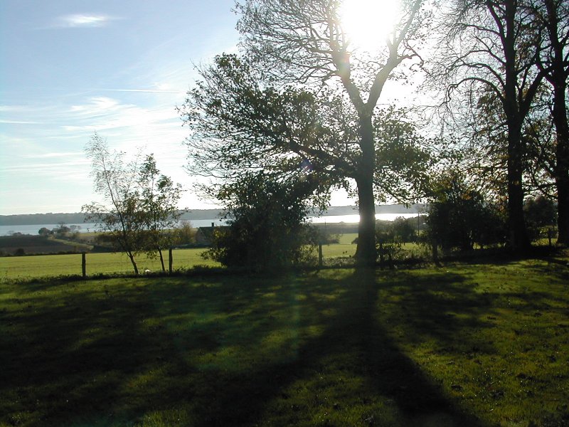
image_size = 200px
image_caption = The Stour atManningtree , EssexThe River Stour is a
river inEast Anglia ,England . It is 76 km (47 m) longcite web | title = Environment Agency - River Stour | publisher = www.environment-agency.gov.uk | month = November | year = 2006 | url = http://www.environment-agency.gov.uk/subjects/navigation/747415/788356/188698/?lang=_e
format = HTML | accessdate = 2006-11-05] and forms most of the county boundary betweenSuffolk to the north, andEssex to the south. It rises in easternCambridgeshire , passes though Haverhill, Cavendish, Sudbury and theDedham Vale , and joins theNorth Sea atHarwich . The name "Stour" derives from the Celtic "sturr" meaning "strong". [ Oxford Dictionary of British Place Names (2003) ]The first settlement on the river in Suffolk was at
Great Bradley , where man has had a recorded presence for over 5,000 years.The River Stour was one of the first improved rivers or canals in England. Parliament passed " 'An Act for making the River Stower navigable from the town of
Manningtree , in the county of Essex, to the town of Sudbury, in the county of Suffolk' " in1705 , mandating public navigation rights and providing the basis of ajoint stock company of London and Suffolk investors who raised £4,800 to cut and manage the river.Although partly supplanted by railways, lighters were still working on the Stour almost untilWorld War II .The Stour valley has been portrayed as a working river by
John Constable ,Thomas Gainsborough andPaul Nash . Today much of the Stour valley is designated an Area of Outstanding Beauty. and forms the spine of "Constable country".The
River Stour Trust , awaterway restoration group, was set up in1968 to protect and enhance the right of the public to navigate the River Stour. The Trust seeks to restore through navigation from Sudbury to the sea, following on the successful restoration of the locks at Dedham, Flatford and Great Cornard, by reinstating the 10 remaining locks. Meanwhile, the Trust encourages use of the River Stour by small craft and organises annual events for all age groups and abilities on different parts of the river.River Stour Trust boat trips and private charters, skippered by friendly volunteer boat crew, are available in Flatford and Sudbury between Easter and October.RSPB Stour Estuary is anature reserve managed by theRoyal Society for the Protection of Birds .(RSPB)ee also
*
Rivers of the United Kingdom References
External links
* [http://www.riverstourtrust.org/ The River Stour Trust]
* [http://www.nationalhistoricships.org.uk/index.cfm/event/getVessel/vref/1434/pic/1 Stour lighter John Constable] Register of National Historic Ships
* [http://easyweb.easynet.co.uk/jim.shead/PNRC0601.htm#PNRCSTRS Priestley's Navigable Rivers and Canals, 1831] River Stour p.597
* [http://www.constablecountry.co.uk/attractions.htm Constable Country website]
* [http://www.bures-online.co.uk/ Bures website] - gives the full Navigation history of the river from the time of the horse drawn "lighters" up to the present day
* [http://www.riverstourboating.org.uk/ River Stour Boating] - provides one or two day canoe trips from Sudbury to Cattawade a distance of nearly 25 miles

Wikimedia Foundation. 2010.