- Middlesbrough Borough Council
-
Middlesbrough Borough Council Type Type Non-metropolitan district council of Middlesbrough Leadership Voting system First past the post Meeting place 
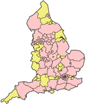
Town Hall, Middlesbrough Website http://www.middlesbrough.gov.uk/ Middlesbrough Borough Council is the local authority of Middlesbrough. It is a unitary authority and borough in North Yorkshire, England. It is based on the town of Middlesbrough, which is sometimes considered to spread outside the borough boundaries into the neighbouring borough of Redcar and Cleveland; the borough extends southwards to a semi-rural area. Whilst part of North Yorkshire for ceremonial purposes it is in the region of North East England. It had a resident population in 2001 of 134,855. A 2006 mid-year estimate suggests the Borough to have a population of 138,400.[1] The borough council is one of the districts bidding to achieve city status in 2012, to celebrate the Queen's Diamond Jubilee.[2]
Contents
History
The district was formed on 1 April 1974, under the Local Government Act 1972, from part of the former County Borough of Teesside, along with the parish of Nunthorpe from the Stokesley Rural District. It was a district, and the county town of the new county of Cleveland from 1 April 1974, until 1996, when Cleveland was abolished under the Banham Review, and Middlesbrough became a unitary authority. The borough borders Stockton-on-Tees to the west, Redcar and Cleveland to the east and the Hambleton district of North Yorkshire to the south.
Mayor
Unlike most English districts, its council is led by a directly-elected mayor, currently Ray Mallon. Mr. Mallon was previously a senior officer in Cleveland Police, and was noted for a zero-tolerance approach to crime, adopted from the New York system, during his time as head of Middlesbrough's CID.
2011 election
Mayor of Middlebrough 2011[3][4] Party Candidate Votes % ±% Independent Ray Mallon 17,917 50.4% -8.3% Labour Michael John Carr 11,405 32.1% +20.2% Liberal Democrat Chris Foote-Wood 3,256 9.2% -14.5% Conservative Lloyd Cole-Nolan 3,001 8.4% +2.6% Majority 6,512 18.3% -16.7% Turnout 36.5% Independent hold Swing 14.2% to Lab Political composition
Below is the political composition of the council in 2008 and 2011.
Year Labour Conservatives Liberal Democrats Independents/Greens 2008 26 6 5 11 2011 30 4 1 13 The borough has 23 council wards. Middlesbrough is mostly unparished, with Nunthorpe and Stainton and Thornton being the only parishes.
Coat of arms
The original coat of arms of the Borough was devised in the nineteenth century by William Hylton Dyer Longstaffe,[5] and regranted in 1996 with slight modifications after the dissolution of Cleveland County. The images, from the collection of the Heraldry Society, will be found on Robert Young's Civic Heraldry website.
References
- ^ Selected age groups for local authorities in United Kingdom: mid-2006 population estimates
- ^ Middlesbrough has thrown its hat into the ring - the Guardian
- ^ "Election Results". Middlesbrough Borough Council. 2011-05. http://www.middlesbrough.gov.uk/ccm/content/main-homepage-features/election-results.en. Retrieved 2011-05-21.
- ^ "Candidates in Mayoral Elections, May 2007". New Local Government Network. 2007. http://www.nlgn.org.uk/public/2007/candidates-in-mayoral-elections-may-2007/. Retrieved 2011-05-21.
- ^ GENUKI: Middlesbrough Parish information from Bulmers' 1890
External links
Categories:- Politics of Middlesbrough
- Unitary authority councils of England
Wikimedia Foundation. 2010.

