- Cleveland, England
-
Coordinates: 54°31′30″N 1°11′20″W / 54.525°N 1.189°W
Cleveland 
The former county of Cleveland shown within EnglandGeography Status Non-metropolitan county 1974 area 144,085 acres (583.09 km2)[1] HQ Middlesbrough ONS code 14 History Origin Teesside and environs Created 1974 Abolished 1996 Succeeded by Hartlepool
Stockton-on-Tees
Middlesbrough
Redcar and ClevelandDemography 1973 population 566,740[2] 1981 population 565,935 1991 population 541,333 Politics Governance Cleveland County Council 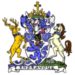
Coat of arms of Cleveland County CouncilSubdivisions Type Non-metropolitan districts 
Units Cleveland (
 /ˈkliːvlənd/) is an area in the north east of England. Its name means literally "cliff-land", referring to its hilly southern areas, which rise to nearly 1,500 ft (460 m). Historically Cleveland, as a geographic area within the North Riding of Yorkshire, was located entirely to the south of the River Tees and its largest town was Guisborough, until the rise of Middlesbrough in the 19th century.
A non-metropolitan county of Cleveland was created in 1974 under the Local Government Act 1972, named after the historic region, but not covering it all, and also including land north of the River Tees that had until then been in County Durham. It was based around the Teesside urban area and included Middlesbrough, Stockton-on-Tees, Hartlepool and Redcar.
The county was abolished in 1996[3] with its boroughs becoming unitary authorities and the Tees re-established as the border between North Yorkshire and County Durham for ceremonial purposes only.
Contents
Heritage
Cleveland has a significant industrial heritage arising from its central role in the 19th century iron boom that led to Middlesbrough growing from a hamlet into a major industrial town in only a few decades. The Cleveland Hills, in the southern part of the district, were key suppliers of the ironstone that was essential to the running of the blast furnaces alongside the River Tees. Middlesbrough's Teesport is still one of the United Kingdom's main ports and the area between Middlesbrough and Redcar is still populated by many heavy industrial plants, although this is much reduced from its 20th century peak.
County of Cleveland
Formation
Between 1974 and 1996 most of Cleveland was incorporated into a non-metropolitan county of the same name, formed from parts of the North Riding of Yorkshire and County Durham. Unlike the traditional geographic area, the county was formed around the Tees estuary and included lands on both sides of the river. It excluded the southernmost parts of traditional Cleveland, including much of the Cleveland Hills, although the original proposal for this county was much larger and covered the coast down including Whitby and the Whitby Rural District.
The county was called "Cleveland", instead of "Teesside" as originally proposed in the Local Government Bill, due to fears in areas not part of the old Teesside county borough that it represented a takeover. It was formed on 1 April 1974, from the former county boroughs of Teesside and Hartlepool, the Stockton Rural District from Durham, and from the North Riding of Yorkshire, the urban districts of Guisborough, Loftus, Saltburn and Marske-by-the-Sea and Skelton and Brotton, along with some parishes from Stokesley Rural District.
The four districts of the County of Cleveland were Hartlepool, Langbaurgh-on-Tees, Stockton-on-Tees, and Middlesbrough. The county town was Middlesbrough. It had a total area of 225 square miles (583 km²) and an estimated population of 567,600 in 2000. The county bordered County Durham to the north and North Yorkshire to the south, and it faced the North Sea to the east.
Abolition
Cleveland was one of the areas in the first tranche of reviews conducted by the Banham Commission. The Commission's final recommendations, accepted by the government, were that each of the districts should be made a unitary authority, and additionally that the Tees should be re-established as a ceremonial border. This was fiercely contested by Cleveland County Council, who applied for judicial review over the decision. According to the Minister, David Curry, in the Commons debate on the order on 11 January 1995, this caused a delay from 1 April 1995 as the reorganisation date to 1 April 1996. The rationale for Cleveland's abolition is widely believed to be due to the fact the name Cleveland became stigmatised due to a misreported child abuse scandal by the local authorities in 1987.[4]
As the first of the Orders to be laid before Parliament, it was done in two stages. The Cleveland (Structural Change) Order 1995 [5] had the main effect of abolishing the County Council, whilst The Cleveland (Further Provision) Order 1995 [3] abolished the actual county, creating four new (non-metropolitan) unitary authorities coterminous with each of the boroughs. A division was forced by the Opposition, on the first Order, with 310 in favour and 223 in opposition. Of Cleveland's 6 MPs, Mo Mowlam and Frank Cook (both Labour) voted against, with Tim Devlin and Michael Bates (both Conservative) voted for. Stuart Bell and Peter Mandelson (both Labour) were present at the debate but did not vote.
On 1 April 1996, the Orders came into force. The district of Langbaurgh-on-Tees was renamed Redcar and Cleveland, the County of Cleveland was abolished, and four unitary authorities created. The post of Lord Lieutenant of Cleveland was abolished, with the area being split between the ceremonial counties of Durham and North Yorkshire. However, Cleveland Police and other institutions covering the four boroughs, were retained. The area (sometimes including Hartlepool) is known as 'Teesside' for some purposes, and with Darlington the term Tees Valley is becoming more popular in the press and with local government, although it continues to be generally unused by the actual residents of this area.
Identity
As a small, recently formed authority, Cleveland was not well known, leaving the post-1996 boroughs effectively unheard of to all but the local population or those with links to the area. Recent investigations into the resident populations opinions as to their own identity reveal that people believe themselves to be part of either 'Cleveland', 'Teesside', 'Yorkshire' or 'Durham'. The age of the interviewee appears to be the defining factor as to which title they identify with.
The name Cleveland has not been entirely eliminated; these bodies still exist:
- Cleveland and Teesside Local History Society
- Cleveland Orienteering Klub
- Middlesbrough & Cleveland Harriers
- Cleveland College of Art & Design
- Cleveland Family History Society
- Cleveland Fire Brigade
- Cleveland Police
Cleveland is a Church of England archdeaconry, in the Diocese of York. It covers a large area including Middlesbrough, Thirsk, Pickering and Whitby.
Cleveland was for many years also the name of a constituency for the House of Commons. The Cleveland constituency had been created by the Redistribution of Seats Act 1885, by the division of the North Riding constituency, and was succeeded by the Cleveland and Whitby for the February 1974 general election. The TS postcode area, which covers much of the former county, is also known officially as the Cleveland postcode area.[6] Cleveland was adopted by the Royal Mail as a postal county in 1974. The 'TS' implies that the county of Cleveland was originally to be named Teesside or that the postcoding scheme was devised for a larger County Borough of Teesside than was actually created.
Geography
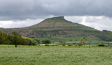 Roseberry Topping, one of the most enduring symbols of ancient Cleveland.
The area is extremely varied geographically. The Tees estuary is highly industrialised and urbanised. Much of the remainder of the lowland parts of Cleveland is farmland. East Cleveland marks the northern end of the chain of cliffs that runs along the North Yorkshire Heritage Coast. South Cleveland is extremely hilly, forming the escarpment of the North York Moors. One of the best known symbols of Cleveland is the distinctive hill of Roseberry Topping, which overlooks Newton under Roseberry on the Great Ayton to Guisborough road. Its original roughly conical form was undercut by extensive mining, giving it a jagged appearance that many have thought reminiscent of the Matterhorn mountain.
Geographical features
Towns and villages
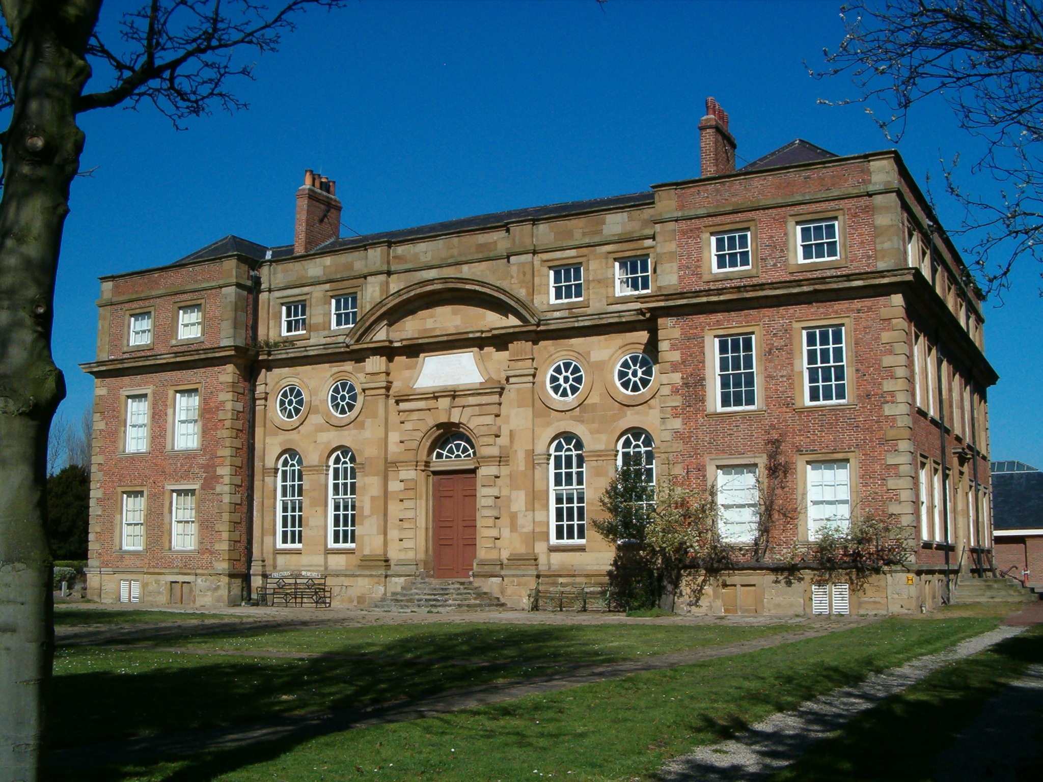
 Kirkleatham Free School of 1709, now Kirkleatham Old Hall Museum
- Billingham
- Brotton
- Eston
- Guisborough
- Hartlepool
- Ingleby Barwick
- Loftus
- Marske-by-the-Sea
- Middlesbrough
- Redcar
- Saltburn-by-the-Sea
- Seaton Carew
- Skelton-in-Cleveland
- Stockton-on-Tees
- Thornaby-on-Tees
- Yarm
Town twinning
See also
- List of Lord Lieutenants of Cleveland
- List of High Sheriffs of Cleveland
- Cleveland Bay
- Cleveland Way
- Duke of Cleveland
- Earl of Cleveland
- East Cleveland
- List of Sites of Special Scientific Interest in Cleveland
References
- ^ Local government in England and Wales: A Guide to the New System. London: HMSO. 1974. p. 37. ISBN 0117508470.
- ^ Registrar General's annual estimated figure mid 1973
- ^ a b OPSI - The Cleveland (Further Provision) Order 1995
- ^ http://www.gazettelive.co.uk/news/teesside-news/2008/07/08/20-years-on-from-the-cleveland-child-sex-abuse-scandal-84229-21303317/
- ^ OPSI - The Cleveland (Structural Change) Order 1995
- ^ Royal Mail, Address Management Guide Edition 4, (2004)
External links
- Cleveland, England at the Open Directory Project
- Historic Cleveland, full of useful information about that part of the old North Riding of Yorkshire from the River Tees down to the Moors
Categories:- Cleveland, England
- Geography of North Yorkshire
- History of County Durham
- Locations in the Tees Valley
- Metropolitan areas of England
- Counties of England established in 1974
- Counties of England disestablished in 1996

Wikimedia Foundation. 2010.