- Bournemouth
-
This article is about a town in the United Kingdom. For other uses, see Bournemouth (disambiguation).
Bournemouth — Unitary, Borough — Aerial view of Bournemouth town centre

Sovereign state United Kingdom Constituent country England Region South West England Ceremonial county Dorset Founded Admin. HQ Bournemouth Government - Type Bournemouth Borough Council - Leadership: Leader & Cabinet - Executive: Conservative - MPs: Conor Burns,
Tobias Ellwood- Mayor Christopher Rochester Area - Total 17.8 sq mi (46.18 km2) Area rank 276th Population (2010 est.) - Total 168,100 - Rank Ranked 104th - Density 9,427.8/sq mi (3,640.1/km2) Time zone Greenwich Mean Time (UTC+0) - Summer (DST) British Summer Time (UTC+1) Postcode ISO 3166-2 ONS code 00HN OS grid reference NUTS 3 Ethnicity 96.7% White Website www.bournemouth.gov.uk Bournemouth (
 pronunciation (help·info)) is a large coastal resort town in the ceremonial county of Dorset, England. According to the 2001 Census the town has a population of 163,444, making it the largest settlement in Dorset. It is also the largest settlement between Southampton and Plymouth. With Poole and Christchurch, Bournemouth forms the South East Dorset conurbation, which has a total population of approximately 400,000.
Founded in 1810 by Lewis Tregonwell, Bournemouth's growth accelerated with the arrival of the railway, becoming a recognised town in 1870. Historically part of Hampshire, it joined Dorset with the reorganisation of local government in 1974. Since 1997 the town has been administered by a unitary authority, meaning that it has autonomy from Dorset County Council. The local authority is Bournemouth Borough Council.
Bournemouth's location on the south coast of England has made it a popular destination for tourists. The town is a regional centre of business, home of the Bournemouth International Centre and financial companies that include Liverpool Victoria and PruHealth.
In a 2007 survey by First Direct, Bournemouth was found to be the happiest place in Britain, with 82% of people questioned saying they were happy with their lives.[1]
Contents
Geography
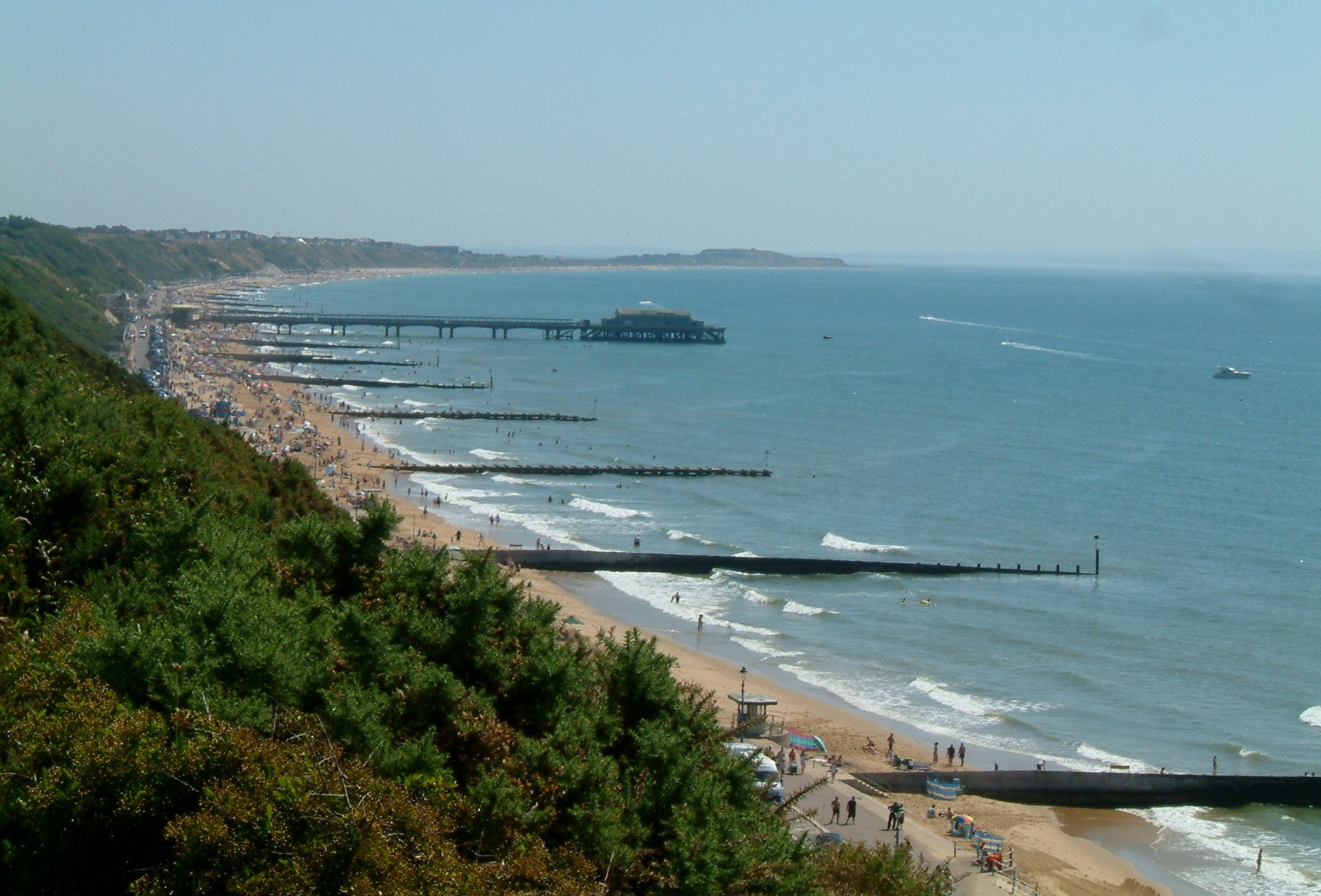
 Bournemouth Beach and Boscombe Pier
Bournemouth is located 105 miles (169 km) southwest of London at 50°43′N 1°53′W / 50.72°N 1.88°WCoordinates: 50°43′N 1°53′W / 50.72°N 1.88°W. The urban geography of Bournemouth is complex: the town adjoins Poole in the west and Christchurch in the east to form the South East Dorset conurbation. The combined population is 383,713, and it is a retail and commercial centre. To the north west of Bournemouth is the small town of Wimborne and to the north east is the settlement of Ferndown. Bournemouth Airport lies to the north east, towards Hurn. The town is intersected by the A338 dual carriageway, known as the "Wessex Way".
Although Bournemouth is on the coast, the centre of the town lies inland - the commercial and civil heart of the town being the Square. From the Square the Upper and Lower Pleasure Gardens descend to the seafront and the pier. Areas within Bournemouth include Bear Cross, Boscombe, Kinson, Pokesdown, Westbourne and Winton. Traditionally a large retirement town, Bournemouth (mostly the Northbourne, Southbourne and Tuckton areas of Bournemouth together with the Wallisdown, and Talbot Village areas of Poole) has seen massive growth in recent years, especially through the growth of students attending Bournemouth University and the large number of language schools teaching English as a foreign language.
Bournemouth is located directly to the east of the Jurassic Coast, a 95-mile (153 km) section of beautiful and largely unspoilt coastline recently designated a World Heritage Site. Apart from the beauty of much of the coastline, the Jurassic Coast provides a complete geological record of the Jurassic period and a rich fossil record.[2] Bournemouth sea front overlooks Poole Bay and the Isle of Wight. Bournemouth also has 7 miles (11 km) of sandy beaches that run from Hengistbury Head in the east to Sandbanks, in Poole, in the west.
Because of the coastal processes that operate in Poole Bay, the area is often used for surfing. An artificial reef (Europe's first) was expected to be installed at Boscombe, in Bournemouth, by October 2008, using large sand-filled geotextile bags. However, this deadline was not met, and the construction was actually finished at the end of October 2009. The Boscombe Reef was constructed as part of the larger Boscombe Spa Village development.[3] Bournemouth also has several chines (e.g. Alum Chine) that lead down to the beaches and form a very attractive feature of the area. The beaches are subdivided by groynes.
Climate
Due to its location on the south coast, Bournemouth has a temperate climate with moderate variation in annual and daily temperatures: from 1971 to 2000 the annual mean temperature was 10.2 to 12 °C (50 to 54 °F).[4] The warmest months are July and August, which have an average temperature range of 12 to 22 °C (54 to 72 °F), while the coolest months are January and February, which have an average temperature range of 1 to 8 °C (34 to 46 °F). Average rainfall in Bournemouth is around 800 mm (31 in) annually, well below the national average of 1,126 millimetres. Since 1960, temperature extremes as measured at Bournemouth Hurn Airport have ranged from 34.1 °C (93.4 °F) in August 1990,[5] down to −13.4 °C (7.9 °F) in January 1963.[6] The lowest temperature to be recorded in recent years was −10.4 °C (13.3 °F) during December 2010.[7]
Climate data for Bournemouth Hurn 10m asl, 1971-2000, Extremes 1960- Month Jan Feb Mar Apr May Jun Jul Aug Sep Oct Nov Dec Year Record high °C (°F) 14.7
(58.5)15.3
(59.5)21.0
(69.8)25.0
(77.0)27.6
(81.7)33.8
(92.8)33.9
(93.0)34.1
(93.4)27.9
(82.2)25.2
(77.4)17.6
(63.7)16.0
(60.8)34.1
(93.4)Average high °C (°F) 8.1
(46.6)8.3
(46.9)10.6
(51.1)13.0
(55.4)16.6
(61.9)19.3
(66.7)22.0
(71.6)21.8
(71.2)18.8
(65.8)15.0
(59.0)11.2
(52.2)9.0
(48.2)14.5 Average low °C (°F) 1.3
(34.3)1.1
(34.0)2.4
(36.3)3.4
(38.1)6.7
(44.1)9.5
(49.1)11.6
(52.9)11.3
(52.3)9.2
(48.6)6.6
(43.9)3.3
(37.9)2.2
(36.0)5.7 Record low °C (°F) −13.4
(7.9)−10.9
(12.4)−10.2
(13.6)−5.7
(21.7)−3.6
(25.5)0.4
(32.7)2.6
(36.7)2.1
(35.8)−1.4
(29.5)−6.4
(20.5)−9.6
(14.7)−10.5
(13.1)−13.4
(7.9)Precipitation mm (inches) 89
(3.5)65
(2.56)65
(2.56)51
(2.01)48
(1.89)56
(2.2)37
(1.46)52
(2.05)72
(2.83)88
(3.46)87
(3.43)103
(4.06)812.7
(31.996)Sunshine hours 62 79 118 176 216 213 228 218 155 117 81 56 1,720 Source no. 1: MeteoFrance[8] Source no. 2: Royal Dutch Meteorological Institute[9] Governance
Historically Bournemouth was part of Hampshire, with Poole just to the west of the border. At the time of the 1974 local government re-organisation, it was considered desirable that the whole of the Poole/Bournemouth urban area should be part of the same county. Bournemouth therefore became part of the non-metropolitan county of Dorset on 1 April 1974. On 1 April 1997, Bournemouth became a unitary authority, independent from Dorset County Council. For the purposes of the Lieutenancy it remains part of the ceremonial county of Dorset.
For local elections the district is divided into 18 wards,[10] and the Bournemouth Borough Council is elected every four years. The Council elects the Mayor and Deputy Mayor annually.[11] For 2009-2010, the Mayor of Bournemouth is Mrs. Beryl Baxter.[12]
History
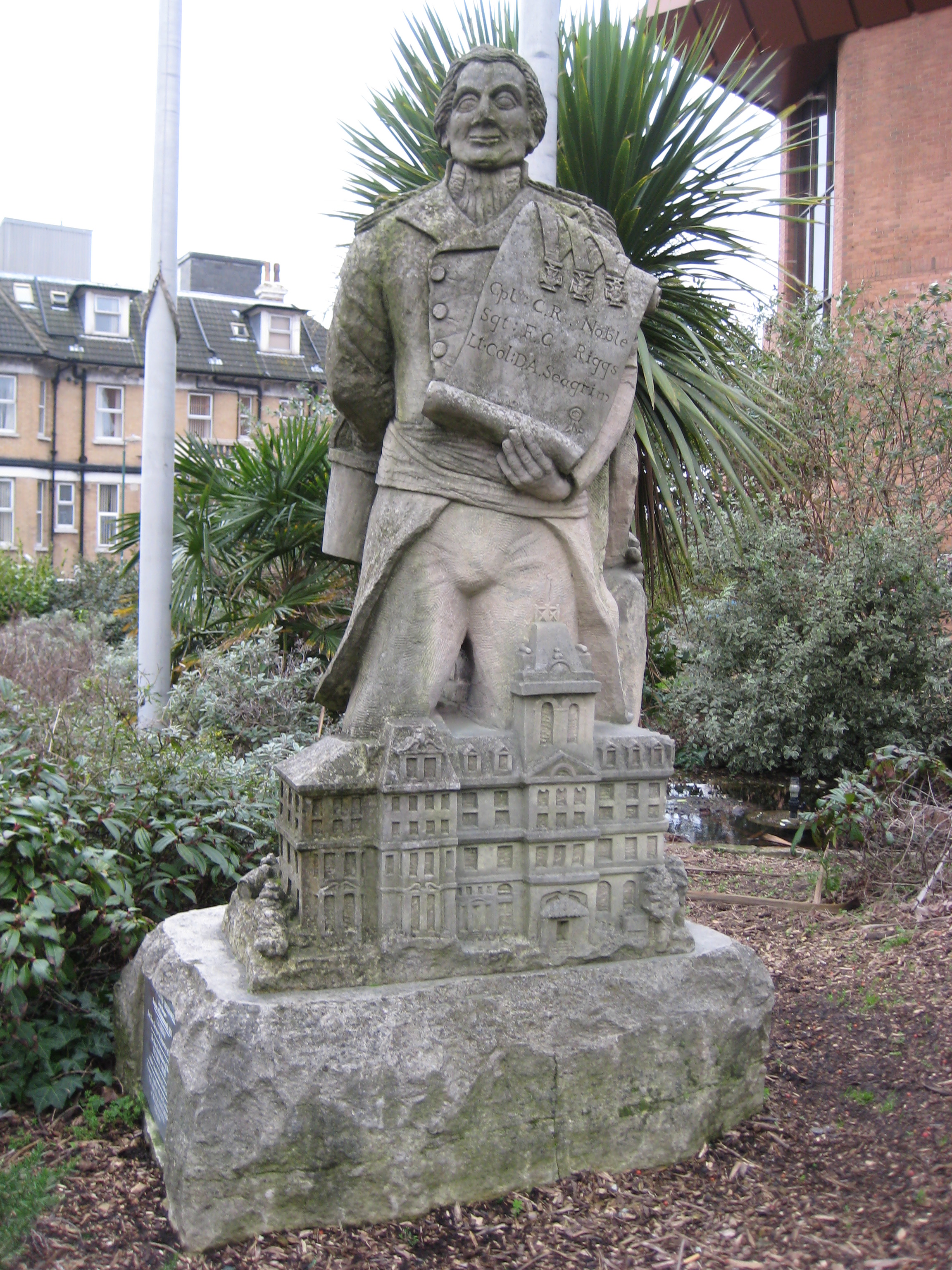
Main article: History of Bournemouth A statue near the seafront, of Lewis Tregonwell, the founder of the original settlement which became Bournemouth.
The Dorset and Hampshire region surrounding Bournemouth has been the site of human settlement for thousands of years. However, in 1800 the Bournemouth area was largely a remote and barren heathland. No one lived at the mouth of the Bourne River and the only regular visitors were a few fishermen, turf cutters and gangs of smugglers until the 16th century. During the Tudor period the area was used as a hunting estate, 'Stourfield Chase', but by the late 18th century only a few small parts of it were maintained, including several fields around the Bourne Stream and a cottage known as Decoy Pond House, which stood near where the Square is today.[13]
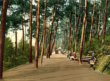 Photochrom of Invalids' walk, 1890s
With the exception of the estate, until 1802 most of the Bournemouth area was common land. The Christchurch Inclosures Act 1802 and the Inclosure Commissioners' Award of 1805 transferred hundreds of acres into private ownership for the first time. In 1809, the Tapps Arms public house appeared on the heath. A few years later, in 1812, the first residents, retired army officer Lewis Tregonwell and his wife, moved into their new home built on land he had purchased from Sir George Ivison Tapps. Tregonwell began developing his land for holiday letting by building a series of sea villas.[13] In association with Tapps, he planted hundreds of pine trees, providing a sheltered walk to the beach (later to become known as the 'Invalids walk'). The town would ultimately grow up around its scattered pines. In 1832 when Tregonwell died, Bournemouth had grown into small community with a scattering of houses, villas and cottages.[13]
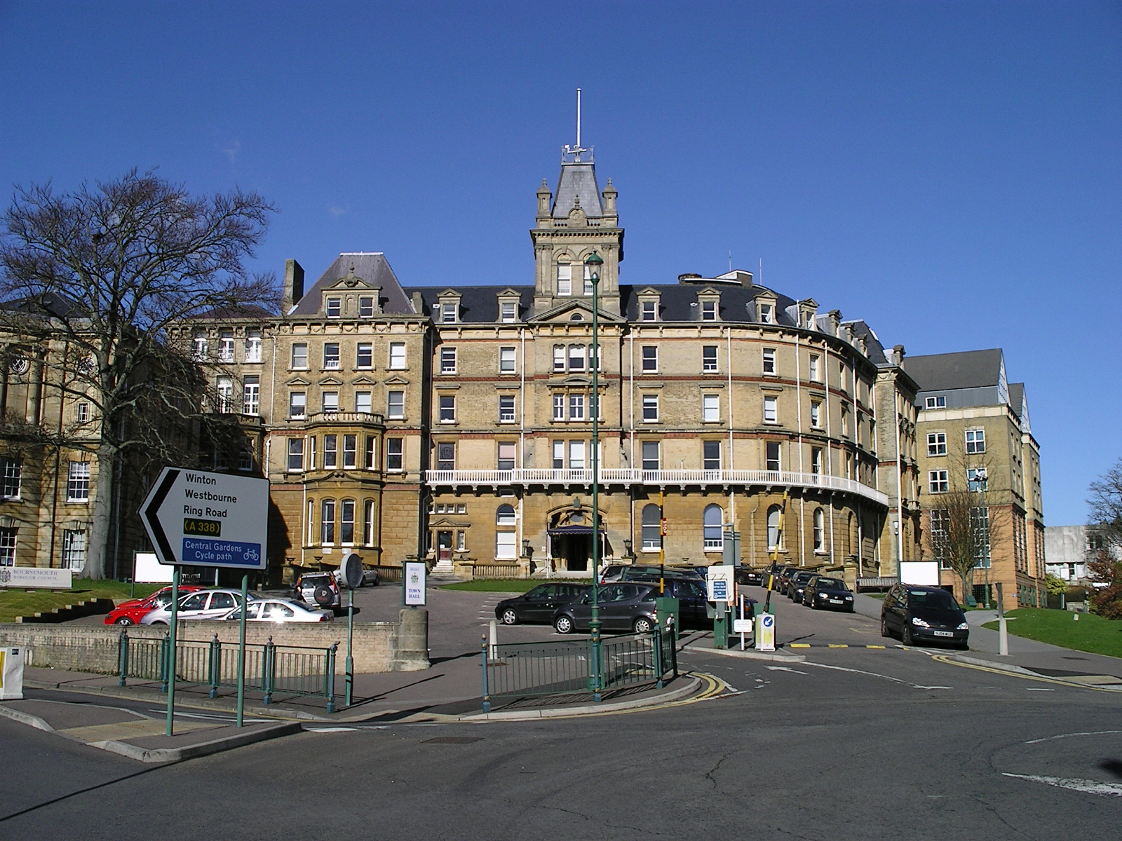
 Bournemouth Town Hall was built in the Victorian period, originally serving as a hotel for visitors to the town.
In 1835, after the death of Sir George Ivison Tapps, his son Sir George William Tapps-Gervis inherited his father's estate. Bournemouth started to grow at a faster rate as George William started developing the seaside village into a resort similar to those that had already grown up along the south coast such as Weymouth and Brighton.[13] In 1841, the town was visited by the physician and writer Augustus Granville. Granville was the author of The Spas of England, which described health resorts around the country. As a result of his visit, Dr Granville included a chapter on Bournemouth in the second edition of his book. The publication of the book, as well as the growth of visitors to the seaside seeking the medicinal use of the seawater and the fresh air of the pines, helped the town to grow and establish itself as an early tourist destination.[13]
 The Bournemouth Pleasure Gardens, laid out in the 1840s and 1860s. The Victorian Folly was added later.
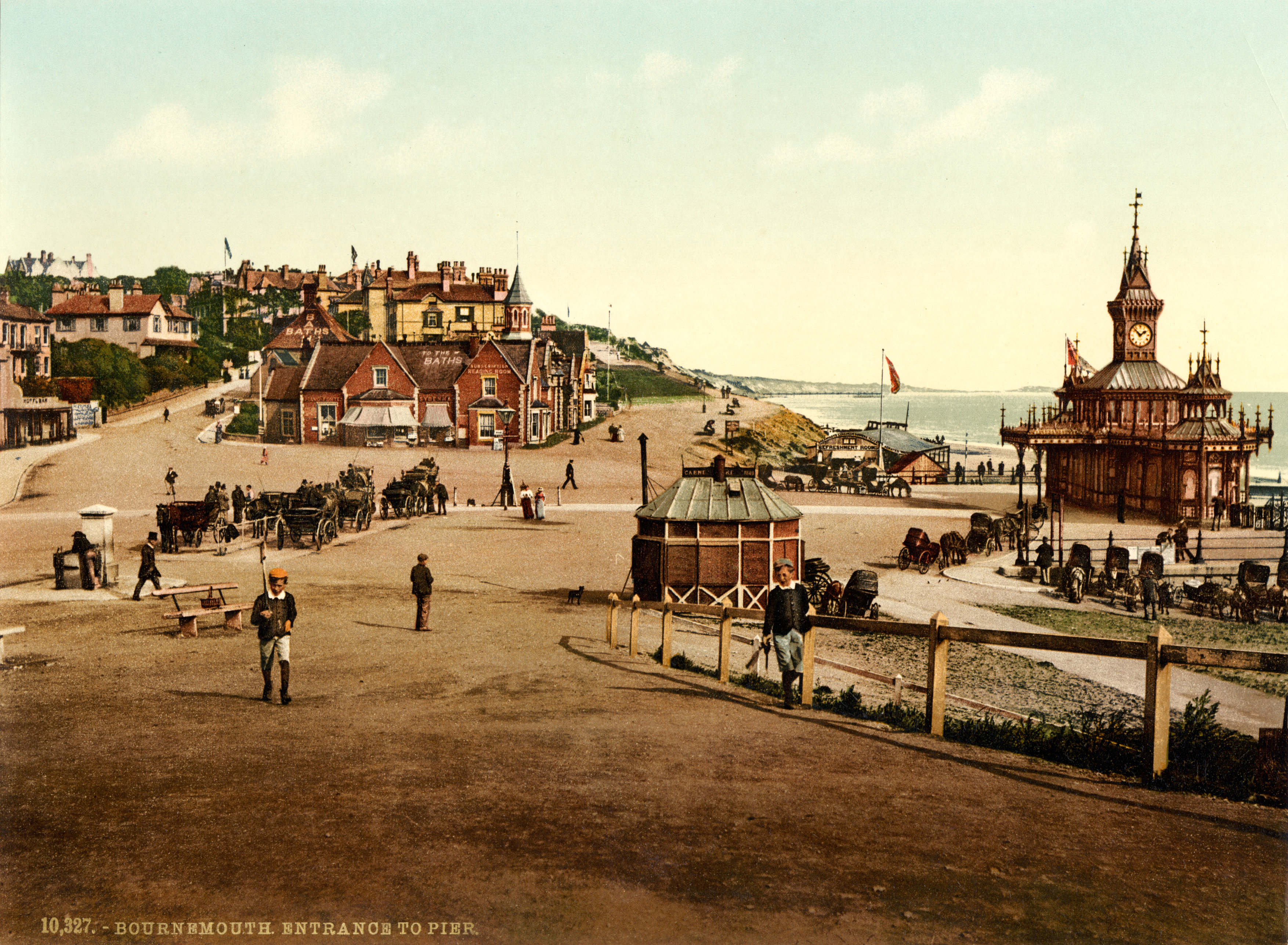
 Photochrom of the entrance to the pier, 1890s
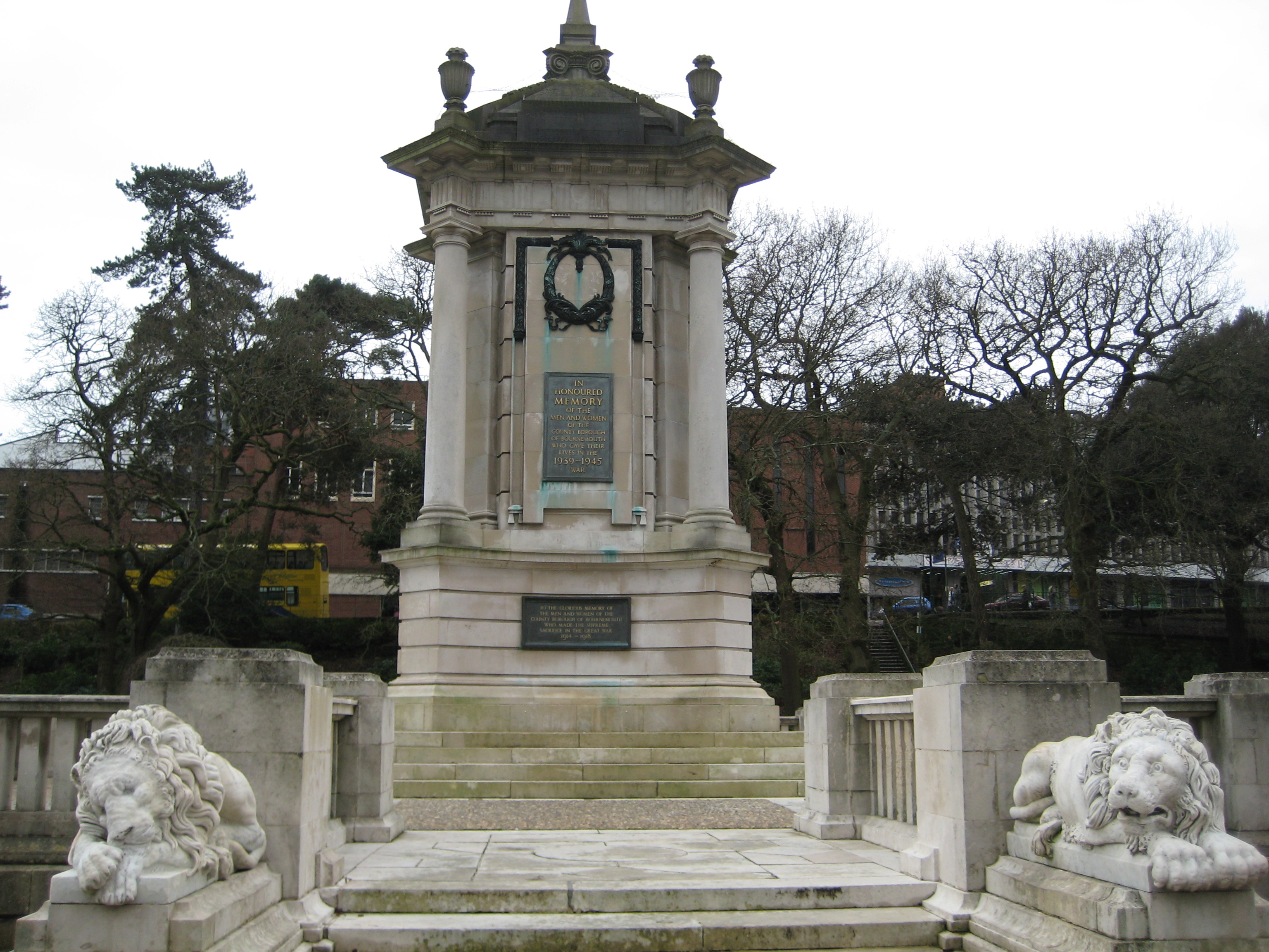
 The Bournemouth War Memorial, built in 1921, located in the Bourne Gardens.
In the 1840s the fields south of the road crossing (later Bournemouth Square) were drained and laid out with shrubberies and walks. Many of these paths including the 'Invalids walk' remain in the town today; forming part of the Pleasure Gardens which extend for several miles along the Bourne stream. The Pleasure Gardens were originally a series of garden walks created in the fields of the owners of the Branksome Estate in the 1860s. In the early 1870s all the fields were leased to the Bournemouth Commissioners by the freeholders.[13] Parliament approved the Bournemouth Improvement Act in 1856. Under the Act, a board of 13 Commissioners was established to build and organise the expanding infrastructure of the town, such as paving, sewers, drainage, street lighting and street cleaning.
During the late 19th century the town continued to develop. The Winter Gardens were finished in 1875 and the cast iron Bournemouth Pier was finished in 1880. The arrival of the railways allowed a massive growth of seaside and summer visits to the town, especially by visitors from the Midlands and London. In 1880 the town had a population of 17,000 people but by 1900, when railway connections were at their most developed to Bournemouth, the town's population had risen to 60,000.[13] It was also during this period that the town became a favourite location for visiting artists and writers. The town was improved greatly during this period through the efforts of Sir Merton Russell-Cotes, the town's mayor and a local philanthropist. He helped establish the town's first library and museum. The Russell-Cotes Art Gallery & Museum was housed in his mansion and after his death it was given to the town.
As Bournemouth's growth increased in the early 20th century, the town centre spawned theatres, cafés, two art deco cinemas and more hotels. Other new buildings included the war memorial in 1921 and the Bournemouth Pavilion, the town's concert hall and grand theatre, finished in 1925. The town escaped great damage during the Second World War but saw a period of decline as a seaside resort in the postwar era.
The Royal National Lifeboat Institution stationed an inshore lifeboat at Bournemouth in 1965 but it was withdrawn in 1972. Coverage for the area has otherwise been provided from Poole Lifeboat Station[14]
In 1985, Bournemouth became the first town in the United Kingdom to introduce and use CCTV cameras for public street-based surveillance.[15][16]
Literature references
Bournemouth appears as Sandbourne in Thomas Hardy's novels. Tess lived in Sandbourne with Alec d'Urberville, and the town also features in The Well-Beloved and Jude the Obscure. It is also mentioned in So Long, and Thanks for all the Fish, the fourth book of the Hitch-Hiker's Guide to the Galaxy trilogy. In James Herbert's horror novel The Fog, the entire population of Bournemouth runs into the sea and drowns in a mass suicide. In Andy McDermott's thriller The Secret of Excalibur, a car chase through the town centre and beach front leads to the destruction of the IMAX Cinema. It is also mentioned in Roald Dahl's The Witches as the setting for the Hotel Magnificent.
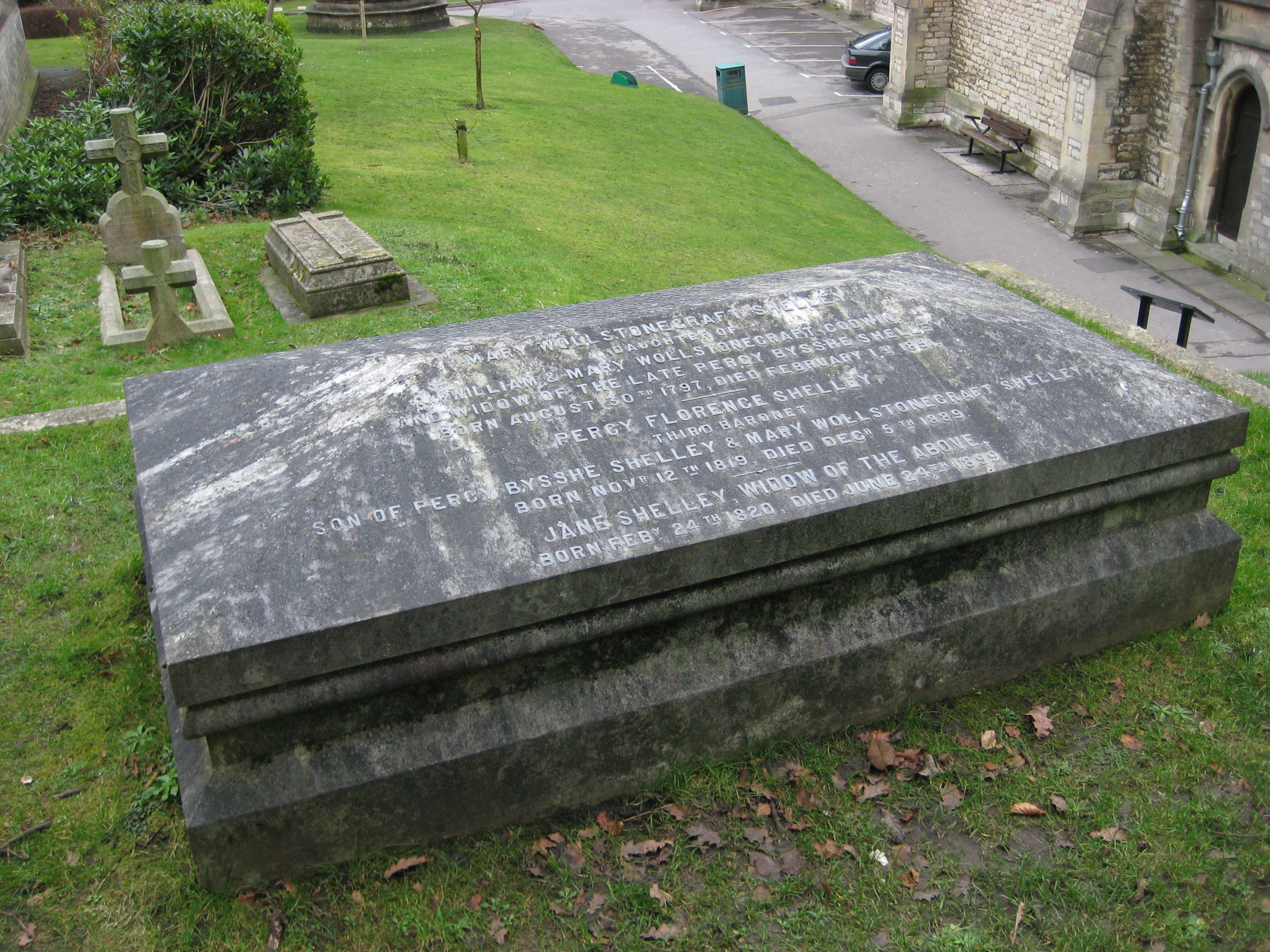
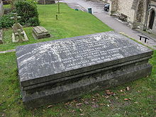 The grave of writer Mary Shelley and her parents including Mary Wollstonecraft in St. Peter's Church, Bournemouth.
J. R. R. Tolkien, the writer, spent 30 years taking holidays in Bournemouth, staying in the same room at the Hotel Miramar, with a second room to write in. He eventually retired to the area in the 1960s with his wife Edith.[17] Tolkien died in September 1973 at his home in Bournemouth and was buried in Oxfordshire.[18]
Mary Shelley, the writer and novelist is buried in St. Peter's Church, her son Sir Percy having settled at Boscombe Manor. Also buried at St Peter's is the heart of Mary's husband, Percy Bysshe Shelley, brought back from Italy, and her parents William Godwin and Mary Wollstonecraft, their remains having been moved there from St Pancras Old Church.[19]
The town was especially rich in literary associations during the late 19th century and earlier years of the 20th century. Oscar Wilde and Paul Verlaine both taught at Bournemouth preparatory schools. Robert Louis Stevenson wrote The Strange Case of Dr. Jekyll and Mr. Hyde and most of his novel Kidnapped from his house "Skerryvore" on the west cliff. Count Vladimir Chertkov established a Tolstoyan publishing house with other Russian exiles in Iford Waterworks at Southbourne, and under the 'Free Age Press' imprint, published the first edition of several works by Tolstoy, however the author himself never visited the town.
In Peter Weir's highly acclaimed 1975 film adaptation of Joan Lindsay's enigmatic 1968 novel, Picnic at Hanging Rock, bygone holidays at Bournemouth are wistfully recalled by Mrs. Appleyard (played by Rachel Roberts), headmistress of Mrs. Appleyard's College for Girls, in Australia.
Culture and recreation
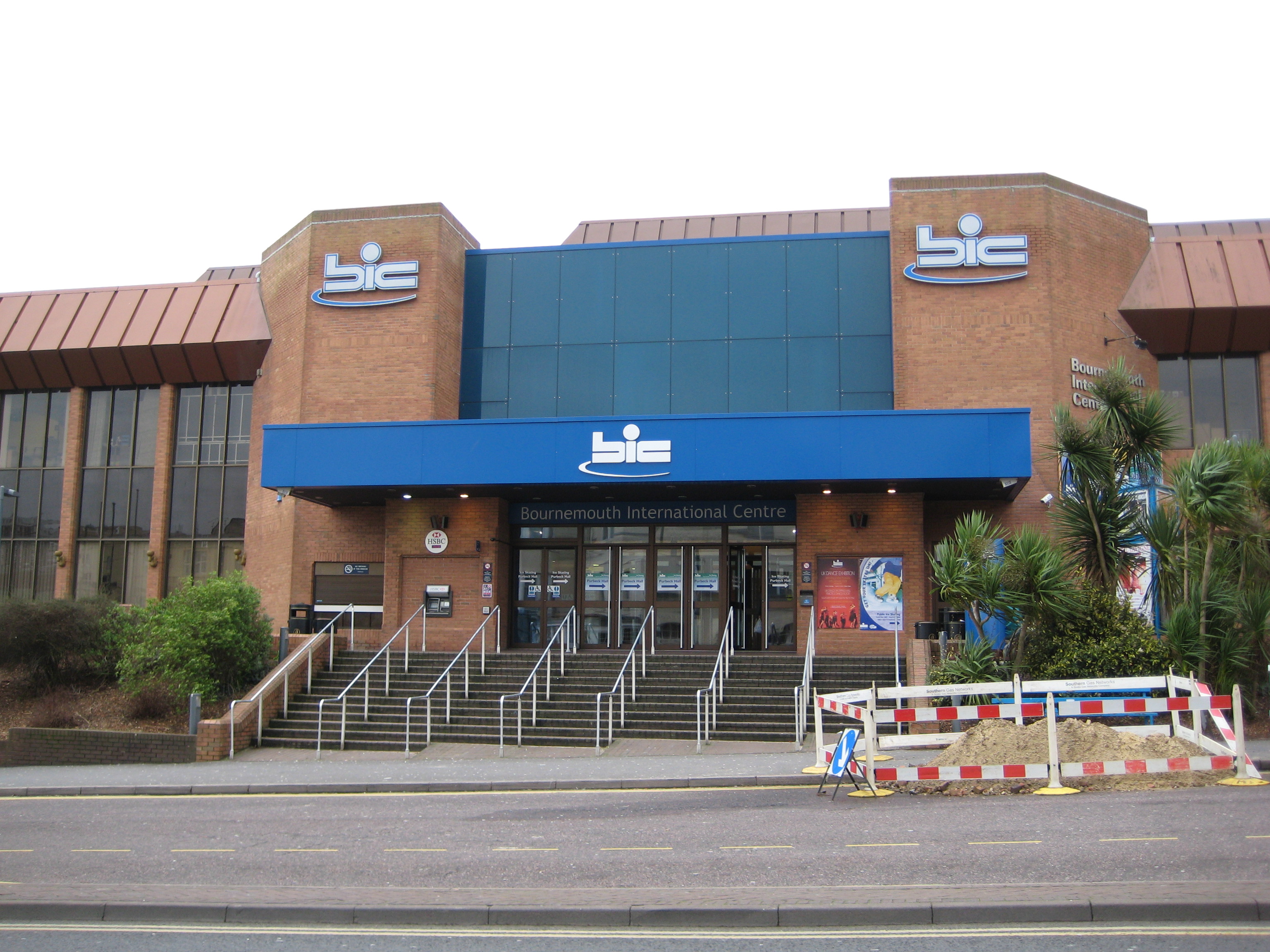
 The Bournemouth International Centre (BIC) is a national conference and music venue in the town.
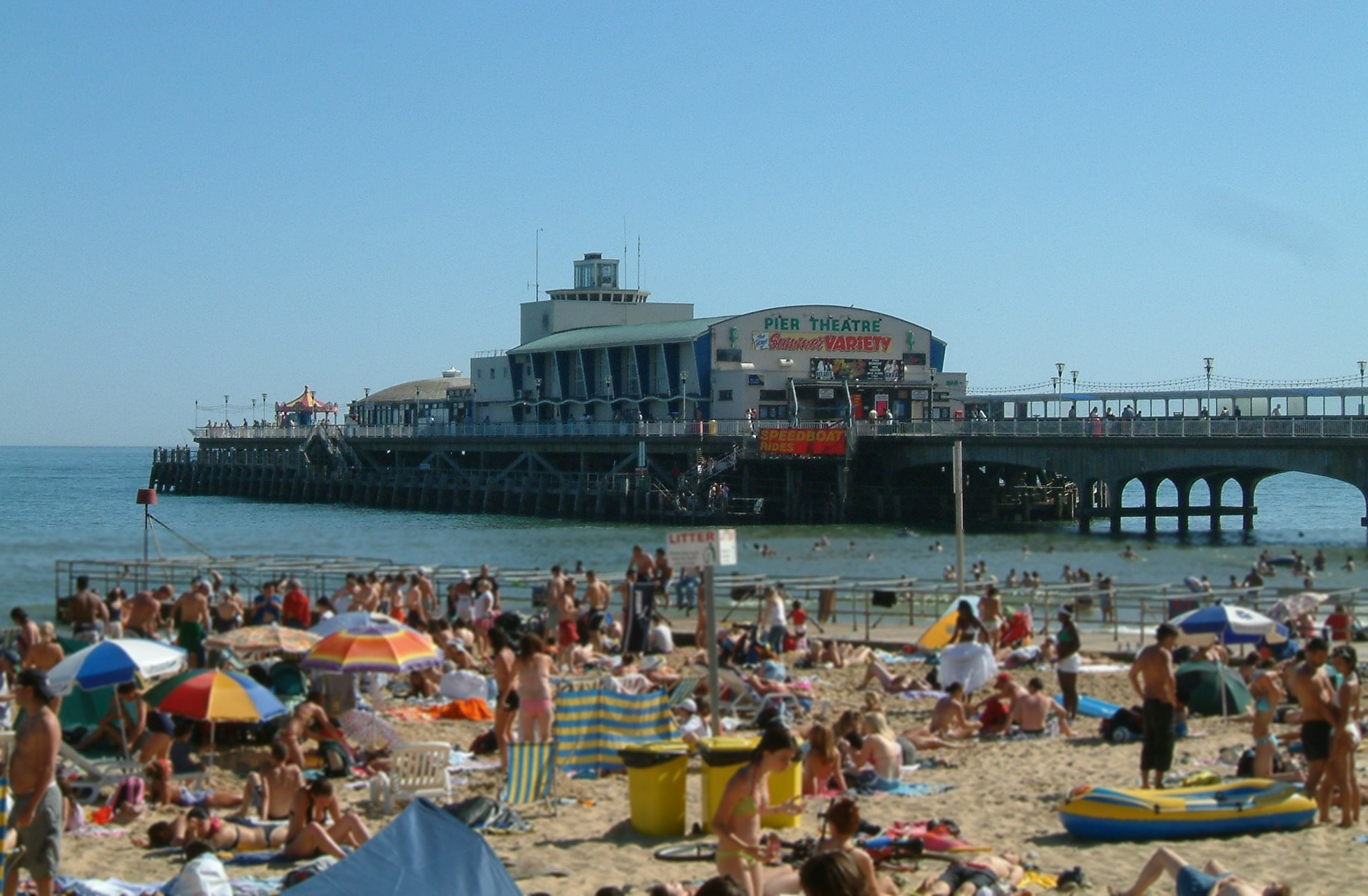
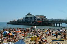 Bournemouth Pier including the Pier Theatre
Bournemouth is a tourist and regional centre for leisure, entertainment, culture and recreation. The award-winning Central Gardens are a separate major public park, leading for several miles down the valley of the River Bourne through the centre of the town to the sea (reaching the sea at Bournemouth Pier) and include the Pleasure Gardens and the area surrounding the Pavilion and the now closed IMAX Cinema. It has a thriving youth culture, including a large university population and many language school students. With the advent of the Boscombe Overstrand, the seeds of a dynamic new business culture revolving around new media and surfing have begun to emerge. Bournemouth also has a well-established gay scene comprising a cluster of bars, restaurants, the Bondi (the South's only exclusively GLBT Hotel) and nightclubs all centred around the Triangle in the centre of the town. Bournemouth is known for its popularity with pensioners and it has many residential care homes.
In recent years, Bournemouth has become a popular nightlife destination with UK tourists. Many clubs, bars and restaurants are located within the town centre. Bliss, Chilli White, Lava & Ignite and Mary Shelley operate on St. Peter's Road. In addition, 'V', the converted St. Andrew's Church, since April 2009 has become very popular within the town's night time entertainment.
The Bournemouth International Centre (BIC), is a popular venue for the conferences of the major political parties. The centre hosted the Labour Party conference in 2003 and 2007, the Conservative Party conference in 2006, and the Liberal Democrat conference in 2008 and 2009[20] The BIC also hosts theatrical productions and musical concerts.[21]
The Russell-Cotes Museum is located just to the east of the Central Gardens near the Pavilion Theatre and next to the Royal Bath Hotel. The museum includes many 19th century paintings and the family collections acquired when travelling especially in Japan and Russia. It was Russell Cotes who successfully campaigned to have a promenade built; it runs continuously along the Bournemouth and Poole shoreline.
The cover of the Beatles' second album "With The Beatles" was photographed in Bournemouth. It was taken at the Palace Court Hotel by Robert Freeman during the group's week-long summer season in August 1963 at the Gaumont Cinema on Westover Road.
The cover sleeve for "All Around the World" by Oasis was shot at Bournemouth, it features four of the bandmates standing on the beach and looking up towards to the sky, while the words "All Around The World" are written in the sand.
Religion and beliefs
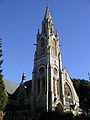
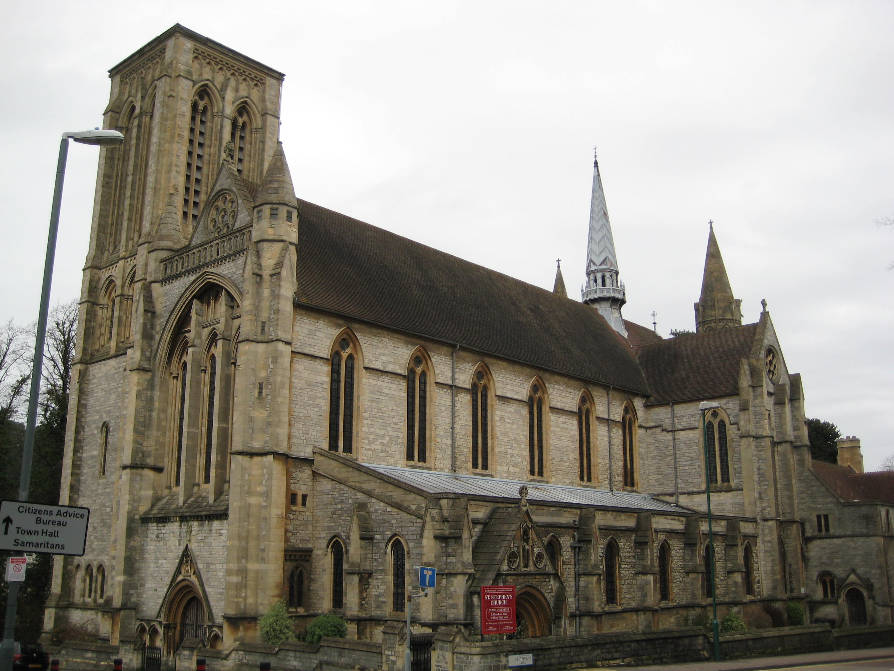
Bournemouth contains places of worships for many denominations. The town has several examples of Victorian church architecture. These include St Stephen's Church, which was built for services under the influence of the Oxford Movement and was finished in 1898.[22] St Stephen's Church was the place of the marriage between Ebba Munck af Fulkila and Prince Oscar of Sweden in 1888. Also included is the Richmond Hill St Andrew's Church, part of the United Reformed Church. The church was built in 1865 and enlarged in 1891.[23] Another ex-church, St. Andrew's on Exeter Road, has now become a popular entertainments venue known as 'V' in the town centre.
The town is also home to a large Jewish community with three synagogues. Chabad-Lubavitch of Bournemouth is a branch of the worldwide movement. The Bournemouth Reform Synagogue, formerly known as Bournemouth New Synagogue, is a Reform Jewish synagogue with over 700 members.[24][25] There is also the architecturally notable Bournemouth Hebrew Congregation.
The Islamic community in the town is served by Bournemouth Islamic Centre in St Stephen's Road, also a mosque and the Winton Mosque.
Humanists and atheists in Bournemouth are supported by the Dorset Humanists, affiliated to the British Humanist Association, who meet at the Moordown Community Centre.
-
St Andrew's Richmond Hill Church, built in 1865.
-

Bournemouth St Stephen's Church, built in 1898.
-

The Bournemouth Hebrew Congregation.
Sport
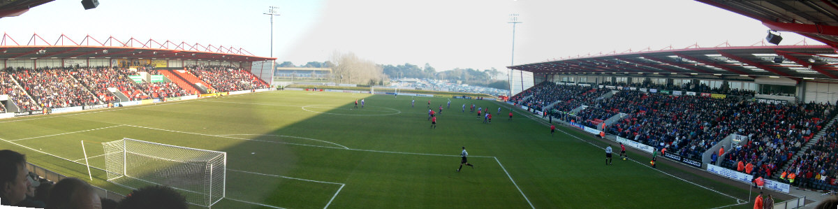
 AFC Bournemouth's Dean Court
The town has a professional football club, AFC Bournemouth, who play in League One, and Bournemouth F.C. who play in the Wessex League Premier Division. AFC Bournemouth play at the Dean Court near Boscombe in Kings' Park, 2 miles (3 km) east of the town centre. The Westover and Bournemouth Rowing Club is the town's coastal rowing club situated on the West Beach next to the Oceanarium. The oldest sporting club in Bournemouth, it competes in regattas organised by the Hants and Dorset Amateur Rowing Association that take place on the South Coast of England between May and September.[26] Bournemouth Rugby Club, who compete in the South West Division One, has its home at the Bournemouth Sports Club located next to Bournemouth Airport.[27] Hampshire County Cricket Club regularly played first-class cricket at Bournemouth's Dean Park until 1992. This became the home ground of Dorset County Cricket Club, a minor county. Bournemouth Cricket Club, also situated next to the airport, is one of Dorset's largest cricket clubs. Their first team play in the Southern Premier League.[28]
Recently, the Bournemouth International Centre has become a venue for a round of the Premier League Darts Championship organised by the Professional Darts Corporation. It was rated as one of the favourites to become the new host for the PDC World Championships as the last site, Circus Tavern, could not hold the growing numbers of fans.[citation needed]
Bournemouth also has a thriving watersports community with its beaches having great conditions for windsurfing and kitesurfing. On a windy day you can see many kitesurfers and windsurfers out enjoying the waves all the way along the beach from Hengistbury Head to Sandbanks, and there are quite a few local schools for the beginner to learn either sport. There is a local kiteboarding club, Bournemouth Boarding, which is recognised by the BKSA.[29]
Shopping
The main shopping streets in the centre of town are just behind the seafront on either side of the River Bourne (also known as the Bourne Stream); footpaths lead down to the sea from the Square through the lower section of Bournemouth Central Gardens.
The shopping streets are mostly pedestrianised and lined with a wide range of boutiques, stores, jewellers and accessory shops. There are modern shopping malls, Victorian arcades (including the Victorian Arcade between Westover Road and Old Christchurch Road), and a large selection of bars, clubs and cafés. About a mile to the west of the town centre, in the district of Westbourne, there is a selection of designer clothing and interior design shops. About a mile to the east, in the district of Boscombe, there is another major shopping area including many antiques shops and a street market. North of the centre there is an out-of-town shopping complex called Castlepoint Shopping Centre with supermarkets, DIY stores and larger versions of high street shops. A new extension to Castlepoint, called Castlemore, is set just south west of the main complex, which features more large retail stores. Other supermarkets are located in the town centre (Asda and Co-op), Boscombe (Sainsbury's) and between Westbourne and Upper Parkstone. A large Tesco Extra store is located at the end of Castle Lane East, two miles east of Castlepoint.
Festivals
The town was a major centre for the 1951 Festival of Britain with classical concerts, opera, ballet and a visit from the Salzburg Marionettes; the two weeks in June also featured a national brass band competition, sea cadet displays and different sporting events.[30]
Bournemouth is currently host to several annual festivals. The town has had an annual literary festival since 2005. A Gay Pride festival named Bourne Free is held in the town each year during the summer.
Since 2008 Bournemouth has held its own air festival over four days in August. This has featured displays from the Red Arrows as well as appearances from the Yakovlevs, Blades, Team Guinot Wing-Walkers, Battle of Britain Memorial Flight including Lancaster, Hurricane, Spitfire and also the last flying Vulcan. The festival has also seen appearances from modern aircraft such as the Eurofighter Typhoon. The air festival attracts nearly one million people over the four-day event.[31]
Education
Main article: List of schools in BournemouthThe Bournemouth local education authority was first set up in 1903 and remained in existence until local government was reorganised in 1974 when Bournemouth lost its County Borough status and became part of the county of Dorset. Under the later reforms of 1997, Bournemouth became a unitary authority and the Bournemouth local education authority was re-established. Bournemouth is one of the minority of local authorities in England still to maintain selective education, with two grammar schools (one for boys, one for girls) and eight secondary modern/comprehensive schools. There are also a small number of independent schools in the town, and a further education college.
Bournemouth University is one of the largest universities in the South of England. Known as Bournemouth Polytechnic between 1990 and 1992, it has its roots in the former Dorset Institute of Higher Education. It is one of the better-performing ex-polytechnics in England. The main campus is however in neighbouring Poole. The Arts University College at Bournemouth, also officially in Poole, specialises in arts, design, media and performance degree courses. Bournemouth is also a major centre for the teaching of English and has numerous English language schools. Many thousands of foreign students are attracted to the town every year, an important form of invisible trade. AECC Chiropractic College is also located in the Bournemouth area, which is the only chiropractic college in England. It is located in Boscombe, three miles from the town centre.
Economy
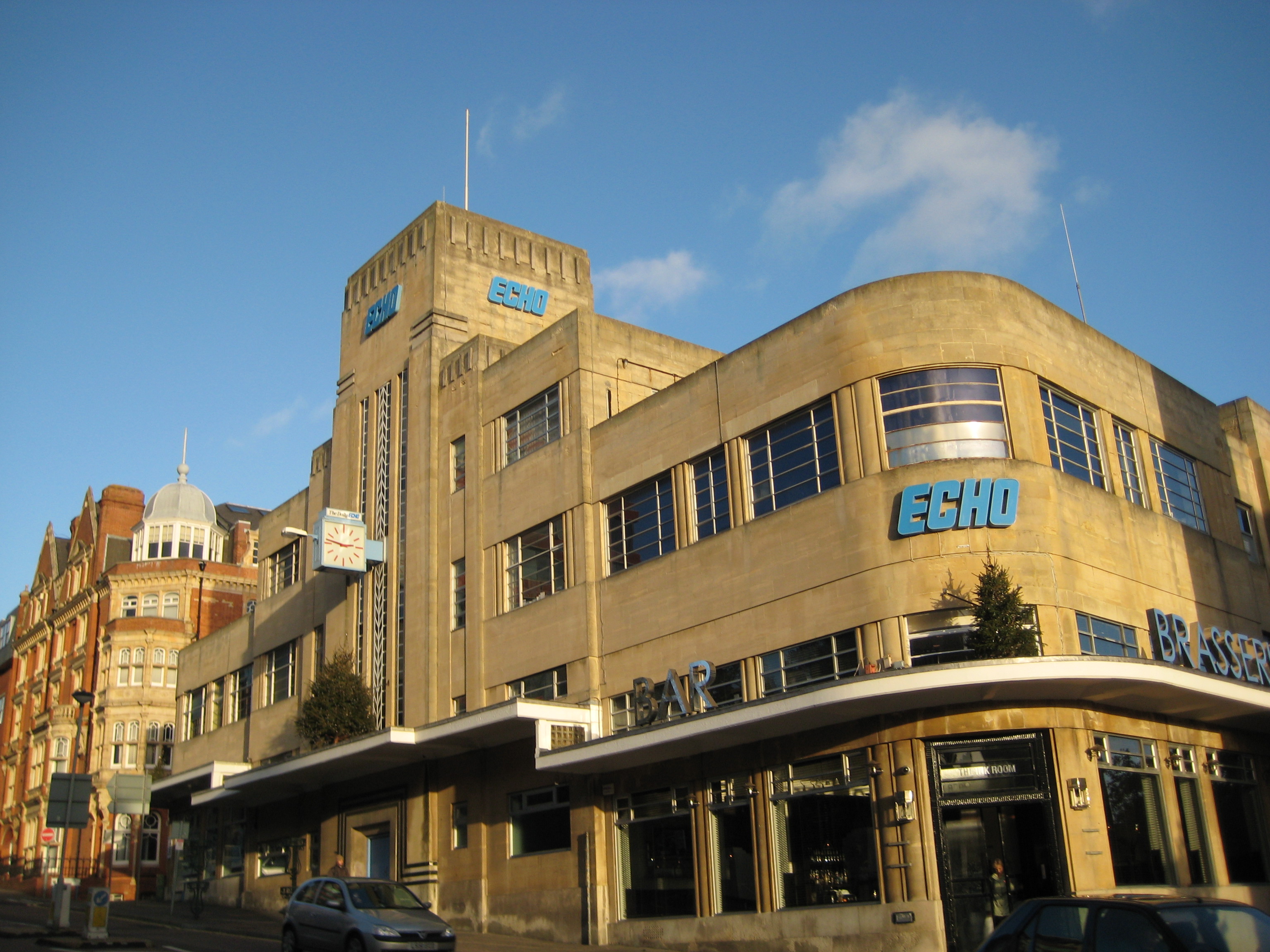
 The Offices of the Bournemouth Daily Echo newspaper, which serves the South East Dorset conurbation.
Similarly to the rest of Dorset, Bournemouth's economy is primarily in the service sector, which employed 93% of the workforce in 2007.[32] This is 10% higher than the average employment in the service sector for Great Britain and the South West.[32] The importance of the manufacturing sector has declined, and is predominantly based in neighbouring Poole, but still employs 3% of the workforce.[32] Tourism is crucial to the economy of Bournemouth, generating £440 million a year and employing thousands of workers.[33] Business tourism alone contributed £127 million in 2007, through delegates and business visitors attending venues such as the BIC and exhibitions in the town.[34][35]
The following is a non-exhaustive list:
- Palmair - Its head office is in the Space House in Bournemouth[36]
- JPMorgan Chase - Employs around 10,000 people
- Portman Building Society - now part of Nationwide Building Society
- Unisys group, the office for UISL
- Parvalux - the UK's largest fractional horsepower motor manufacturer has its headquarters in Wallisdown
- Fitness First was started in Bournemouth and its headquarters are in the neighbouring town of Poole
- McCarthy & Stone
- Liverpool Victoria formerly Frizzell Insurance
- RIAS Insurance company has its headquarters in Bournemouth
- Bournemouth Borough Council is one of the largest employers in the area.
- PruHealth has a large office in Bournemouth
- Lloyds TSB Insurance has its call centre in Bournemouth, formerly Abbey Life
- Imagine Publishing a modern consumer specialist magazine company is based on Richmond Hill
In April 2008, Bournemouth was announced to be the first 'Fibrecity' in the United Kingdom, with work starting in September to bring 100 Mbit Broadband internet access into homes and businesses within the town; running fibre optic cables through the sewers reduces the cost and disruption to road networks during cable laying.[37] This is part of the National Government's plans for everyone in the UK to have access to 100 Mbit Broadband by 2010.[citation needed] A trial to the proposed 100 Mbit is scheduled to begin at the end of March 2009, where 30 homes will be connected for free. As the trial continues, all businesses and homes within BH10 and BH11 are entitled to sign up for free. As of February 2010, Fibrecity is connecting 4,000 homes and businesses a month in Bournemouth to the network and it is hoped that the town will be fully connected by the end of 2010.
Transport
Road
Bournemouth's road network is focused on a few main roads in and out of the town centre.[38] The principal route into the town centre is the A338 dual carriageway, which joins the A31, itself the major trunk road in central Southern England, connecting to the M27 at Southampton. From here the M3 leads to London, and fast access may also be gained via the A34 to the M4 north of Newbury, Berkshire. National Express coaches serve Bournemouth Travel Interchange & Bournemouth University. There are frequent departures to London Victoria Coach Station. There are also direct services to the West Country, Sussex coast (Brighton and Eastbourne), Bristol, Birmingham and the Midlands, the North West, and to Edinburgh and Glasgow. Flightlink serves Heathrow Airport with connections to Gatwick and Stansted Airports.
Local buses are provided mainly by two companies, Wilts & Dorset, the former National Bus Company subsidiary and now owned by the Go-Ahead group, and Yellow Buses, the former Bournemouth Council-owned company and successors to Bournemouth Corporation Transport, which began operating trams in 1902. In 1969 the town became one of the last in England to discontinue its trolleybus system and replace the trolleybuses with diesel buses.[39] Other operators serving the town include Shamrock Buses, Damory Coaches (a subsidiary of Wilts & Dorset), Shaftesbury & District, Thompson's Travel and Verwood Buses.
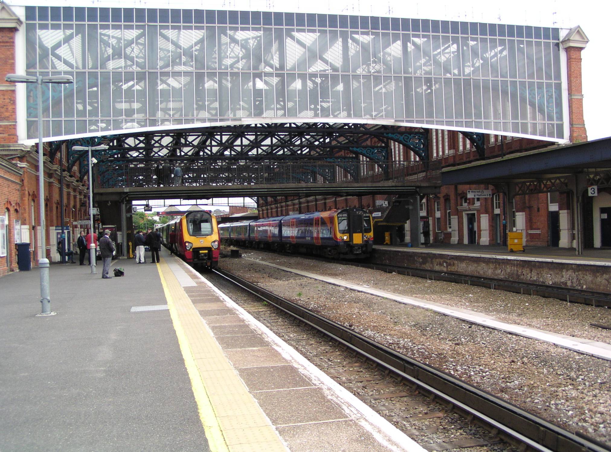
Rail

Bournemouth is well served by the rail network with two stations in the town, Bournemouth railway station and Pokesdown railway station to the east. Parts of western Bournemouth can also be reached from Branksome station. Bournemouth railway station is located some way from the town centre, due to the town's early leaders not wishing to have a railway station within the town boundary, which extended 1-mile (1.6 km) from the pier. However, the station is now well within the town, as the town has grown significantly since its founding. The station was originally called Bournemouth East with a second station, Bournemouth West serving the west of the town in Queen's Road. South West Trains operates a comprehensive service to London Waterloo with a journey time of 1 hour 50 minutes. This line also serves Southampton, Winchester and Basingstoke to the east, and Poole, Wareham, Dorchester and Weymouth to the west. CrossCountry trains serve destinations to the north with direct trains to Reading, Oxford, Birmingham, Wolverhampton and Manchester. The North West, Yorkshire, Newcastle, Edinburgh and Glasgow can be reached by changing at Reading or Birmingham. West Coastway Line services are available by changing at Southampton Central. The Sussex coastal towns of Chichester, Worthing, Hove and Brighton are served and trains continue to Gatwick Airport and London Victoria.
Besides its main line railway connections, Bournemouth is also the site of three funicular railways, the East Cliff Railway, West Cliff Railway and Fisherman's Walk Cliff Railway. These are all owned and operated by Bournemouth Borough Council, and each serves to link the seaside promenade with the cliff top, at various points along the seafront.[40]
Air
Bournemouth Airport, in Hurn on the periphery of Bournemouth is a short journey from the town centre enabling passengers and freight to be flown directly to destinations in the UK and Europe. Taxis going to Bournemouth are available at the taxi stand on the airport and can transport one to the town centre in about 20–30 minutes. An hourly bus service also connects the airport with the town centre, travel interchange and also operates along the major hotel routes. Ryanair, EasyJet, Palmair and Thomson Airways provide scheduled services to destinations throughout Europe.
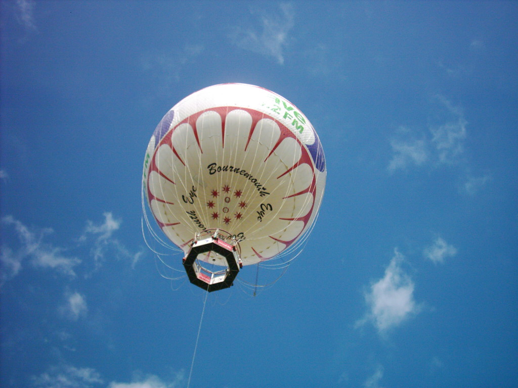
Bournemouth Eye
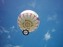 The Bournemouth Eye as seen from the ground.
The Bournemouth Eye is a local landmark, a helium-filled balloon attached to a steel cable in Bournemouth. It is a spherical helium-filled balloon with an enclosed gondola that carries up to 30 passengers. Tethered by a high tensile steel cable, the passenger gondola rises to a height of 390 ft (120 m), the maximum height allowed by the Civil Aviation Authority. This provides a panoramic view of the surrounding area.[41]
Wildlife
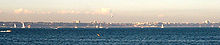 Bournemouth seen from Studland
The Bournemouth area has long been a place where many unusual species of animals and plants can be found. Brownsea Island, in nearby Poole Harbour, is one of the few places in the south where the red squirrel still remains, and the ant Formica pratensis had its last stronghold in the area, although it is now thought to be extinct on the mainland. Although described by Farren White as "the common wood ant of Bournemouth" in the mid-19th century, the noted entomologist Horace Donisthorpe found only one colony of true pratensis out of hundreds of F. rufa nests there in 1906. In recent times the last known two colonies disappeared in the 1980s, making this ant the only ant species thought to have become extinct in Great Britain. It does, however, still survive on cliff-top locations in the Channel Islands. The rare narrow-headed ant also used to exist in Bournemouth, although it has died out in the area.
Naming conventions
The word 'Bournemouth' is often used loosely to describe the South East Dorset conurbation, which also contains neighbouring towns Poole, Christchurch, Wimborne Minster, Verwood, Ringwood and New Milton. As a result, "Bournemouth" is used in the following terms:
- Although it has a significant presence in Bournemouth town centre, Bournemouth University's main campus is located in Poole, on the boundary with Bournemouth
- Bournemouth Airport is located near Hurn in the borough of Christchurch, and was originally named RAF Hurn
- "Bournemouth Bay" is sometimes used for Poole Bay[42]
- The Bournemouth Symphony Orchestra is now based in Poole
Twin towns
See also
- List of Dorset beaches
- List of schools in Bournemouth
- UK coastline
Notes and references
- ^ "Bournemouth happiest town in UK". BBC News. 2007-03-08. http://news.bbc.co.uk/1/hi/england/dorset/6431649.stm. Retrieved 2007-09-06.
- ^ West, Ian (August 2007). "The Eocene Cliffs, with Leaf Bed, of Bournemouth, Dorset.". School of Ocean and Earth Science, Southampton University. http://www.soton.ac.uk/~imw/bourne.htm. Retrieved 2007-09-06.
- ^ "Boscombe Spa Village Surfing". Bournemouth Borough Council. http://www.bournemouth.gov.uk/spa/surfing/. Retrieved 2007-09-06.
- ^ "Mean Temperature Annual Average". Met Office. 2001. http://www.metoffice.gov.uk/climate/uk/averages/19712000/tmean/17.gif. Retrieved 2009-02-10.
- ^ "1990 temperature". KNMI. http://eca.knmi.nl/utils/monitordetail.php?seasonid=14&year=1990&indexid=TXx&stationid=1867.
- ^ "1963 temperature". KNMI. http://eca.knmi.nl/utils/monitordetail.php?seasonid=7&year=1963&indexid=TNn&stationid=2133.
- ^ "2010 temperature". UKMO. http://metofficenews.wordpress.com/2010/12/26/heavy-snow-before-less-cold-air-arrives/.
- ^ "Bournemouth 1971-2000 climate". MeteoFrance. http://monde.meteofrance.com/monde/climat?68991.path=climatstation%252F03862. Retrieved 09 Nov 2011.
- ^ "Bournemouth 1960- temperature extremes". KNMI. http://eca.knmi.nl/utils/mapserver/anomaly.php?indexcat=**&indexid=TNn&year=1993&seasonid=18&minx=-1111428.5714287&miny=-4687142.8571429&maxx=621904.76190476&maxy=-3387142.8571428&MapSize=560%2C420&imagewidth=560&imageheight=420&CMD=QUERY_POINT&CMD=QUERY_POINT#bottom. Retrieved 09 Nov 2011.
- ^ Local Election Map
- ^ Bournemouth Borough Council Constitution (part)
- ^ Bournemouth Borough Council
- ^ a b c d e f g Elizabeth Edwards, A History of Bournemouth, Phillimore & Co, 1981.
- ^ Denton, Tony (2009). Handbook 2009. Shrewsbury: Lifeboat Enthusiasts Society. p. 59.
- ^ CCTV This is Dorset, accessdate = 2008-02-01
- ^ History of CCTV, accessdate = 2008-02-01
- ^ "J. R. R. Tolkien, Biography. Author and Illustrator Archive.". New York Times. http://www.theweeweb.co.uk/public/author_profile.php?id=96. Retrieved 2008-04-06.
- ^ "J. R. R. Tolkien Dead at 81. Wrote 'Lord of the Rings'. Creator of Escapist Literature. Served in World War I. Took 14 Years to Write.". New York Times. 3 September 1973, Monday. http://select.nytimes.com/gst/abstract.html?res=F30D16FB3A59137A93C1A91782D85F478785F9. Retrieved 2007-09-25. "J. R. R. Tolkien, linguist, scholar and author of "The Lord of the Rings," died today in Bournemouth. He was 81 years old. Three sons and a daughter survive."
- ^ Sunstein, Emily W. Mary Shelley: Romance and Reality. 1989. Baltimore: Johns Hopkins University Press, 1991. ISBN 0801842182. Sunstein, pp.383–84.
- ^ The Labour Party 2007 Conference, The Guardian, Accessed 2008-04-06.
- ^ Bournemouth International Centre (BIC), Accessed 2008-04-06.
- ^ St Stephen's Church, Bournemouth, Accessed 2008-04-06.
- ^ Richmond Hill St Andrew's Church, Accessed 2008-04-06.
- ^ Ruth Pauline, Goldschmidt-Lehmann (1973). Anglo-Jewish Bibliography, 1937-1970. Jewish Historical Society of England
- ^ David Soetendorp (2003). "A Generation Confronting the Loss of Community". European Judaism 36.
- ^ Westover and Bournemouth Rowing Club.
- ^ Bournemouth Rugby Club, Accessed 2008-04-06.
- ^ Bournemouth Cricket Club, Accessed 2008-04-06. Archived February 25, 2008 at the Wayback Machine
- ^ Bournemouth Boarding, Accessed 6 April 2009.
- ^ The Festival of Britain (Official Book of the Festival of Britain 1951). HMSO, 1951.
- ^ Bournemouth Air Show
- ^ a b c Dorset For You
- ^ "Economy booming thanks to tourism". Bournemouth Daily Echo. 2007. http://www.bournemouthecho.co.uk/search/1502719.Economy_booming_thanks_to_tourism/. Retrieved 2009-02-12.
- ^ Bournemouth Echo "Business tourism’s £127m contribution to local economy". Bournemouth Daily Echo. 2007. http://www.bournemouthecho.co.uk/search/2433532.Business_tourism___s___127m_contribution_to_local_economy/ Bournemouth Echo. Retrieved 2009-02-12.
- ^ "The Economy of the Conurbation". Burrows Communications Ltd. http://www.burrows.co.uk/bournemouth/05TheM.htm. Retrieved 2009-02-12.[dead link]
- ^ "Contact Palmair." Palmair. Retrieved on 1 July 2010.
- ^ http://www.bournemouthecho.co.uk/news/4055310.First_connections_for_superfast_broadband/
- ^ "Bournemouth's Roads, Travel, Transport & Parking". Bournemouth Borough Council. August 2007. http://www.bournemouth.gov.uk/transport/. Retrieved 2007-09-06.
- ^ Bradley, David. "Picture Gallery of Bournemouth's Trolleybuses". http://www.trolleybus.net/bournemouth.htm. Retrieved 2008-07-11.
- ^ "Bournemouth's Cliff Railways". The Heritage Trail. http://www.theheritagetrail.co.uk/cliff_trams/bournemouth_railways.htm. Retrieved 2009-05-15.
- ^ Bournemouth Eye Balloon Homepage Frequently Asked Questions about the Bournemouth Eye
- ^ e.g. Bournemouth Bay Run
- ^ http://www.bournemouth.gov.uk/Council/twin_towns.asp
External links
- Official Bournemouth Borough Council information site
- Official Bournemouth tourist information site
- Bournemouth at the Open Directory Project
Neighbourhoods Bear Cross · Boscombe · Branksome Woods · Charminster · East Cliff · East Howe · Ensbury Park · Holdenhurst · Iford · Kinson · Lansdowne · Littledown · Moordown · Muscliff · Northbourne · Pokesdown · · Queens Park · Redhill · Southbourne · Springbourne · Strouden Park · · Talbot Woods · Throop · Town Centre · Townsend · Tuckton · Wallisdown · Westbourne · West Cliff · · West Howe · Wick · WintonBlue Flag beaches Alum Chine · Durley Chine · Fisherman's Walk · SouthbourneCeremonial county of Dorset Dorset Portal Unitary authorities Bournemouth · PooleBoroughs or districts Major settlements Beaminster · Blandford Forum · Bournemouth · Bridport · Chickerell · Christchurch · Dorchester · Ferndown · Gillingham · Lyme Regis · Poole · Portland · Shaftesbury · Sherborne · Stalbridge · Sturminster Newton · Swanage · Upton · Verwood · Wareham · Weymouth · Wimborne Minster
See also: List of civil parishes in DorsetRivers Topics Beaches · County Council · Flag · Geology · History · Lord Lieutenants · Museums · People · Places · Settlements · SSSIs · Transport Districts of South West England
Devon Dorset Gloucestershire Somerset Unitary authorities Bath and North East Somerset · Bournemouth · Bristol · Cornwall · Isles of Scilly · North Somerset · Plymouth · Poole · South Gloucestershire · Swindon · Torbay · WiltshireCategories:- Bournemouth
- Local government in Bournemouth
- Local government in Dorset
- Unitary authorities of England
- Seaside resorts in England
- Towns in Dorset
- Beaches of Dorset
- Surfing locations in England
- Local government districts of South West England
-


Wikimedia Foundation. 2010.