- Basingstoke
-
Coordinates: 51°16′00″N 1°05′15″W / 51.2667°N 1.0876°W
Basingstoke 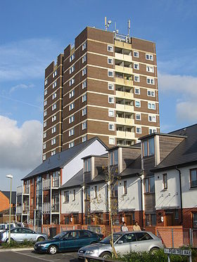
Old and modern housing
 Basingstoke shown within Hampshire
Population 83,662 [1][a] OS grid reference SU637523 District Basingstoke and Deane Shire county Hampshire Region South East Country England Sovereign state United Kingdom Post town Basingstoke Postcode district RG21, RG22, RG23, RG24 Dialling code 01256 Police Hampshire Fire Hampshire Ambulance South Central EU Parliament South East England UK Parliament Basingstoke Website www.basingstoke.gov.uk List of places: UK • England • Hampshire Basingstoke is a town in northeast Hampshire, in south central England. It lies across a valley at the source of the River Loddon. It is 48 miles (77 km) southwest of London, 30 miles (48 km) northeast of Southampton, 16 miles (26 km) southwest of Reading and 19 miles (31 km) northeast of the county town, Winchester. In 2008 it had an estimated population of 82,913. It is part of the borough of Basingstoke and Deane and part of the parliamentary constituency of Basingstoke. Basingstoke is often nicknamed "Doughnut City" or "Roundabout City" due to the number of roundabouts.
Often mistaken for a new town, Basingstoke is an old market town expanded in the 1960s as part of a tripartite agreement between London County Council, Hampshire County Council and Basingstoke Borough Council. It was developed rapidly, along with Andover and Tadley, to accommodate part of the London 'overspill' as perceived under the Greater London Plan, 1944.[2]
Basingstoke market was mentioned in the Domesday Book and Basingstoke remained a small market town until the 1950s. It still has a regular market, but is now bigger than Hampshire County Council's definition of a market town.[3]
Basingstoke is an economic centre, and is the location of the UK headquarters of De La Rue, Sun Life Financial of Canada, The Automobile Association, ST Ericsson, Huawei Technologies, GAME, Motorola, Barracuda Networks, BNP PARIBAS Lease Group UK,[4] the leasing arm of BNP Paribas in the UK, and Sony Professional Solutions (Europe). Other industries include drug manufacture, IT, communications, insurance and electronics.
Contents
Geography and administration
Situated in a valley through the North Downs at an average altitude of 88 m (289 ft),[5] Basingstoke is a major interchange between Reading, Newbury, Andover, Winchester, and Alton, and lies on the natural trade route between the southwest of England and London.
Politics
The Basingstoke parliamentary constituency was formed under the 1885 Act and is currently served by Conservative Member of Parliament (MP) Mrs Maria Miller, who was elected in the 2005 general election.[6]
Basingstoke and Deane is the local Borough Council and has its offices in the town. Elections to the council take place in 3 out of every 4 years. After the latest election in 2011 the council has 34 Conservative, 13 Liberal Democrat, 11 Labour and 2 independent councillors.[7]
Basingstoke is part of a two-tier local government structure and returns county councillors to Hampshire County Council. When the cities of Southampton and Portsmouth attained unitary authority status in 1998, Basingstoke became Hampshire's largest settlement.[8][9]
Physical geography and geology
The precise size and shape of Basingstoke today are difficult to identify, as it has no single official boundary that encompasses all the areas contiguous to its development. The unparished area of the town represents its bulk, but several areas that might be considered part of the town are separate parishes, namely Chineham, Rooksdown, and Lychpit. The unparished area includes Worting which was previously a separate village and parish,[10] extending beyond Roman Road and Old Kempshott Lane, which might otherwise be considered the town’s ‘natural’ western extremity. The ward boundaries within the parliamentary constituency are not (as of August 2007[update]) coterminous with the parish boundaries.
Basingstoke is situated on a bed of cretaceous upper chalk with small areas of clayey and loamy soil, inset with combined clay and flint patches. Loam and alluvium recent and pleistocene sediments line the bed of the river Loddon. A narrow line of tertiary Reading beds run diagonally from the northwest to the southeast along a line from Sherborne St John through Popley, Daneshill and the north part of Basing. To the north of this line, encompassing the areas of Chineham and Pyotts Hill, is London clay.[11]
Divisions and suburbs
Main article: Basingstoke DistrictsBasingstoke's expansion has absorbed much surrounding farmland and scattered housing, transforming it into housing estates or local districts. Many of these new estates are designed as almost self-contained communities, such as Lychpit, Chineham, Popley, Winklebury, Oakridge, Kempshott, Brighton Hill, Viables, South Ham, Black Dam and Hatch Warren. The M3 acts as a buffer zone to the south of the town, and the South Western Main Line constrains the western expansion, with a green belt to the north and north-east, making Basingstoke shaped almost like a kite. As a result, the villages of Cliddesden, Dummer, Sherborne St John and Oakley, although being very close to the town limits, are considered distinct entities. Popley, Hatch Warren and Beggarwood are seeing rapid growth in housing.[12][13]
Nearby towns: Hook, Tadley, Whitchurch,
Nearby villages: Aldermaston, Baughurst, Bramley, Kingsclere, Oakley, Old Basing, Overton, Ramsdell, Silchester, Sherfield on Loddon.
History
Early settlements
The hillfort at Winklebury (2 miles (3 km) west of the town centre), known locally as Winklebury Camp or Winklebury Ring[14] dates from the Iron age and there are remains of several other earthworks around Basingstoke including a long barrow near Down Grange. The site is now home to Fort Hill Community School. [15] Nearby, to the west, Roman Road and Kempshott Lane mark the course of a Roman road that ran from Winchester to Silchester. Further to the east, another Roman road ran from Chichester through the outlying villages of Upton Grey and Mapledurwell. The Harrow Way is an ancient route that runs to the south of the town.
Etymology
The name Basingstoke (A.D 990; Embasinga stocæ,[16] Domesday; Basingestoches) is believed to have been derived from the town's position as the outlying, western settlement of Basa's people.[17][b] Basing, now Old Basing, a village a few miles to the east, is thought to have the same etymology, but is considered by some to be the older settlement.[18]
Market town
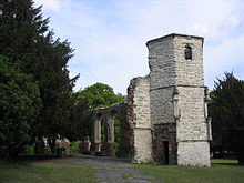
Basingstoke is recorded as being a market site in the Domesday Book, and has held a regular Wednesday market since 1214.[19] During the Civil War, and the siege of Basing House between 1643 and 1645, the town played host to large numbers of Parliamentarians. During this time, St. Michael's Church was damaged whilst being used as an explosive store[20] and lead was stripped from the roof of the Chapel of the Holy Ghost, Basingstoke[21] leading to its eventual ruin. Cromwell is believed to have stayed in the town towards the end of the siege and wrote a letter to the Speaker of the House of Commons addressed from Basingstoke.[22]
The cloth industry appears to have been important in the development of the town until the 17th century along with malting.[23]
Brewing became important during the 18th and 19th centuries, and the oldest and most successful was May's Brewery, established by Thomas and William May in 1750 in Brook Street.
Victorian history
The London and South Western Railway arrived in 1839 from London, and within a year it was connected to Winchester and Southampton. In 1848 a rival company, sponsored by the Great Western Railway built a branch from Reading, and in 1854 a line was built to Salisbury.[24] In the 19th century Basingstoke began to move into industrial manufacture, Wallis and Haslam (later Wallis & Steevens),[25] began producing agricultural equipment including threshing machines in the 1850s, moving into the production of stationary steam engines in the 1860s and then traction engines in the 1870s.
Two traders who opened their first shops within a year of each other in the town, went on to become household names nationally: Thomas Burberry in 1856 and Alfred Milward in 1857.[26] Burberry became famous after he invented Gabardine and Milward founded the Milwards chain of shoe shops, which could be found on almost every high street until the 1980s.[27]
Ordinary citizens were said to be shocked[28] by the emotive, evangelical tactics of the Salvation Army when they arrived in the town in 1880, but the reaction from those employed by the breweries or within the Licence trade quickly grew more openly hostile. Violent clashes became a regular occurrence[c] culminating on Sunday 27 March 1881 with troops being called upon to break up the conflict after the Mayor had read the Riot Act. The riot and its causes led to questions in Parliament and a period of notoriety for the town.[29]
In 1898 John Isaac Thornycroft began production of steam-powered lorries in the town and Thornycroft’s quickly grew to become the town’s largest employer.[30]
Recent history
Basingstoke was among the towns and cities targeted during the Second World War, and suffered bomb damage including St Michael's Church. After the war, it had a population of 25,000.
As part of the London Overspill plan, Basingstoke was rapidly developed in the late 1960s as an 'expanded town', along with places such as Harlow and Swindon. Basingstoke town centre was completely rebuilt. At this time many buildings of historic interest were replaced by a large red brick shopping centre and concrete multi-storey car park. Many office blocks and large estates were built, including a ring road.
The shopping centre, following money issues, was built in phases. The first phase was completed by the 1970s and was later covered in the 1980s, and was known as The Walks. The second phase was completed by the early 1980s, and became The Malls. The third phase was abandoned and the site was later used to build The Anvil concert hall.
In 2003 Basingstoke was voted ninth in the Crap Towns survey, a humorous, but unscientific guide to the worst places to live in Britain though it was not in the top ten of the 2004 survey.
Later that year, the Basingstoke Gazette launched its "Basingstoke – A Place to be Proud of" campaign, aimed at changing people’s perception of the town.[31] The campaign is ongoing (as of June 2011[update]) and marked by the presentation of annual awards to individuals, organisations or businesses nominated by the public for commendable local achievement.[32]
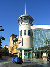 Festival Place shopping centre
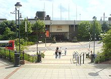
The central part of the shopping centre was rebuilt in 2002 and reopened as Festival Place. This has bought a dramatic improvement to shoppers' opinions of the town centre, but it is unclear if it has softened the town's overall image.[33]
Further work to improve the image of the town continues with the latest Central Basingstoke Vision project coordinated by the Borough Council.[34]
In the mid 1990s, numerous reports described sightings of the Beast of Basingstoke, a big cat believed to be a lion or a puma, possibly two. Local legend suggests the animal was shot and killed, although no official news sources document any capture or killing of the beast.[35]
During the severe snow storms of December 2009, Basingstoke and the surrounding area was one of the worst hit regions in the UK, where an estimated 3000 motorists were forced to abandon their vehicles around the town and on the ring road during the evening rush hour of the 21st.[36]
Demographics
Year Population[37] 1801 2,589 1841 4,066 1871 5,574 1891 7,960 1911 11,259 1921 12,415 1931 13,865 1951 16,978 1961 25,980 1971 52,608 Basingstoke & Deane Compared 2001 UK census Basingstoke and Deane South East England England Total population 152,573 8,000,645 49,138,831 Population density 2.41 4.20 3.77 White British 96.6% 95.1% 90.9% Asian 1.2% 2.3% 4.6% Mixed race 1.0% 1.1% 1.3% Christian 74.0% 72.8% 71.7% No religion 17.0% 16.5% 14.6% Good health 74.3% 71.5% 68.8% Employed full time 51.0% 43.2% 40.8% Owner Occupier with mortgage or loan 48.7% 41.9% 38.9% Travelling less than 10 km to work 64.2% 63.0% 67.5% The borough of Basingstoke was merged with other local districts in 1974 to form the borough of Basingstoke and Deane. Since then most census data has been for the larger area: before 1974, census information was published for the town as a separate entity.
Figures published for the most recent UK census in 2001 for the Borough of Basingstoke and Deane, give a population of 152,573 and a population density of 2.41 persons per hectare.[38] The number of women at 50.48% slightly exceeded that of men.[39] 96.56% of the population were White British, 1.22% Asian or Asian British, 1.02% mixed race, 0.58% Black or Black British and 0.61% Chinese or other ethnic group. With regard to religion, 74.02% of the population were Christian, 16.98% had no religion and 7.22% did not respond. Other religions in total accounting for less than 2%. Amongst other findings were that 74.33% felt they were in good health, 50.98% were economically active full time employees (over 10% higher than the National Average) and 48.73% were buying their property with a mortgage or loan (almost 10% higher than the national average).[38] Amongst the working population, 64.2% travelled less than 10 km to work.[40] The biggest percentage of employees, 17.67% worked in real estate, renting and business activities.[41]
Facilities
Festival Place, a new shopping centre, opened in October 2002, adding a huge boost to the town centre,[42] transforming the former The Walks Shopping Centre and the New Market Square. Aside from a wide range of shops, there is also a range of cafés and restaurants as well as a large multiple-screen Vue cinema (formerly Ster Century until their takeover in 2005).[43]
Central Basingstoke has two further shopping areas: The Malls and the Top of Town. The Malls area has declined since the opening of Festival Place and the closure of its Allders department store, though it is still home to several major retailers. The leasehold was purchased in 2004 by the St Modwen development group in partnership with the Kuwait property investment company Salhia Real Estate, with provision for redevelopment[44] The redevelopment of The Malls which started in late 2010, will see the dated looking shopping centre given a major facelift. The existing canopies will be removed and a clear roof canopy will be installed, which will protect the centre from bad weather, but still allows natural light and air in. The whole shopping centre will be repaved and new street furniture will be installed. A new gateway entrance to The Malls will be created and this will give a more desirable first impression of the town when people arrive from the railway station. The redevelopment is due to be completed in the Summer of 2011 but has been delayed until September 2011. The Malls Transformation work has been carried out by Wates Group using a variety of sub-contractors.[45]
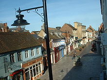
The Top of Town is the historic heart of Basingstoke, housing the town's Willis Museum[46] in the former Town Hall building as well as several locally run shops, as well as the post office, and the market place.
The town's nightlife is split between the new Festival Square, and the traditional hostelries at the Top of Town, with a few local community pubs outside the central area. The town has four nightclubs, two in the town itself, one on the east side and one 2 miles (3 km) out to the west.
In Portchester Square is the Basingstoke Sports Centre[47] which has a subterranean swimming pool, sauna, jacuzzi and steam room. Above ground there is a gym, aerobics studios, squash courts and main hall. There is also a playden for young children.
Basingstoke is also home to multiple theatrical organisations; a modern concert hall, The Anvil.[48], the Haymarket Theatre in the former Corn exchange and Proteus Theatre.
Sports and leisure
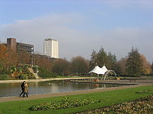 Eastrop Park, with Fanum House in the background
Outside the town centre, there is a leisure park featuring the Aquadrome swimming pool, which opened in May 2002.[49] The park also includes an ice rink, bowling alley, Bingo club and a ten screen cinema, as well as a restaurant and fast food outlets. The leisure park is also home to the Milestones Museum which contains a network of streets and buildings based on the history of Hampshire.
Basingstoke has its own football club, Basingstoke Town F.C. who play in the Conference South. The Basingstoke Rugby Football Club play in Rugby Football Union's Powergen South West League 1, and the Basingstoke Bison ice hockey team play in the Elite Ice Hockey League until the end of 2008/2009 season. From the 2009/2010 season, the team will play in the English Premier Ice Hockey League. Basingstoke also has a swimming team, known as the Basingstoke Bluefins and an American Flag Football Team known as the Basingstoke Zombie Horde. The diversity of sporting activity in the area is also illustrated by organisations such as Basingstoke Demons Floorball Club, Basingstoke Bulls Korfball Club and Lasham Gliding Society. The home ground of Basingstoke & North Hants Cricket Club, Mays Bounty was until 2000 used once a season by Hampshire County Cricket Club. Players such as Shane Warne and Sachin Tendulkar as well as Ashes winners Michael Vaughan, Steve Harmison and Matthew Hoggard have graced the ground.[50][51][52] It was also where celebrated commentator and playwright John Arlott watched his first match.[53] In August 2008 County Cricket returned to May’s Bounty with Hampshire County Cricket Club defeating eventual County Champions Durham County Cricket Club.[54]
Plans have recently been announced for a new multi-million pound sports facility at Down Grange, which would be suitable for many sports. Proposals include a stadium for Basingstoke Town FC and Basingstoke RFC which would be up to the standard of the Football League, a new 8 lane athletics track and hockey pitch, as well as a gym, swimming pool, hotel and conference facilities.
Media
Basingstoke is served by regional radio stations Kestrel FM serving North Hampshire and parts of Surrey and Sussex and Heart Berkshire, broadcast from Reading and London also provide regional coverage in the area. The town also has coverage from digital radio; the BBC, Independent National and Now Reading multiplexes can be received in the town,[55] and the outskirts can receive London and South Hampshire stations as well.[56][57]
There are three local newspapers – the Basingstoke Gazette who also publish the Wednesday Extra, delivered free, and the Basingstoke Observer. The town is also covered by the Hampshire Chronicle.
Education
See also: List of schools in Basingstoke and DeaneEducation in Basingstoke is co-ordinated by Hampshire County Council. Each neighbourhood in the town has at least one Primary school, while Secondary schools are distributed around the town on larger campuses.
Basingstoke has two large further education colleges: a sixth form college, Queen Mary's College (QMC) and Basingstoke College of Technology (BCoT).
Universities
The University of Winchester had a Campus in Basingstoke (Chute House Campus) which closed in July 2011. It had offered full-time and part-time university courses in subjects including childhood studies, various management pathways, community development and creative industries.
Basingstoke is within 30 miles (48 km) of eight universities, namely Thames Valley University (TVU at Reading), the University of Winchester, the University of Portsmouth, the University of Reading, the University of Southampton, Southampton Solent University, the University of Surrey and University for the Creative Arts, formerly Surrey Institute of Art & Design, University College in Farnham.
Transport
Road
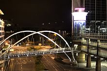 Churchill Way running through the centre of Basingstoke town centre, as seen from Festival Place car park
Basingstoke is at Junction 6 and Junction 7 of the M3 motorway, which skirts the town's southern edge, linking the town to London and to Southampton and the south-west. The central area of the town is encircled by a ring road constructed in the 1960s named The Ringway and bisected from east to west by the A3010, Churchill Way. Major roads radiate from the Ringway like spokes from a hub. The A33 runs north east to Reading and the M4 Motorway and south west to Winchester. The A30 runs east to Hook and west to Salisbury. The A303 begins a few miles south west of Basingstoke to head west towards Wiltshire and the West Country, sharing the first few miles with the A30. The A339 runs south east to Alton and north west to Newbury. Basingstoke has a reputation for having a large density of roundabouts.
Rail
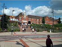 Basingstoke railway station, as seen from Alençon Link
The South Western Main Line railway runs east and west through the centre of the town and Basingstoke railway station linking it to the South West of England, London Waterloo (the fastest train Basingstoke to London takes 44 minutes), Winchester, Southampton and Bournemouth, and via the Eastleigh to Fareham Line and West Coastway Line to Portsmouth and Brighton. The West of England Main Line to Salisbury and Exeter diverges at Worting Junction, to the west. The Basingstoke Branch[58] runs north-east to Reading, providing services to Oxford, Birmingham, the north of England and Scotland. The town was also the terminus of the defunct Basingstoke and Alton Light Railway. Current rail services from Basingstoke are operated by South West Trains, Crosscountry and First Great Western.
Bus
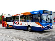
Most bus services in the town operate from Basingstoke Bus Station. The majority are provided by the Stagecoach Group through their Stagecoach in Hampshire sub-division. Newbury Buses also operate over individual routes and cango operate a service linking villages between Basingstoke and Alton. A Park and Ride service provided by Courtney Coaches[59] links Basingstoke leisure park with Basing View, via Basingstoke Railway Station. This service uses distinctive purple and white Optare Solo busses, and provides a daytime service at roughly 10-minute intervals throughout the week. The buses on this service being provided by Basingstoke and Deane Borough Council. Currently (2010), a complimentary peak time service is also provided by Courtney Coaches Limited[60] between Chineham Business Park and the railway station. National Express offers direct coach services to London and Southampton from the bus station.
Cycle
Separate provision for cyclists from other road traffic was not part of the remit of the 1960s town redevelopment, and until recently provision for cyclists was very poor.[61] A Basingstoke Area Cycling Strategy was developed in 1999[62] and subsequently an extensive cycle network has been developed[63] mainly utilising on-road routes or off-road routes that run parallel with and directly alongside roads. Basingstoke was linked to Reading on the National Cycle Network route 23 in May 2003 and the route was extended south to Alton and Alresford in April 2006. A Basingstoke Bicycle Users Group meets quarterly to discuss local cycling issues.[64]
Air
The closest international airport to Basingstoke is Southampton, about 25 miles (40 km) away. Blackbushe (9 miles (14 km)) and Farnborough (11 miles (18 km)) have Civil Aviation Authority (CAA) Ordinary Licences, allowing for the public transport of passengers. Other General Aviation (GA) airfields in the area for which Prior Permission is Required (PPR) are at Popham Airfield[65] (7 miles (11 km)), Lasham (5 miles (8 km)), Brimpton Airfield[66] and Hook. Lasham Airfield is particularly well known for its gliding club.
Canal
There are now no navigable waterways within the immediate area, although there used to be a canal to the centre of Basingstoke, but this fell into disuse and the last five miles of the canal route have now been lost. This section of the canal fell into disuse due to a lack of boat traffic, general neglect and a lack of water levels. There were no locks on this part of the canal and so the route generally followed the contours of the land with occasional cuttings, tunnels and embankments. The route can be partly determined by noting that the canal falls between the 75m and 80m contours on Ordnance Survey maps.
The Basingstoke Canal started at a canal basin, roughly where the cinema in Festival Place is located. From there the canal ran alongside the River Loddon following the line of Eastrop Way. The old canal route passes under the perimeter ring road and then follows a long loop partly on an embankment to pass over small streams and water meadows towards Old Basing, where the route goes around the now ruined palace of Basing House and then through and around the eastern edge of Old Basing. It followed another loop to go over small streams near the Hatch public house (a lot of this section was built over when constructing the M3) and headed across fields on an embankment towards Mapledurwell. The canal then headed towards a small tunnel under the Andwell Drove and then across another field partly on an embankment towards Up Nately. The section of the canal from Up Nately to the western entrance of the Greywell Tunnel still exists and is a nature reserve; there is water in the canal and the canal towpath can be walked. A permissive footpath at the western entrance to the tunnel allows walkers to access public footpaths to get to the eastern entrance of the tunnel. The limit of navigation is about 500m east of the Greywell Tunnel. The renovated sections of the canal can then be navigated east towards West Byfleet where it joins the Wey Navigation, which itself can be navigated to the Thames at Weybridge.
The Basingstoke Canal Heritage Footpath roughly follows the canal route for 2 miles (3 km) from Festival Place to Basing House.
Plans to reconnect the town with the surviving section of the Canal have been mooted several times in the past and this remains a long term aim of the Surrey and Hampshire Canal Society.[67] Another possible idea also considered was to connect the remaining canal to the Kennet and Avon navigation near Reading.
Religious sites
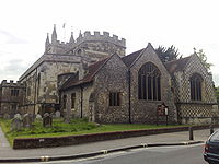
The Anglican church of St. Michael's is west of Festival Place and dates from 1464.[68] The nave and isles were added 50 years later by Richard Foxe, Bishop of Winchester. The Memorial Chapel at the north east corner of the church was completed in 1921.
Nearest places
Destinations from Basingstoke 
Newbury Reading, Tadley London, Wokingham, Yateley 
Andover, Salisbury 
Hook, Fleet, Farnborough, Aldershot, Guildford  Basingstoke

Southampton, Winchester Portsmouth, New Alresford, Fareham Farnham, Alton Cultural references
In the 1887 Gilbert and Sullivan comic opera Ruddigore, the word "Basingstoke" is used as a code word by Sir Despard Murgatroyd to soothe his new wife, Mad Margaret, when she seems in danger of relapsing into madness. Margaret suggests this course of action herself:
Well, then, when I am lying awake at night, and the pale moonlight streams through the latticed casement, strange fancies crowd upon my poor mad brain, and I sometimes think that if we could hit upon some word for you to use whenever I am about to relapse—some word that teems with hidden meaning—like "Basingstoke"—it might recall me to my saner self.
In 1895, Thomas Hardy referred to Basingstoke as "Stoke Barehills" in Jude the Obscure – Part Fifth, Chapter 5
- "There is in Upper Wessex an old town of nine or ten thousand souls; the town may be called Stoke-Barehills. It stands with its gaunt, unattractive, ancient church, and its new red brick suburb".
- "The most familiar object in Stoke-Barehills nowadays is its cemetery, standing among some picturesque mediaeval ruins beside the railway; the modern chapels, modern tombs, and modern shrubs having a look of intrusiveness amid the crumbling and ivy-covered decay of the ancient walls."
In Hunter Davies' 1968 biography of The Beatles, Paul McCartney offers John Lennon "some amazing cake from Basingstoke."[69]
In 1974 Basingstoke is mentioned in a skit from Episode 42 of Monty Python's Flying Circus as the site of a World War I battle. When the General (sitting as president of a court martial) asks "Basingstoke, Hampshire?" he is told no, the battle occurred in Basingstoke, Westphalia (which can only be located on a map produced by Cole Porter).
In 1978, Carl Barât, co-founder of The Libertines rock band, was born in Basingstoke and responded to a request for a description of the town with the question: "Have you seen The Office?".[70]
In 1979, The Hitchhiker's Guide to the Galaxy by Douglas Adams includes a reference to the town. Just after Ford Prefect has explained to Arthur Dent that they hitched a lift on a spaceship Arthur replies: "Are you trying to tell me that we just stuck out our thumbs and some green bug-eyed monster stuck his head out and said, Hi fellas, hop right in. I can take you as far as the Basingstoke roundabout?".[71]
Also in 1979, A Stone in Heaven, part of Poul Anderson's Dominic Flandry series, Admiral Flandry uses "Basingstoke" as a password, in an apparent homage to its usage in Ruddigore.
In 1981, in the sitcom Only Fools And Horses, its revealed that the character Rodney Trotter was expelled from Art College in Basingstoke for smoking cannabis.
In the 1984 Robyn Hitchcock's song "I Often Dream Of Trains", Basingstoke is mentioned as in the following lyric snippet:
I often dream of trains when I'm alone
I ride on them into another zone
I dream of them constantly
Heading for paradise
Or Basingstoke
Or ReadingIn the 1990 Broadway musical Jekyll & Hyde, based on the novel The Strange Case of Dr Jekyll and Mr Hyde by Robert Louis Stevenson, His Grace Rupert the 14th Bishop of Basingstoke is a character.
Patrick Wilde's 1993 play, What's Wrong With Angry? is set in Basingstoke. It was later adapted into the 1998 film, Get Real.
In the 2005 novel "The Big Over Easy" by Jasper Fforde', Detective Mary Mary from hails from Basingstoke, and is continually claiming to not be ashamed of it, a play on the town's public relations campaign that it's "A Place to Be Proud Of."
Filmography
The 1998 film Get Real was filmed at various locations around the town.[72]
Basingstoke’s North Hampshire Hospital was one of two hospitals used for the filming of Channel 4's hit comedy Green Wing.[73]
An episode of Top Gear was filmed in Festival Place in November 2008. The episode was broadcast on BBC2 at 8:00pm on 7 December. Jeremy Clarkson was testing the new Ford Fiesta in the town in the early hours of the morning.[74]
In the first series of Ultimate Force, episode 2 "Just a Target", the assassination attempt towards the end of the episode was set in Basingstoke.
Basingstoke is mentioned briefly in a Monty Python sketch where Michael Palin is in the midst of hi-jacking a plane when the pilot (John Cleese) suggest he could drop him off at a "haystack just outside Basingstoke", the footage of Palin falling into the haystack and getting onto a coach is actually filmed on the outskirts of Basingstoke.
See also
Notes
a. ^ Population figure is an estimate for 2010, and includes only the unparished area, not the surrounding area.
b. ^ The List of generic forms in British place names shows a toponomic interpretation of the various Old English elements within the names Basing and Basingstoke. ‘’Bas’’ is taken to be from the personal name 'Basa', ‘’ingas’’ as 'people of' and ‘’stoc’’ as 'dependent farmstead' or 'secondary settlement'.
c. ^ In summarising to Magistrates at the trial of those members of the public said to have rioted against the Salvationists, defence counsel stated that ‘’Until this body known as the Salvation Army was formed here, the number of summonses which had come before the Magistrates was comparatively unknown. They now had a large number of assault cases to hear.’’ ‘’The army perfectly well knew that their conduct was leading to disturbances in the town’’. The case against the defendants was dismissed.[75]
References
- ^ "Parish total level forecast: (unparished area) Basingstoke & Deane". Hampshire County Council. 2010. http://www3.hants.gov.uk/parish_total_level_forecast_2010.xls. Retrieved 2011-10-24.
- ^ Stokes, Eric (1980). Basingstoke – Expanding Town. The Workers’ Educational Association. p. 15.
- ^ "Rural Hampshire FAQs". Hampshire County Council. 2006. http://www.hants.gov.uk/factsandfigures/ruralfaqsgeneral.html#5. Retrieved 2007-01-12.
- ^ "BNP Paribas". http://www.bplg.co.uk.
- ^ "Meteoconsult web site Accessed 11 January 2011". Unitedkingdom.meteoconsult.co.uk. http://unitedkingdom.meteoconsult.co.uk/weather/basingstoke/united-kingdom/weather_forecast_basingstoke_united-kingdom_city_9945_0.php. Retrieved 2011-08-06.
- ^ "Maria Miller MP". They WorkForYou.com. http://www.theyworkforyou.com/mp/maria_miller/basingstoke. Retrieved 2007-08-26.
- ^ "England council elections". BBC News Online. http://www.bbc.co.uk/news/special/election2011/council/html/24ub.stm. Retrieved 20 July 2011.
- ^ "Hampshire County Council library service, Best Value Inspection 2001" (PDF). Hampshire County Council. http://www.audit-commission.gov.uk/Products/BVIR/AC0D8291-8C93-4141-9347-E1DB6121A44E/HampshireCC01.pdf. Retrieved 2007-08-26.
- ^ "Combined feasibility and building design project appraisal". Hampshire County Council. Archived from the original on October 1, 2007. http://web.archive.org/web/20071001005701/http://www.hants.gov.uk/scrmxn/c20001.html. Retrieved 2007-08-26.
- ^ "Victoria County History, Worting Parish". British History Online. http://www.british-history.ac.uk/report.asp?compid=56798&strquery=worting. Retrieved 2007-08-26.
- ^ Stokes, Eric (1980). Basingstoke – Expanding Town. The Worker’s Educational Association. p. 45.
- ^ "Report of the Director of Property, Business and Regulatory Services". Hampshire County Council. http://www.hants.gov.uk/decisions/decisions-docs/070717-excsed-R0710180838.html. Retrieved 2007-08-26.
- ^ "Report of the Director of Environment". Hampshire County Council. http://www.hants.gov.uk/decisions/decisions-docs/031111-exemss-R1106153251.html. Retrieved 2007-08-26.
- ^ "A brief history of Winklebury Ring". Fort Hill Community School. 2005. Archived from the original on September 28, 2007. http://web.archive.org/web/20070928145535/http://www.forthill.hants.sch.uk/folders/community/history_of_winklebury_ring/a_brief_history_of_winklebury_ring.cfm. Retrieved 2007-05-09.
- ^ "Hampshire Treasures Vol 2". Hampshire County Council. 2006. http://www.hants.gov.uk/hampshiretreasures/vol02/page029.html. Retrieved 2007-05-09.
- ^ "Anglo-Saxon Charters". Sean Miller. 2006. http://www.anglo-saxons.net/hwaet/?do=get&type=charter&id=874. Retrieved 2007-06-03.
- ^ "English Place Names". The University of Nottingham. 2006. http://www.nottingham.ac.uk/english/ins/epntest/keytoepn.html. Retrieved 2007-06-03.
- ^ "Old Basing & Lychpit Parish History". Old Basing & Lychpit Parish Council. 2006. http://www.oldbasing.gov.uk/profile.htm#history. Retrieved 2007-06-03.
- ^ "Gazetteer of Markets and Fairs". Centre for Metropolitan History. 2004. http://www.history.ac.uk/cmh/gaz/gazweb2.html. Retrieved 2007-05-09.
- ^ "St Michael's Church – the building". Hampshire County Council. 2006. Archived from the original on July 3, 2007. http://web.archive.org/web/20070703061428/http://www.stmichaelsbasingstoke.org.uk/ChurchBuilding.html. Retrieved 2007-06-03.
- ^ "Hampshire Treasures Vol 2". Hampshire County Council. 2006. http://www.hants.gov.uk/hampshiretreasures/vol02/page035.html. Retrieved 2007-06-03.
- ^ Baigent, Francis J.; James Millard (1889). A History of the Ancient Town and Manor of Basingstoke. C.J. Jacob. p. 565.
- ^ "Victorian County History – Hampshire Vol 4". British History Online. 2007. http://www.british-history.ac.uk/report.asp?compid=56764. Retrieved 2007-05-29.
- ^ Christopher J. Tolley (2001). "Basingstoke's Railway History in Maps". Archived from the original on May 15, 2008. http://web.archive.org/web/20080515181902/http://web.ukonline.co.uk/cj.tolley/cjt-brhc.htm. Retrieved 3/5/2008.
- ^ "Wallis and Steevens – A Timeline". Hampshire County Council. 2006. http://www.hants.gov.uk/museum/history/wallis_and_steevens/index.html. Retrieved 2007-06-06.
- ^ Hawker, Anne (1999). The Story of Basingstoke. Hampshire County Museum Service. p. 69.
- ^ "Milward’s celebrates 125 years of footwear". Hants & Berks Gazette. 1982
- ^ Baigent, Francis J.; James Millard (1889). A History of the Ancient Town and Manor of Basingstoke. C.J. Jacob. p. 552.
- ^ Baigent, Francis J.; James Millard (1889). A History of the Ancient Town and Manor of Basingstoke. C.J. Jacob. pp. 551–553.
- ^ "Thornycroft of Basingstoke". Hampshire County Council. 2005. http://www.hants.gov.uk/thornycroft/. Retrieved 2007-06-06.
- ^ "Gazette aims to put pride back into Basingstoke". HoldtheFrontPage.co.uk. 2003. http://www.holdthefrontpage.co.uk/campaigns/2003/10oct/031013pride.shtml. Retrieved 2007-08-26.
- ^ "Place to be proud of awards". Basingstoke and Deane Borough Council. 2007. Archived from the original on August 8, 2007. http://web.archive.org/web/20070808014643/http://www.basingstoke.gov.uk/community/proud/. Retrieved 2007-08-26.
- ^ "Central Basingstoke Vision, Single Issue Panel Meeting No 5". Basingstoke & Deane Borough Council. 2007. http://www.basingstoke.gov.uk/CommitteeDocs/Committees/Central%20Basingstoke%20Vision%20Single%20Issue%20Panel/20070410/Minutes%20of%20the%20Meeting%20held%20on%2010%20April%202007.doc. Retrieved 2007-05-08.
- ^ "The Libertines – Drugs, Jail and R&R". Rolling Stone.com. 2004. Archived from the original on October 2, 2007. http://web.archive.org/web/20071002062742/http://www.rollingstone.com/news/story/6593147/drugs_jail_and_rr. Retrieved 2007-05-14.
- ^ "It's Basingstoke NOT Boringstoke". http://www.basingstoke.me.uk/. Retrieved 2009-10-29.
- ^ "Thousands trapped in cars overnight due to snow and ice". BBC News. 2009-12-22. http://news.bbc.co.uk/1/hi/uk/8425718.stm. Retrieved 2009-12-24.
- ^ "A Vision of Britain Through Time". Great Britain Historical GIS Project. 2007. http://www.visionofbritain.org.uk/data_cube_table_page.jsp?data_theme=T_POP&data_cube=N_TPop&u_id=10135758&c_id=10001043&add=N. Retrieved 2007-06-05.
- ^ a b "Neighbourhood Statistics". Statistics.gov.uk. http://neighbourhood.statistics.gov.uk/dissemination/LeadKeyFigures.do?a=7&b=276977&c=basingstoke+and+deane&d=13&e=16&g=449607&i=1001x1003x1004&m=0&enc=1. Retrieved 2007-06-17.
- ^ "Neighbourhood Statistics". Statistics.gov.uk. http://neighbourhood.statistics.gov.uk/dissemination/LeadTableView.do?a=7&b=276977&c=basingstoke+and+deane&d=13&e=16&g=449607&i=1001x1003x1004&m=0&enc=1&dsFamilyId=77. Retrieved 2007-06-17.
- ^ "Neighbourhood Statistics". Statistics.gov.uk. http://neighbourhood.statistics.gov.uk/dissemination/LeadTableView.do?a=7&b=276977&c=basingstoke+and+deane&d=13&e=16&g=449607&i=1001x1003x1004&m=0&enc=1&dsFamilyId=121. Retrieved 2007-06-17.
- ^ "Neighbourhood Statistics". Statistics.gov.uk. http://neighbourhood.statistics.gov.uk/dissemination/LeadTableView.do?a=7&b=276977&c=basingstoke+and+deane&d=13&e=16&g=449607&i=1001x1003x1004&m=0&enc=1&dsFamilyId=119. Retrieved 2007-06-17.
- ^ "The Place to be proud of!". Thisishampshire.net. 2004. http://archive.thisishampshire.net/2004/9/10/22938.html. Retrieved 2007-05-09.
- ^ "Completed acquisition by Vue Entertainment Holdings". Office of Fair Trading. http://www.oft.gov.uk/advice_and_resources/resource_base/Mergers_home/decisions/2005/vue. Retrieved 2007-08-26.
- ^ "St Modwen buys Basingstoke’s Malls with Key Kuwaiti partner". Property Week.com. 2004. http://www.propertyweek.com/story.asp?storyCode=3044488. Retrieved 2007-05-09.
- ^ "The Malls Transformation". Basingstoke.gov.uk. http://www.basingstoke.gov.uk/leisure/shopping/themalls.htm. Retrieved 2011-08-06.
- ^ "Willis Museum". Hampshire County Council. http://www3.hants.gov.uk/hampshire-museums/willis-museum. Retrieved 2007-08-26.
- ^ "Sports Centre". Basingstoke & District Sports Trust Limited. Archived from the original on October 27, 2007. http://web.archive.org/web/20071027132546/http://www.sportscentre.org.uk/home.html. Retrieved 2007-08-26.
- ^ "The Anvil". Anvil Arts. Archived from the original on August 10, 2007. http://web.archive.org/web/20070810125952/http://www.theanvil.org.uk/. Retrieved 2007-08-26.
- ^ "Aquadrome opens its shores to swimmers". This is Hampshire.net. http://archive.thisishampshire.net/2002/5/29/64320.html. Retrieved 2007-12-18.
- ^ "Hampshire v Yorkshire, CGU National League, May’s Bounty, Basingstoke 13 June 1999". cricket-online.org. http://www.cricket-online.org/scorecard_la.php?la=11974. Retrieved 2007-08-27.
- ^ "Hampshire v Yorkshire, County Championship, May’s Bounty, Basingstoke 2–4 June 1992". cricket-online.org. http://www.cricket-online.org/scorecard_fc.php?fc=39698. Retrieved 2007-08-27.
- ^ "Hampshire v Durham, County Championship, May’s Bounty, Basingstoke 14–16 June 2000". cricinfo.com. http://www.cricinfo.com/link_to_database/ARCHIVE/2000/ENG_LOCAL/CC1/SCORECARDS/14-18JUN2000/HANTS_DURHAM_CC1_14-17JUN2000.html. Retrieved 2007-08-27.
- ^ Arlott, John (1990). Basingstoke Boy. Willow Books, Harper Collins. p. 26.
- ^ http://www.basingstokegazette.co.uk/sport/sporthome/display.var.1972615.0.august_fixture_for_county_at_bounty.php basingstokegazette.co.uk
- ^ "DAB Digital Radio Coverage Maps". MDS975.co.uk. http://www.arar93.dsl.pipex.com/mds975/txmaps/DABmaps01.html. Retrieved 2007-08-27.
- ^ "Digital Radio Now, Station Finder". digitalradionow.com. Archived from the original on September 27, 2007. http://web.archive.org/web/20070927181902/http://www.digitalradionow.com/statf.php?pcode=rg21+7qd#results. Retrieved 2007-08-27.
- ^ "Radio stations in the South Midlands and Thames Valley". radio-now.co.uk. http://www.radio-now.co.uk/smids.htm. Retrieved 2007-08-27.
- ^ Crawford, Ewan (2002). "Basingstoke Branch". Ewan Crawford. http://www.railscot.co.uk/Basingstoke_Branch/frame.htm. Retrieved 2007-08-26.
- ^ "Courtney Coaches Limited". Courtney Coaches Limited. 2007. http://www.courtneycoaches.com. Retrieved 2007-06-14.
- ^ "MEPC Chineham Park". MEPC. 2007. http://www.mepc.co.uk/chinehampark/Travel/Bybus.aspx. Retrieved 2007-06-14.
- ^ "Public attitudes on Transport Issues". Hampshire County Council. 1996. Archived from the original on September 30, 2007. http://web.archive.org/web/20070930201123/http://www.hants.gov.uk/scrmxn/c19733.html. Retrieved 2007-06-14.
- ^ "Basingstoke Environmental Strategy for Transport". Hampshire County Council. 2000. Archived from the original on September 30, 2007. http://web.archive.org/web/20070930211020/http://www.hants.gov.uk/scrmxn/c29946.html. Retrieved 2007-06-14.
- ^ "Basingstoke Cycle Network Map" (PDF). Hampshire County Council. 2007. http://www.basingstoke.gov.uk/NR/rdonlyres/25DA32B0-8691-4D42-BCBF-C70B7AE51637/0/cycle_map.pdf. Retrieved 2007-06-14.
- ^ "Basingstoke Bicycle Users Group". Basingstoke & Deane Borough Council. 2008. http://www.basingstoke.gov.uk/planning/transport/cycling/BBUG.htm. Retrieved 2009-10-29.
- ^ "Popham Airfield home page". Chris Thompson, Popham Airfield. 2007. http://www.popham-airfield.co.uk/Index.htm. Retrieved 2007-06-14.
- ^ "Brimpton Airfield". Brimpton Flying Club. 2007. http://www.brimpton-airfield.co.uk/. Retrieved 2007-06-14.
- ^ "Basingstoke Canal – The last 5 miles". Surrey and Hampshire Canal Society. 2004. Archived from the original on June 17, 2007. http://web.archive.org/web/20070617130424/http://www.basingstoke-canal.org.uk/last5m.htm. Retrieved 2007-06-14.
- ^ "St Michael's Church, Basingstoke". 14 January 2009. http://www.basingstoketeamparish.org.uk/stm/buildings/. Retrieved 8 June 2011.
- ^ The Beatles, Hunter Davies, 1968
- ^ Binelli, Mark (2004). "The Libertines – Drugs, Jail and R&R". Rolling Stone.com. Archived from the original on October 2, 2007. http://web.archive.org/web/20071002062742/http://www.rollingstone.com/news/story/6593147/drugs_jail_and_rr. Retrieved 2007-05-14.
- ^ Adams, Douglas (1979). The Hitchhiker's Guide to the Galaxy. Pan Books. p. 43. ISBN 0330258648.
- ^ Shaw, Pete (2007). "Get Real, Basingstoke filming locations". bensilverstone.net. http://www.bensilverstone.net/bslocations.asp. Retrieved 2007-08-26.
- ^ Raphael, Amy (29 March 2006). "Green Wing's midwife and surgeon". London: The Daily Telegraph. http://www.telegraph.co.uk/arts/main.jhtml?xml=/arts/2006/03/29/btvpile29.xml&sSheet=/arts/2006/03/29/ixartleft.html. Retrieved 2006-12-26.
- ^ Hampshire News: TV stars hit top gear in shopping centre.
- ^ The Salvation Army at Basingstoke. Report of the proceedings before the Magistrates on May 3rd and 9th, 1881. Basingstoke. 1881.
External links
- Basingstoke and Deane Borough Council
- University of Winchester Basingstoke Campus
- Local info on Basingstoke from Hampshire County Council
- Holy Ghost Chapel cemetery trail from Basingstoke Heritage Society
Ceremonial county of Hampshire Hampshire Portal Unitary authorities Boroughs or districts Major settlements Aldershot • Alton • Andover • Basingstoke • Bishop's Waltham • Blackwater • Bordon • Eastleigh • Fareham • Farnborough • Fleet • Fordingbridge • Gosport • Havant • Hedge End • Lee-on-the-Solent • Lymington • New Alresford • New Milton • Petersfield • Portsmouth • Ringwood • Romsey • Southampton • Stockbridge • Tadley • Totton and Eling • Waterlooville • Whitchurch • Winchester • Yateley
See also: List of civil parishes in HampshireRivers Topics Categories:- Basingstoke and Deane
- Basingstoke
- Towns in Hampshire
Wikimedia Foundation. 2010.


