- Newtown, Hampshire
-
Coordinates: 51°22′21″N 1°19′04″W / 51.3724°N 1.3177°W
Newtown, Hampshire 
Newtown Church
 Newtown, Hampshire
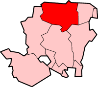
Newtown, Hampshire shown within HampshireDistrict Basingstoke and Deane Shire county Hampshire Region South East Country England Sovereign state United Kingdom Post town NEWBURY Postcode district RG20 Dialling code 01635 Police Hampshire Fire Hampshire Ambulance South Central EU Parliament South East England UK Parliament North West Hampshire List of places: UK • England • Hampshire Newtown is a village and civil parish in the English county of Hampshire, located just south of Newbury.
Contents
History
The mediaeval borough of Newtown was formed from part of the parish of Burghclere, and flourished in the 13th and 14th centuries. Sandleford Priory in Berkshire was founded between 1193 and 1202 and an entirely new town was created just over the border in Hampshire. In 1218, the grant of a market and a fair at Newtown was made to the Bishop of Winchester and, in the bishop's account roll of 1218-19, fifty-two burgesses are listed, who occupied sixty-seven plots of land in the new borough. The Prior of Sandleford bought three plots in Newtown. Also in 1218-19, a chapel was built for the local people of the new borough, and was originally known as the Chapel of Sandleford.
In 1224-25, a ditch was dug around the town at the bishop's expense and, in 1225-26, the bishop's own house was built in the borough. By the 16th century, the town had begun to decay, although the reason for its decline is not known, and, in 1674, only sixty-four houses remained, probably scattered throughout the parish. No traces of the medieval borough can be seen above ground today.
Governance
The village of Newtown is part of the civil parish of Newtown,[1] and is part of the Burghclere, Highclere and St. Mary Bourne ward of Basingstoke and Deane borough council.[2] The borough council is a Non-metropolitan district of Hampshire County Council.
Religious sites
The Church of England parish church of St Mary and St John the Baptist was built in 1865 on the site of the original medieval chapel. The building was financed entirely by Edmund and Elizabeth Arbuthnot.
Industry
Butchers, bakers, ironmongers and shoemakers were listed in the old borough records, but more recently the parish has been famed locally for making wooden rakes.
Famous people
- Eustace Roskill, Baron Roskill, Lord of Appeal in Ordinary, Tristan de Vere Cole (tv producer)
References
- ^ "Hampshire County Council’s legal record of public rights of way in Hampshire". 2008. http://www.hants.gov.uk/rh/row/maps/1225.pdf. Retrieved 26 October 2010.
- ^ "Basingstoke and Deane Wards info". 2010. http://www.basingstoke.gov.uk/council/councillors/wardsinfo.htm. Retrieved 26 October 2010.
External links
 Media related to Newtown, Hampshire at Wikimedia CommonsCategories:
- Villages in Hampshire
- Basingstoke and Deane


Wikimedia Foundation. 2010.