- Nutley, Hampshire
-
Coordinates: 51°11′34″N 1°07′35″W / 51.1927°N 1.1265°W
Nutley 
 Nutley
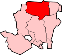
Nutley shown within HampshireOS grid reference SU5538837410 District Basingstoke and Deane Shire county Hampshire Region South East Country England Sovereign state United Kingdom Post town BASINGSTOKE Postcode district SO24 9 Dialling code 01256 Police Hampshire Fire Hampshire Ambulance South Central EU Parliament South East England UK Parliament Basingstoke Website Preston Candover and Nutley Parish Council List of places: UK • England • Hampshire Nutley is a small village and civil parish in the Basingstoke and Deane district of Hampshire, England. It lies approximately 5.6 miles (9.0 km) south-west from Basingstoke, just off the B3046 road. The parish has an acreage of 1,524 acres (617 ha) with 74 acres (30 ha) made up of permanent grass and 386 acres (156 ha) of woodland.[1]
Governance
The village of Nutley is part of the civil parish of Nutley,[2] which is part of the parish council of Preston Candover and Nutley. It is also part of the Upton Grey and the Candovers ward of Basingstoke and Deane borough council.[3] The borough council is a Non-metropolitan district of Hampshire County Council.
References
- ^ "Nutley acreage". http://www.british-history.ac.uk/report.aspx?compid=42003. Retrieved 27 October 2010.
- ^ "Hampshire County Council’s legal record of public rights of way in Hampshire". 2008. http://www.hants.gov.uk/rh/row/maps/1519.pdf. Retrieved 27 October 2010.
- ^ "Basingstoke and Deane Wards info". 2010. http://www.basingstoke.gov.uk/council/councillors/wardsinfo.htm. Retrieved 27 October 2010.
Categories:- Hampshire geography stubs
- Villages in Hampshire
- Basingstoke and Deane

Wikimedia Foundation. 2010.