- North Sydmonton
-
Coordinates: 51°20′45″N 1°17′23″W / 51.345877°N 1.289773°W
North Sydmonton 
 North Sydmonton
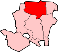
North Sydmonton shown within HampshireOS grid reference SU5009862144 Parish Ecchinswell, Sydmonton and Bishops Green District Basingstoke and Deane Shire county Hampshire Region South East Country England Sovereign state United Kingdom Post town NEWBURY Postcode district RG26 Dialling code 01256 Police Hampshire Fire Hampshire Ambulance South Central EU Parliament South East England UK Parliament Basingstoke List of places: UK • England • Hampshire North Sydmonton is a small village in the Basingstoke and Deane district of Hampshire, England. Its nearest town is Newbury, which lies approximately 4.3 miles (6.9 km) north-west from the village.
Governance
The village of North Sydmonton is part of the civil parish of Ecchinswell, Sydmonton and Bishops Green[1] and is part of the Burghclere, Highclere and St Mary Bourne ward of Basingstoke and Deane borough council.[2] The borough council is a Non-metropolitan district of Hampshire County Council.
References
- ^ "Hampshire County Council’s legal record of public rights of way in Hampshire". 2008. http://www.hants.gov.uk/rh/row/maps/1225.pdf. Retrieved 26 October 2010.
- ^ "Basingstoke and Deane Wards info". 2010. http://www.basingstoke.gov.uk/council/councillors/wardsinfo.htm. Retrieved 26 October 2010.
Categories:- Hampshire geography stubs
- Villages in Hampshire
- Basingstoke and Deane

Wikimedia Foundation. 2010.