Charter Alley

Charter Alley

Coordinates: 51°18′48″N 1°08′48″W / 51.3133°N 1.1467°W / 51.3133; -1.1467

Charter Alley
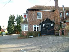
The White Hart, Charter Alley. - geograph.org.uk - 84004.jpg
The White Hart, Charter Alley.
Charter Alley is located in Hampshire
Charter Alley

 Charter Alley shown within Hampshire
District Basingstoke and Deane
Shire county Hampshire
Region South East
Country England
Sovereign state United Kingdom
Police Hampshire
Fire Hampshire
Ambulance South Central
EU Parliament South East England
UK Parliament North West Hampshire
List of places: UK • England • Hampshire

Charter Alley is a village in north east Hampshire, England. The village was originally known as West Sherbourne and then Charter Ley before becoming Charter Alley[1].

References


External links

Media related to Charter Alley at Wikimedia Commons


Wikimedia Foundation. 2010.

Игры ⚽ Нужно сделать НИР?

Look at other dictionaries:

  • Basingstoke — Coordinates: 51°16′00″N 1°05′15″W …   Wikipedia

  • Historical bus routes in Basingstoke — The town of Basingstoke in Hampshire, England, has a large bus network, providing the main public transport service there. Most services are currently run by Stagecoach in Hampshire. The network has a long history, and some routes are… …   Wikipedia

  • List of places in Hampshire — Location map+|Hampshire caption = Some of the larger settlements of Hampshire. float = right width = 400 places = Location map |Hampshire label = Winchester long = 1.31 lat = 51.06 background = white Location map |Hampshire label = Andover long …   Wikipedia

  • Newnham, Hampshire — Coordinates: 51°16′48″N 0°59′21″W / 51.279946°N 0.98928787°W / 51.279946; 0.98928787 …   Wikipedia

  • Old Basing — Coordinates: 51°16′13″N 1°02′50″W / 51.2704°N 1.0473°W / 51.2704; 1.0473 …   Wikipedia

  • Oakley, Hampshire — Coordinates: 51°15′03″N 1°10′35″W / 51.25095°N 1.17639°W / 51.25095; 1.17639 …   Wikipedia

  • Overton, Hampshire — Coordinates: 51°14′38″N 1°15′41″W / 51.2439°N 1.2615°W / 51.2439; 1.2615 …   Wikipedia

  • North Waltham, Hampshire — Coordinates: 51°12′41″N 1°11′38″W / 51.2113°N 1.1940°W / 51.2113; 1.1940 …   Wikipedia

  • Cliddesden — Coordinates: 51°14′13″N 1°05′38″W / 51.236830°N 1.0939644°W / 51.236830; 1.0939644 …   Wikipedia

  • Newtown, Hampshire — Coordinates: 51°22′21″N 1°19′04″W / 51.3724°N 1.3177°W / 51.3724; 1.3177 …   Wikipedia

Share the article and excerpts

Direct link
Do a right-click on the link above
and select “Copy Link”