- River Colne, Essex
-
This article is about the River Colne in Essex. For other uses, see River Colne.
 The River Colne near Colchester
The River Colne is a small river that runs through Colchester, England. It is not a tributary of any other river, instead having an estuary that joins the sea near Brightlingsea.
Contents
Source
The Colne's two main tributaries start near the villages of Stambourne Green and Birdbrook in Essex. These converge in Great Yeldham, and then flow through Sible Hedingham, Halstead, Earls Colne, Colne Engaine, White Colne, Chappel and Ford Street before reaching Colchester.
In Colchester
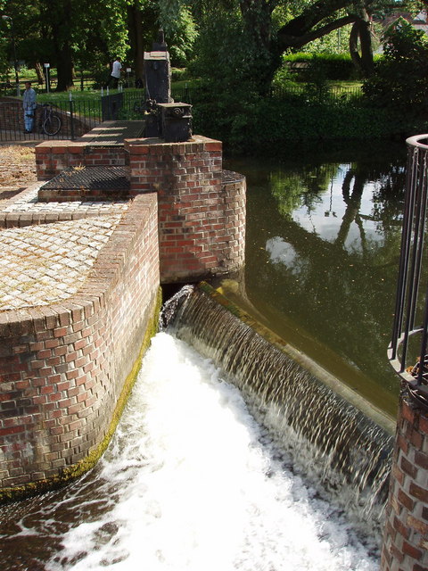
 Middlemill weir, in the centre of Colchester
The Colne Valley has a flood plain which spans approximately 300 metres by the time it enters Colchester. This area is used as pasture, as the river at this stage has no safeguards against it rising the two feet it needs to burst its banks, although it is split between two pasture areas in Spring Lane, Old Lexden. Roughly to the south of Colchester North Station, the river passes under a bridge and into a concrete-lined area that was used as an open-air bathing facility until the 1970s, and is now used by canoeists.
It then meanders under a road bridge at the bottom of North Hill, and tumbles down a weir used for discharge control at Middlemill, the site of a now-demolished mill. It forms the border of Colchester's Castle Park and the cricket ground, and footbridges cross it to provide access from the town centre to residential areas on the north side of the flood plain, which occasionally floods should the river rise too much. The river encircles one side of a small lake, and then turns south-east, and then south, before falling over a large weir and becoming tidal.
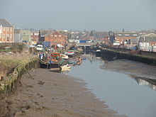
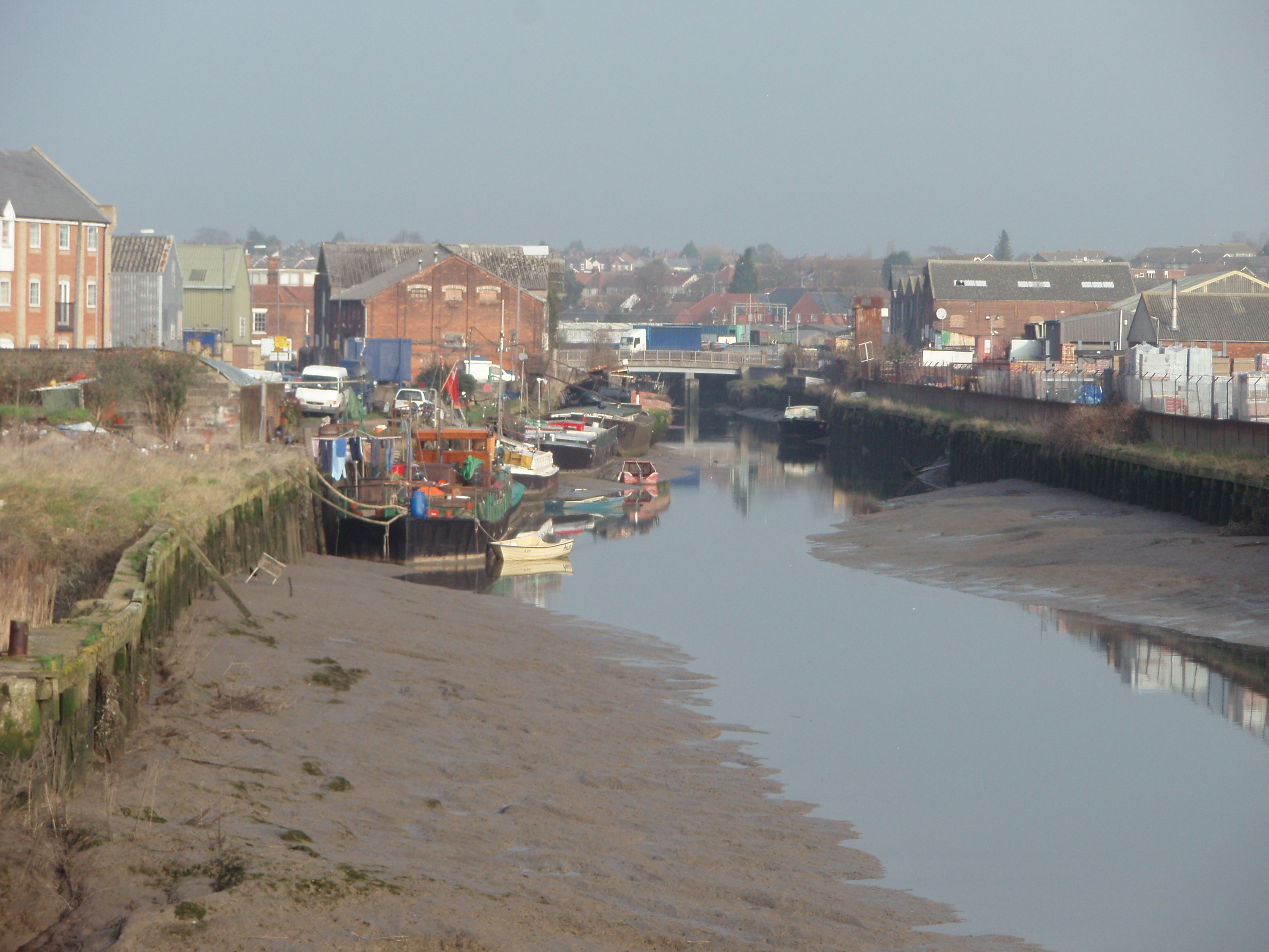
After Colchester
Beyond this point, the river shows significant mud banks at low tide, and flows through the Hythe, Rowhedge, past the University of Essex campus, and then through Wivenhoe past the tidal barrier and down to Brightlingsea. Downstream from the barrier, the Colne is marked by navigation buoys.
Situation
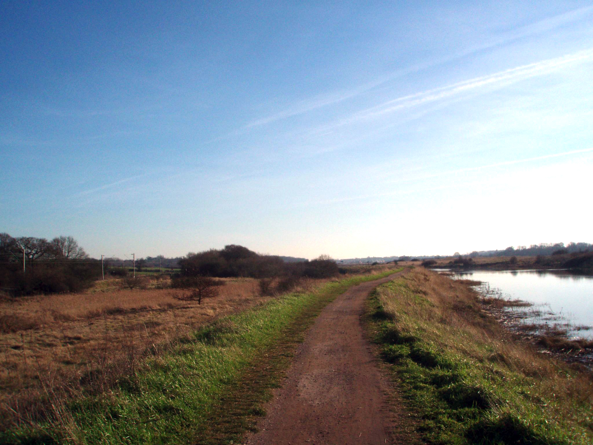
 Route 51 between Colchester and Wivenhoe
The banks of the Colne frequently incorporate Second World War pillboxes, particularly close to navigable crossings.
From Castle Park to Wivenhoe Railway Station, National Cycle Network Route 51 roughly follows the course of the Colne. This is a mixture of tarmac-surfaced shared-use paths, a short tarmac/gravel-surfaced area and, once out of the urban area of Colchester, a hard dirt path on the north levee of the river that passes the Hythe and the university all the way to Wivenhoe.
The Hythe area of Colchester, through which the Colne flows, was, from Roman times, a small port that supplied the town. However, the river is no longer deep enough to support ships large enough to make this viable, and water trade is now non-existent. Victorian-era plans to dredge the river once more ultimately failed.
External links
- Flood warning from the Environment Agency
- Flood warning from the Environment Agency
- River Colne Countryside Project
- Colne estuary partnership
Categories:- Rivers of Essex
- Estuaries of England
Wikimedia Foundation. 2010.