- Chignall Smealy
-
Coordinates: 51°46′41″N 0°24′58″E / 51.778°N 0.416°E
Chignal Smealy 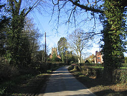
Village of Chignall Smealy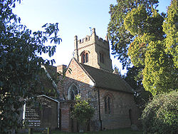
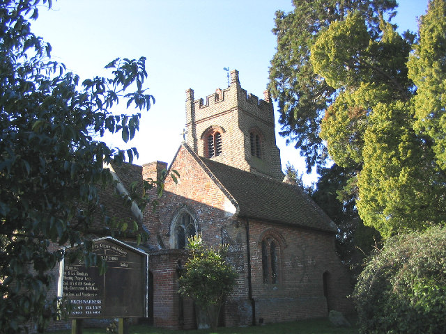
The church of St Nicholas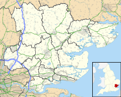
 Chignal Smealy
Chignal Smealy shown within EssexOS grid reference TL663113 District Chelmsford Shire county Essex Region East Country England Sovereign state United Kingdom Post town CHELMSFORD Postcode district CM1 Dialling code 01245 Police Essex Fire Essex Ambulance East of England EU Parliament East of England List of places: UK • England • Essex Chignal Smealy is a small village on the north-western outskirts of Chelmsford, Essex. The local church (St. Nicholas) is a red brick building, containing an unusual red brick baptismal font which has been used for many christenings.
The spelling of the village name is open to discussion. Sometimes it is spelt "Chignall Smealy" other times, it is spelt "Chignal Smealy".
Contents
The Queen's Birthday Flypast
The open views from the village give an excellent opportunity to watch the Queen's Birthday Flypast in June each year. The route is classified but in previous years the flight has been routed over the village then on to Hainault Country Park, Fairlop station and finally to the Mall. One memorable flypast over the village took place during the Queen's Golden Jubilee Weekend on 4 June, 2002. A lavish flypast 14 miles long passed overhead at a speed of 310mph, concluded by Concorde escorted by the Red Arrows.
The Village
Chignall Smealy has a number of different clubs and groups including: Bowls Club, Chignal 4 Art, Cricket Club, Gardening Club, Wine Discovery, Women's Institute.
The Pig and Whistle is a traditional rural village pub, dating back to the mid-19th century[1]http://www.shepherdneame.co.uk/pub/chelmsford/pig-whistle.aspx.
References
- ^ Cite error: Invalid
<ref>tag; no text was provided for refs namedundefined; see Help:Cite errors/Cite error references no text
http://www.shepherdneame.co.uk/pub/chelmsford/pig-whistle.aspx
External links
Contiguous with Chelmsford: Broomfield • Chelmer Village • Great Baddow • Moulsham • North Melbourne • Springfield • Widford Towns: 
Villages & Hamlets: Bicknacre • Boreham • Chalk End • Chatham Green • Chignal St James • Chignall Smealy • Cooksmill Green • Danbury • Downham • East Hanningfield • Fanner's Green • Ford End • Galleywood • Galleyend • Good Easter • Great Leighs • Great Oxney Green • Great Waltham • Highwood • Howe Green • Howe Street • Little Baddow • Little Leighs • Littley Green • Little Waltham • Margaretting • Margaretting Tye • Mashbury • Newney Green • North End • Pepper's Green • Pleshey • Ramsden Heath • Rettendon • Rettendon Place • Roxwell • Runwell • Sandon • South Hanningfield • Stock • Tye Green • West Hanningfield • Woodham Ferrers • WrittleChelmsford is the county town of Essex
List of places in EssexCategories:- Chelmsford
- Villages in Essex
- Essex geography stubs
- ^ Cite error: Invalid


Wikimedia Foundation. 2010.