- Dengie
-
Coordinates: 51°40′43″N 0°52′18″E / 51.6785°N 0.8716°E
Dengie 
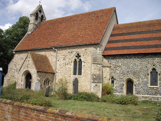
St. James Church, Dengie
 Dengie
Dengie shown within EssexPopulation 135 OS grid reference TL986016 District Maldon Shire county Essex Region East Country England Sovereign state United Kingdom Postcode district CM0 Police Essex Fire Essex Ambulance East of England EU Parliament East of England List of places: UK • England • Essex Dengie (
 /ˈdɛndʒiː/) is a village and civil parish in the Maldon district of Essex, England, with a population of 135.
It gives its name to the Dengie peninsula and hundred and to the Dengie Special Protection Area.
The 14th century church of St James is the parish Church for the village.
External links
- Information and photographs of Dengie Village
- -Click here to visit a Flickr group where anyone can upload & display their photos of the Dengie Hundred
- www.burnhamrotary.info - The Rotary Club of Burnham on Crouch & Dengie Hundred
- The history of Dengie Village
Towns: 
Villages: Althorne • Asheldham • Bradwell Waterside • Bradwell-on-Sea • Cold Norton • Creeksea • Dengie • Great Totham • Hazeleigh • Heybridge • Langford • Latchingdon • Mayland • Maylandsea • Mundon • North Fambridge • Purleigh • Snoreham • Southminster • Steeple • Stow Maries • St. Lawrence • Tillingham • Tolleshunt D'Arcy • Wickham Bishops • Woodham Mortimer • Woodham WalterMaldon is the seat of the Maldon district
List of places in EssexCategories:- Maldon (district)
- Villages in Essex
- Essex geography stubs

Wikimedia Foundation. 2010.