- CR postcode area
-
CR0, CR3, CR4 and CR8 redirect here and can also mean the control registers of the 386 and later x86 processors.
Croydon postcode area 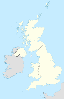
 CR
CRPostcode area CR Postcode area name Croydon Post towns 10 Postcode districts 10 Postcode sectors 58 Postcodes (live) 8,232 Postcodes (total) 13,119 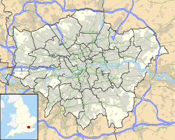 Locations in Greater London
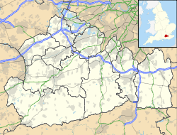 Locations in Surrey
Statistics as at October 2006 [1] The CR postcode area, also known as the Croydon postcode area,[2] is a group of nine postcode districts in England, which are subdivisions of eight post towns. The majority of these postcode districts cover part of South London, although CR3 and CR6 cover both places in South London and places in Surrey.
The main sorting office is in Croydon, and the area served includes parts of the London Borough of Croydon and the London Borough of Merton. Part of the Tandridge district of Surrey is covered by parts of the CR3 and CR6 postcode districts.
For historical reasons the code CR9 differs from all others – CR9 is allocated to specific large users rather than a geographical area.
Contents
Coverage
The approximate coverage of the postcode districts:
Postcode district Post town Coverage Local authority area CR0 CROYDON Croydon, Addiscombe, Shirley, Addington, New Addington, Forestdale, Waddon, Beddington Croydon, Sutton CR2 SOUTH CROYDON South Croydon, Sanderstead, Selsdon, Part of Addington Croydon CR3 CATERHAM Caterham Croydon, Tandridge CR3 WHYTELEAFE Whyteleafe Chaldon Woldingham Croydon, Tandridge CR4 MITCHAM Mitcham, Beddington Corner Merton, Lambeth, Sutton CR5 COULSDON Coulsdon, Parts of Chipstead and Woodmansterne Croydon, Sutton CR6 WARLINGHAM Warlingham, parts of Chelsham and Farleigh Tandridge, Croydon CR7 THORNTON HEATH(part) Thornton Heath Croydon CR8 PURLEY Purley, Kenley Croydon, Sutton CR9 CROYDON Non-geographic postcode district (located in CR0) Croydon Adjacent areas
Adjacent postcode areas SW SE 
SM  CR
CR 
BR 
KT RH TN Clockwise from the east, the adjacent postcode areas are: BR (Bromley), TN (Tonbridge), RH (Redhill), KT (Kingston upon Thames), SM (Sutton), SW (London SW), SE (London SE).
See also
References
- ^ "National Statistics Postcode Directory" (PDF). Office for National Statistics Postcode Directory (November 2006). Office for National Statistics. November 2006. http://www.statistics.gov.uk/geography/downloads/NSPDVersionNotes.pdf. Retrieved 2009-05-29.
- ^ Royal Mail, Address Management Guide, (2004)
External links
Postcode areas in the United Kingdom, Channel Islands and Isle of Man AB AL B BA BB BD BH BL BN BR BS BT BX CA CB CF CH CM CO CR CT CV CW DA DD DE DG DH DL DN DT DY E EC EH EN EX FK FY G GIR GL GU GY HA HD HG HP HR HS HU HX IG IM IP IV JE KA KT KW KY L LA LD LE LL LN LS LU M ME MK ML N NE NG NN NP NR NW OL OX PA PE PH PL PO PR RG RH RM S SA SE SG SK SL SM SN SO SP SR SS ST SW SY TA TD TF TN TQ TR TS TW UB W WA WC WD WF WN WR WS WV YO ZE
Postcode areas in London London postal district Outer areas Categories:- Postcode areas covering London
- Postcode areas covering South East England
- Media and communications in Croydon
- Media and communications in Merton


Wikimedia Foundation. 2010.