- Croydon
-
For the larger local government district, see London Borough of Croydon.For other uses, see Croydon (disambiguation).
Coordinates: 51°22′22″N 0°06′36″W / 51.3727°N 0.1099°W
Croydon 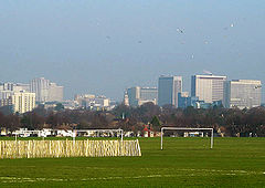
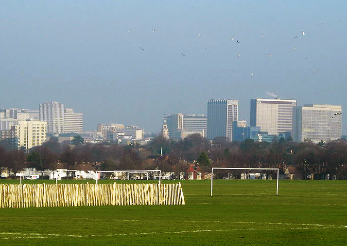
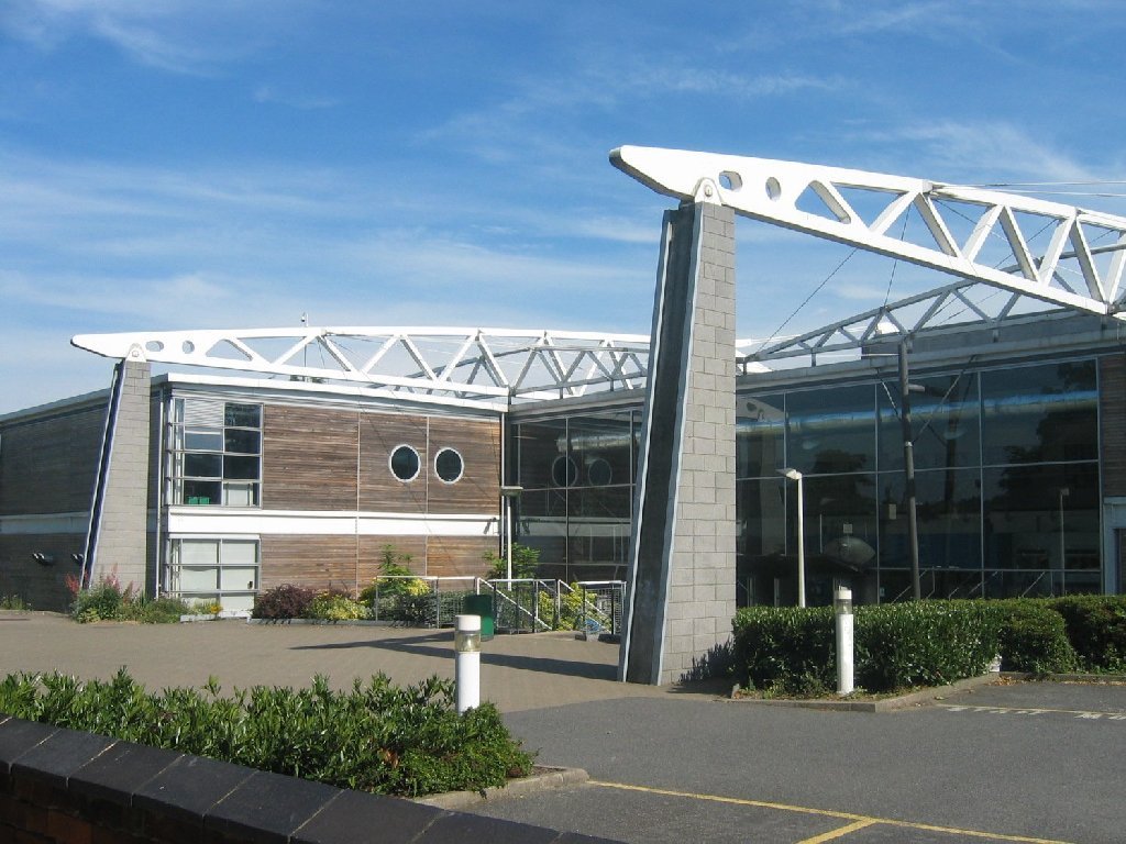
View of the Croydon town centre skyline, as seen from the Colonnades
 Croydon
Croydon shown within Greater LondonPopulation 330,587 OS grid reference TQ335655 - Charing Cross 9.5 mi (15.3 km) N London borough Croydon Ceremonial county Greater London Region London Country England Sovereign state United Kingdom Post town CROYDON, LONDON Postcode district CR0 Dialling code 020 Police Metropolitan Fire London Ambulance London EU Parliament London UK Parliament Croydon Central Croydon North Croydon South London Assembly Croydon and Sutton List of places: UK • England • London Croydon is a town in South London, England, located within the London Borough of Croydon to which it gives its name. It is situated 9.5 miles (15.3 km) south of Charing Cross. The area is identified in the London Plan as one of 11 metropolitan centres in Greater London.[1]
Croydon is located on the natural transport corridor between London and England's south coast, just to the north of two gaps in the North Downs, one followed by the route of the A23 Brighton Road from Purley to Merstham and the other followed by the A22 from Purley to the M25 Godstone interchange.
Historically a part of Surrey, at the time of the Norman conquest of England Croydon had a church, a mill and around 365 inhabitants (as recorded in the Domesday Book of 1086). Croydon expanded during the Middle Ages as a market town and a centre for charcoal production, leather tanning and brewing. The Surrey Iron Railway from Croydon to Wandsworth opened in 1803 and was the world's first public horse-drawn railway, which later developed into an important means of transport – facilitating Croydon's growth as a commuter town for the City of London and beyond. By the early 20th century, Croydon was an important industrial area, known for car manufacture, metal working and its airport. In the mid 20th century these sectors were replaced by retailing and service economy, brought about by massive redevelopment which saw the rise of office blocks and the Whitgift shopping centre. Croydon was amalgamated into Greater London in 1965. Road traffic is now diverted away from a largely pedestrianised town centre, but its main railway station, East Croydon, is still a major hub within the national railway transport system. The town is expected to have its urban planning changed as part of Croydon Vision 2020.
Contents
History
Toponymy
As the vast majority of place-names in the area are of Anglo-Saxon origin, the most likely theory is that the name Croydon derives originally from the Anglo-Saxon croh, meaning "crocus" and denu 'valley', indicating that, like Saffron Walden in Essex, it was a centre for the collection of saffron.[2]
There is an alternative if less probable theory of the origin of the name. According to John Corbett Anderson,[3] "The earliest mention of Croydon is in the joint will of Beorhtric and Aelfswth, dated about the year 962. In this Anglo-Saxon document the name is spelt (here he uses original script) Crogdaene. Crog was, and still is, the Norse or Danish word for crooked, which is expressed in Anglo-Saxon by crumb, a totally different word. From the Danish came our crook and crooked. This term accurately describes the locality; it is a crooked or winding valley; in reference to the valley that runs in an oblique and serpentine course from Godstone to Croydon." Anderson refuted a claim, originally cited by Andrew Coltee Ducarel, that the name came from the Old French for 'chalk hill', because the name was in use at least a century before the French language would have been commonly used following the Norman Invasion. However, there was no long-term Danish occupation (see Danelaw) in Surrey, which was part of Wessex, and Danish derived nomenclature is highly unlikely.
Early history
There is a plate recording a Bronze Age settlement on Croham Hurst. In addition there is evidence of a Roman settlement in the area on the London to Brighton Way Roman road, and a 5th to 6th century pagan Saxon cemetery.[citation needed]
In the late Saxon period it was the centre of a large estate belonging to the Archbishops of Canterbury. The church and the archbishops' manor house occupied the area still known as the Old Town. The archbishops used the manor house as an occasional place of residence and continued to have important links as Lords of the manor, a title originally bestowed on Archbishop Lanfranc by William the Conqueror,[2] and then as local patrons right up to the present day. Croydon appears in Domesday Book as Croindene. It was held by Archbishop Lanfranc of Canterbury. Its domesday assets were: 16 hides and 1 virgate; 1 church, 1 mill worth 5s, 38 ploughs, 8 acres (32,000 m2) of meadow, woodland worth 200 hogs. It rendered £37 10s 0d.[4]
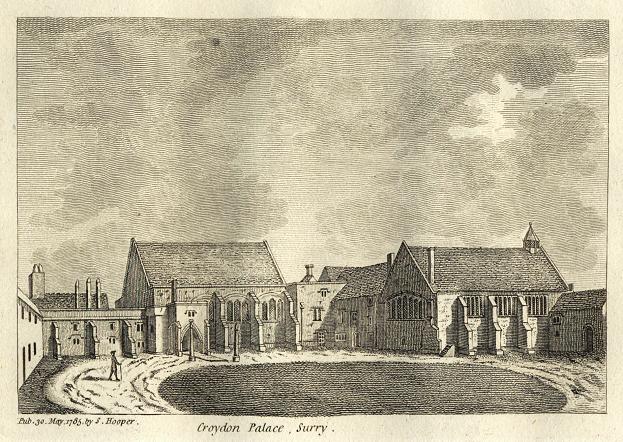
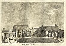 Croydon Palace in 1785
In 1276 the archbishop acquired a charter for a weekly market, and this probably marks the foundation of Croydon as an urban centre. Croydon developed into one of the main market towns of northeast Surrey. The market place was laid out on the higher ground to the east of the manor house in the triangle now bounded by High Street, Surrey Street and Crown Hill. By the 16th century the manor house had become a substantial palace used as the main summer home of the archbishops, visited by monarchs and other dignitaries. The original palace was sold in 1781, by then dilapidated and surrounded by slums and stagnant ponds, and a new residence, nearby at Addington, purchased in its place. Many of the buildings of the original Croydon Palace survive, and are in use today as Old Palace School.
The earliest record of Christian leaders in Croydon is in an Anglo-Saxon will made in about 960, witnessed by Elfsies, priest of Croydon. The Domesday Book contains the earliest written record of Croydon Church. The earliest recording of the name of the church is 6 December 1347, when it was recorded in the will of John de Croydon, fishmonger, containing a bequest to "the church of S John de Croydon". The church still bears the arms of Archbishop Courtenay and Archbishop Chicheley, presumed to be its benefactors.
Croydon Parish Church is a Perpendicular-style church, which was remodelled in 1849 but destroyed in a great fire in 1867, following which only the tower, south porch, and outer walls remained. A new church was designed by Sir George Gilbert Scott, one of the greatest architects of the Victorian age, and opened in 1870. His design loosely followed the previous layout, with knapped flint facing and many of the original features, including several important tombs. Croydon Parish Church is the burial place of six Archbishops of Canterbury including John Whitgift, Edmund Grindal, Gilbert Sheldon, William Wake, John Potter and Thomas Herring. Previously part of the Diocese of Canterbury, Croydon is now in the Diocese of Southwark. The Vicar of Croydon is an important post, in addition to the suffragan Bishop of Croydon.
Addington Palace is a Palladian-style mansion between Addington Village and Shirley, surrounded by park landscapes and golf courses, within the boundaries of Croydon. After an Act of Parliament enabled the mansion to be purchased for the Archbishops of Canterbury in 1807, it became the official residence of six Archbishops until it was sold in 1898. In 1953 it was leased to the Royal School of Church Music until 1996, when it was leased to a private company that developed it as a conference and banqueting venue, with plans for a health farm and country club. The grounds were landscaped by Capability Brown and are mainly a golf course and public park. A famous very large cedar tree stands next to the Palace.
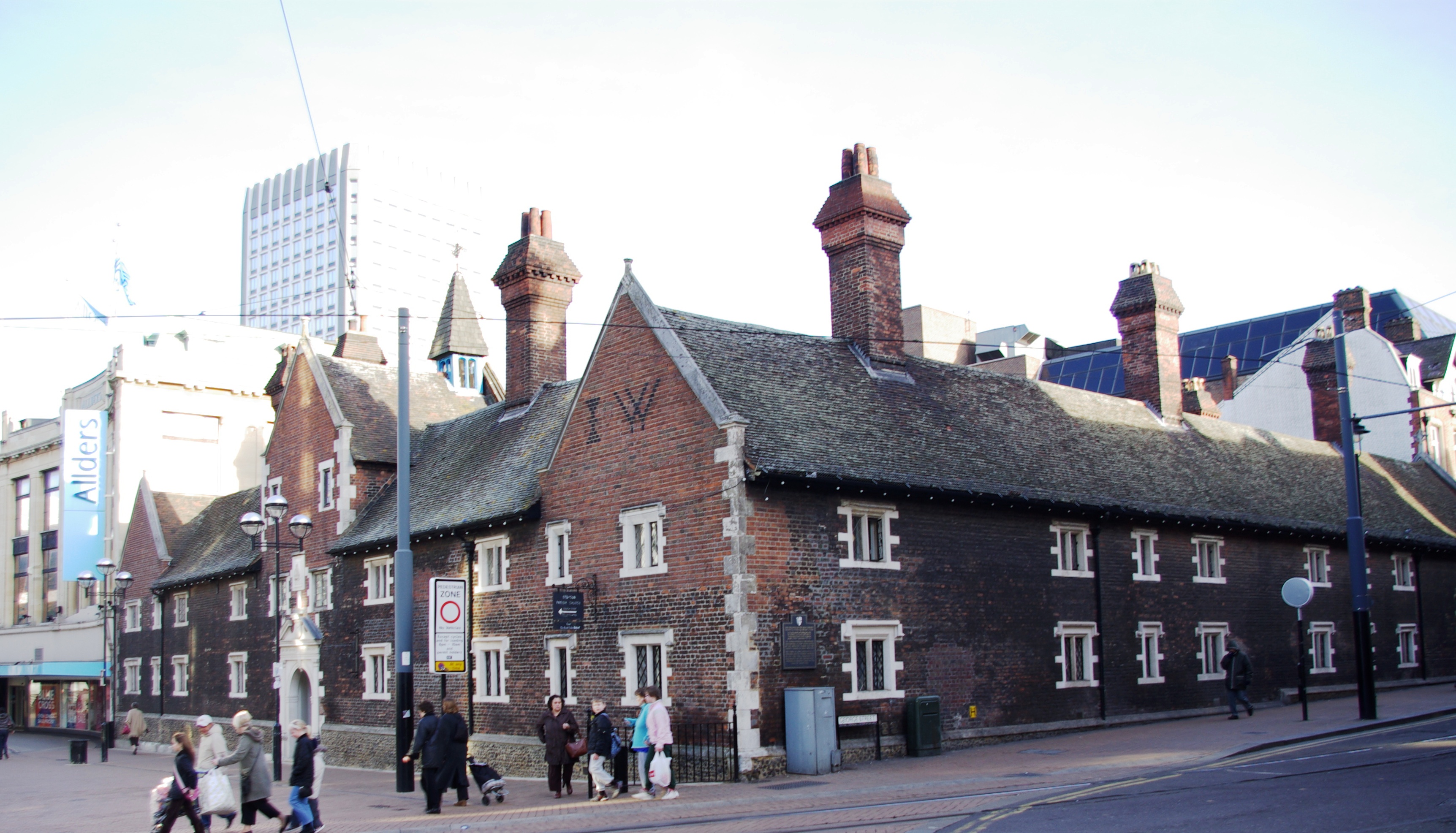
 The "Whitgift Hospital" almshouses in the centre of Croydon
The Elizabethan Whitgift Almshouses, named the "Hospital of the Holy Trinity", have stood in the centre of Croydon (at the corner of North End and George Street) since they were erected by Archbishop John Whitgift. He had petitioned for and had received permission from Queen Elizabeth I to establish a hospital and school in Croydon for the "poor, needy and impotent people" from the parishes of Croydon and Lambeth. The foundation stone was laid in 1596 and the building was completed in 1599.
The premises included the actual Hospital or Almshouses, providing accommodation for between 28 and 40 people, and a nearby schoolhouse and schoolmaster's house. There was a Warden in charge for the well-being of the almoners. The building is constructed with the chambers of the almoners and various offices surrounding an inner courtyard.
Threatened by various reconstruction plans and road-widening schemes, the Almshouses were saved in 1923 by intervention of the House of Lords. On 21 June 1983 Queen Elizabeth II visited the almshouses and unveiled a plaque celebrating the recently completed reconstruction of the building. On 22 March each year the laying of the foundation stone is commemorated as Founder's Day.
Industrial Revolution and the railway
The development of Brighton as a fashionable resort in the 1780s increased Croydon's role as a significant halt for stage coaches on the road south of London. At the beginning of the 19th century, Croydon became the terminus of two pioneering commercial transport links with London. The first, opened in 1803, was the horse-drawn Surrey Iron Railway from Wandsworth, which in 1805 was extended to Merstham, as the Croydon, Merstham and Godstone Railway. The second, opened in 1809, was the Croydon Canal, which branched off the Grand Surrey Canal at Deptford. The London and Croydon Railway (an atmospheric and steam-powered railway), opened between London Bridge and West Croydon in 1839, using much of the route of the canal (which had closed in 1836), and other connections to London and the south followed.
The arrival of the railways and other communications advances in the 19th century led to a 23-fold increase in Croydon's population between 1801 and 1901.[2] This rapid expansion of the town led to considerable health problems, especially in the damp and overcrowded working class district of the Old Town. In response to this, in 1849 Croydon became one of the first towns in the country to acquire a Local Board of Health. The Board constructed public health infrastructure including a reservoir, and water supply network, and sewers, a pumping station, and sewage disposal works.
A growing town
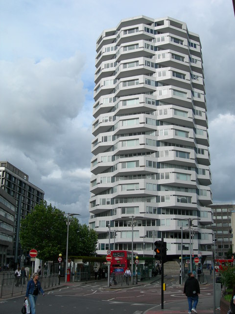
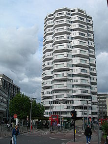 The growing town attracted many new buildings to be built including No.1 Croydon, formerly the NLA Tower.[5][6]
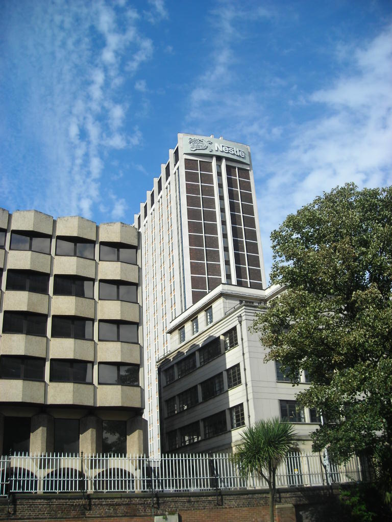
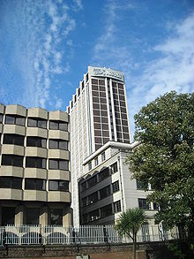 H.Q. of Nestlé U.K
As the town continued to grow it became especially popular as a pleasant leafy residential suburb for members of the Victorian middle classes, who could commute to the City of London by fast train in 15 minutes. In 1883 Croydon was incorporated as a borough. In 1889 it became a county borough, with a still greater degree of autonomy. The new county borough council implemented the Croydon Improvement scheme in the early 1890s, which resulted in the widening of the High Street and the clearance of much of the 'Middle Row' slum area. The remaining slums were cleared shortly after World War II, with much of the population relocated to the isolated new community at New Addington. New stores opened and expanded in central Croydon, including Allders, Kennards and Grants, and the first Sainsbury's self-service shop in the country.[2] There was also a bustling market on Surrey Street.[7]
Croydon became the location of London's main airport until the second world war. During the war, much of central Croydon was destroyed by German strategic bombing and attacks by V-1 flying bombs and V-2 rockets, and for many years the town bore the scars of the destruction. After the war, Heathrow Airport superseded Croydon Airport as London's main airport.
By the 1950s, with its continuing growth, the town was becoming congested, and the Council decided to introduce another major redevelopment scheme. The Croydon Corporation Act was passed in 1956. This, coupled with government incentives for office relocation out of London, led to the building of new offices and accompanying road schemes through the late 1950s and 1960s, and the town boomed as an important business centre in the 1960s, with the building of a large number of multi-storey office blocks, an underpass, a flyover and multi-storey car parks. In 1960 Croydon celebrated its' millenium with an exhibition held at Croydon Aerodrome.
Modern Croydon
See also: Economy of CroydonIn more modern times Croydon has developed an important centre for shopping, with the construction of the Whitgift Centre, which opened in 1969. The Fairfield Halls arts centre and event venue opened in 1962. The Warehouse Theatre opened in 1977. The 1990s saw further changes intended to give the town a more attractive image. These include the closure of North End to vehicles in 1989 and the opening of the Croydon Clocktower arts centre in 1994. Tramlink began operation in May 2000. A new equally large shopping centre, Centrale, opened in 2004 opposite the Whitgift Centre, straddling the site of the smaller Drummond Centre and what was once a large branch of C&A. There are plans for a large new shopping centre, Park Place, which will replace most of the eastern edge of the shopping district including St George's Walk; the redevelopment of the Croydon Gateway site; and extensions of Tramlink to Purley, Streatham, Lewisham and Crystal Palace. Croydon has become the second-largest place to shop in the south east, after central London, offering a wide range of shops and department stores. Notable independent traders include House of Reeves, a two-outlet furniture store established in 1867.[8] One of their stores was razed to the ground by an arson attack during a civil disturbance on 8 August 2011.[8] It is home to many high density buildings such as the Nestlé Tower, being London's third main CBD, after the Square Mile and the Docklands and South London's main business centre. The Croydon area is served by various hospitals of which the main one is Croydon University Hospital in London Road. The Mayor of London, Boris Johnson, said he would support Croydon becoming an official city.[9]
Governance
For centuries the area lay within the Wallington hundred, an ancient Anglo-Saxon administrative division of the county of Surrey.[10] Croydon was created a municipal borough of Surrey in 1883. In 1889, through its growing economic importance, it was made a county borough exempt from county administration. In 1965 the County Borough of Croydon was abolished and its former area was transferred to Greater London and combined with that of the Coulsdon and Purley Urban District to form the present-day London Borough of Croydon.
Most of the area lies within the Addiscombe and Fairfield wards, which form part of the Croydon Central constituency.[11] The rest of the town is in the Croham ward, which is part of Croydon South. These wards are all in the local authority of Croydon, which has the responsibility for providing services such as education, refuse collection, and tourism. The Addiscombe ward is currently represented by Councillors Russell Jackson, Andrew Price, and Maria Garcia de la Huerta, members of the Conservative Party. The Fairfield and Croham wards also brought back Conservatives, leaving the area represented only by Conservatives at council level.[12] Labour lost the seat that it had in Addiscombe in the 2006 local elections. The area also forms part of the London constituency of the European Parliament. The sitting Member of Parliament for Croydon Central is Gavin Barwell, a member of the Conservative Party. The sitting Member of Parliament for Croydon South is Richard Ottaway, who is also a member of the Conservatives.
The police service is provided by the Metropolitan Police with Croydon Police Station on Park Lane next to Croydon College.[13] The London Fire Brigade provide services for the area and Greater London as a whole. The nearest fire station is in Old Town, which has only two pumping appliance.
Geography
Neighbouring areas 
Thornton Heath Selhurst Addiscombe Beddington & Mitcham 
Shirley  Croydon

Waddon South Croydon Selsdon Croydon is situated in the centre of the borough of Croydon. To the south are the North Downs, which stretch to the white cliffs of Dover in Kent, as well as parts of Surrey and the south coast. The Pilgrims' Way path is to the south of Croydon.
The town is bordered by Selhurst and South Norwood to the north, which are both part of the same borough; South Croydon to the south; Shirley due east and Beddington in the borough of Sutton to the west. The northernmost point of Croydon is at the junction with Northcote Road and Whitehorse Road where there are a community centre and a few retail shops, overlapping with Selhurst and Broad Green. The postcode area that covers most of Croydon is CR0, which forms part of the CR postcode area. The CR postcode was created especially for Croydon and its surrounding areas.
Croydon is split up by a number of different areas in the same borough. Fairfield, Broad Green, West Croydon and South Croydon make up the rest of Croydon, but are known as separate areas in their own right. The most prominent of these towns is South Croydon, which has become a town of its own, with various shops and its own high street. It is essentially a dormitory suburb for Croydon and Central London. The street South End is the prominent main road in South Croydon and continues northward as High Street, Croydon and southward as Brighton Road.
The town is split in the middle with a rough line from west to east along Wellesley Road on the A212 road. This type of urban planning has been discouraged recently by the London Plan and there have been a number of proposals to ease the relation between East Croydon station and the town centre of Croydon. Croydon Vision 2020 aims to solve that problem and make the whole road easier for pedestrians by creating a centre island pathway.
Culture
Arts
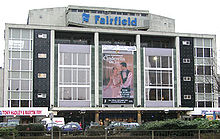 The Fairfield Halls, Croydon's entertainment complex
 The BRIT School
There are several arts venues. Foremost amongst these is the Fairfield Halls, opened in 1962, which consists of a large concert hall frequently used for BBC recordings, the Ashcroft Theatre and the Arnhem Gallery. Fairfield is the home of the London Mozart Players, whose Principal Guest Conductor is flautist Sir James Galway. Many famous faces have appeared at the Fairfield Halls, from the Beatles through Bucks Fizz, Omid Djalili, Robert Cray, JLS, Chuck Berry, BB King, Don McLean, The Monkees, Johnny Cash, Dionne Warwick, Gladys Knight, Tom Jones, The Stylistics, Status Quo, Level 42, A-HA, John Mayall, Jools Holland, Kenny Rogers, James Last to Coolio. The main concert hall was used for the conference scene in the Tom Hanks film The Da Vinci Code.
The Warehouse Theatre is a studio theatre known for promoting new writing, as well as comedy and youth theatre. Croydon Clocktower, built by the London Borough of Croydon in the mid-1990s, houses a state-of-the-art library, the David Lean cinema, a performance venue in the old reference library and the town museum. The Pembroke Theatre had many productions with well known actors before its closure in about 1962.
There are several local and small venues for comedy and community events dotted around Croydon and its neighbourhoods. Croydon Youth Theatre Organisation celebrated its 40th birthday in 2005. There are several community arts groups, particularly in the large Asian community. There are controversial plans to develop an arena for entertainment and sporting events at the Croydon Gateway site.
A calendar titled "Rare Roundabouts of Croydon", with a picture of a different Croydon roundabout each month, has enjoyed some success.[14]
Literature
Croydon is the setting of two poems by British Poet Laureate Sir John Betjeman, "Croydon" and "Love in a Valley".
The borough has been the residence of many renowned authors and novelists, including Sir Arthur Conan Doyle who set up house in Norwood, D. H. Lawrence, and French novelist Emile Zola who lived for a time in the Queen's Hotel, South Norwood. Cicely Mary Barker, author and illustrator of the Flower Fairies series of books, was born in Croydon.
Croydon is the setting of many novels. The now defunct airport lent itself to the mysteries, The 12.30 from Croydon and Death in the Clouds, and the town is mentioned in some Sherlock Holmes mysteries.
Music
Croydon has been at the centre of the development of the dubstep genre, a relatively recent musical development that traces its roots from Jamaican dub music, UK Garage and drum and bass. Artists such as Benga and Skream, who honed their production and DJing skills whilst working at the now defunct Big Apple Records on Surrey Street, along with Norwood's Digital Mystikz, DJ Chef, Timi Korus and Thornton Heath's Plastician, form the core roster of dubstep DJs and producers.
Croydon also has a thriving rock scene producing such local talent as 5th Man Down, Frankmusik and Noisettes. Local venues for live music include the Black Sheep Bar, The Ship, The Green Dragon, The Brief, The George, and The Scream Lounge.
In addition to the Fairfield Halls, there have been several notable venues in Croydon that have hosted major established national and international rock acts - established in 1976, The Cartoon was a very popular live music venue, but closed its doors for the final time in November 2006. The Greyhound in Park Lane (in the site within the Nestle complex currently occupied by the Blue Orchid) played host to acts such as Led Zeppelin, Jimi Hendrix, The Who, David Bowie, Queen, Siouxsie and the Banshees, The Damned, The Boomtown Rats, A-ha in (1987) and many others during the 1960s and 1970s. The Fox and Hounds Pub saw the debut of the Electric Light Orchestra on 15 April 1972.[15]
The composer Samuel Coleridge-Taylor (1875–1912) lived at 30 Dagnall Park, Selhurst, until his death. He grew up in Croydon and sang in the church choir at St George's and taught at the Crystal Palace and many other schools of music. He died from pneumonia after collapsing at West Croydon station. There is an impressive grave with a touching poem at Bandon Hill Cemetery, as well as exhibits about him in the Clock Tower Museum, Katharine Street.
The town centre was for 30 years home to Europe's largest second-hand record store, Beanos, offering rare vinyl, CDs and books. In November 2008, it was announced that Beanos would close. The premises (off Church Street near the Grants cinema complex) are to become a "market place" with stalls for rent by small business and individuals.[16][17]
Croydon is home to the BRIT School for performing arts and technology, based in Selhurst, which has produced stars such as Adele, Katie Melua, Amy Winehouse, Leona Lewis, Katy B, Imogen Heap, Dane Bowers and members of The Feeling & The Kooks.
Media
Croydon also plays host to the filming of the popular Channel 4 show, Peep Show. Croydon is also home to several video game developers, including Crawfish. The ITV police drama The Bill, although it was set in East London, was filmed in Croydon and many of the town centre locations were filmed around Surrey Street and St George's House (the Nestle Building). Sun Hill Police station is situated in nearby Mitcham. In 2007, the music video for pop star Mika's single Big Girl (You Are Beautiful) was filmed in various locations around the town, including the High Street and Surrey Street Market. Croydon was also revealed to be the true birthplace of Phillip the "African Prince" in the 1980 film version of Rising Damp.[18] (Don Warrington revealed in Britains 50 Best Sitcoms on Channel 4, that this fact was actually supposed to be revealed in the TV Series, but that the death of Richard Beckinsale meant that this was not possible). The opening credits for the sitcom Terry and June featured the eponymous stars walking around the Whitgift Centre and the Fairfield Halls area. Croydon also has its own fully independent television station. It does not receive any government or local authority grant or funding and is supported by donations, spornsorship and by commercial advertising.[19]
Transport
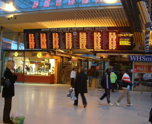
 The inside concourse of East Croydon station
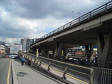 Croydon Flyover
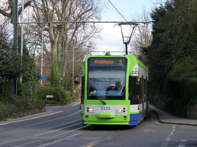
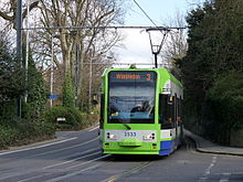 A Tram near East Croydon
The River Wandle is a major tributary of the River Thames, where it stretches to Wandsworth and Putney for 9 miles (14 km) from its main source in Croydon. It forms a rough western boundary with the London Borough of Sutton, and for part of its length forms the boundary between the London Boroughs of Croydon and Lambeth. The main river ends near Croydon with one of its tributaries ending in Selhurst. Just to the south of Croydon is a significant gap in the North Downs, which acts as a route focus for transport from London to the south coast. The old London to Brighton road used to pass through the town on North End before it was shut off to motor traffic. The A23 now bypasses the centre of the town and follows Purley Way, to the west of the area, instead.
- Buses
Transport for London operates a variety of buses in and around Croydon. Most buses serve the West Croydon bus station, which is next to the rail and tram stop. Buses from Croydon serve destinations such as Heathrow Airport, Norwood, New Addington, Purley, Lewisham, Penge, Mitcham, Norbury and Bromley.
- Rail
The Brighton Main Line railway route south from Croydon links the town to Sussex, Surrey, and Kent and to Central London to the north: providing direct services to Hastings, Southampton, Brighton, Portsmouth, Gatwick Airport, Bedford and Luton. The main station for all these services is East Croydon station in the east part of the town centre. East Croydon station is the largest and busiest railway station in Croydon and the third busiest in London, excluding those in Travelcard Zone 1.
West Croydon station serves all trains travelling west except the fastest. The East London Line, operated by London Overground opened in May 2010 reaching destinations such as Surrey Quays, Shoreditch, Dalston and Highbury (from 2011) serves West Croydon. The East London Line Extension will be a major contribution to London's transport infrastructure in time for the Olympic and Paralympic Games to be held in the capital in 2012. There are currently no plans for any London Underground services to be extended to Croydon, mainly due to the East London Line extension and the promise of extended the Tramlink network. There are also more regional stations scattered around the borough. Passenger rail services through Croydon are provided by Southern and First Capital Connect.[20]
- Tramlink
The light rail system Tramlink (Operated by Tramtrack Croydon, a wholly owned subsidiary of Transport for London),[21] opened in 2000, and Croydon serves as its main hub. Its network consists of three lines, from Elmers End to West Croydon, from Beckenham to West Croydon, and from New Addington to Wimbledon, with all three lines running via the Croydon loop on which it is centred. It has been highly successful, environmentally friendly and a reliable light rail system carrying around 22 million passengers a year. It is also the only tram system in London but there is another light rail system in the Docklands. It serves Mitcham, Woodside, Addiscombe and the Purley Way retail and industrial area amongst others. An extension to Crystal Palace is currently on hold. Other possible extensions include Sutton, a new park and ride close to the M25, Coulsdon, Purley, Kingston upon Thames, Tolworth, Tooting, Brixton, Bromley and Lewisham for an interchange with the Docklands Light Railway. If the Cross River Tram was still being planned for construction, it may have had an interchange at Brixton, but those plans have since been cancelled.
Croydon's early transport links
The horse-drawn Surrey Iron Railway was the world's first public railway. It was opened in 1803, had double track, was some 8.5 miles (13.7 km) long and ran from Wandsworth to Croydon, at what is now Reeves Corner. In 1805, it was extended to Merstham as the Croydon, Merstham, and Godstone Railway. The railway boom of the 1840s brought superior and faster steam lines and it closed in 1846. The route is followed in part by the modern Tramlink. The last remaining sections of rail can be seen behind railings in a corner of Rotary Field in Purley. With the opening of the London, Brighton and South Coast Railway line to London Victoria in 1860, extra platforms were provided that the LBSCR treated as part of a separate station named New Croydon. The South Eastern Railway (SER) was excluded from this station, which ran exclusively LBSCR services to London at fares cheaper than those the SER offered from the original station.[22] In 1864, the LBSCR obtained authorisation to construct a ½-mile long branch line into the heart of the town centre near Katharine Street where Croydon Central station was built. The new line opened in 1868 but enjoyed little success and closed in 1871, only to reopen in 1886 under pressure from the Town Council before finally closing in 1890. The station was subsequently demolished and replaced by the new Town Hall.[23] In 1897-98, East Croydon and New Croydon stations were merged into a single station equipped with three island platforms, which remain today. Even so, the two stations kept separate booking accounts until 1924.[22]
The Croydon Canal ran for 9.5 miles (15.3 km) from what is now West Croydon station. It travelled north to largely along the course of the present railway line to New Cross Gate, where it joined the Grand Surrey Canal and went on into the Thames. It opened in 1809 and had 28 locks. It had a strong competitor in the Surrey Iron Railway and was never a financial success. It sold out to the London & Croydon Railway in 1836. The lake at South Norwood is the former reservoir for the canal.
Croydon Airport on Purley Way was the main international airport for London until it was superseded by London Heathrow Airport and London Gatwick Airport. Starting out during World War I as an airfield for protection against Zeppelins, and developing into one of the great airports of the world during the 1920s and 1930s, it welcomed the world's pioneer aviators in its heyday. As aviation technology progressed, however, and aircraft became larger and more numerous, it was recognized in 1952 that the airport would be too small to cope with increasing air traffic. The last scheduled flight departed on 30 September 1959. The air terminal, now known as Airport House, has been restored and has a museum open one day a month.
Education
The town is home to Croydon College, with its main site on Park Lane and College Road near East Croydon railway station. It currently has over 13,000 students attending one of its three sub-colleges.[24] The sub-colleges were created in 2007 to allow for more students to be catered for and to ensure that the courses on offer, the style of teaching and the way the college is run are right for the students that attend each college. The three colleges that were created by the action are the Croydon Sixth Form College, Croydon Skills and Enterprise College and the Croydon Higher Education College. The Higher Education College offers university-level education in a range of subjects from Law through to Fine Art. Croydon Skills and Enterprise College delivers training and education opportunities that have been designed to meet the various needs of businesses of all sizes, across different sectors within London and the south east.
See also
- List of people from Croydon
- List of schools in Croydon
Notes
- Croydon Observatory Borough Profile,Ethnicity Census Figures by Ward. (Population of Fairfield ward 2001 at the census is 14085 ) Accessed January 2011.
References
- ^ Mayor of London (February 2008). "London Plan (Consolidated with Alterations since 2004)". Greater London Authority. http://www.london.gov.uk/thelondonplan/docs/londonplan08.pdf.
- ^ a b c d Ayto, John; Ian Crofton (2005). Brewer's Britain and Ireland. Weidenfeld & Nicolson. ISBN 0-304-35385-X.
- ^ Corbett Anderson, John; Ian Crofton (1882). A Short Chronicle Concerning the Parish of Croydon. London: Reeves and Turner. pp. 19–20. ISBN 0-304-35385-X. Republished in 1970 by SR Publishers, East Ardsley, Wakefield
- ^ Surrey Domesday Book
- ^ Looking Out For No1 (from Croydon Guardian)
- ^ State of the art refurbishment
- ^ http://www.surreystreetmarket.com/
- ^ a b "Family's Croydon furniture store destroyed in riots". The Independent. http://www.independent.co.uk/news/uk/crime/familys-croydon-furniture-store-destroyed-in-riots-2334330.html. Retrieved 9 August 2011.
- ^ http://yourlocalguardian.co.uk/news/3557069.Exclusive__Boris_backs_Croydon_city_bid/
- ^ "An 1868 Gazetteer description of Croydon". UK and Ireland Genealogy. 2003. http://homepages.gold.ac.uk/genuki/SRY/Croydon/WholeGaz1868.html. Retrieved 2008-07-17.
- ^ "London Borough of Croydon map of wards". Croydon Council. 2006. Archived from the original on 2008-06-27. http://web.archive.org/web/20080627171929/http://www.croydon.gov.uk/content/departments/570770/570872/wardmap.pdf. Retrieved 2008-07-18.
- ^ "Who are my councillors?". Croydon Council. http://www.croydon.gov.uk/democracy/elected/allcouncillors/. Retrieved 2008-07-11.
- ^ "Metropolitan Police: Croydon Police Station". Metropolitan Police. 2007. http://cms.met.police.uk/met/boroughs/croydon/09contact_us/index. Retrieved 2008-07-18.
- ^ BBC News - Roundabout calendar is gift hit
- ^ Whalley, Kirsty (15 September 2010). "ELO man dies". Croydon Guardian (Newsquest Media Group): p. 15.
- ^ http://news.bbc.co.uk/2/hi/business/6214278.stm Beanos closing down
- ^ http://www.beanos.co.uk/ Beanos announcing closing down sales
- ^ http://www.leonardrossiter.com/risingdamp/StoryPlay.html Croydon Phillip's birthplace
- ^ http://www.croydontv.co.uk/
- ^ "UK rail network map". National Rail website. National Rail. 2006. http://www.nationalrail.co.uk/system/galleries/download/print_maps/Nat_Rail_Passenger_Operators_2006.pdf. Retrieved 2008-05-25.
- ^ "TfL announces plans to take over Tramlink services". 2008-03-17. Archived from the original on 2008-04-12. http://web.archive.org/web/20080412011803/http://www.tfl.gov.uk/corporate/media/newscentre/archive/7741.aspx. Retrieved 2008-05-24.
- ^ a b White, H.P., op. cit. p. 79.
- ^ Treby, E., op. cit. p. 106.
- ^ "About Croydon College". 2007. http://www.croydon.ac.uk/about_us.html. Retrieved 2008-07-18.
External links
List of places in London Major districts Abbey Wood · Acton · Barking · Barnes · Barnet · Barnsbury · Battersea · Beckenham · Bermondsey · Bethnal Green · Bexleyheath · Bloomsbury · Bow · Brentford · Brixton · Brockley · Bromley · Camberwell · Camden Town · Canonbury · Carshalton · Catford · Charlton · Chelsea · Chessington · Chingford · Chislehurst · Chiswick · City · Clapham · Clerkenwell · Cricklewood · Coulsdon · Croydon · Dagenham · Deptford · Ealing · East Ham · Edmonton · Eltham · Enfield Town · Erith · Feltham · Finchley · Forest Hill · Forest Gate · Fulham · Greenwich · Hackney · Hammersmith · Hampstead · Harrow · Hendon · Highams Park · Highbury · Highgate · Hillingdon · Holborn · Hook · Holloway · Hornchurch · Hounslow · Ilford · Isle of Dogs · Isleworth · Islington · Kensington · Kentish Town · Kensal Green · Kilburn · Kingston upon Thames · Lambeth · Lewisham · Leyton · Marylebone · Mayfair · Mitcham · Morden · Muswell Hill · New Cross · New Malden · Orpington · Paddington · Peckham · Penge · Pinner · Poplar · Purley · Putney · Richmond · Romford · Ruislip · Shepherd's Bush · Shoreditch · Sidcup · Soho · Southall · Southgate · South Norwood · Southwark · Stepney · Stoke Newington · Stratford · Streatham · Surbiton · Sutton · Sydenham · Teddington · Thamesmead · Tolworth · Tooting · Tottenham · Twickenham · Upminster · Upper Clapton · Uxbridge · Walthamstow · Wandsworth · Wanstead · Wapping · Wealdstone · Welling · Wembley · West Ham · Westminster · West Norwood · Whitechapel · Willesden · Wimbledon · Wood Green · Woodford · Woolwich
Barking and Dagenham · Barnet · Bexley · Brent · Bromley · Camden · Croydon · Ealing · Enfield · Greenwich · Hackney · Hammersmith and Fulham · Haringey · Harrow · Havering · Hillingdon · Hounslow · Islington · Kensington and Chelsea · Kingston · Lambeth · Lewisham · Merton · Newham · Redbridge · Richmond · Southwark · Sutton · Tower Hamlets · Waltham Forest · Wandsworth · Westminster
Categories:- Districts of London
- Districts of Croydon
- Metropolitan centres of London
- Market towns in London
- Districts of London listed in the Domesday Book
- Turkish communities in the United Kingdom


Wikimedia Foundation. 2010.