- Nestlé Tower
-
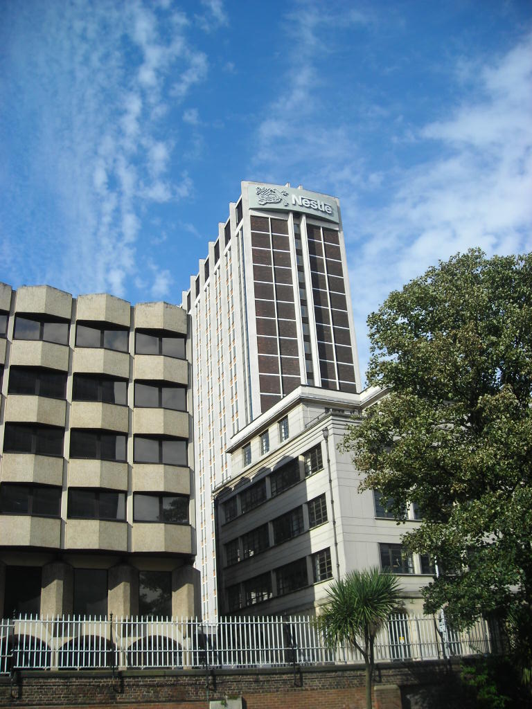
Nestlé Tower 
The Nestlé TowerGeneral information Town or city Croydon, London Country  United Kingdom
Completed 1964 Design and construction Client Nestlé S.A. Architect Ronald Ward and Partners The Nestlé Tower (or St George's House) is a skyscraper located in Croydon, United Kingdom occupied by the multinational food and consumer goods company Nestlé S.A. as their UK headquarters[1] (the world headquarters being in Vevey, Switzerland). Nestlé is the single most powerful company to have headquarters in Croydon, however until 2009 this was AIG who relocated from the No.1 Croydon that year. It was designed by architects Ronald Ward and Partners, who later designed Millbank Tower, and it was completed in 1964. The site is on the 'urban motorway' of Wellesley Road above the Croydon Underpass and next to Croydon Council's offices in Taberner House, Croydon College, and the theatre and performance space of the Fairfield Halls and the Ashcroft Theatre. In recent years, the development of tall buildings has been encouraged in the London Plan, which will lead to the erection of new skyscrapers over the next few years as London goes through a high-rise boom.[2] This means that more skyscrapers including the planned Wellesley Square will go up around the town. As part of the Park Place development, the tower is part of the Croydon Vision 2020 regeneration plan for the London Borough of Croydon to add to its goal of being London's Third City.
Contents
Transport links
The Nestlé Tower is located in Croydon and has various transport links nearby. George Street tram stop is the closest Tramlink station to the offices. From here there are services to Wimbledon station on route 3 for connections to the London Underground, and on route 1 and 2 services terminate at West Croydon station for trains to Sutton and slow trains to Central London as well as London Overground services from 2010. There are also tram services from East Croydon to New Addington, Elmers End and Beckenham.There is also a bus station at West Croydon with buses on the northbound corridor and the rest of the borough. East Croydon station, the main railway station in the borough, is also close by. The station provides mainline services from Southern and First Capital Connect. These train operating companies provide services to Brighton and the South Coast, Bedford, Luton, Luton Airport, Gatwick Airport and fast services to Victoria and London Bridge. a short walk from Victoria is Victoria Coach Station which provide's coach services to the rest of the United Kingdom
See also
References
- ^ "Location of Nestlé offices in the UK and EIRE". Nestlé. 2008. Archived from the original on 2008-02-21. http://web.archive.org/web/20080221175607/http://www.nestle.co.uk/AboutNestle/NestleLocations/. Retrieved 2008-03-15.
- ^ "London - Full Summary of Projects". Will Fox, SkyscraperCity.com. http://www.skyscrapernews.com/buildings.php?id=46. Retrieved 2006-12-15.
the building is 78 metres tall and the 3rd tallest in multicultural croydon
External links
- Nestlé UK
- Nestlé Locations
- Guardian article on Millbank Tower and St George's House architects Ronald Ward and Partners
Buildings and structures in Croydon Highrises 100 George Street · Altitude 25 · Apollo House (Croydon) · Central One · Cherry Orchard Road Towers · Croydon Tower · Croydon transmitting station · Croydon Vocational Tower · Direct Line House · IYLO · Lunar House · Nestlé Tower · No.1 Croydon · Prudential House · Ruskin Square · Saffron Square · Taberner House · Wettern House
Notable lowrises Addington Palace · Airport House · Ashcroft Theatre · Bridge House · BRIT School · Croydon College · Croydon Clocktower (David Lean Cinema • Museum of Croydon • Croydon Central Library) · Cane Hill · Old Palace · Croydon Minster · Fairfield Halls · Grants · John Ruskin College · Croydon University Hospital · RAF Kenley · Ruskin House · Safari Cinema · The Exchange · Trinity School of John Whitgift · Warehouse Theatre
Major railway stations Major complexes Sports venues Croydon Arena · Croydon Sports Arena · Croydon Water Palace · Selhurst Park
Categories:- Croydon 2020
- Skyscrapers in Croydon
- Buildings and structures in Croydon
Wikimedia Foundation. 2010.