- Upper Norwood
-
Coordinates: 51°25′11″N 0°05′16″W / 51.4196°N 0.0877°W
Upper Norwood 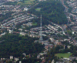
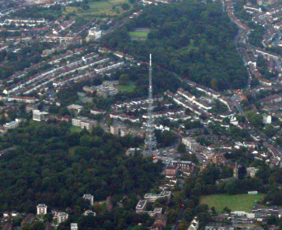
Upper Norwood from the Air
 Upper Norwood
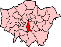
Upper Norwood shown within Greater LondonOS grid reference TQ329707 London borough Croydon Lambeth Bromley Ceremonial county Greater London Region London Country England Sovereign state United Kingdom Post town LONDON Postcode district SE19 Dialling code 020 Police Metropolitan Fire London Ambulance London EU Parliament London UK Parliament Croydon North Dulwich and West Norwood London Assembly Croydon and Sutton Lambeth and Southwark Bexley and Bromley List of places: UK • England • London Upper Norwood is an elevated area in south London, England within the postcode SE19. It is a residential district largely in the London Borough of Croydon although some parts extend into the London Borough of Lambeth, London Borough of Southwark and the London Borough of Bromley. Upper Norwood borders West Norwood, West Dulwich, South Norwood, Norbury, Anerley and Thornton Heath. Historically it was in the county of Surrey.
Contents
Description
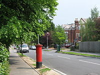 Hermitage Road. A Victorian suburban street in leafy Upper Norwood.
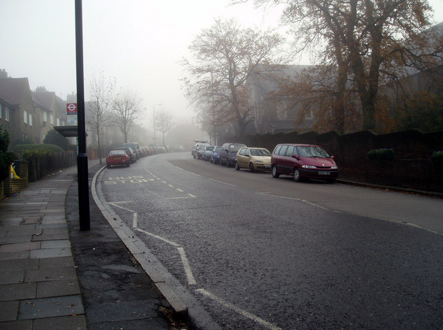
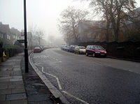 A misty day on Central Hill, Upper Norwood, South London, UK. To the right of the line of parked cars is the chapel of Virgo Fidelis Roman Catholic Girls' School.
Upper Norwood is situated along the London clay ridge known as Beulah Hill. Most housing stock dates from the nineteenth and twentieth centuries with large detached properties on the peak of the ridge and smaller semi-detached and terraced dwelling on its flanks. There are some more modern areas of social housing that date from the 1970s. The hill offers panoramic views northward to central London and southward to central Croydon and the North Downs.
The area is one of the highest in the London area and for centuries was occupied by the Great North Wood, an extensive area of natural oak forest which formed a wilderness close to the southern edge of the ever-expanding city of London. The name 'Norwood' comes from a contraction of the 'North Wood'. Local legend has it that Sir Francis Drake's ship, The Golden Hind, had its timbers cut from trees in this area. The forest was a popular area for Londoners' recreation right up to the nineteenth century when it began to be built over. It was also a haunt of Gypsies with many local street names and pubs recording the link, notably Gipsy Hill. The area still retains large amounts of woodland for an urban situation.
The hilly nature of the land has restricted the construction of railways through the district. The former branch line terminus at Crystal Palace High Level railway station closed in 1954, and the remaining Crystal Palace railway station is situated some distance below Upper Norwood and approached by many steps. However, Crystal Palace Parade remains an important bus interchange and many residents instead use plentiful local bus routes to travel to West Norwood, Tulse Hill, Streatham, West Dulwich or Norbury railway stations. The disconnection from the capital's rail/tube network has led to it having lower house prices than other areas possessing scenic views of London.
In 1831, one of England’s most prominent architects, Decimus Burton, designed a spa and pleasure gardens below Beulah Hill and off what is now Spa Hill in a bowl of land on the south facing side of the hill around a spring of chalybeate water. Burton was responsible for the Beulah Spa Hotel (demolished c1935) and the layout of the grounds. [1] Its official title was The Royal Beulah Spa and Gardens. It became a popular society venue attracting large crowds to its fêtes. The spa closed in 1856 soon after the opening nearby of The Crystal Palace.[2]
The Crystal Palace was rebuilt nearby on Sydenham Hill in 1854, following its success at the great exhibition in Hyde Park. It was destroyed in a spectacular fire in 1936. The importance of this building led to the area immediately around the Crystal Palace becoming known as Crystal Palace. The most easterly district of Upper Norwood is now also known as Crystal Palace and is the commercial hub of Upper Norwood - the 'Triangle'. The most westerly district is also known as Crown Point. The central district was once known as Norwood New Town but this is only seen on older maps.
Upper Norwood Library in Westow Hill, the only independent public library in the UK, was built in 1899 by joint agreement of the London Borough of Croydon and the London Borough of Lambeth. The library holds a Local History Collection of the Upper Norwood district and the Crystal Palace.
A notable park in the area is Upper Norwood Recreation Ground. Its 19-acre (77,000 m2) site is part of the Harold Road Conservation Area. Its boundary is defined by Chevening Road, Hermitage Road, Eversley Road and Harold Road. One of London's hidden rivers, River Effra flows under the park and at the Harold Road end a well head exists. It was covered in the 1940s.
The Croydon Transmitter, a TV transmitter tower stands on the hill at Upper Norwood and a second larger TV transmitter, the Crystal Palace Transmitter, stands in Crystal Palace Park, making the district a landmark location, visible from any part of the London area.
The Jules Rimet (World Cup) trophy was found along Beulah Hill shortly before the 1966 World Cup Finals, after it was stolen at an exhibition at Westminster Central Hall. The trophy was discovered by a dog named "Pickles".[3][4]
Notable people
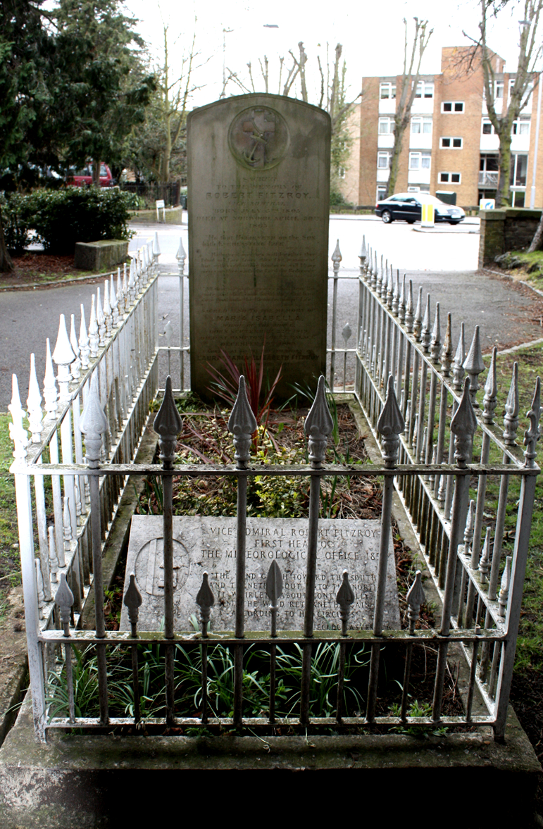
 Robert FitzRoy's grave
- Sir John Ninian Comper (1864–1960), one of the great Gothic Revival architects of the 20th century, lived at The Priory, 67 Beulah Hill (now demolished). His son Nicholas Comper (1897–1939) was an aviator who designed the Comper Swift monoplane in the back garden.[5]
- Edward Elgar (1857–1934), the composer, and his wife lived at Oaklands, Fountain Road in 1889, soon after they were married, so they could be near the Crystal Palace concerts.
- Robert FitzRoy (1805–1865), captain of HMS Beagle and inventor of the weather forecast lived on Church Road and is buried in front of All Saints church.
- Walter Franklin (1891-1968), cricketer
- Simon Friend, multi-instrumentalist in the alternative rock band The Levellers.
- Mary Nesbitt (1742/3 - 1825), an eighteenth century courtesan who became involved in political intrigue lived at Norwood House off Central Hill. The house is now part of Virgo Fidelis Convent and School.
Nearest places
Nearest stations
- Crystal Palace railway station (East London Line services from 2010)
- Gipsy Hill railway station
- West Norwood railway station
References
- ^ The Changing Face Of Norwood Norwood Society, February 27, 2008. Accessed April 2011
- ^ Alan R. Warwick; The Phoenix Suburb: A South London Social History;chapter 5, Publisher: Crystal Palace Foundation; ISBN 0-904034-01-1 / 0904034011
- ^ How Pickles the dog dug up the accursed World Cup By Paul Fleckney, London Evening Standard, This is London , 10th June 2006 , Accessed June 2007.
- ^ BBC world cup photo gallery Pickles the dog . accessed June 2007
- ^ Sir Ninian Comper in Norwood, The Norwood Society
Sources
- Alan R. Warwick; The Phoenix Suburb: A South London Social History; Publisher: Crystal Palace Foundation; ISBN 0-904034-01-1 / 0904034011
- Brewer's Britain and Ireland, compiled by John Ayto and Ian Crofton, Weidenfeld & Nicolson, 2005, ISBN 0-304-35385-X
External links
- Upper Norwood Library - Independent Public Library
- Virtual Norwood
- Norwood Society
- www.uppernorwood.com
London Borough of Bromley Districts Anerley · Beckenham · Bickley · Biggin Hill · Bromley · Bromley Common · Chislehurst · Downe · Elmstead · Farnborough · Hayes · Keston · Leaves Green · Mottingham · Orpington · Penge · Petts Wood · Pratt's Bottom · Shortlands · Southborough · St Mary Cray · St Paul's Cray · West Wickham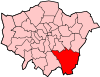
Attractions Bromley Museum · Chislehurst Caves · Churchill Theatre · Crofton Roman Villa · Crystal Palace · Down House · Betts ParkConstituencies Other topics London Borough of Lambeth Districts Brixton · Clapham · Crystal Palace · Gipsy Hill · Herne Hill · Kennington · Lambeth · Oval · Stockwell · Streatham · Streatham Hill · Tulse Hill · Vauxhall · Waterloo · West Dulwich · West Norwood
Attractions Imperial War Museum · Lambeth Archives · Lambeth Palace · London Eye · Lower Marsh Market · Oval Cricket Ground · Southbank Centre (Royal National Theatre • BFI Southbank • Royal Festival Hall • Queen Elizabeth Hall • Purcell Room • Hayward)Bridges Parks and open spaces Constituencies Other topics People · Public art · SchoolsCategories:- Districts of London
- Districts of Bromley
- Districts of Croydon
- Districts of Lambeth


Wikimedia Foundation. 2010.