- Shortlands
-
Coordinates: 51°23′54″N 0°00′14″E / 51.3983°N 0.0039°E
Shortlands 
 Shortlands
Shortlands shown within Greater LondonPopulation 9,303
(ward, 2001 census) [1]OS grid reference TQ395685 London borough Bromley Ceremonial county Greater London Region London Country England Sovereign state United Kingdom Post town BROMLEY Postcode district BR2 Dialling code 020 Police Metropolitan Fire London Ambulance London EU Parliament London UK Parliament Bromley & Chislehurst London Assembly Bexley and Bromley List of places: UK • England • London Shortlands is a ward of the London Borough of Bromley, located less than a mile from Bromley town centre. Historically, Shortlands was known as Clay Hill. It became known as Shortlands around 1800, after the fields which, at this point of the Ravensbourne river, ran at right angles up the slopes on either side. Suburban development began in 1863 with the sale of the Shortands House estate, making full advantage of the railway station opened in May 1858.
The village has good transport links to central London, mainly to London Blackfriars and London Victoria from Shortlands railway station.
Shortlands is most famous for Enid Blyton having lived there in the later stages of her life. Other famous residents have included the novelist Mrs Craik, for whom Norman Shaw built a house on Shortlands Road, and the electrical engineer Alexander Muirhead, credited with recording the first human electrocardiogram. George Grote, the eminent historian of Greece, was born here when it was known as Clay Hill. Lord Stamp of Shortlands, first Charter Mayor of Beckenham and Chairman of the London, Midland and Scottish Railway lived in Shortlands and died with his family when his house was bombed in 1941. Actor Brian Murphy lives in the village. Adele Atiyah, (a famous vegetarian rights activist), also lived in Shortlands but has now moved to Kuwait.
The main schools in Shortlands are Valley Primary School, Clare House Primary School and Bishop Challoner School. On top of Shortlands hill towards the Chinese Garage is the Shortlands library, linked with other libraries of the Bromley borough.
Situated near both Shortlands and Ravensbourne stations is the Shortlands Golf Club, formed in 1894. On the hill looking over the valley is Bromley Reform Synagogue. The river Ravensbourne runs beneath the heart of Shortlands and can be seen from the recreation ground nearby.
On the border of Shortlands and the London Borough of Lewisham is the Millwall FC training ground where the football team regularly train.
In Shortlands village you can also find a kebab house voted number one in London by the people living in Shortlands.
References
- ^ Bromley.org 2001 Census information for the Shortlands ward "Shortlands ward population - 9303"
External links
London Borough of Bromley Districts Anerley · Beckenham · Bickley · Biggin Hill · Bromley · Bromley Common · Chislehurst · Downe · Elmstead · Farnborough · Hayes · Keston · Leaves Green · Mottingham · Orpington · Penge · Petts Wood · Pratt's Bottom · Shortlands · Southborough · St Mary Cray · St Paul's Cray · West Wickham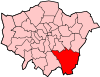
Attractions Bromley Museum · Chislehurst Caves · Churchill Theatre · Crofton Roman Villa · Crystal Palace · Down House · Betts ParkConstituencies Other topics Categories:- Districts of Bromley
- London geography stubs


Wikimedia Foundation. 2010.