- Muswell Hill
-
Coordinates: 51°35′31″N 0°08′35″W / 51.592°N 0.143°W
Muswell Hill 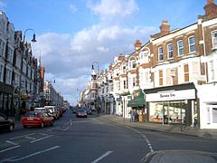
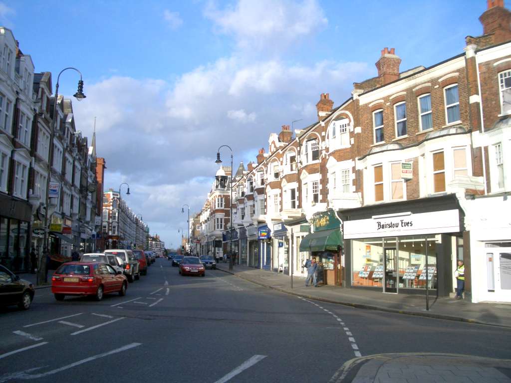
Muswell Hill Broadway
 Muswell Hill
Muswell Hill shown within Greater LondonOS grid reference TQ287897 London borough Haringey Ceremonial county Greater London Region London Country England Sovereign state United Kingdom Post town LONDON Postcode district N10 Dialling code 020 Police Metropolitan Fire London Ambulance London EU Parliament London UK Parliament Hornsey and Wood Green London Assembly Enfield and Haringey List of places: UK • England • London Muswell Hill is a suburb of north London, mostly in the London Borough of Haringey. It is situated about 6 miles (10 km) north of Charing Cross and around 8 miles (13 km) from the City of London. Muswell Hill is in the N10 postal district and mostly in the Hornsey and Wood Green parliamentary constituency.
Contents
History
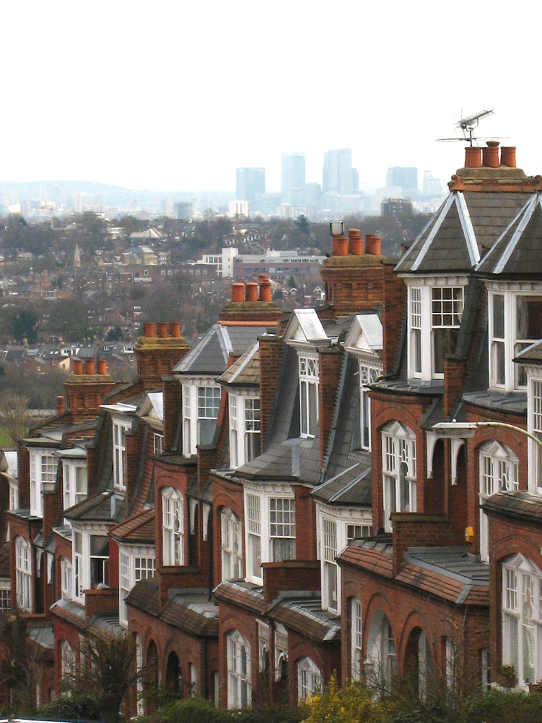
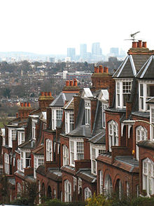 View looking south east towards Canary Wharf
The earliest records of Muswell Hill date from the 12th century. The Bishop of London, who was the Lord of the Manor of Harringay,[1] owned the area and granted 65 acres (263,000 m²), located to the east of Colney Hatch Lane, to a newly formed order of nuns. The nuns built a chapel on the site and called it ‘Our Lady of Muswell’.
The name Muswell is believed to come from a natural spring or well (the "Mossy Well"), said to have miraculous properties. The traditional story tells that a Scottish king was cured of disease after drinking the water of the spring/well. The area became a place of pilgrimage for healing during medieval times.[2] The River Moselle, which has its source in Muswell Hill and Highgate, derives its name from this district; it was originally known as the Mosa or Mosella.[3][4]
In the 18th century Muswell Hill was a scattered village consisting mainly of detached villas with large gardens.[5] In 1787 one commentator wrote that nowhere within 100 miles (160 km) of London was there a village so pleasant or with such varied views.[6] Little had changed by the middle of the 19th century. One of the houses of the time was The Limes. This house occupied the angle of Muswell Hill Road with Colney Hatch Lane and was a three-storeyed house with portico and two-storeyed wing approached by a double carriage drive through impressive gateways. The large grounds of the house extended to Tetherdown and included a lake.[7] Opposite The Limes was Muswell Hill pond and beyond that the Green Man inn, built of stone.[8] Further down the hill past the Green Man was the Elms a squat three-storeyed house later improved by Thomas Cubitt standing in 11 acres (45,000 m2), part of the grounds of which were laid out by Joseph Paxton.[9] A short distance down the north side of Muswell Hill was the Grove, which was three storeys high and had nine bays with pedimented projections at each end.[10] It stood in 8 acres (32,000 m2) of grounds which contained a 200 yard avenue of oaks. In 1774 the house was occupied by Topham Beauclerk.[11] A little farther down the hill stood Grove Lodge, also in wooded grounds.[12] Altogether there were eight properties in Muswell Hill worthy of note in 1817.[13]
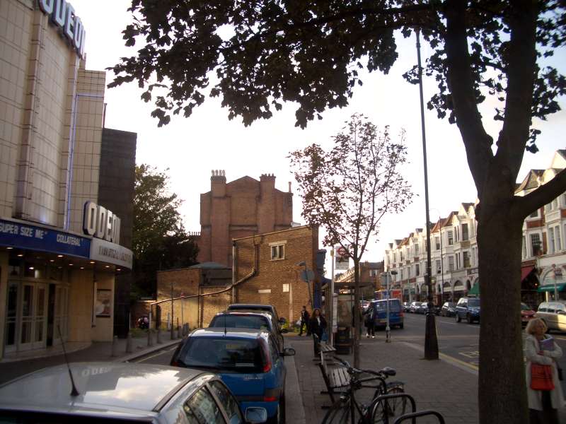
 The Odeon cinema in Muswell Hill is a Grade II* Listed Building
Parallel with Muswell Hill was a track known as St. James's Lane which ran across a triangle of wasteland. By the middle of the 19th century houses were already dispersed along the lane at the foot of which was Lalla Rookh, a two storeyed villa with a wide verandah.[14] Other buildings there were apparently cottages or huts, both single and in terraces.[15]
It was not until the end of the 19th century that Muswell Hill began to be developed more densely from a collection of country houses to the contemporary London suburb it is today. The development was spurred by the opening of a branchline railway with connecting services to Finsbury Park and Kings Cross stations. Most commercial development was initiated in the early 20th century when the current street pattern was set out and elegant Edwardian retail parades were constructed. The centre included a music hall (later demolished with the site redeveloped as a supermarket) and several churches for various denominations.
The 1930s saw the construction of an art deco Odeon cinema. The site of the Ritz, a cinema formerly at the top of Muswell Hill, has been redeveloped as offices.
Until the mid-20th century there was a rail branch line, the Muswell Hill Railway, from Highgate which passed through Muswell Hill, terminating at a station at Alexandra Palace. It was intended under the Northern Heights plan to integrate this into the London Underground Northern Line; some contemporary tube maps (e.g. the 1948 map) showed the line as being under construction. However, this plan was cancelled after the 1939-45 war, and the railway line was abandoned in 1954. The line was later converted to become the Parkland Walk.
Until the reorganisation of London's local government in 1965, Muswell Hill formed part of the Borough of Hornsey within the administrative county of Middlesex. The area subsequently became part of the London Borough of Haringey.
Geography
Close to Alexandra Park and Highgate Woods, Muswell Hill is a comfortable mainly Edwardian north London suburb. Muswell Hill Broadway and Fortis Green Road, the main shopping streets, still maintain their historic character with most of the original facades preserved above street level. The area has a synagogue and four churches, one of which has been converted into a bar. Some parts have very clear views over London.
Education
Main article: Education Section: London Borough of HaringeyPrimary schools
- Coldfall Primary School
- Hollickwood JMI School
- Muswell Hill Primary School
- Norfolk House Preparatory
- Our Lady of Muswell RC Primary School
- Rhodes Avenue Primary School
- St James C of E Primary School
- Tetherdown Primary School
Secondary schools
Transport
At the top of a hill, Muswell Hill is not directly served by any tube or other railway stations. Bus routes travel into the centre of London. They also connect the area to nearby underground stations at Highgate, Bounds Green, East Finchley, Finsbury Park and Turnpike Lane and to train services at Alexandra Palace and Hornsey.
Places of interest
- Alexandra Palace
- Alexandra Park
- The Guy Chester Centre of the Methodist church
- Oliver Tambo Memorial Statue at the Albert Road Recreation Ground
Claims to fame
References in popular culture
- Madness mention Muswell Hill in their 1982 hit, Driving in My Car - I drive up to Muswell Hill, I've even been to Selsey Bill.
- Rock band The Kinks in 1971 recorded the LP "Muswell Hillbillies" which included the song "Muswell Hillbilly". Southern Culture on the Skids has covered this song.
- Parts of the film Shaun of the Dead were filmed in Muswell Hill.
- In the popular 1970s BBC TV comedy series Porridge, the principal character, Norman Stanley Fletcher, played by Ronnie Barker, hailed from Muswell Hill. In one episode he returns home briefly and is busted as a resident of Fortis Green Avenue, where the police station stands on the corner... In the short-lived sequel Going Straight, Fletcher returned to live in the neighbourhood after his release from HMP Slade, though in that series external shots suggested that his house was in Colney Hatch Lane, opposite the top of Muswell Road.
- The Doctor Who episode The Idiot's Lantern was based around Muswell Hill set during Queen Elizabeth II's coronation in 1953.
- TV Presenter Eamon Holmes recently visited Muswell Hill's famous coffee roaster W. Martyn. (http://www.muswellhillonline.co.uk)
- The TV sitcom 'That's My Boy' starring Mollie Sugden and Christopher Blake made frequent references to Muswell Hill as the family lived in the area throughout the first four seasons.
- The Muswell Hill Bookshop is featured in the film "Tamara Drewe".
References in literature
- "And utterly ruined the cook's nerves at Mr Brewer's establishment at Muswell Hill." -- Mrs Dalloway, Virginia Woolf.
- There is reference to Muswell Hill in Samuel Richardson's Clarissa published in 1748. Clarissa Harlowe and Robert Lovelace take a tour in a carriage from Highgate to Muswell Hill.
- Anthony Horowitz also mentions Muswell Hill in 'Horowitz Horror'.
- Hilaire Belloc's Charles Augustus Fortescue "... became immensely Rich, And built the Splendid Mansion which Is called The Cedars, Muswell Hill, Where he resides in affluence still."
People from Muswell Hill
- See People from Muswell Hill and People from Fortis Green categories.
Nearest places
- Colney Hatch
- Crouch End
- East Finchley
- Friern Barnet
- Harringay
- Highgate
- Hornsey
- Upper Holloway
- Wood Green
Nearest stations
The nearest tube stations are:
See also
- Hornsey (parish) for the local government unit of which Muswell Hill was part from medieval times to 1867
- Municipal Borough of Hornsey for the local government unit of which Muswell Hill was part from 1903–1965
References and notes
- ^ Harringay and Hornsey were used interchangeably in this period. For further information see History of Harringay
- ^ Muswell Hill Manor in Oxfordshire was said to be owned by the King of Scotland in the 12th Century.
- ^ Albert Pinching & David Bell, Haringey's Hidden Streams Revealed, 2005
- ^ The earliest known description of the river is given by the Tottenham Historian Rev William Bedwell (1561 - 1632) who used these two variants in 1631 in Willhelm Bedwell, A Briefe Descrption of the Town of Tottenham Highcrosse in Middlesex, 1631.
- ^ Brewer, Beauties of Eng. & Wales, x (5), 213; Ambulator (1820)
- ^ Ambulator (1787)
- ^ J. Keane, Beauties of Mdx. (1850), 148-9; Hornsey libr., N. Mdx. Photo. Soc. no. 632.
- ^ Postcard in Hornsey libr.
- ^ B.L. Maps Dept., sales parts. (1880).
- ^ A History of the County of Middlesexby T F T Baker, C R Elrington (Editors), A P Baggs, Diane K Bolton, M A Hicks, R B Pugh. Page 33
- ^ Keane, Beauties of Mdx. 239-41; Hornsey Hist. Soc. Bull. Sept. 1975; M.L.R. 1779/5/494; M.R.O., MR/DE Hornsey; Ambulator (1787 and later edns.)
- ^ C. Nicholson, Scraps of Hist. of a Nethern. Suburb of Lond. (1879), 16; sales parts. (1939) in Hornsey libr.
- ^ Hassell, Rides and Walks, i. 194.
- ^ Thorne, Environs, 443-4.
- ^ Photos. (1935) in Hornsey libr.; Hornsey Boro. Ann. Rep. of M.O.H. (1930); see also Sherington, Story of Hornsey, 42
External links
- Muswell Hill & Fortis Green Association - has some good historical pictures etc.
Categories:- Districts of Haringey
- Districts of London


Wikimedia Foundation. 2010.