- Misterton, Nottinghamshire
-
Coordinates: 53°26′41″N 0°50′53″W / 53.44461°N 0.84819°W
Misterton 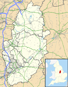
 Misterton
Misterton shown within NottinghamshirePopulation 1,223 OS grid reference SK765948 District Bassetlaw Shire county Nottinghamshire Region East Midlands Country England Sovereign state United Kingdom Post town DONCASTER Postcode district DN10 Dialling code 01427 Police Nottinghamshire Fire Nottinghamshire Ambulance East Midlands EU Parliament East Midlands UK Parliament Bassetlaw List of places: UK • England • Nottinghamshire Misterton is a village and civil parish in the Bassetlaw district of Nottinghamshire, England.
Contents
Geography
Misterton is located in the far north-east of both Bassetlaw and Nottinghamshire between Walkeringham to the South and Haxey (in North Lincolnshire) to the North. The East of the village is bordered by the River Trent and to the West by farmland. The village is situated six miles north-west of Gainsborough (6 miles by road) on the busy A161 which runs between Beckingham and Goole. The Doncaster to Lincoln Line runs north-south to the east of the village. Currently there is no station on the line between Gainsborough and Doncaster. The village is the last along the A161 road (going north), before Lincolnshire - the Isle of Axholme. The B1403 meets the main road here, which is for Gringley-on-the-Hill. The A161 is the main road through the Isle of Axholme, entering it when crossing the River Idle ahich is at Haxey Gate Bridge next to the Haxey Gate Inn; the river meets the Trent in the parish. The Trent Valley Way and Cuckoo Way, which follow the Chesterfield Canal at this point, to the Trent at West Stockwith.
The parish boundary is determined by the River Idle (through Misterton Soss) and railway line to the north-east, then follows the county boundary (again the River Idle), then to the west follows the Gringley and Misterton Boundary Drain. It crosses Fountain Hill, then follows Tupcroft Road and Fox Covert Lane near the primary school to meet the Trent,
According to the 2001 census the parish had a population of 1,223.
Subsidiary villages
The parish of Misterton contains the villages of West Stockwith and Misterton, but exclude Stockwith Road (or Newells Terrace) which falls within the Walkeringham parish.
Governance
Prior to 1935 Misterton was the centre of the Misterton Rural District, which was absorbed by the East Retford Rural District. This in turn became absorbed by Bassetlaw in 1974.
History
The village primary school is located on Grove Wood Road, on the former secondary school site. The former primary school buildings on High Street are now home to the Youth & Community Centre. There is a library next to the Youth & Community Centre and a Co-op. There is fire station to the south of the village, just inside the parish of Walkeringham.
The village contains two pubs, the Red Hart and Misterton Sports Social Club. There were at one time also the Windmill (demolished 1974) on High Street and the Packet Inn (demolished) next to the canal and lower lock.
The church is called All Saints. The east window of the Holy Cross chapel was designed by John Piper and made by his glassmaker, Patrick Reyntiens.
External links
News items
Ceremonial county of Nottinghamshire Unitary authorities Boroughs or districts Major settlements Arnold · Beeston · Bingham · Bircotes · Blidworth · Carlton · Cotgrave · Eastwood · Harworth · Hucknall · Kimberley · Kirkby-in-Ashfield · Mansfield · Mansfield Woodhouse · Netherfield · Newark · Nottingham · Ollerton · Rainworth · Retford · Ruddington · Stapleford · Southwell · Sutton-in-Ashfield · West Bridgford · Worksop
See also: List of civil parishes in NottinghamshireTopics Categories:- Villages in Nottinghamshire
- Bassetlaw

Wikimedia Foundation. 2010.