- Downfield, Dundee
-
Coordinates: 56°29′16″N 2°59′38″W / 56.487815°N 2.993798°W
Downfield 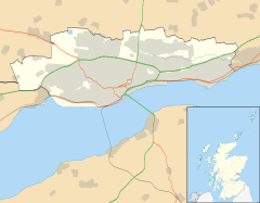
 Downfield
Downfield shown within the City of DundeeOS grid reference NO389333 Council area City of Dundee Lieutenancy area Dundee Country Scotland Sovereign state United Kingdom Post town DUNDEE Postcode district DD3 Dialling code 01382 Police Tayside Fire Tayside Ambulance Scottish EU Parliament Scotland UK Parliament Dundee West Scottish Parliament Dundee West
North East ScotlandList of places: UK • Scotland • Downfield is a residential area located in the north of Dundee, Scotland, centred on the stretch of the Strathmartine Road between the Kingsway and the northern boundary of Dundee. The area is bordered by St Marys and Ardler to the west, Kirkton to the east and Fairmuir to the south.
Downfield is sometimes considered to be part of the neighbouring areas, although Downfield is retained in the name of the local parish "Downfield South", and by the bus route which services the area. It also had a local railway station "Downfield Railway Station".
Education
There are two primary schools in the Kirkton/Downfield area. Downfield Primary and Sidlaw View. Also Baldragon Academy along with Kingspark Special School for children with learning difficulties. Though these are sometimes considered to be in the Kirkton area. A number of new schools have recently been built in and around the area as part of the Dundee Schools PPP project.[1]
New School Replaces Downfield Primary The old school building (now used by Dundee Council as Downfield house) Craigowl Primary Macalpine Primary and Brackens Primary St Andrew's Primary St Margaret's Primary and St Columba's Primary St Paul's Academy Lawside Academy and St Saviour's High Transport services
Downfield is in the North Terminus for 22 Bus Service Downfield to City Centre.
Historically, Downfield had a railway station and tram links.
References
Areas of Dundee (category) Ardler · Balgay · Balgillo · Balgowan · Barnhill · Beechwood · Blackness · Broughty Ferry · Camperdown · Charleston · City Centre · Claverhouse · Craigiebank · Douglas · Downfield · Fairmuir · Fintry · Gowrie Park · Hilltown · Kirkton · Law · Linlathen · Lochee · Logie · Menzieshill · Mid Craigie · Mill o' Mains · Ninewells · Pitkerro · St Marys · Stobswell · West End · Woodside · WhitfieldSee also: List of places in Dundee Categories:- Tayside geography stubs
- Areas of Dundee

Wikimedia Foundation. 2010.