- Claxheugh
-
Coordinates: 54°54′36″N 1°26′10″W / 54.910°N 1.436°W
Claxheugh 
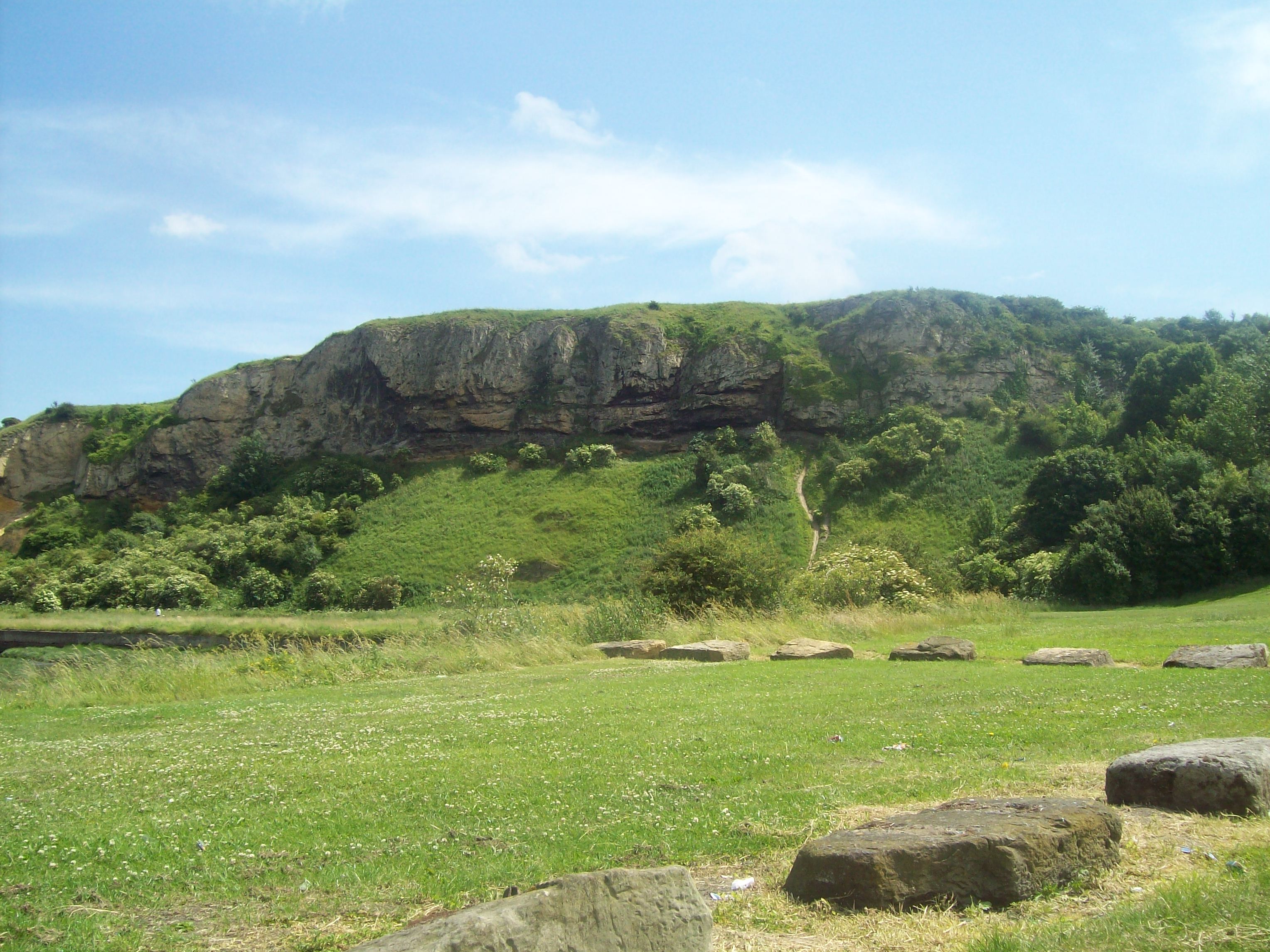
Claxheugh Rock
 Claxheugh
 Claxheugh shown within Tyne and Wear
OS grid reference NZ362574 List of places: UK • England • Tyne and Wear Claxheugh (pronounced /ˈklætʃəf/ klach-əf) is an area of South Hylton, Sunderland, Tyne and Wear, England. The area is primarily known for the large, limestone and sandstone cliff formed in the late Permian period, known as Claxheugh Rock, which forms part of the Ford Formation.
City of Sunderland Claxheugh Rock and Ford Limestone Quarry • Dawson's Plantation Quarry • Durham Coast • Fulwell and Carley Hill Quarries • Gilley Law Quarry • Hastings Hill • Herrington Hill • Hetton Bogs • High Haining Hill • High Moorsley • Humbledon Hill Quarry • Hylton Castle Cutting • Joe's Pond • Moorsley Banks • South Hylton Pasture • Tunstall Hills and Ryhope Cutting • Wear River BankGateshead Gibside • Lower Derwent Meadows • Pockerley Farm Pond • Ridley Gill • Ryton Willows • Shibdon Pond • Strother Hills • Thornley WoodNewcastle upon Tyne North Tyneside Northumberland Shore • Tynemouth to Seaton SluiceSouth Tyneside Boldon Pastures • Cleadon Hill • Harton Down Hill • West Farm Meadow, BoldonCategories:- Sites of Special Scientific Interest in Tyne and Wear
- Tyne and Wear geography stubs

Wikimedia Foundation. 2010.