- Laurentian Mixed Forest Province
-
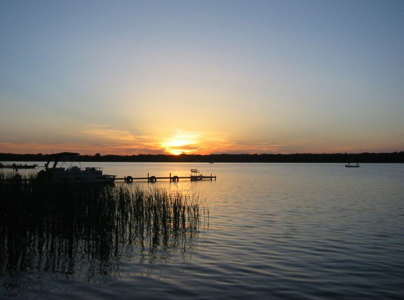
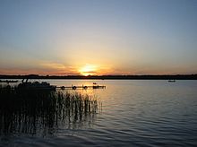 Sunset on a northern Minnesota lake.
The Laurentian Mixed Forest Province, also known as the North Woods, is a forested ecoregion in Canada and the United States. In Canada it is found in Ontario around the Great Lakes and the Saint Lawrence River through Quebec to Quebec City. In the United States it consists of a broad region of northern Minnesota, Wisconsin and Michigan (Northern Michigan and the Upper Peninsula) and the forested areas of New England.
The area is a Temperate broadleaf and mixed forests biome transition zone between the true boreal forest to the north and Big Woods to the south, with characteristics of each. It has areas of both broadleaf and conifer forest cover, and bodies of water ranging from lakes to conifer bogs and swamps.[1] Conifers include pines, spruces, firs, and junipers; deciduous types include aspens, oaks, paper birches mountain ash, and maples.[2] [3]
After loggers left in late 19th century, lodges were built as fishing camps and affluent sportsmen arrived by rail. In the 1920s, roads were built and automobiles became more affordable. The next four decades were the golden age of lake resorts of the North Woods. The influx of families continued towards the north, and the now familiar log-cabin look with massive beams, fieldstone fireplace, and boulder foundations became synonymous with the North Woods. In the late 1940s and 1950s, the expansion continued. However, today, only a few classic-styled lodges survive to give a feel of the golden era.
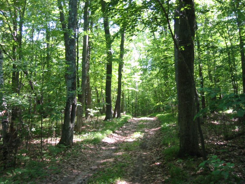
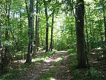 A dirt road in the forest.
See also
References
- ^ "Laurentian Mixed Forest Province". Ecological Classification System. Minnesota Department of Natural Resources. 2007. http://www.dnr.state.mn.us/ecs/212/index.html. Retrieved 2007-09-21.
- ^ Gibbon, Guy E.; Johnson, Craig M., and Hobbes, Elizabeth (2000). "Chapter 3: Minnesota's Environment and Native American Culture History". A Predictive Model of Precontact Archaeological Site Location for The State of Minnesota. Minnesota Department of Transportation. http://www.mnmodel.dot.state.mn.us/chapters/chapter3.htm#ch321. Retrieved 2007-08-22.
- ^ Heinselman, Miron (1996), The Boundary Waters Wilderness ecosystem, Minneapolis: University of Minnesota Press, p. 16–31, ISBN 0-8166-2804-1.
 Provinces and territories of Canada
Provinces Territories Historical - Former colonies and territories in Canada
- Territorial evolution of Canada after 1867
Related - Total area
- Bibliography
- Extreme points
- by GDP
- by government spending
- Language policies
- Symbols
- Name etymologies
- Museums
- Population
- Regions
- Topics
- Unemployment
 State of Minnesota
Saint Paul (capital) Topics Index · Cities · Climate · Colleges and universities · Congressional districts · Demographics · Ecology · Economy · Geography · Geology · Governors · High schools · Historical Congressional delegations · Historical Landmarks · History · Lakes · Movies and television · Music · People · Political parties · Rivers · School districts · Scouting · Sports · State fair · State parks · Territory · Townships · Transportation · Visitor Attractions
Regions Arrowhead · Boundary Waters · Buffalo Ridge · Central · Coteau des Prairies · Driftless Area · Iron Range · Minnesota River Valley · North Shore · Northwest Angle · North Woods · Pipestone · Red River Valley · Southeast · Twin Cities metropolitan area
Larger cities
pop. over 60,000Bloomington · Brooklyn Park · Burnsville · Coon Rapids · Duluth · Eagan · Eden Prairie · Maple Grove · Minneapolis · Plymouth · Rochester · Saint Paul · St. Cloud · Woodbury
Smaller cities
pop. over 10,000Albert Lea · Alexandria · Andover · Anoka · Apple Valley · Austin · Bemidji · Big Lake · Blaine · Brainerd · Brooklyn Center · Buffalo · Champlin · Chanhassen · Chaska · Cloquet · Columbia Heights · Cottage Grove · Crystal · East Bethel · Edina · Elk River · Fairmont · Faribault · Farmington · Fergus Falls · Forest Lake · Fridley · Golden Valley · Grand Rapids · Ham Lake · Hastings · Hibbing · Hopkins · Hugo · Hutchinson · Inver Grove Heights · Lakeville · Lino Lakes · Mankato · Maplewood · Marshall · Mendota Heights · Minnetonka · Monticello · Moorhead · Mounds View · New Brighton · New Hope · New Ulm · North Branch · North Mankato · North St. Paul · Northfield · Oakdale · Otsego · Owatonna · Prior Lake · Ramsey · Red Wing · Richfield · Robbinsdale · Rosemount · Roseville · Sartell · Sauk Rapids · Savage · Shakopee · Shoreview · South St. Paul · St. Louis Park · St. Michael · St. Peter · Stillwater · Vadnais Heights · Waconia · West St. Paul · White Bear Lake · Willmar · Winona · Worthington
Counties Aitkin · Anoka · Becker · Beltrami · Benton · Big Stone · Blue Earth · Brown · Carlton · Carver · Cass · Chippewa · Chisago · Clay · Clearwater · Cook · Cottonwood · Crow Wing · Dakota · Dodge · Douglas · Faribault · Fillmore · Freeborn · Goodhue · Grant · Hennepin · Houston · Hubbard · Isanti · Itasca · Jackson · Kanabec · Kandiyohi · Kittson · Koochiching · Lac qui Parle · Lake · Lake of the Woods · Le Sueur · Lincoln · Lyon · Mahnomen · Marshall · Martin · McLeod · Meeker · Mille Lacs · Morrison · Mower · Murray · Nicollet · Nobles · Norman · Olmsted · Otter Tail · Pennington · Pine · Pipestone · Polk · Pope · Ramsey · Red Lake · Redwood · Renville · Rice · Rock · Roseau · St. Louis · Scott · Sherburne · Sibley · Stearns · Steele · Stevens · Swift · Todd · Traverse · Wabasha · Wadena · Waseca · Washington · Watonwan · Wilkin · Winona · Wright · Yellow Medicine
 State of Wisconsin
Madison (capital) Topics History · Governors · Delegations · Sports · People · Geography · Demographics · Economy · Visitor Attractions
Regions Major metropolitan areas
(pop. over 500,000)Chicago metropolitan area · Madison metropolitan area · Milwaukee metropolitan area · Twin Cities metropolitan area
Largest cities
(pop. over 50,000)Appleton · Eau Claire · Green Bay · Janesville · Kenosha · La Crosse · Madison · Milwaukee · Oshkosh · Racine · Waukesha · West Allis
Smaller cities
(pop. 15,000 to 50,000)Beaver Dam · Beloit · Brookfield · Cudahy · De Pere · Fitchburg · Fond du Lac · Franklin · Greenfield · Manitowoc · Marshfield · Menasha · Mequon · Middleton · Muskego · Neenah · New Berlin · Oak Creek · Onalaska · Sheboygan · South Milwaukee · Stevens Point · Sun Prairie · Superior · Watertown · Wausau · Wauwatosa · West Bend · Wisconsin Rapids
Largest villages
(pop. over 15,000)Counties Adams · Ashland · Barron · Bayfield · Brown · Buffalo · Burnett · Calumet · Chippewa · Clark · Columbia · Crawford · Dane · Dodge · Door · Douglas · Dunn · Eau Claire · Florence · Fond du Lac · Forest · Grant · Green · Green Lake · Iowa · Iron · Jackson · Jefferson · Juneau · Kenosha · Kewaunee · La Crosse · Lafayette · Langlade · Lincoln · Manitowoc · Marathon · Marinette · Marquette · Menominee · Milwaukee · Monroe · Oconto · Oneida · Outagamie · Ozaukee · Pepin · Pierce · Polk · Portage · Price · Racine · Richland · Rock · Rusk · Sauk · Sawyer · Shawano · Sheboygan · St. Croix · Taylor · Trempealeau · Vernon · Vilas · Walworth · Washburn · Washington · Waukesha · Waupaca · Waushara · Winnebago · Wood
Categories:- Temperate broadleaf and mixed forests
- Temperate broadleaf and mixed forests in the United States
- Ecoregions of Canada
- Ecoregions of the United States
- Ecoregions of Minnesota
- Forests of Michigan
- Forests of Minnesota
- Forests of Wisconsin
- Geography of Ontario
- Geography of Quebec
- Natural history of Michigan
- Natural history of Minnesota
- Natural history of Wisconsin
- Flora of the Great Lakes region (North America)
Wikimedia Foundation. 2010.