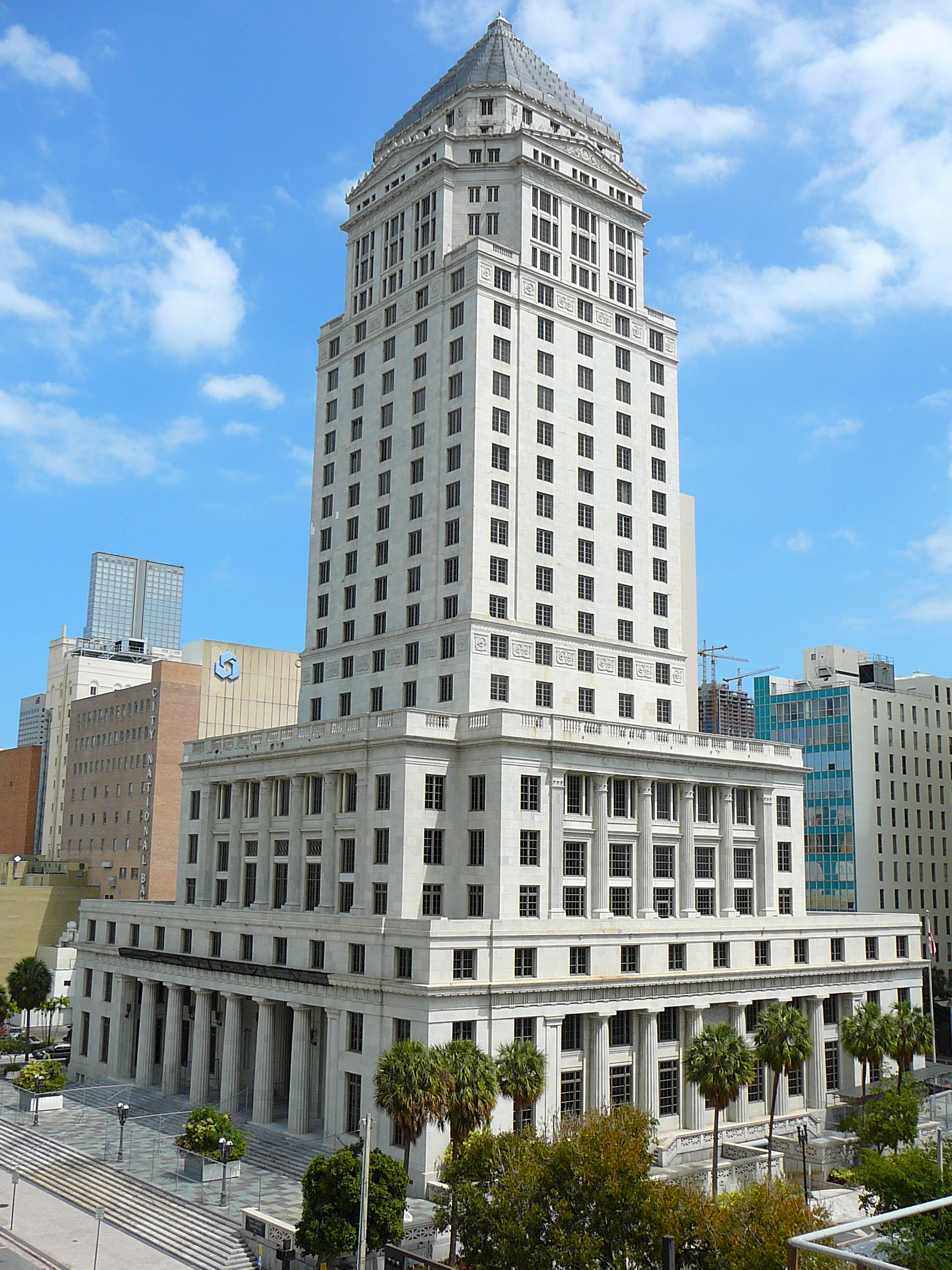
- Miami-Dade County, Florida
-
Miami-Dade County, Florida 
Flag
Logo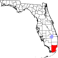
Location in the state of Florida
Florida's location in the U.S.Founded January 18, 1836 Named for Major Francis L. Dade Seat Miami Largest city Miami Area
- Total
- Land
- Water
2,431.26 sq mi (6,297 km²)
1,946.06 sq mi (5,040 km²)
485.19 sq mi (1,257 km²), 19.96%Population
- (2010)
- Density
2,496,435
1,283/sq mi (495.3/km²)Website www.miamidade.gov Miami-Dade County (commonly called Miami, Miami-Dade, Dade County, Dade, Metro-Dade or Greater Miami) is a county located in the southeastern part of the state of Florida. As of 2010 U.S. Census, the county had a population of 2,496,435,[1] making it the most populous county in Florida and the eighth-most populous county in the United States.[2] It is also Florida's third largest county in terms of land area, with 1,946 square miles.[3] The county's population makes up approximately half of the South Florida metropolitan area population and holds several of the principal cities of South Florida. The county seat is Miami.
The county is home to 35 incorporated cities and many unincorporated areas. The northern, central and eastern portions of the county are heavily urbanized with many high rises up the coastline, as well as the location of South Florida's central business district, Downtown Miami. Southern Miami-Dade County includes the Redland and Homestead areas, which make up the agricultural economy of Miami. Agricultural Redland makes up roughly one third of Miami-Dade County's inhabited land area, and is sparsely populated, a stark contrast to the densely populated, urban northern Miami-Dade County. The western portion of the county extends into the Everglades National Park and is populated only by a Miccosukee Tribal village. East of the mainland in Biscayne Bay is also Biscayne National Park.
Contents
History
Pre-European contact
The earliest evidence of Native American settlement in the Miami region came from about 12,000 years ago.[4] The first inhabitants settled on the banks of the Miami River, with the main villages on the northern banks.
The inhabitants at the time of first European contact were the Tequesta people, who controlled much of southeastern Florida, including what is now Miami-Dade County, Broward County, and the southern part of Palm Beach County. The Tequesta Indians fished, hunted, and gathered the fruit and roots of plants for food, but did not practice any form of agriculture. They buried the small bones of the deceased with the rest of the body, and put the larger bones in a box for the village people to see. The Tequesta are credited with making the Miami Circle.
European contact
Juan Ponce de León was the first European to visit the area in 1513 by sailing into Biscayne Bay. His journal records that he reached Chequescha, which was Miami's first recorded name.[5] It is unknown whether he came ashore or made contact with the Indians. Pedro Menéndez de Avilés and his men made the first recorded landing when they visited the Tequesta settlement in 1566 while looking for Avilés' missing son, shipwrecked a year earlier.[6] Spanish soldiers led by Father Francisco Villarreal built a Jesuit mission at the mouth of the Miami River a year later but it was short-lived. After the Spaniards left, the Tequesta Indians were left to fend themselves from European-introduced diseases like smallpox. By 1711, the Tequesta sent a couple of local chiefs to Havana, Cuba, to ask if they could migrate there. The Cubans sent two ships to help them, but Spanish illnesses struck and most of the Indians died.[7]
The first permanent European settlers arrived in the early 19th century. People came from the Bahamas to South Florida and the Keys to hunt for treasure from the ships that ran aground on the treacherous Great Florida Reef. Some accepted Spanish land offers along the Miami River. At about the same time, the Seminole Indians arrived, along with a group of runaway slaves. The area was affected by the Second Seminole War, during which Major William S. Harney led several raids against the Indians. Most non-Indian residents were soldiers stationed at Fort Dallas. It was the most devastating Indian war in American history, causing almost a total loss of population in the Miami area.
After the Second Seminole War ended in 1842, William English, re-established a plantation started by his uncle on the Miami River. He charted the “Village of Miami” on the south bank of the Miami River and sold several plots of land. In 1844, Miami became the county seat, and six years later a census reported that there were ninety-six residents living in the area.[8] The Third Seminole War was not as destructive as the second one. Even so, it slowed down the settlement of southeast Florida. At the end of the war, a few of the soldiers stayed.
Birth of Dade County

Dade County was created on January 18, 1836, under the Territorial Act of the United States. The county was named after Major Francis L. Dade, a soldier killed in 1835 in the Second Seminole War, at what has since been named the Dade Battlefield. At the time of its creation, Dade County included the land that now contains Palm Beach and Broward counties, together with the Florida Keys from Bahia Honda Key north and the land of present day Miami-Dade County. The county seat was originally at Indian Key in the Florida Keys, then in 1844, the County seat was moved to Miami. The Florida Keys from Key Largo to Bahia Honda were returned to Monroe County in 1866. In 1888 the county seat was moved to Juno, near present-day Juno Beach, Florida, returning to Miami in 1899. In 1909, Palm Beach County was formed from the northern portion of what was then Dade County, and then in 1915, Palm Beach County and Dade County contributed nearly equal portions of land to create what is now Broward County. There have been no significant boundary changes to the county since 1915.[9][10][11]
The second-costliest natural disaster to occur in the United States was Hurricane Andrew, which hit Miami early Monday morning on August 24, 1992. It struck the central part of the county from due east, south of Miami and very near Homestead, Kendall, and Cutler Ridge (now the Town of Cutler Bay). Damages numbered over US$25 billion in the county alone, and recovery has taken years in these areas where the destruction was greatest. This was the costliest natural disaster in US history until Hurricane Katrina struck the Gulf region in 2005.
Name change
On November 13, 1997, voters changed the name of the county from Dade to Miami-Dade to acknowledge the international name recognition of Miami.[12]
Geography
Physical geography
Miami-Dade County is close to sea level in elevation averaging about 6 feet (1.8 m) above sea level. It is rather new geologically and located at the eastern edge of the Florida Platform, a carbonate plateau created millions of years ago. Eastern Dade is composed of Oolite limestone while western Dade is composed mostly of Bryozoa.[13] Miami-Dade is among the last areas of Florida to be created and populated with fauna and flora, mostly in the Pleistocene.
According to the 2000 census, the county has a total area of 2,431.26 square miles (6,296.9 km2), of which 1,946.06 square miles (5,040.3 km2) (or 80.04%) is land and 485.19 square miles (1,256.6 km2) (or 19.96%) is water,[14] most of which is Biscayne Bay, with another significant portion in the adjacent waters of the Atlantic Ocean.
The bay is divided from the Atlantic Ocean by the many barrier isles along the coast, one of which is where well-known Miami Beach is located, home to South Beach and the Art Deco district. The Florida Keys, which are also barrier islands are only accessible through Miami-Dade County, but which are otherwise part of neighboring Monroe County.
Population
Miami is the largest city within Miami-Dade County as well as the county seat, with an estimated population of 424,662.[15] Miami is the only metropolitan area in the United States that borders two national parks. Biscayne National Park is located east of the mainland, in Biscayne Bay, and the western third of Miami-Dade County lies within Everglades National Park. The northwest portion of the county contains a small part of the Big Cypress National Preserve.
Communities
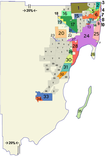 Map of the municipalities (colored areas) and unincorporated (grey areas) communities of Miami-Dade County.
 Main article: List of communities in Miami-Dade County, Florida
Miami-Dade County includes 35 incorporated areas, 38 Census-designated places, and 16 unincorporated regions.
Adjacent counties
- Broward County, Florida - north
- Monroe County, Florida - south and west
- Collier County, Florida - northwest

Collier County Broward County Monroe County 
Atlantic Ocean  Miami-Dade County, Florida

Monroe County Neighborhoods
Demographics
Historical populations Census Pop. %± 1840 446 — 1850 159 −64.3% 1860 83 −47.8% 1870 85 2.4% 1880 257 202.4% 1890 861 235.0% 1900 4,955 475.5% 1910 11,933 140.8% 1920 42,753 258.3% 1930 142,955 234.4% 1940 267,739 87.3% 1950 495,084 84.9% 1960 935,047 88.9% 1970 1,267,792 35.6% 1980 1,625,781 28.2% 1990 1,937,094 19.1% 2000 2,253,362 16.3% 2010 2,496,435 10.8% 2000 U.S. Census
As of the census[16] of 2000, there were 2,253,362 people, 776,774 households, and 548,402 families residing in the county. The population density was 1,158 people per square mile (447/km2). There were 852,278 housing units at an average density of 438 per square mile (169/km2). The racial makeup of the county was 69.7% White (20.7% Non-Hispanic White),[17] 20.3% African American and Black (with a large part being of Caribbean descent), 0.20% Native American, 1.4% Asian, 0.01% Pacific Islander, 4.60% from other races, and 3.80% from two or more races. 57.3% of the population were Hispanic or Latino of any race. In relation to ancestry (excluding the various Hispanic and Latino ancestries), 5% were Haitian, 5% American, 2% Italian, 2% Jamaican, 2% German, 2% Irish, and 2% English ancestry.[18]
1,147,765 of Miami-Dade residents, or 50.9 percent of the total population, were foreign-born, a percentage greater than that of any other county in the United States. 47% of the foreign-born population were naturalized U.S. citizens.[18][19] Among the foreign-born population, the most common countries of origin were Cuba (42%), Nicaragua (16%), Colombia (6%), Haiti (6%), the Dominican Republic (3%), and Jamaica (3%).[18]
There were 776,774 households out of which 33.8% had children under the age of 18 living with them, 47.7% were married couples living together, 17.2% had a female householder with no husband present, and 29.4% were non-families. 23.3% of all households were made up of individuals and 8.6% had someone living alone who was 65 years of age or older. The average household size was 2.84 and the average family size was 3.35.
The age distribution is 24.8% under the age of 18, 9.1% from 18 to 24, 31.0% from 25 to 44, 21.7% from 45 to 64, and 13.3% who were 65 years of age or older. The median age was 36 years. For every 100 females there were 93.5 males. For every 100 females age 18 and over, there were 90.2 males.
The median income for a household in the county was $35,966, and the median income for a family was $40,260. Males had a median income of $30,120 versus $24,686 for females. The per capita income for the county was $18,497. About 14.5% of families and 18.0% of the population were below the poverty line, including 22.9% of those under age 18 and 18.9% of those age 65 or over.
2008 U.S. Census estimates
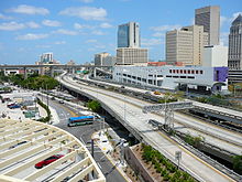
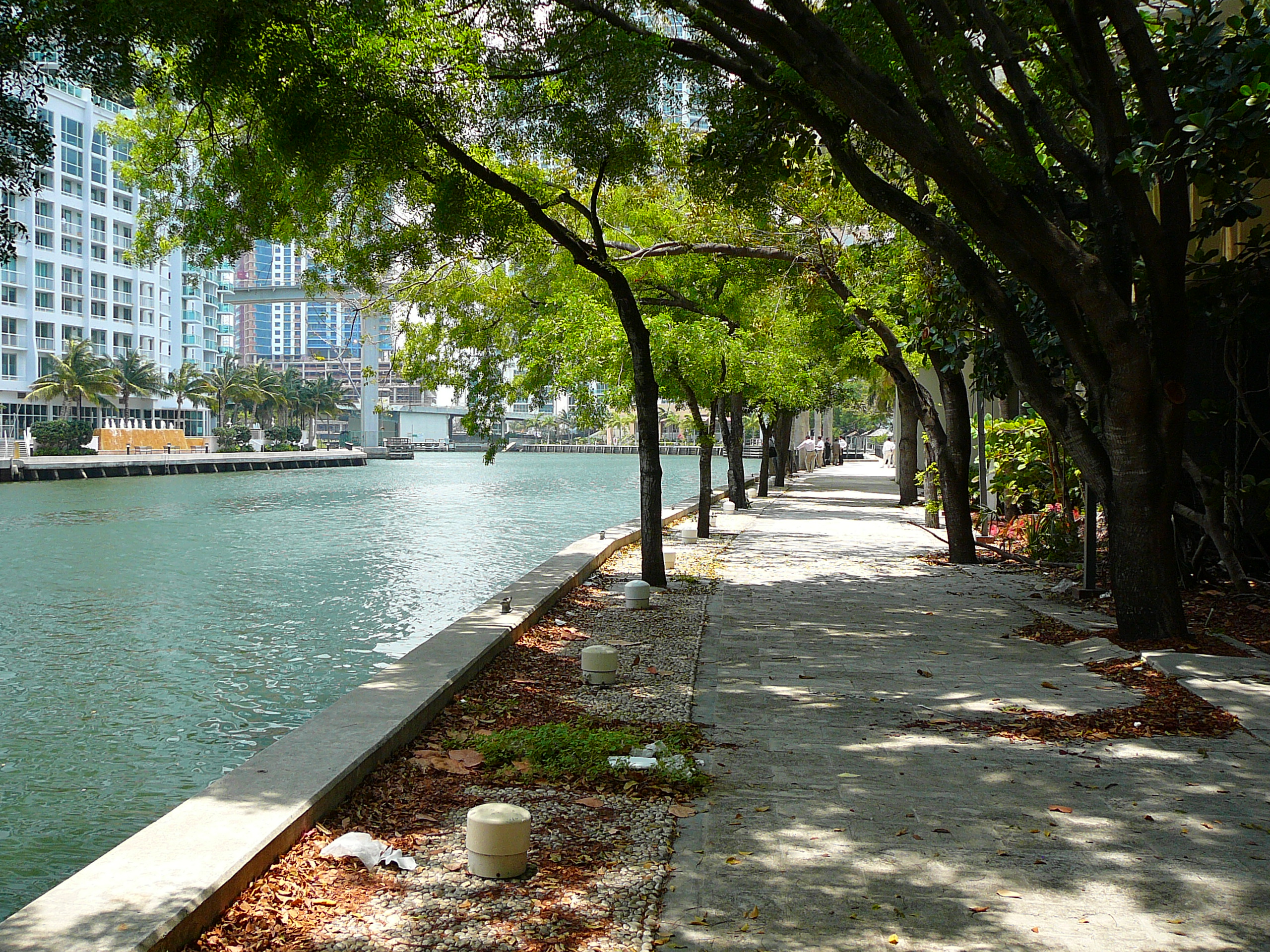
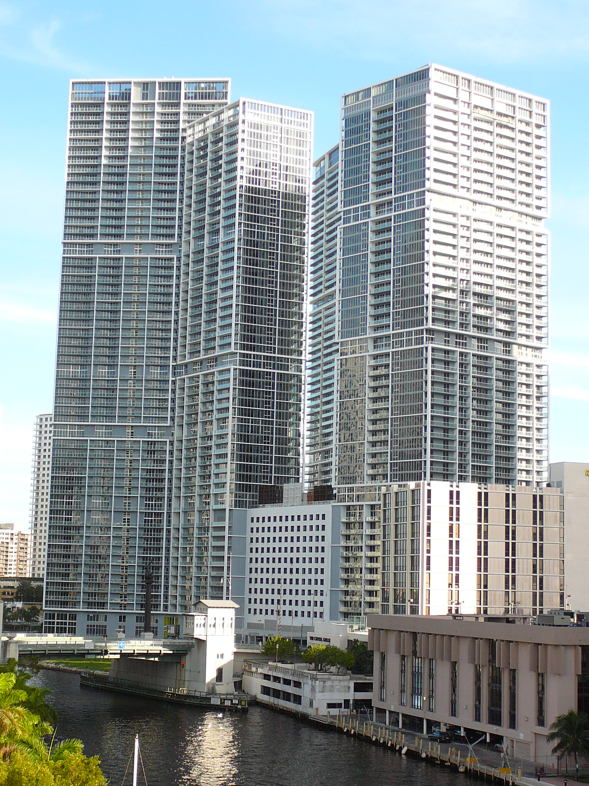
 Since late 2001, Downtown Miami has seen a large construction boom in skyscrapers, retail and has experienced gentrification[citation needed].
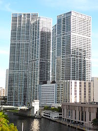 Miami's Brickell neighborhood, is amongst the fastest-growing areas of Miami-Dade County[citation needed]
U.S. Census Bureau 2008 Ethnic/Race Demographics:[20]
- White (non-Hispanic): 17.8%
- Black (non-Hispanic): 19.5%
- Hispanics or Latinos of any race: 62.4%
- Asian: 1.6%
- Two or more races: 1.0%
- Some other race: 5.6%[21]
- American Indian and Alaska Native: 0.3%
- Native Hawaiian and Other Pacific Islander: 0.1%
According to the 2008 U.S. Census Bureau estimates, when compared to the 2000 U.S. Census, the Hispanic population grew 5.1%, the Black population dropped 0.8%, the White (non-Hispanic) population dropped 2.9%, and the Asian population grew 0.2%.
Population Miami-Dade 2030 Projection 3,196,805 2025 Projection 3,019,785 2010 Projection 2,551,284 2006 Estimate 2,402,208 2000 Census 2,253,485 1990 Census 1,967,000 Languages
As of 2000, 32.09% of the population spoke only English at home; 59.25% spoke Spanish, 4.12% French Creole, 0.89% French, and 0.67% spoke Portuguese as their mother language.[24] 50.9% of the county residents were born outside the United States, while 67.90% of the population spoke a language other than English at home.[24]
Economy
Corporate headquarters
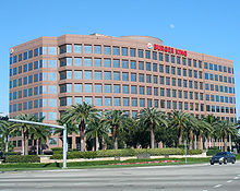
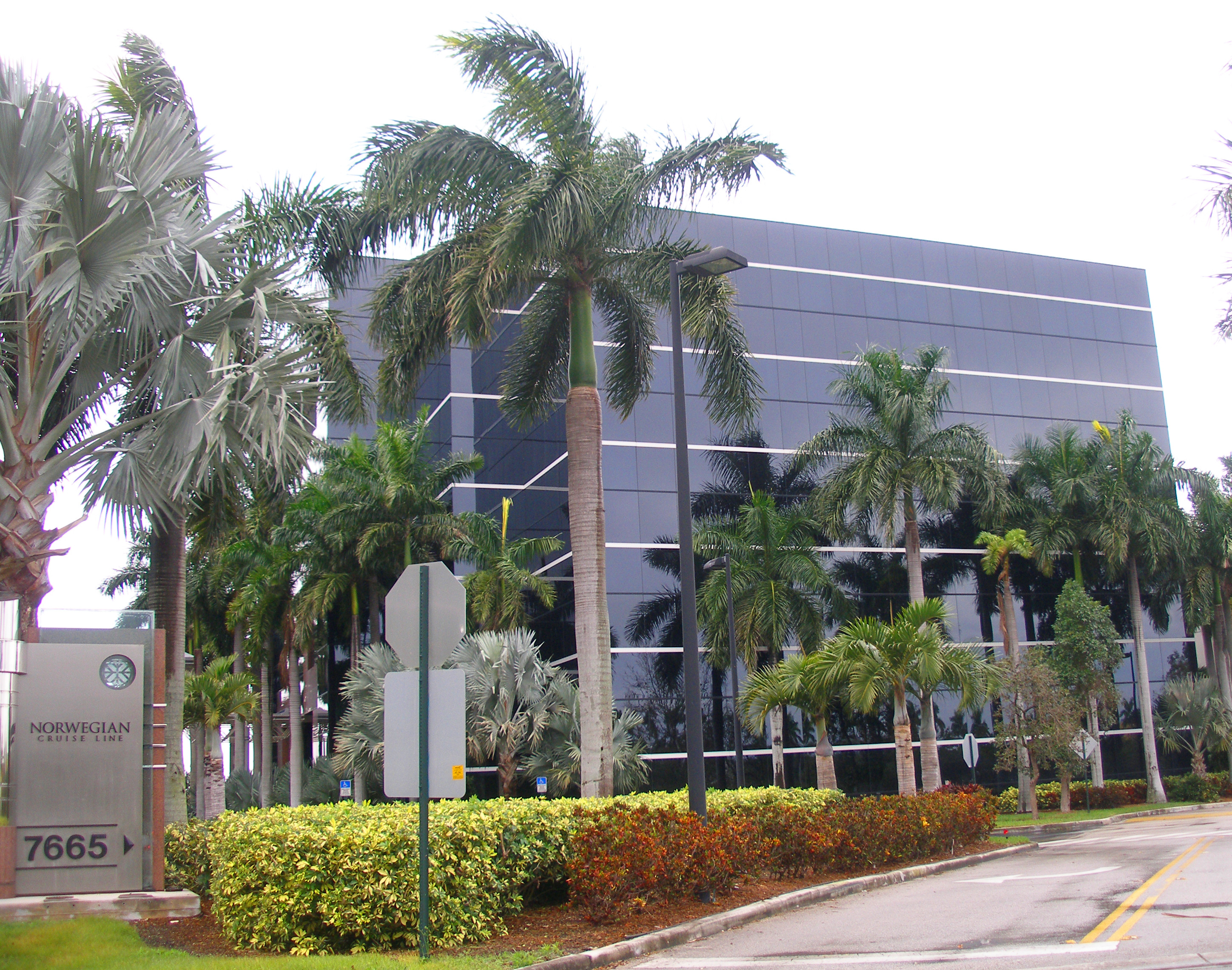
Brightstar Corporation,[25] Burger King,[26] Intradeco Holdings,[27] Latin Flavors,[28] Norwegian Cruise Line,[29] and Ryder have their headquarters in unincorporated areas in the county.[30] Centurion Air Cargo, Florida West International Airways, and IBC Airways have their headquarters on the grounds of Miami International Airport in an unincorporated area in the county.[31][32][33]
Domestic operations
Hewlett Packard's main Latin America offices are located on the ninth floor of the Waterford Building in unincorporated Miami-Dade County.[34]
Foreign operations
AstraZeneca has its Latin American headquarters in an unincorporated area.[35] Gate Group has its Latin American headquarters in an unincorporated area.[36] Unicomer Group has its United States offices in an unincorporated area.[37] TAME has its United States offices in an unincorporated area.[38]
Former economic operations
Several defunct airlines, including Airlift International, Arrow Air, and National Airlines (NA), were headquartered on or near the airport property.[39][40][41]
After Frank Borman became president of Eastern Airlines in 1975, he moved Eastern's headquarters from Rockefeller Center in Midtown Manhattan, New York City to an unincorporated area in Miami-Dade County[42][43] Around 1991 the Miami-Dade County lost a few corporations, including Eastern Airlines, which folded in 1991.[44]
At one time the cruise line ResidenSea had its headquarters in an unincorporated area in the county.[45]
Top private employers
According to Miami's Beacon Council, the top private employers in 2008 in Miami-Dade were:[46]
# Employer # of employees 1 Publix Super Markets 11,000 2 Baptist Health South Florida 10,826 3 University of Miami 9,874 4 American Airlines 9,000 5 Precision Response Corporation 6,000 6 Bellsouth 5,500 7 Winn-Dixie Stores 4,833 8 Florida Power & Light Company 3,900 9 Carnival Cruise Lines 3,500 10 Macy's Florida 3,368 Top public employers
According to Miami's Beacon Council, the top public employers in 2008 in Miami-Dade were:[47]
# Employer # of employees 1 Miami-Dade County Public Schools 50,000 2 Miami-Dade County 32,000 3 U.S. Federal Government 20,400 4 Florida State Government 17,000 5 Jackson Health Systems 5,500 6 Miami Dade College 6,500 7 City of Miami 4,034 8 Florida International University 3,132 9 VA Medical Center 2,300 10 City of Miami Beach 1,979 Diplomatic missions
Several consulates are located in Miami-Dade County. Those in unincorporated areas within the county are the Consulate-General of Honduras,[48] the Consulate-General of Nicaragua,[49] and the Consulate-General of Panama.[50]
Law and government
Miami-Dade County has operated under a unique metropolitan system of government, a "two-tier federation," since 1957. This was made possible when Florida voters approved a constitutional amendment in 1956 that allowed the people of Dade County (as it was known then) to enact a home rule charter. Prior to this year, home rule did not exist in Florida, and all counties were limited to the same set of powers by the Florida Constitution and state law. Mattie Belle Davis, the first woman from Florida elected to the American Bar Foundation and the second woman to be elected in the US, was the first woman judge of Metropolitan Court of Dade County, Florida.
Division between county and municipality politics
Presidential elections results Year Republican Democrat 2008 41.6% 358,256 58.1% 497,386 2004 46.6% 361,095 52.9% 409,732 2000 46.3% 289,574 52.6% 328,867 1996 37.9% 209,740 57.3% 317,555 1992 43.2% 235,313 46.7% 254,609 1988 55.3% 270,937 44.3% 216,970 1984 59.2% 144,281 40.8% 223,863 1980 50.7% 265,888 40.2% 210,868 1976 40.5% 211,148 58.1% 303,047 1972 58.9% 256,529 40.8% 177,693 1968 37.0% 135,222 48.4% 176,689 1964 36.0% 117,480 64.0% 208,941 1960 42.3% 134,506 57.7% 183,114 Unlike a consolidated city-county, where the city and county governments merge into a single entity, these two entities remain separate. Instead there are two "tiers", or levels, of government: city and county. There are 35 municipalities in the county, the City of Miami being the largest.
District Commissioner 1st Barbara J. Jordan 2nd Jean Monestime 3rd Audrey Edmonson 4th Sally A. Heyman 5th Bruno A. Barreiro 6th Rebeca Sosa 7th Carlos A. Gimenez 8th Lynda Bell 9th Dennis C. Moss, Chairman 10th Javier D. Souto 11th Joe A. Martinez 12th José Pepe Diaz 13th Natacha Seijas Cities are the "lower tier" of local government, providing police and fire protection, zoning and code enforcement, and other typical city services within their jurisdiction. These services are paid for by city taxes. The County is the "upper tier", and it provides services of a metropolitan nature, such as emergency management, airport and seaport operations, public housing and health care services, transportation, environmental services, solid waste disposal etc. These are funded by county taxes, which are assessed on all incorporated and unincorporated areas.
Of the county's 2.2 million total residents (as of 2000), approximately 52% live in unincorporated areas, the majority of which are heavily urbanized. These residents are part of the Unincorporated Municipal Services Area (UMSA). For these residents, the County fills the role of both lower- and upper-tier government, the County Commission acting as their lower-tier municipal representative body. Residents within UMSA pay a UMSA tax, equivalent to a city tax, which is used to provide County residents with equivalent city services (police, fire, zoning, water and sewer, etc.). Residents of incorporated areas do not pay UMSA tax.
Structure of county government

The Executive Mayor of Miami-Dade County is elected countywide to serve a four-year term. The Mayor is not a member of the County Commission. The Mayor appoints a County Manager, with approval and consent of the Board of County Commissioners, to oversee the operations of the County Departments. The Mayor has veto power over the Commission. The post is filled by Carlos A. Gimenez.
The Board of County Commissioners is the legislative body, consisting of 13 members elected from single-member districts. Members are elected to serve four-year terms, and elections of members are staggered. The Board chooses a Chairperson, who presides over the Commission, as well as appoints the members of its legislative committees. The Board has a wide array of powers to enact legislation, create departments, and regulate businesses operating within the County. It also has the power to override the Mayor's veto with a two-thirds vote.
The election of Commissioners from single member districts came to be in 1992 after a group led by attorney and then Dade County Commissioner Arthur E. Teele, Jr. with the support of some African American and Hispanic civic leaders, challenged the at large election system in the courts, arguing that the present system did not allow for the election of minority commissioners, despite the fact that African American Commissioner Barbara Carey-Shuler had been elected several times. The court, under the ruling of U.S. District Court Judge Donald Graham, created the single member district election system.
Florida's Constitution provides for four elected officials to oversee executive and administrative functions for each county (called "Constitutional Officers"): Sheriff, Property Appraiser, Supervisor of Elections, and Tax Collector. However, the current Constitution allows voters in home-rule counties (including Miami-Dade) to abolish the offices and reorganize them as subordinate County departments; Miami-Dade voters chose this option.
The most visible distinction between Miami-Dade and other Florida counties is the title of its law enforcement agency. It is the only county in Florida that does not have an elected sheriff, or an agency titled "Sheriff's Office." Instead the equivalent agency is known as the Miami-Dade Police Department, and its leader is known as the Metropolitan Sheriff and Director of the Miami-Dade Police Department. The judicial offices of Clerk of the Circuit Court, State Attorney, and Public Defender are still branches of State government and are therefore independently elected and not part of County government.
Public services
Fire Rescue
The Miami-Dade County Fire Rescue Department is the agency that provides fire protection and emergency medical services for Miami-Dade County, Florida. The department serves 28 municipalities and all unincorporated areas of Miami-Dade County from 60 fire stations.[51] The Department also provides fire protection services for Miami International Airport, Kendall-Tamiami Executive Airport and Opa-Locka Airport.[52]
The communities served are Aventura, Bal Harbour, Bay Harbor Islands, Biscayne Park, Doral, El Portal, Florida City, Golden Beach, Hialeah Gardens, Homestead, Indian Creek, Islandia, Medley, Miami Lakes, Miami Shores, Miami Springs, North Bay Village, North Miami, North Miami Beach, Opa-locka, Palmetto Bay, Pinecrest, South Miami, Surfside, Sweetwater, Sunny Isles Beach, Virginia Gardens, and West Miami.[53]
Miami-Dade Fire Rescue is also the home to Urban Search and Rescue Florida Task Force 1 as well as EMS operations consisting of 57 Advanced Life Support units staffed by 760 state-certified paramedics and 640 state-certified emergency medical technicians.
Police Department
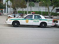
The Miami-Dade Police Department is a full service metropolitan police department serving Miami-Dade County's unincorporated areas, although they have lenient mutual aid agreements with other municipalities, most often the City of Miami Police Department. The Miami-Dade Police Department is the largest police department in the state of Florida with over 4,700 employees. The Department is still often referred by its former name, the Metro-Dade Police or simply Metro.
The Miami-Dade Police Department operate out of nine districts throughout Miami-Dade County and have two special bureaus. The current director of the department is James Loftus, who succeeded Robert Parker. The Department's headquarters are located in Doral, Florida.
Water and Sewer Department
Miami-Dade Water and Sewer Department (MDWASD) is one of the largest public utilities in the United States, employing approximately 2,700 employees as of 2007. It provides service to over 2.4 million customers, operating with an annual budget of almost $400 million. Approximately 330 million gallons of water are drawn everyday from the Biscayne Aquifer for consumer use. MDWASD has over 7,100 miles (11,400 km) of water lines, a service area of 396 square miles (1,026 km2) and 14 pump stations. MDWASD has over 3,600 miles (5,800 km) of sewage pipes, a service area of 341 square miles (883 km2) and 954 pump stations [54]
County representation
The Florida Department of Juvenile Justice operates the Miami-Dade Regional Juvenile Detention Center in an unincorporated area in the county.[55]
Education
In Florida, each county is also a school district. Miami-Dade County Public Schools, is operated by an independently-elected School Board. A professional Superintendent of Schools manages the day-to-day operations of the district, who is appointed by and serves at the pleasure of the School Board. The Miami-Dade County Public School District is currently the fourth-largest public school district in the nation with almost 400,000 students in 2007/2008.
The Miami-Dade Public Library is one of the largest public library systems in the country, comprising 42 branch locations, and 8 branch locations currently being built/not officially opened.
Colleges and universities
Miami-Dade County is home to many private and public universities and colleges. Total approximate college/university student enrollment in the county in 2006 was about 245,000, one of the largest number for university students in the USA.[citation needed]
- University of Miami (private)
- Florida International University (public, largest enrollment in South Florida)
- Miami Dade College (public)
- Barry University (private/Catholic)
- Nova Southeastern University (private)
- Florida Memorial University (private/historically black)
- St. Thomas University (private/Catholic)
- Johnson and Wales University (private)
- Carlos Albizu University (private)
- Miami International University of Art & Design (private)
- Talmudic University (private/Jewish)
Transportation
See also: Transportation in MiamiAirports
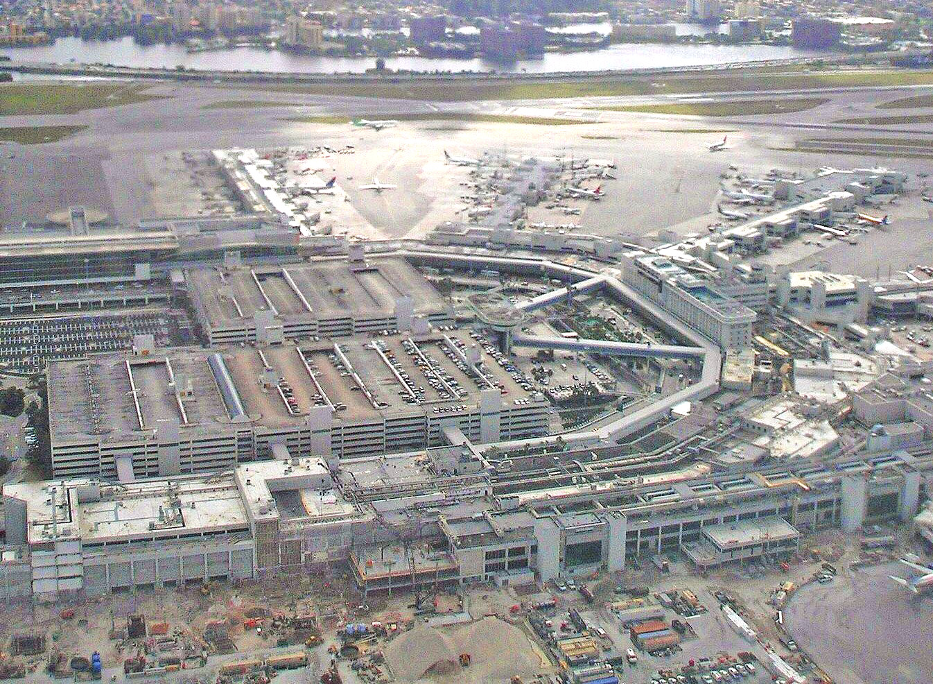
Miami International Airport, located in an unincorporated area in the county, serves as the primary international airport of the Miami Area. One of the busiest international airports in the world, Miami International Airport caters to over 35 million passengers a year. Identifiable locally, as well as several worldwide authorities, as MIA or KMIA, the airport is a major hub and the single largest international gateway for American Airlines, the world’s largest passenger air carrier. Miami International is the United States’ third largest international port of entry for foreign air passengers (behind New York's John F. Kennedy International Airport and Los Angeles International Airport), and is the seventh largest such gateway in the world. The airport’s extensive international route network includes non-stop flights to over seventy international cities in North and South America, Europe, Asia, and the Middle East.
General aviation airports in the county include Kendall-Tamiami Executive Airport in an unincorporated area, Opa-Locka Airport in Opa-Locka, and Homestead General Aviation Airport in an unincorporated area west of Homestead. Homestead Joint Air Reserve Base, east of Homestead in an unincorporated area, serves military traffic.
Public transit

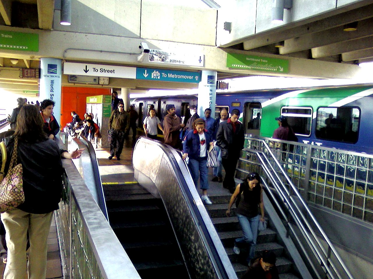
Public transit in Miami-Dade County is served by Miami-Dade Transit, and is the largest public transit in Florida. Miami-Dade Transit operates a heavy rail metro system Metrorail, an elevated people mover in Downtown Miami, Metromover and the bus system, Metrobus. Currently, expansion of Metrorail is underway with the construction of the AirportLink to Miami International Airport.
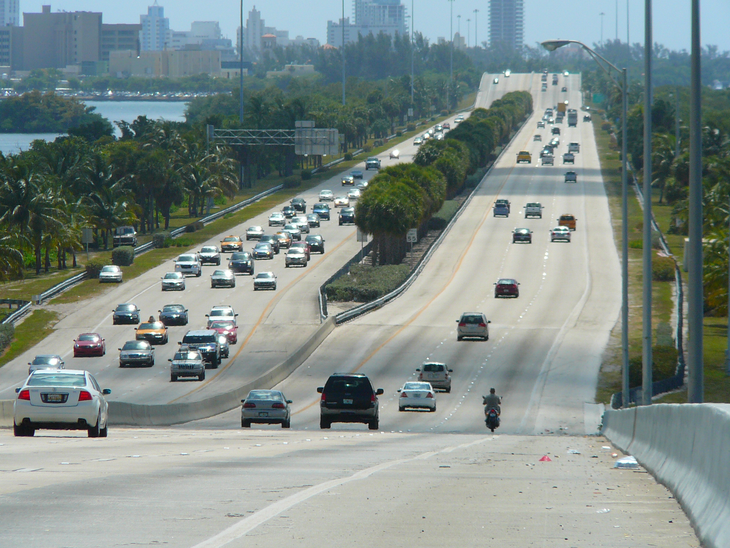
Major expressways

 Downtown Distributor
In Florida a Tolled State Road is often (but not always) denoted by having the word "TOLL" printed on the top of the State Road shield.
When a driver passes through a toll plaza without paying the proper toll a digital image of the cars license tag is recorded. Under Florida Law, this image can be used by the Authority to issue a toll violation.[56]
Miami-Dade County has 10 major expressways and 1 minor expressway in Downtown Miami.
 Interstate 95
 Interstate 75
 Florida's Turnpike
- Homestead Extension of Florida's Turnpike
 Dolphin Expressway (State Road 836) /
  Interstate 395
 Gratigny Parkway (State Road 924)
 Airport Expressway (State Road 112) /
  Interstate 195
 Don Shula Expressway (State Road 874)
 Snapper Creek Expressway (State Road 878)
 Palmetto Expressway (State Road 826)
 Hialeah Expressway (State Road 934)
 Downtown Distributor (State Road 970)
County roads
This is a list of Miami-Dade county roads. Miami-Dade County has fewer county roads than any other county in Florida, despite its large population.
# Road Name(s) Direction and Termini Notes  CR 94
CR 94Loop Road E/W US 41 Fortymile Bend Monroe-Miami-Dade County line west of Fortymile Bend CR 94 is a multi-county county road.  CR 905A
Card Sound Road N/S US 1 near Homestead Monroe-Miami-Dade County Line. near Card Sound Bridge CR 905A is a multi-county road. Street grid
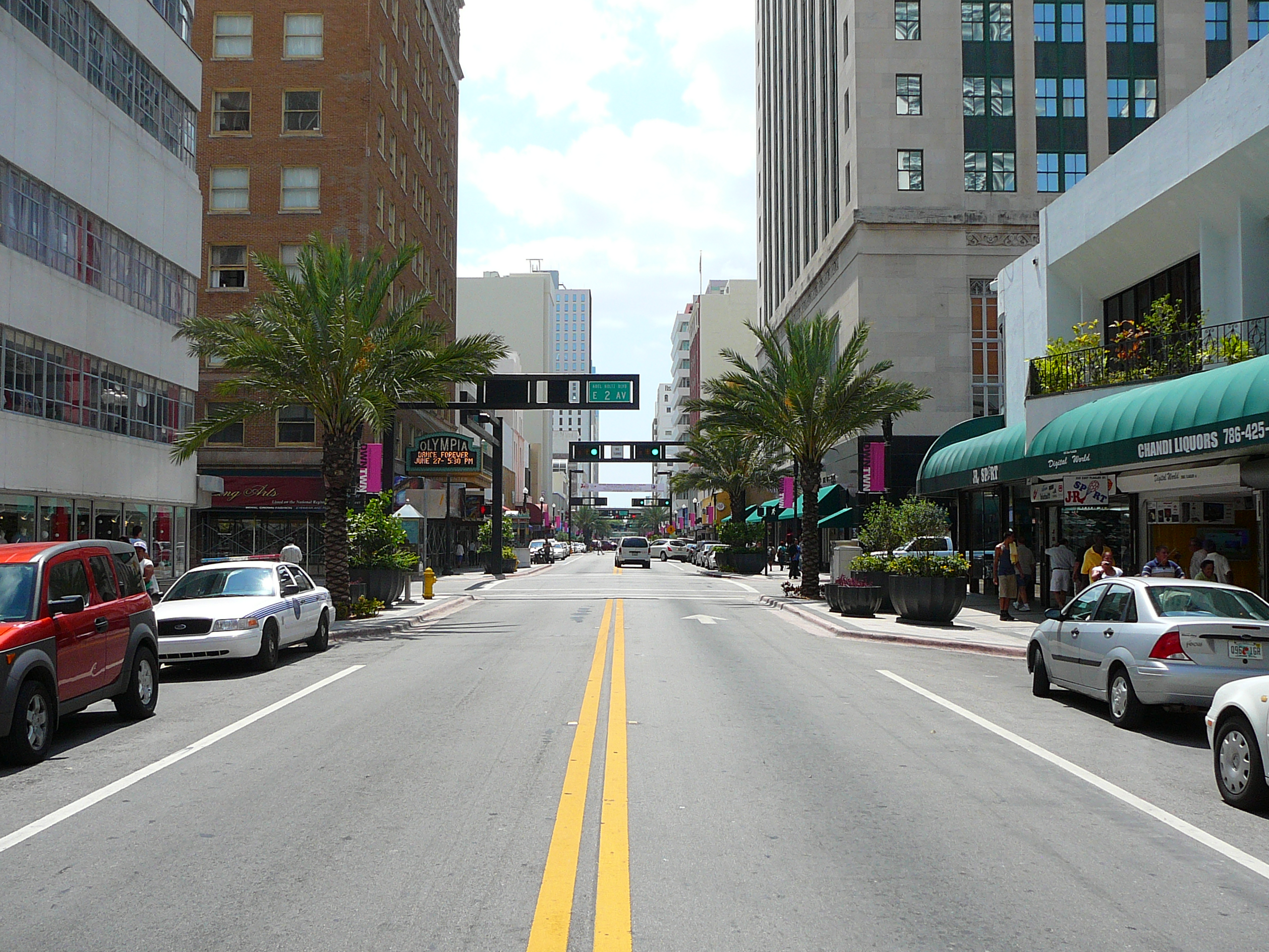
A street grid stretches from downtown Miami throughout the county. This grid was adopted by the City of Miami following World War I after the United States Post Office threatened to cease mail deliveries in the city because the original system of named streets, with names often changing every few blocks and multiple streets in the city sharing the same name, was too confusing for the mail carriers.[57] The new grid was later extended throughout the county as the population grew west, south, and north of city limits. The grid is laid out with Miami Avenue as the meridian going North-South and Flagler Street the baseline going east-west. The grid is primarily numerical so that, for example, all street addresses north of Flagler and west of Miami Avenue have NW in their address (e.g. NW 27th Avenue). Because its point of origin is in downtown Miami which is close to the coast, the NW and SW quadrants are much larger than the SE and NE quadrants. Many roads, especially major ones, are also named, although, with a few notable exceptions, the number is in more common usage among locals. Although this grid is easy to understand once one is oriented to it, it is not universal in the entire county. Hialeah uses its own grid system which is entirely different in its orientation. Coral Gables and Miami Lakes use named streets almost exclusively, and various smaller municipalities such as Florida City and Homestead use their own grid system along with the Miami-Dade grid system adding to the confusion. Miami Beach has its own system of numbered streets without compass directions.
Sites of interest
Museums
- American Police Hall of Fame, Miami
- Bass Museum of Art, Miami Beach
- Cuban Museum of Arts and Culture, Coral Gables
- Fairchild Tropical Botanic Garden, Coral Gables
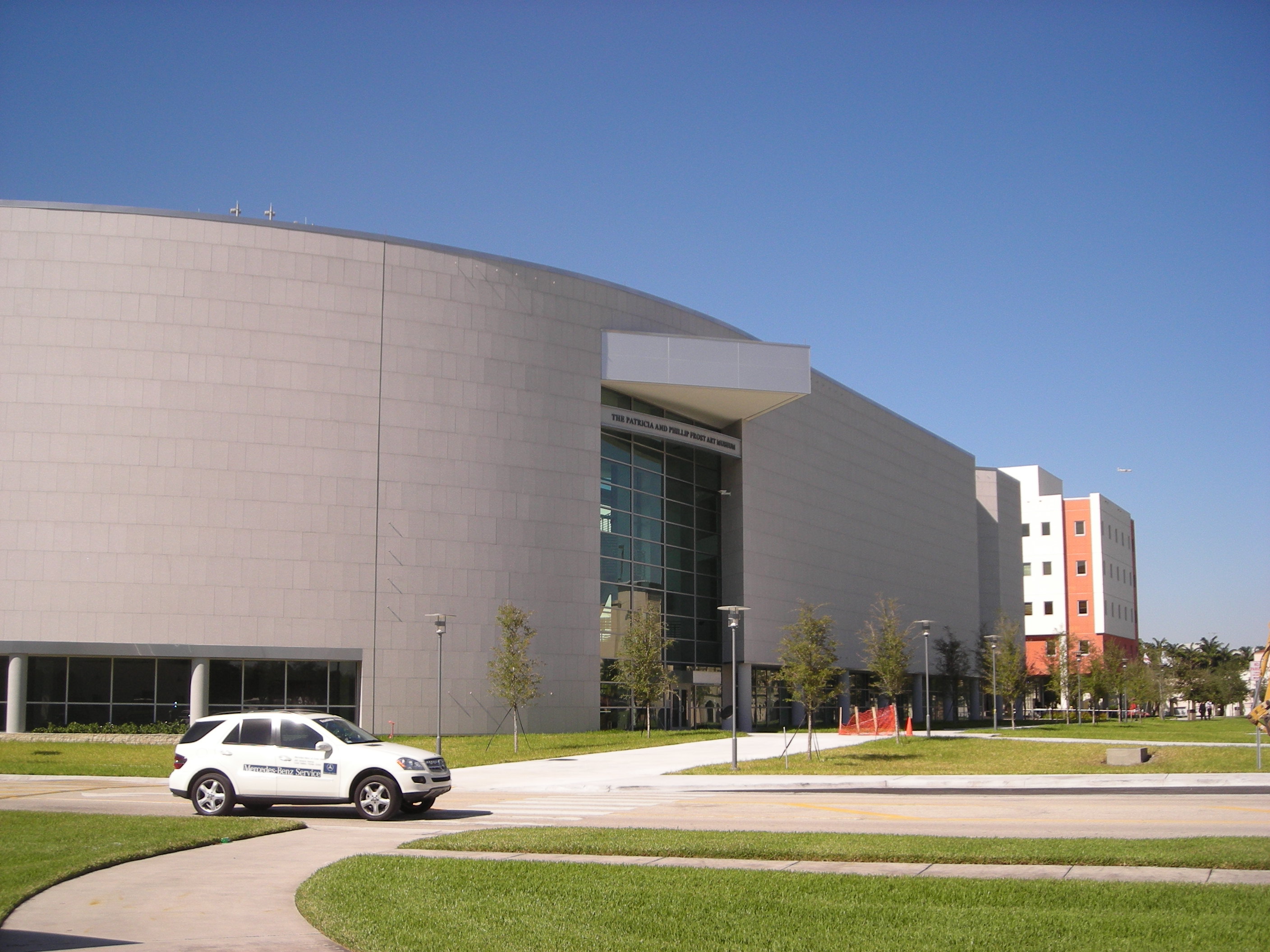
- Frost Art Museum, (Florida International University, Miami)
- Haitian Heritage Museum, Miami
- HistoryMiami, Downtown Miami
- Holocaust Memorial, Miami Beach
- Jewish Museum of Florida, Miami Beach
- Lowe Art Museum, (University of Miami, Coral Gables)
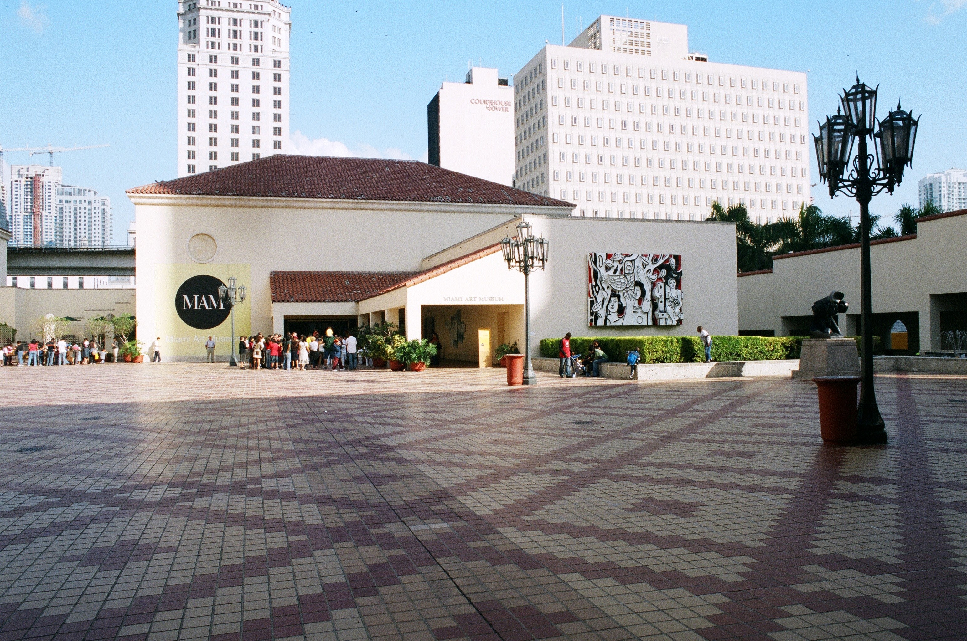
- Miami Art Museum, Downtown Miami
- Miami Children's Museum, Miami
- Miami Cultural Center, Downtown Miami
- Miami Science Museum, Miami
- Museum of Contemporary Art, North Miami
- Rubell Family Collection, Miami
- The Gold Coast Railroad Museum, Miami
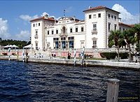
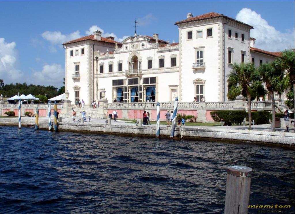
- Vizcaya Museum and Gardens, Miami
- Weeks Air Museum, Miami
- Wings Over Miami Museum, Miami
- Wolfsonian, (Florida International University, Miami Beach)
- World Erotic Art Museum, Miami Beach
- The World Famous Mondesi Carranza Museum, Miami Beach
Culture and wildlife
- Zoo Miami, Miami
- Jungle Island, Miami
- Vizcaya Museum and Gardens, Miami
- Bayside Marketplace, Downtown Miami
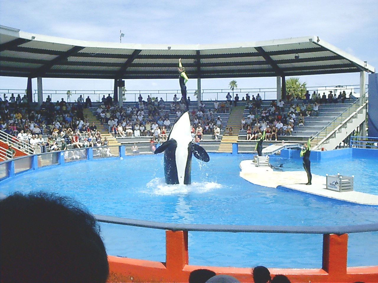
- Miami Seaquarium, Miami
- Monkey Jungle, Miami
- Ancient Spanish Monastery, North Miami
- Adrienne Arsht Center for the Performing Arts, Downtown Miami
- Wertheim Performing Arts Center, (Florida International University, Miami)
- Florida Grand Opera, Miami
- Gusman Center for the Performing Arts, Downtown Miami
- Bayfront Park Amphitheatre, Downtown Miami
Other areas and attractions
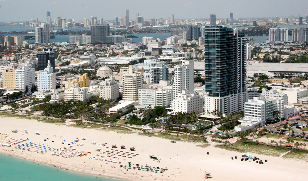
- South Beach
- Ocean Drive
- Calle Ocho
- Lincoln Road
- Downtown Miami
- Brickell
- City of Miami Cemetery
- Española Way
- Mary Brickell Village
- Wynwood Art District
Parks
- Domino Park
- Tropical Park
- Bayfront Park
- Bicentennial Park
- Crandon Park
- Cape Florida State Park
- Biscayne Bay Aquatic Preserve
- Oleta River State Park
- Everglades National Park
- Biscayne National Park
Sports venues

Miami-Dade County holds the majority of sports arenas, stadiums and complexes in South Florida. Some of these sports facilities are:
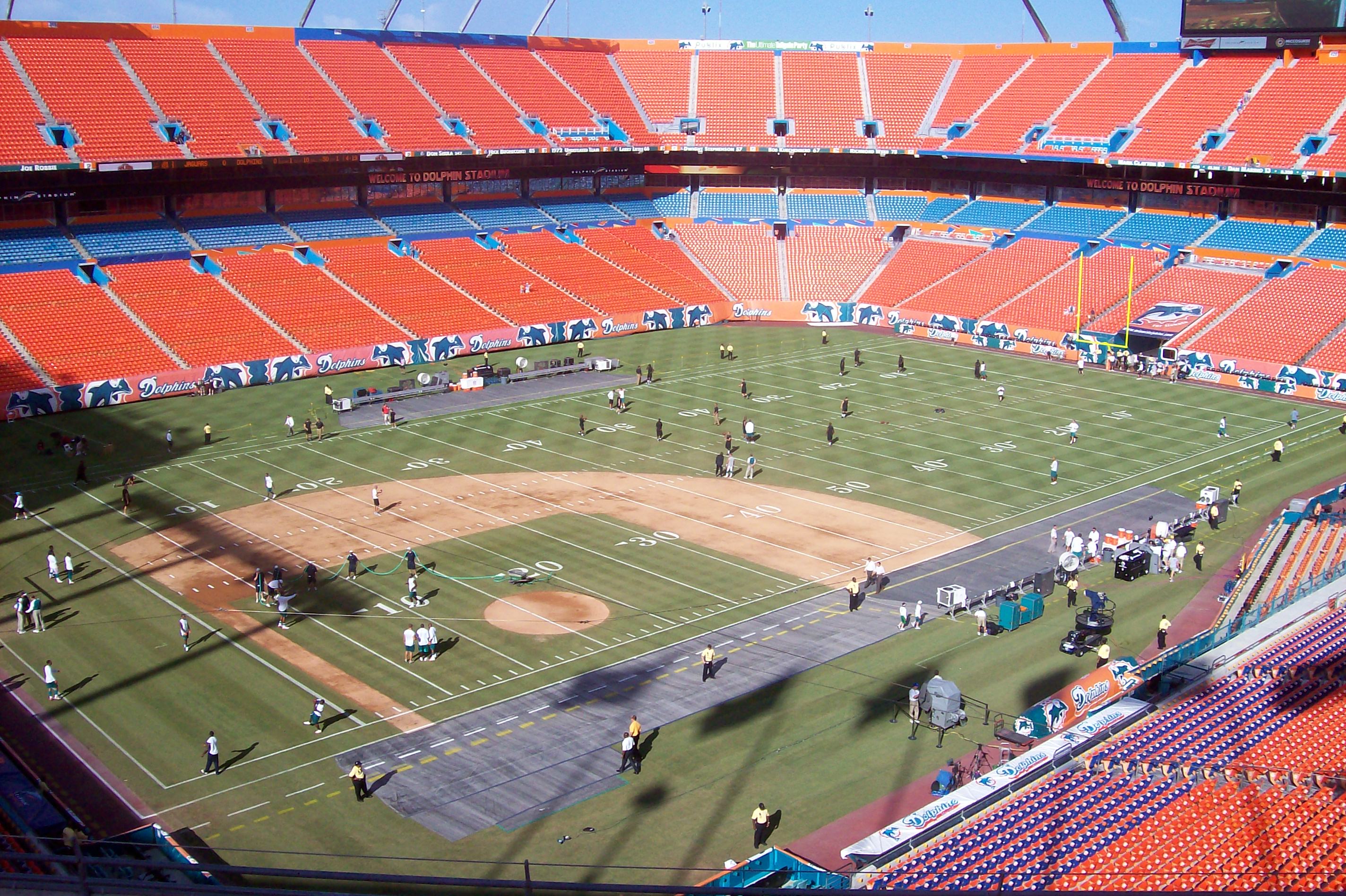
- Sun Life Stadium- Miami Dolphins (football), Miami Hurricanes (football), and Florida Marlins (baseball)
- Florida Marlins' new ballpark - Miami Marlins (baseball) - in construction
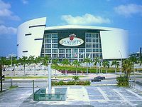
- American Airlines Arena- Miami Heat (basketball)
- Tennis Center at Crandon Park- Sony Ericcson Open
- FIU Stadium- FIU Golden Panthers (football)
- Pharmed Arena- FIU Golden Panthers (basketball)
- University Park Stadium- FIU Golden Panthers (baseball)
- BankUnited Center- Miami Hurricanes (basketball)
- Tropical Park Stadium
- Homestead-Miami Speedway
- Calder Race Course
- Hialeah Park Race Track
- Alex Rodriguez Park at Mark Light Field- Miami Hurricanes (baseball)
Former venues include:
Notable people
Main article: List of people from MiamiSister cities
Miami-Dade County has 23 sister cities, as designated by Sister Cities International:
See also
- List of tallest buildings in Miami
- National Register of Historic Places listings in Miami-Dade County, Florida
References
- ^ http://2010.census.gov/2010census/data/
- ^ MiamiHerald.com
- ^ US Census Bureau
- ^ Parks, Arva Moore (1991). Miami: The Magic City. Miami, FL: Centennial Press. pp. 12. ISBN 0962940224.
- ^ Parks, p 13
- ^ Parks, p 14
- ^ Parks, p 14-16
- ^ History of Miami-Dade county retrieved January 26, 2006 Archived January 10, 2006 at the Wayback Machine
- ^ "Miami-Dade County Annual Report for Bondholders. For the Fiscal Year of 1998." (PDF). Miami-Dade County, Florida. 1998. http://www.miamidade.gov/finance/library/Bookgo.PDF. Retrieved 2007-04-07.
- ^ History of Indian Key - retrieved September 13, 2007
- ^ Muir, Helen. (1953) Miami, U.S.A. Coconut Grove, Florida. Hurricane House Publishers. Pp. 33, 100
- ^ Miami-Dade County Government
- ^ Notes on Florida Geography, Florida International University
- ^ "Census 2000 U.S. Gazetteer Files: Counties". United States Census. http://www.census.gov/tiger/tms/gazetteer/county2k.txt. Retrieved 2011-02-13.
- ^ Census.gov
- ^ "American FactFinder". United States Census Bureau. http://factfinder.census.gov. Retrieved 2008-01-31.
- ^ "Demographics of Miami-Dade County, FL". MuniNetGuide.com. http://www.muninetguide.com/states/florida/Miami-Dade.php. Retrieved 2008-06-23.
- ^ a b c "Miami-Dade County, FL Detailed Profile". city-data.com. http://www.city-data.com/county/Miami-Dade_County-FL.html. Retrieved 2008-06-23.
- ^ Census Bureau, American Community Survey Ranking Tables
- ^ "2008 Miami-Dade County Demographics". http://quickfacts.census.gov/qfd/states/12/12086.html.
- ^ "2006 U.S. Census for Some Other Race". http://factfinder.census.gov/servlet/ACSSAFFFacts?_event=Search&geo_id=05000US12099&_geoContext=01000US%7C04000US12%7C05000US12099&_street=&_county=Miami-Dade+County&_cityTown=Miami-Dade+County&_state=04000US12&_zip=&_lang=en&_sse=on&ActiveGeoDiv=geoSelect&_useEV=&pctxt=fph&pgsl=050&_submenuId=factsheet_1&ds_name=ACS_2006_SAFF&_ci_nbr=null&qr_name=null®=null%3Anull&_keyword=&_industry=.
- ^ Miamidade.gov
- ^ Regional & Local Profiles
- ^ a b "Modern Language Association Data Center Results of Miami-Dade County, Florida". Modern Language Association. http://www.mla.org/map_data_results&state_id=12&county_id=86&mode=geographic&zip=&place_id=&cty_id=&ll=&a=&ea=&order=r. Retrieved 2008-06-23.
- ^ "Contact Us." Brightstar Corporation. Retrieved on January 9, 2010.
- ^ "We're Listening." Burger King. Retrieved on January 31, 2009.
- ^ "Contact Us." Intradeco Holdings. Retrieved on January 9, 2010.
- ^ "Contact Us." Latin Flavors. Retrieved on January 9, 2010.
- ^ "Contact Us." Norwegian Cruise Line. Retrieved on January 9, 2010.
- ^ "Contact Us." Ryder. Retrieved on January 9, 2010.
- ^ "Contact Us." (Direct link to image) Centurion Air Cargo. Retrieved on July 1, 2010. "Head Office 1851 NW 68 Ave., Bldg 706 Miami, FL 33126. This address may incorrectly be mapped to a residential subdivision. The proper location is at Miami International Airport.
- ^ Home page. Florida West International Airways. Retrieved on January 7, 2010.
- ^ "Locations." International Bonded Couriers. Retrieved on January 9, 2010.
- ^ "Office Locations." Hewlett Packard. Retrieved on August 29, 2011. "Hewlett-Packard Latin America Waterford Building, 9th Floor 5200 Blue Lagoon Drive Miami, Florida 33126 USA"
- ^ "USA." AstraZeneca. Retrieved on March 11, 2010.
- ^ "Contact Us." Gate Group. Retrieved on September 17, 2011. "North America Regional Office11710 Plaza America Drive, Suite 800 Reston, VA 20190 USA"
- ^ "Prelude." (Select "English," then select the mail icon in the upper right hand corner of the screen) Unicomer Group. Retrieved on March 4, 2010.
- ^ "Miami." TAME. Retrieved on March 14, 2010.
- ^ "Contact Us." Arrow Air. Retrieved on January 7, 2010.
- ^ "Walkout by 3,500 Cancels All Flights Of National Airlines." The New York Times. Sunday February 1, 1970. Page 58. Retrieved on September 24, 2009.
- ^ "World Airline Directory." Flight International. 14–20 March 1990 "Airlift International" 57.
- ^ Bernstein, Aaron. Grounded: Frank Lorenzo and the Destruction of Eastern Airlines. Beard Books, 1999. 22. Retrieved on August 28, 2009.
- ^ "World Airline Directory." Flight International. March 30, 1985. 72." Retrieved on June 17, 2009.
- ^ Stieghorst, Tom. "Sings of decline." Sun Sentinel. May 6, 1991. Weekly Business 8. Retrieved on August 28, 2009.
- ^ "Welcome to ResidenSea." ResidenSea. January 18, 2006. Retrieved on January 20, 2010.
- ^ http://www.beaconcouncil.com/web/Content.aspx?Page=majorEmployers
- ^ http://www.beaconcouncil.com/web/Content.aspx?Page=majorEmployers
- ^ "Consulados de Honduras en Estados Unidos" Consulate-General of Honduras. Retrieved on January 31, 2009.
- ^ "Bienvenidos al Consulado de Nicaragua en Miami, FL" Consulate-General of Nicaragua. Retrieved on January 31, 2009.
- ^ "Panamanian Consulates in the U.S." Embassy of Panama in Washington, D.C.. Retrieved on January 30, 2009.
- ^ "Locations". Miami-Dade Fire Rescue Department. Miami-Dade County. http://www.miamidade.gov/MDFR/locations.asp. Retrieved August 30, 2006.[dead link]
- ^ "Airport Fire Rescue Division". Miami-Dade Fire Rescue Department. Miami-Dade County. http://www.miamidade.gov/mdfr/airport.asp. Retrieved August 30, 2006.[dead link]
- ^ "Cities Served". Miami-Dade Fire Rescue Department. Miami-Dade County. http://www.miamidade.gov/MDFR/cities_served.asp. Retrieved August 30, 2006.[dead link]
- ^ Miamidade.gov
- ^ "Miami-Dade Regional Juvenile Detention Center." Florida Department of Juvenile Justice. Retrieved on June 4, 2010.
- ^ Toll Violation Attorney
- ^ Muir, Helen. (1953) Miami, U.S.A. Coconut Grove, Florida: Hurricane House Publishers. Pp. 136-7.
- ^ La ocupación para el primer mes del vuelo Tenerife-Miami de Air Europa alcanza ya el 70 por ciento
- ^ Prefeitura.Sp - Descentralized Cooperation
- ^ International Relations - São Paulo City Hall - Official Sister Cities
External links
Government links
County departments and agencies
- Miami-Dade Public Library System
- Miami-Dade Police Department
- Public Health Trust of Miami-Dade County Jackson Memorial Hospital
- Miami-Dade Aviation Department Miami International Airport
- Miami-Dade Water and Sewer Department
- Miami-Dade Department of Solid Waste Management
Special districts
- Miami-Dade County Public Schools (MDCPS) is the 4th largest school district in the United States. The Miami-Dade School Board is a nine-member publicly elected body responsible for overseeing the administration of the (MDCPS).
- South Florida Water Management District
Judicial branch
- Miami-Dade Clerk of Courts
- Miami-Dade Public Defender, 11th Judicial Circuit
- Miami-Dade State Attorney's Office, 11th Judicial Circuit
- Circuit and County Court, 11th Judicial Circuit of Florida
Tourism
Environment
Greater Miami CBD Urban centers Major thoroughfares North 36th Street · North 79th Street · North 103rd Street · North 125th Street · West 7th Avenue · West 27th Avenue · West 107th Avenue · Allapattah Road · Alton Road · Bird Road · Biscayne Boulevard · Collins Avenue · Coral Reef Drive · Coral Way · County Line Road · Flagler Street · Galloway Road · Gratigny · Ives Dairy Road · Julia Tuttle Causeway · Kendall Drive · Killian · Krome Avenue · William H. Lehman Causeway · LeJeune Road · Ludlam Road · MacArthur Causeway · Miami Avenue · Miami Gardens Drive · Milam Dairy Road · Miracle Mile · Ocean Drive · Okeechobee Road · Old Cutler Road · Port Boulevard · Red Road · Rickenbacker Causeway · South Dixie Highway · Sunset Drive · Tamiami Trail · Venetian CausewayColleges and universities Parks and recreation Amelia Earhart Park · Arch Creek · The Barnacle Historic State Park · Bayfront Park · Bicentennial Park · Big Cypress National Preserve · Bill Baggs Cape Florida State Park · Biscayne National Park · Chapman Field Park · Crandon Park · Dinner Key · Everglades National Park · Fairchild Tropical Botanic Garden · Fort Dallas · Fruit and Spice Park · Greynolds Park · Haulover Park · The Kampong · Matheson Hammock Park · Oleta River State Park · Peacock Park · Shark Valley · South Pointe Park · Tamiami Park · Tropical Park · Virginia Key · Zoo MiamiMajor districts and attractions Adrienne Arsht Center for the Performing Arts · American Airlines Arena · Boca Chita Key Historic District · Coral Castle · Design District · Downtown Miami Historic District · Jungle Island · Lummus Park · Homestead Historic Downtown District · MacFarlane Homestead District · Miami Art Deco District · Miami Seaquarium · Monkey Jungle · Normandy Isles Historic District · North Shore Historic District · Miami Riverwalk · South Beach · Villa VizcayaMajor shopping centers Aventura Mall · Bal Harbour Shops · Bayside Marketplace · CocoWalk · Dadeland Mall · Dadeland Station · Dolphin Mall · The Falls · Lincoln Road Mall · The Mall at 163rd Street · Mall of the Americas · Mary Brickell Village · Metrofare Shops & Cafe · Miami International Mall · Miracle Marketplace · The Shops at Sunset Place · Southland Mall · Village of Merrick Park · Westland MallPrimary modes of transport South Florida metropolitan area Largest city Counties
(by population)Cities and towns
100k-250kCities and towns
25k-99kAventura • Boca Raton • Boynton Beach • Coconut Creek • Cooper City • Coral Gables • Dania Beach • Davie • Deerfield Beach • Delray Beach • Doral • Greenacres • Hallandale Beach • Homestead • Jupiter • Lake Worth • Lauderdale Lakes • Lauderhill • Margate • Miami Beach • North Lauderdale • North Miami • North Miami Beach • Oakland Park • Palm Beach Gardens • Plantation • Riviera Beach • Sunrise • Tamarac • West Park • Weston • Wilton ManorsCities and towns
10k-25k State of Florida
Topics - Delegations
- Environment
- Floridians
- Geography
- Government
- History
- State Parks
- Transportation
- Visitor Attractions
Society - Culture
- Crime
- Demographics
- Economy
- Education
- Politics
Regions Metro areas - Miami–Fort Lauderdale–Pompano Beach (Miami-Dade, Broward, Palm Beach)
- Tampa-St. Petersburg-Clearwater (Hernando, Hillsborough, Pasco, Pinellas)
- Orlando-Kissimmee-Sanford (Lake, Orange, Osceola, Seminole)
- Jacksonville (Duval, Clay, St. Johns, Nassau, Baker)
- North Port–Bradenton–Sarasota (Manatee, Sarasota)
- Cape Coral-Fort Myers (Lee)
- Lakeland-Winter Haven (Polk)
- Palm Bay-Melbourne-Titusville (Brevard)
- Deltona-Daytona Beach-Ormond Beach (Volusia)
- Pensacola-Ferry Pass-Brent (Escambia, Santa Rosa)
- Port St. Lucie (St. Lucie, Martin)
- Tallahassee (Gadsden, Jefferson, Leon, Wakulla)
- Ocala (Marion)
- Naples-Marco Island (Collier)
- Gainesville (Alachua, Gilchrist)
- Fort Walton Beach-Crestview-Destin (Okaloosa)
- Panama City-Lynn Haven-Panama City Beach (Bay)
- Punta Gorda (Charlotte)
- Sebastian-Vero Beach (Indian River)
- Palm Coast (Flagler)
Largest cities Counties - Alachua
- Baker
- Bay
- Bradford
- Brevard
- Broward
- Calhoun
- Charlotte
- Citrus
- Clay
- Collier
- Columbia
- DeSoto
- Dixie
- Duval
- Escambia
- Flagler
- Franklin
- Gadsden
- Gilchrist
- Glades
- Gulf
- Hamilton
- Hardee
- Hendry
- Hernando
- Highlands
- Hillsborough
- Holmes
- Indian River
- Jackson
- Jefferson
- Lafayette
- Lake
- Lee
- Leon
- Levy
- Liberty
- Madison
- Manatee
- Marion
- Martin
- Miami‑Dade
- Monroe
- Nassau
- Okaloosa
- Okeechobee
- Orange
- Osceola
- Palm Beach
- Pasco
- Pinellas
- Polk
- Putnam
- Santa Rosa
- Sarasota
- Seminole
- St. Johns
- St. Lucie
- Sumter
- Suwannee
- Taylor
- Union
- Volusia
- Wakulla
- Walton
- Washington
Coordinates: 25°46′27″N 80°11′37″W / 25.77417°N 80.19361°W
Categories:- Florida counties
- South Florida metropolitan area
- Charter counties in Florida
- Miami-Dade County, Florida
- Counties of the United States with Hispanic majority populations


Wikimedia Foundation. 2010.